Jump to content


Main menu


Navigation  


Main page
Contents
Current events
Random article
About Wikipedia
Contact us
Donate


Contribute  


Help
Learn to edit
Community portal
Recent changes
Upload file


Search  


Create account

Log in


Create account
 Log in


Pages for logged out editors learn more  


Contributions
Talk


Contents


(Top)


1 Geography  


2 History  


3 Transport  


4 See also  


5 References  


Sebnitz


العربية
تۆرکجه
Башҡортса
Български
Cebuano
Čeština
Deutsch
Dolnoserbski
Español
Esperanto
Euskara
فارسی
Français
Հայերեն
Hornjoserbsce
Italiano
Jawa
Kurdî
Ladin
Latviešu
Magyar
Македонски
Bahasa Melayu
Nederlands
Нохчийн
Norsk bokmål
Oʻzbekcha / ўзбекча
Polski
Português
Română
Русский
Српски / srpski
Srpskohrvatski / српскохрватски
Svenska
Татарча / tatarça
Türkçe
Українська
Tiếng Vit
Winaray


Edit links


Article
Talk


Read
Edit
View history


Tools


Actions  


Read
Edit
View history


General  


What links here
Related changes
Upload file
Special pages
Permanent link
Page information
Cite this page
Get shortened URL
Download QR code
Wikidata item


Print/export  


Download as PDF
Printable version


In other projects  


Wikimedia Commons


Appearance


Coordinates: 50°58N 14°17E / 50.967°N 14.283°E / 50.967; 14.283
 

From Wikipedia, the free encyclopedia


Sebnitz
Sebnitz during winter
Coat of arms of Sebnitz
Location of Sebnitz within Sächsische Schweiz-Osterzgebirge district
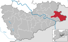
AltenbergBad Gottleuba-BerggießhübelBad SchandauBahretalBannewitzDippoldiswaldeDohmaDohnaDorfhainDürrröhrsdorf-DittersbachFreitalGlashütteGohrischHartmannsdorf-ReichenauHeidenauHermsdorfHohnsteinSebnitzKlingenbergKönigsteinKreischaLiebstadtLohmenMüglitztalNeustadt in SachsenPirnaRabenauRathenRathmannsdorfReinhardtsdorf-SchönaRosenthal-BielatalDippoldiswaldeSebnitzSebnitzStadt WehlenStruppenStolpenTharandtWilsdruffSaxonyCzech RepublicBautzen (district)DresdenMeißen (district)Mittelsachsen
Sebnitz is located in Germany
Sebnitz

Sebnitz

Sebnitz is located in Saxony
Sebnitz

Sebnitz

Coordinates: 50°58′N 14°17′E / 50.967°N 14.283°E / 50.967; 14.283
CountryGermany
StateSaxony
DistrictSächsische Schweiz-Osterzgebirge
Municipal assoc.Sebnitz
Subdivisions5
Government
 • Mayor (2022–29) Ronald Kretzschmar[1]
Area
 • Total88.09 km2 (34.01 sq mi)
Elevation
379 m (1,243 ft)
Population
 (2022-12-31)[2]
 • Total9,522
 • Density110/km2 (280/sq mi)
Time zoneUTC+01:00 (CET)
 • Summer (DST)UTC+02:00 (CEST)
Postal codes
01851–01855
Dialling codes035971
Vehicle registrationPIR, DW, FTL, SEB
Websitewww.sebnitz.de
Senior mayor Mike Ruckh Sebnitz with Flower Girl

Sebnitz (German: [ˈzɛpnɪts]; Upper Sorbian: Zebnica, pronounced [ˈzɛbnʲitsa]) is a town in the Sächsische Schweiz-Osterzgebirge district, in Saxony, Germany.

Geography

[edit]

The town of Sebnitz lies in the valley of the river Sebnitz and its side valleys between 251 and 460 m above sea level between the mountains of Saxon Switzerland and the Lusatian Highlands. Topographically the town itself lies in the West Lusatian Upland, but lies right on the border with the Upper Lusatian Highlands. Because the natural region of Saxon Switzerland is also very close by, the countryside around the town is very varied.

The municipality consists of the town Sebnitz itself, Schönbach (joined 1935), Hainersdorf (joined 1920), Hertigswalde (joined 1950), Hinterhermsdorf (joined 1998) and the former municipality of Kirnitzschtal (joined 2012), that itself consisted of the villages Altendorf, Mittelndorf, Lichtenhain, Ottendorf and Saupsdorf.

History

[edit]

Sebnitz was first mentioned in a document of 1223/1241 outlining the borders between the kingdom of Bohemia and the diocese of Meißen. In 1451 it was first mentioned as a town. A new town hall was built in 1714–1715, but was destroyed together with numerous other buildings, among them the school house, in a fire in 1854. Around 1900 Sebnitz became a centre of the manufacture of artificial flowers. From 1952 until 1994 the town was the administrative centre of the district Sebnitz.

In 1997, six-year-old German-Iraqi Joseph Kantelberg-Abdulla, who suffered from a heart condition, had a heart attack and drowned in the local public swimming pool. Three months later, his mother claimed that the boy had been tortured and drowned by no less than 50 neo-Nazis, wearing boots, tattoos, and all. While Der Spiegel did not buy the story, tabloid Bild took full advantage, dragging the town into the national spotlight for about a week until the mother was investigated by police for encouraging false accusations.[3]

Sebnitz hosted the Festival "Tag der Sachsen" in 2003. In October 2015 around 3000 people protested against the migration policy of the German Chancellor Angela Merkel and built a symbolic 'living frontier' (lebende Grenze) against asylum seekers.[4]

Transport

[edit]

Sebnitz railway station is located at Rumburk–Sebnitz railway, which connects here to Bautzen–Bad Schandau railway. Train services are operated by Städtebahn Sachsen (Pirna–Neustadt–Sebnitz) and DB Regio (in cooperation with České dráhy) (Rumburk–Dolní Poustevna–Sebnitz–Bad Schandau–Děčín hl.n.), mostly every two hours. The Kirnitzschtalbahn, a rural tramway, serves the Lichtenhain Waterfall from Bad Schandau.

See also

[edit]

References

[edit]
  • ^ "Einwohnerzahlen nach Gemeinden als Excel-Arbeitsmappe" (XLS) (in German). Statistisches Landesamt des Freistaates Sachsen. 2024.
  • ^ Helm, Toby (December 2, 2000). "A death that preys on Germany's guilt" – via www.telegraph.co.uk.
  • ^ "Asylpolitik treibt wieder Tausende auf die Straße | MDR.DE". www.mdr.de. Archived from the original on 6 October 2015. Retrieved 13 January 2022.

  • Retrieved from "https://en.wikipedia.org/w/index.php?title=Sebnitz&oldid=1182978748"

    Categories: 
    Towns in Saxony
    Sebnitz
    Czech RepublicGermany border
    Hidden categories: 
    Pages using gadget WikiMiniAtlas
    CS1 German-language sources (de)
    Articles with short description
    Short description is different from Wikidata
    Coordinates on Wikidata
    Pages with German IPA
    Articles containing Upper Sorbian-language text
    Pages with Upper Sorbian IPA
    Articles containing German-language text
    Commons category link is on Wikidata
    Articles with VIAF identifiers
    Articles with WorldCat Entities identifiers
    Articles with GND identifiers
    Articles with NKC identifiers
    Articles with MusicBrainz area identifiers


    This page was last edited on 1 November 2023, at 14:47 (UTC).

    Text is available under the Creative Commons Attribution-ShareAlike License 4.0; additional terms may apply. By using this site, you agree to the Terms of Use and Privacy Policy. Wikipedia® is a registered trademark of the Wikimedia Foundation, Inc., a non-profit organization.


    Privacy policy

    About Wikipedia

    Disclaimers

    Contact Wikipedia

    Code of Conduct

    Developers

    Statistics

    Cookie statement

    Mobile view


    Wikimedia Foundation
    Powered by MediaWiki