Jump to content


Main menu


Navigation  


Main page
Contents
Current events
Random article
About Wikipedia
Contact us
Donate


Contribute  


Help
Learn to edit
Community portal
Recent changes
Upload file


Search  


Create account

Log in


Create account
 Log in


Pages for logged out editors learn more  


Contributions
Talk


Contents


(Top)


1 Excavations of the site  


2 History and dating  


3 References  


4 External links  


Rawak Stupa


Deutsch
Bahasa Indonesia
Português
Suomi


Edit links


Article
Talk


Read
Edit
View history


Tools


Actions  


Read
Edit
View history


General  


What links here
Related changes
Upload file
Special pages
Permanent link
Page information
Cite this page
Get shortened URL
Download QR code
Wikidata item


Print/export  


Download as PDF
Printable version


In other projects  


Wikimedia Commons


Appearance


Coordinates: 37°2046N 80°0949E / 37.3460°N 80.1635°E / 37.3460; 80.1635
 

From Wikipedia, the free encyclopedia


Rawak
Rawak Stupa from above southwest wall. November 2008.
Rawak Stupa is located in Southern Xinjiang
Rawak Stupa

Location of Rawak Stupa

Location China
RegionLop County, Hotan Prefecture, Xinjiang
Coordinates37°20′46N 80°09′49E / 37.3460°N 80.1635°E / 37.3460; 80.1635

Rawak (Chinese: 热瓦克佛寺遗址) is a Buddhist stupa located on the southern rim of the Taklamakan DesertinXinjiang, China, along the famous trade route known as the Silk Road in the first millennium Kingdom of Khotan. Around the stupa there are other smaller structures which were originally decorated with a large number of colossal statues. The courtyard of the temple was surrounded by a wall, which contained terracotta relieves and some wall-paintings. The stupa and other structures form a three-dimensional mandala.[1] The site is now about 40 km north of the modern city of Hotan (Chinese: 和田) in Xinjiang Autonomous Region, China.
Excavations of the site[edit]

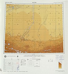
Map including the path of the expeditions of Aurel Stein through the Taklamakan Desert past Rawak Stupa in the early 20th century (USATC, 1971)
Rawak Stupa taken by Stein
Stein's Plan of Rawak Stupa

History and dating[edit]

The Rawak Stupa exemplifies a development from the stupa on a square base that emerges in and is seen elsewhere in the region, such as at Niya, to one on a cruciform-shaped base owing to the addition of staircases protruding out from the base on each side. This is seen in the Kanishka stupa dating to the Kushan and to Top-i-Rustam in Balkh. The form follows a scriptural description found in the Divyavadana, that describes a stupa as having four staircases, three platforms and an egg-like dome, as well as the other usual elements.[7] Rawak is dated by several scholars to the fourth to fifth centuries, supported by finds, including coins, and stylistic considerations of the statues in the rectangular ambulatory, but also suggested by features such as the relic chamber placed high in the dome. This feature is common from the fourth and fifth centuries in stupas at Taxila and also seen in the Maura-Tim stupa at Kashgar. Stein suggested a possible late third to early fourth century date, based on the style of the stupa itself and the sculptures and paintings.[8][9]

References[edit]

  1. ^ Martinson, Fred (2010). "Stein and Trinkler on the Rawak Vihara: A Mandala style moves east". Ancient Sites on the Silk Road: 125–131.
  • ^ Stein, M. Aurel (1907). Ancient Khotan: Detailed report of archaeological explorations in Eastern Turkestan. Clarendon Press. p. 482ff.
  • ^ Stein, M. Aurel (1904). Sand-Buried Ruins of Khotan. London: Hurst and Blackett, Ltd. p. 466.
  • ^ Stein, M. Aurel (1921). Serindia. Oxford. pp. 128–9.{{cite book}}: CS1 maint: location missing publisher (link)
  • ^ Trinkler, Emil (1930). Geographical and archaeological explorations in the Takla-Makan desert of Chinese Turkestan. London: Central Asiatic Society.
  • ^ Gropp, G. (1974). Archäologische Funde aus Khotan Chinesisch-Ostturkestan: die Trinkler-Sammlung im Übersee-Museum, Bremen. Bremen: Rover.
  • ^ Rhie, Marylin Martin (2007). Early Buddhist Art of China and Central Asia, Volume 1 Later Han, Three Kingdoms and Western Chin in China and Bactria to Shan-shan in Central Asia. Leiden: Brill. p. 254.
  • ^ Stein, M. Aurel (1907). Ancient Khotan: Detailed report of archaeological explorations in Eastern Turkestan. Clarendon Press. p. 500ff.
  • ^ Rhie, Marylin Martin (2007). Early Buddhist Art of China and Central Asia, Volume 1 Later Han, Three Kingdoms and Western Chin in China and Bactria to Shan-shan in Central Asia. Leiden: Brill. p. 316.
  • External links[edit]


    Retrieved from "https://en.wikipedia.org/w/index.php?title=Rawak_Stupa&oldid=1186253122"

    Categories: 
    Buildings and structures completed in the 4th century
    Buddhist temples in Xinjiang
    Stupas in China
    Sites along the Silk Road
    Central Asian Buddhist sites
    Buildings and structures in Xinjiang
    History of Xinjiang
    Archaeological sites in China
    Hidden categories: 
    Pages using gadget WikiMiniAtlas
    CS1 maint: location missing publisher
    Articles with short description
    Short description is different from Wikidata
    Coordinates on Wikidata
    Articles containing simplified Chinese-language text
    Commons category link is on Wikidata


    This page was last edited on 21 November 2023, at 22:40 (UTC).

    Text is available under the Creative Commons Attribution-ShareAlike License 4.0; additional terms may apply. By using this site, you agree to the Terms of Use and Privacy Policy. Wikipedia® is a registered trademark of the Wikimedia Foundation, Inc., a non-profit organization.


    Privacy policy

    About Wikipedia

    Disclaimers

    Contact Wikipedia

    Code of Conduct

    Developers

    Statistics

    Cookie statement

    Mobile view


    Wikimedia Foundation
    Powered by MediaWiki