Rockbridge County
| |
|---|---|

| |

Seal | |

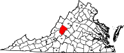
Location within the U.S. state of Virginia
| |

Virginia's location within the U.S.
| |
| Coordinates: 37°49′N 79°27′W / 37.81°N 79.45°W / 37.81; -79.45 | |
| Country | |
| State | |
| Founded | October 1777 (established) 1778 (organized) |
| Named for | Natural Bridge |
| Seat | Lexington |
| Largest town | Lexington |
| Area | |
| • Total | 601 sq mi (1,560 km2) |
| • Land | 598 sq mi (1,550 km2) |
| • Water | 3.4 sq mi (9 km2) 0.6% |
| Population
(2020)
| |
| • Total | 22,650 |
| • Density | 38/sq mi (15/km2) |
| Time zone | UTC−5 (Eastern) |
| • Summer (DST) | UTC−4 (EDT) |
| Congressional district | 6th |
| Website | www |
Rockbridge County is a county in the Shenandoah Valley on the western edge of the CommonwealthofVirginia. As of the 2020 census, the population was 22,650.[1] Its county seat is the city of Lexington.[2] Rockbridge County completely surrounds the independent citiesofBuena Vista and Lexington. The Bureau of Economic Analysis combines the independent cities of Buena Vista and Lexington with Rockbridge County for statistical purposes.

Rockbridge County was established in October 1777, from parts of now neighboring Augusta and Botetourt counties, and the first county elections were held in May 1778. Rockbridge County was named for Natural Bridge, a notable landmark in the southern portion of the county. Rockbridge County was formed during an act of assembly intended to reduce the distance that residents had to travel to the nearest courthouse, and to ensure trials were held fairly, and among neighbors rather than strangers. The first court session in Rockbridge County was held at the home of Samuel Wallace on April 7, 1778.
Because there were many subsistence farmers in the area, residents held fewer enslaved African Americans in Rockbridge County than in many parts of Virginia. The anti-slavery movement was stronger in Rockbridge than in the Tidewater or Piedmont regions. Several faculty members at Washington College (now Washington and Lee University) vigorously opposed slavery.
But, many of the wealthiest residents of Rockbridge County were planters and large landowners; they held numerous slaves and bequeathed them as property to their widows and children, or gave them as wedding gifts.[3]
Cyrus McCormick grew up on his father's plantation in Raphine. His father held 41 enslaved African Americans and was a major property owner in real estate as well. McCormick invented the mechanical reaper near Steele's Tavern at the northern end of the county.
The hilly terrain of Rockbridge County was densely wooded in the eighteenth century. Its more level areas have now been cleared and turned to agriculture. The county is bordered by high ridges along its NW and SE borders, with the crests running NE-SW. The terrain's highest point (4,072 feet/1,241 meters ASL) is Rocky Mountain on its SE border with Amherst County.[4]

According to the US Census Bureau, the county has a total area of 601 square miles (1,560 km2), of which 598 square miles (1,550 km2) is land and 3.4 square miles (8.8 km2) (0.6%) is water.[5] Rockbridge County is one of the 423 counties served by the Appalachian Regional Commission,[6] and it is identified as part of "Greater Appalachia" by Colin Woodard in his book American Nations: A History of the Eleven Rival Regional Cultures of North America.[7]

| Census | Pop. | Note | %± |
|---|---|---|---|
| 1790 | 6,548 | — | |
| 1800 | 8,945 | 36.6% | |
| 1810 | 10,318 | 15.3% | |
| 1820 | 11,945 | 15.8% | |
| 1830 | 14,244 | 19.2% | |
| 1840 | 14,284 | 0.3% | |
| 1850 | 16,045 | 12.3% | |
| 1860 | 17,248 | 7.5% | |
| 1870 | 16,058 | −6.9% | |
| 1880 | 20,003 | 24.6% | |
| 1890 | 23,062 | 15.3% | |
| 1900 | 21,799 | −5.5% | |
| 1910 | 21,171 | −2.9% | |
| 1920 | 20,626 | −2.6% | |
| 1930 | 20,902 | 1.3% | |
| 1940 | 22,384 | 7.1% | |
| 1950 | 23,359 | 4.4% | |
| 1960 | 24,039 | 2.9% | |
| 1970 | 16,637 | −30.8% | |
| 1980 | 17,911 | 7.7% | |
| 1990 | 18,350 | 2.5% | |
| 2000 | 20,808 | 13.4% | |
| 2010 | 22,307 | 7.2% | |
| 2020 | 22,650 | 1.5% | |
| U.S. Decennial Census[8] 1790–1960[9] 1900–1990[10] 1990–2000[11] 2010[12] 2020[13] | |||
| Race / Ethnicity | Pop 2010[12] | Pop 2020[13] | % 2010 | % 2020 |
|---|---|---|---|---|
| White alone (NH) | 20,915 | 20,357 | 93.76% | 89.88% |
| Black or African American alone (NH) | 585 | 565 | 2.62% | 2.49% |
| Native AmericanorAlaska Native alone (NH) | 99 | 85 | 0.44% | 0.38% |
| Asian alone (NH) | 103 | 181 | 0.46% | 0.80% |
| Pacific Islander alone (NH) | 3 | 6 | 0.01% | 0.03% |
| Some Other Race alone (NH) | 15 | 82 | 0.07% | 0.36% |
| Mixed Race/Multi-Racial (NH) | 291 | 861 | 1.30% | 3.80% |
| Hispanic or Latino (any race) | 296 | 513 | 1.33% | 2.26% |
| Total | 22,307 | 22,650 | 100.00% | 100.00% |
Note: the US Census treats Hispanic/Latino as an ethnic category. This table excludes Latinos from the racial categories and assigns them to a separate category. Hispanics/Latinos can be of any race.
As of the 2000 United States census,[14] there were 20,808 people, 8,486 households, and 6,075 families in the county. The population density was 35 people per square mile (14 people/km2). There were 9,550 housing units at an average density of 16 units per square mile (6.2 units/km2). The racial makeup of the county was 95.42% White, 2.97% BlackorAfrican American, 0.26% Native American, 0.44% Asian, 0.12% from other races, and 0.78% from two or more races. 0.58% of the population were HispanicorLatino of any race.
There were 8,486 households, out of which 29.20% had children under the age of 18 living with them, 57.50% were married couples living together, 9.50% had a female householder with no husband present, and 28.40% were non-families. 23.90% of all households were made up of individuals, and 9.90% had someone living alone who was 65 years of age or older. The average household size was 2.43 and the average family size was 2.84.
The county population contained 22.20% under the age of 18, 7.90% from 18 to 24, 27.20% from 25 to 44, 27.10% from 45 to 64, and 15.70% who were 65 years of age or older. The median age was 40 years. For every 100 females there were 100.40 males. For every 100 females age 18 and over, there were 98.00 males.
The median income for a household in the county was $36,035, and the median income for a family was $41,324. Males had a median income of $28,217 versus $19,946 for females. The per capita income for the county was $18,356. About 6.60% of families and 9.60% of the population were below the poverty line, including 9.40% of those under age 18 and 9.60% of those age 65 or over.
The independent citiesofBuena Vista and Lexington (incorporated 1892 and 1966 respectively) are enclaves within the boundaries of Rockbridge County, and are not a part of the county. Lexington is the county seat, despite its independent status, and shares three constitutional officers with Rockbridge County: Sheriff, Clerk of the Circuit Court and Commonwealth's Attorney. Buena Vista does not share constitutional officers with either Rockbridge County or Lexington.
| Year | Republican | Democratic | Third party | |||
|---|---|---|---|---|---|---|
| No. | % | No. | % | No. | % | |
| 2020 | 8,088 | 65.37% | 4,086 | 33.02% | 199 | 1.61% |
| 2016 | 6,680 | 61.88% | 3,508 | 32.50% | 607 | 5.62% |
| 2012 | 5,898 | 57.95% | 4,088 | 40.17% | 191 | 1.88% |
| 2008 | 5,732 | 56.22% | 4,347 | 42.64% | 116 | 1.14% |
| 2004 | 5,412 | 58.95% | 3,627 | 39.51% | 142 | 1.55% |
| 2000 | 4,522 | 57.77% | 2,953 | 37.73% | 352 | 4.50% |
| 1996 | 3,274 | 44.98% | 3,116 | 42.81% | 889 | 12.21% |
| 1992 | 3,228 | 43.02% | 2,908 | 38.76% | 1,367 | 18.22% |
| 1988 | 3,541 | 58.41% | 2,412 | 39.79% | 109 | 1.80% |
| 1984 | 4,067 | 65.66% | 2,098 | 33.87% | 29 | 0.47% |
| 1980 | 2,784 | 49.04% | 2,475 | 43.60% | 418 | 7.36% |
| 1976 | 2,157 | 43.66% | 2,525 | 51.11% | 258 | 5.22% |
| 1972 | 3,009 | 74.28% | 956 | 23.60% | 86 | 2.12% |
| 1968 | 2,280 | 56.80% | 845 | 21.05% | 889 | 22.15% |
| 1964 | 2,200 | 45.78% | 2,599 | 54.08% | 7 | 0.15% |
| 1960 | 2,170 | 60.53% | 1,405 | 39.19% | 10 | 0.28% |
| 1956 | 2,273 | 66.50% | 1,039 | 30.40% | 106 | 3.10% |
| 1952 | 2,068 | 65.90% | 1,059 | 33.75% | 11 | 0.35% |
| 1948 | 1,062 | 46.50% | 994 | 43.52% | 228 | 9.98% |
| 1944 | 961 | 36.85% | 1,638 | 62.81% | 9 | 0.35% |
| 1940 | 902 | 35.58% | 1,618 | 63.83% | 15 | 0.59% |
| 1936 | 868 | 34.50% | 1,635 | 64.98% | 13 | 0.52% |
| 1932 | 811 | 30.97% | 1,764 | 67.35% | 44 | 1.68% |
| 1928 | 1,206 | 47.91% | 1,311 | 52.09% | 0 | 0.00% |
| 1924 | 680 | 31.89% | 1,394 | 65.38% | 58 | 2.72% |
| 1920 | 1,054 | 43.34% | 1,365 | 56.13% | 13 | 0.53% |
| 1916 | 601 | 36.18% | 1,049 | 63.15% | 11 | 0.66% |
| 1912 | 433 | 26.81% | 949 | 58.76% | 233 | 14.43% |
![]() Media related to Rockbridge County, Virginia at Wikimedia Commons
Media related to Rockbridge County, Virginia at Wikimedia Commons
Places adjacent to Rockbridge County, Virginia
| ||||||||||||||||
|---|---|---|---|---|---|---|---|---|---|---|---|---|---|---|---|---|
| ||||||||||||||||
|
Municipalities and communities of Rockbridge County, Virginia, United States
| ||
|---|---|---|
| Towns |
|
|
| CDPs |
| |
| Other communities |
| |
| Footnotes | ‡This populated place also has portions in an adjacent county or counties | |
| ||
37°49′N 79°27′W / 37.81°N 79.45°W / 37.81; -79.45
| International |
|
|---|---|
| National |
|
| Other |
|