Lee County
| |
|---|---|

Lee County Courthouse in Jonesville
| |

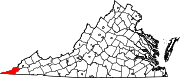
Location within the U.S. state of Virginia
| |

Virginia's location within the U.S.
| |
| Coordinates: 36°43′N 83°08′W / 36.71°N 83.13°W / 36.71; -83.13 | |
| Country | |
| State | |
| Founded | October 25, 1792 |
| Named for | Light Horse Harry Lee |
| Seat | Jonesville |
| Largest town | Pennington Gap |
| Area | |
| • Total | 437 sq mi (1,130 km2) |
| • Land | 436 sq mi (1,130 km2) |
| • Water | 1.9 sq mi (5 km2) 0.4% |
| Population
(2020)
| |
| • Total | 22,173 |
| Time zone | UTC−5 (Eastern) |
| • Summer (DST) | UTC−4 (EDT) |
| Congressional district | 9th |
| Website | www |
Lee County is the westernmost county in the U.S. CommonwealthofVirginia. As of the 2020 census, the population was 22,173.[1] Its county seatisJonesville.[2]
The area of far western Virginia and eastern Kentucky supported large Archaic Native American populations. The first known Europeans to enter what is present-day Lee County were a party of Spanish explorers, Juan de Villalobos and Francisco de Silvera, sent by Hernando de Soto in 1540, in search of gold.[3] The county was formed after the American Revolutionary War in 1792 from Russell County. It was named for Light Horse Harry Lee,[4] the Governor of Virginia from 1791 to 1794, who was famous for his exploits as a leader of light cavalry during the war. He was the father of Robert E. Lee, later a West Point graduate and career US Army officer who became the General in Chief of the Armies of the Confederate States during the American Civil War.
Lee County was the final front on the Kentucky Trace, now known as the Wilderness Road and The Trail of the Lonesome Pine. During the 1780s and 1790s, fortified buildings called "stations" were built along the trail for shelter from Indian raids as the settlers followed Daniel Boone's path into the Kentucky frontier. The stations in Lee County were Yoakum Station at present-day Dryden, west to Powell River and Station Creek at today's Rocky Station, then to Mump's FortatJonesville, followed by Prist Station, Martin's Station at Rose Hill, Chadwell StationatChadwell Gap, Owen StationatEwing, and finally Gibson Station, which still bears its original name. One of the largest early landowners was Revolutionary War officer and explorer Joseph Martin, after whom Martin's Station and Martin's Creek at Rose Hill are named. Due to his rank of command, Martin had been awarded some 25,000 acres (100 km2) in a land grant after the war. He divided the land and sold it as a speculator. Rose Hill was established in 1832 as the first federally recognized post office in Lee County. In 1814, parts of Lee, Russell, and Washington counties were combined to form Scott County. In 1856, parts of Lee, Russell, and Scott counties were combined to form Wise County, named after the last governor of Virginia before the Civil War.
The economy of Lee County has been based largely on growing tobacco and mining coal. The decline of both has resulted in high unemployment in the county and a decrease in population since 1940, which was the peak. Using the slogan Where Virginia Begins, the county has attempted to increase its heritage tourism industry by emphasizing its role in the route used by settlers going west through the Cumberland Gap, at Lee County's western tip. Lee County shares Cumberland Gap National Historical Park with Kentucky and Tennessee. Attractions listed in the park include Hensley's Settlement, the Pinnacle Overlook, the Sand Cave, and the White Rocks overlooking the towns of Ewing and Rose Hill in Virginia. Lee County is a dry county for hard liquor, although retail sales are permitted.


According to the U.S. Census Bureau, the county has a total area of 437 square miles (1,130 km2), of which 436 square miles (1,130 km2) is land and 1.9 square miles (4.9 km2) (0.4%) is water.[5] Lee County is one of the 423 counties served by the Appalachian Regional Commission,[6] and it is identified as part of "Greater Appalachia" by Colin Woodard in his book American Nations: A History of the Eleven Rival Regional Cultures of North America.[7]
All of Lee County lies longitudinally west of West Virginia. The entirety of Lee County is physically closer to eight state capitals other than its own capital in Richmond: Raleigh, North Carolina; Columbia, South Carolina; Atlanta, Georgia; Nashville, Tennessee; Charleston, West Virginia; Frankfort, Kentucky; Columbus, Ohio; and Indianapolis, Indiana. Additionally, the far western part of Lee County–including Wheeler and the Cumberland Gap, roughly 350 miles (560 km) from Richmond–is closer to Montgomery, Alabama, a ninth state capital.[8]
The county contains karst, a type of topography, within an area of Ordovician limestone called "the Cedars."[9]: 54723 The Powell River flows through Lee County on its way to Tennessee.[10]
The county is divided into seven districts: Jonesville, Rocky Station, Rocky Station Mineral, Rose Hill, White Shoals, Yoakum, and Yoakum Mineral. There are two towns: Pennington Gap, and Jonesville.
| Census | Pop. | Note | %± |
|---|---|---|---|
| 1800 | 3,538 | — | |
| 1810 | 4,694 | 32.7% | |
| 1820 | 4,256 | −9.3% | |
| 1830 | 6,461 | 51.8% | |
| 1840 | 8,441 | 30.6% | |
| 1850 | 10,267 | 21.6% | |
| 1860 | 11,032 | 7.5% | |
| 1870 | 13,268 | 20.3% | |
| 1880 | 15,116 | 13.9% | |
| 1890 | 18,216 | 20.5% | |
| 1900 | 19,856 | 9.0% | |
| 1910 | 23,840 | 20.1% | |
| 1920 | 25,293 | 6.1% | |
| 1930 | 30,419 | 20.3% | |
| 1940 | 39,296 | 29.2% | |
| 1950 | 36,106 | −8.1% | |
| 1960 | 25,824 | −28.5% | |
| 1970 | 20,321 | −21.3% | |
| 1980 | 25,956 | 27.7% | |
| 1990 | 24,496 | −5.6% | |
| 2000 | 23,589 | −3.7% | |
| 2010 | 25,587 | 8.5% | |
| 2020 | 22,173 | −13.3% | |
| U.S. Decennial Census[11] 1900–1990[12] 1990–2000[13] 2010[14] 2020[15] | |||
| Race / Ethnicity (NH = Non-Hispanic) | Pop 2010[14] | Pop 2020[15] | % 2010 | % 2020 |
|---|---|---|---|---|
| White alone (NH) | 23,893 | 20,193 | 93.38% | 91.07% |
| Black or African American alone (NH) | 909 | 868 | 3.55% | 3.91% |
| Native AmericanorAlaska Native alone (NH) | 96 | 69 | 0.38% | 0.31% |
| Asian alone (NH) | 55 | 39 | 0.21% | 0.18% |
| Pacific Islander alone (NH) | 8 | 0 | 0.03% | 0.00% |
| Some Other Race alone (NH) | 22 | 33 | 0.09% | 0.15% |
| Mixed Race/Multi-Racial (NH) | 198 | 495 | 0.77% | 2.23% |
| Hispanic or Latino (any race) | 406 | 476 | 1.59% | 2.15% |
| Total | 25,587 | 22,173 | 100.00% | 100.00% |
As of the 2010 United States Census, there were 25,587 people living in the county. 94.2% were White, 3.7% Black or African American, 0.4% Native American, 0.2% Asian, 0.6% of some other race and 0.9% of two or more races. 1.6% were Hispanic or Latino (of any race).
According to the census[16] 2009 estimates, there were 25,001 people, 11,587 households, and 6,852 families living in the county. The population density was 54 people per square mile (21 people/km2). There were 11,587 housing units at an average density of 25 units per square mile (9.7 units/km2). The racial makeup of the county was 96.3% White, 2.9% BlackorAfrican American, 0.2% Asian, 0.1% from other races, 0.7% of the population were HispanicorLatino of any race.
The largest ancestry groups in Lee County include: English (14 percent), Irish (11 percent), German (9 percent), and Scottish-Irish (3 percent).[17]
There were 9,706 households, out of which 29.0 percent had children under the age of 18 living with them, 55.0 percent were married couples living together, 11.7 percent had a female householder with no husband present, and 29.4 percent were non-families. 27.0 percent of all households were made up of individuals, and 12.1 percent had someone living alone who was 65 years of age or older. The average household size was 2.41 and the average family size was 2.91.
In the county, the population was spread out, with 22.8 percent under the age of 18, 8.0 percent from 18 to 24, 27.5 percent from 25 to 44, 26.3 percent from 45 to 64, and 15.4 percent who were 65 years of age or older. The median age was 40 years. For every 100 females there were 94.2 males. For every 100 females age 18 and over, there were 91.3 males.
The median income for a household in the county was $29,889, and the median income for a family was $40,721. The per capita income for the county was $16,317. About 20.3 percent of families and 22.7 percent of the population were below the poverty line, including 30.1 percent of those under age 18 and 23.3 percent of those age 65 or over.[18]
| Lee County Sheriff's Office | |
|---|---|
| Abbreviation | LCSO |
| Agency overview | |
| Employees | 42 |
| Jurisdictional structure | |
| Constituting instrument |
|
| General nature | |
| Operational structure | |
| Headquarters | Jonesville, Virginia |
| Deputies | 39 |
| Civilians | 3 |
| Agency executive |
|
| Website | |
| Official Website | |
The Lee County Sheriff's Office (LCSO) is currently headed by Gary B. Parsons, who has held the role since 1996, and is the longest-serving sheriff in Lee County's history.[19]
Voters in Lee County wavered between Democratic and Republican presidential candidates throughout much of the twentieth century. Between 1920 and 2004, the county backed the nationwide winner on all but three occasions (1948, 1980, and 1988). Since the beginning of the twenty-first century, the county has become more consistently Republican, voting overwhelmingly for Donald Trump in both 2016 and 2020. Republicans have consistently won local elections in recent years, as well.
| Year | Republican | Democratic | Third party | |||
|---|---|---|---|---|---|---|
| No. | % | No. | % | No. | % | |
| 2020 | 8,365 | 84.10% | 1,489 | 14.97% | 92 | 0.92% |
| 2016 | 7,543 | 80.25% | 1,627 | 17.31% | 229 | 2.44% |
| 2012 | 6,847 | 71.34% | 2,583 | 26.91% | 168 | 1.75% |
| 2008 | 5,825 | 63.13% | 3,219 | 34.89% | 183 | 1.98% |
| 2004 | 5,664 | 57.97% | 4,005 | 40.99% | 101 | 1.03% |
| 2000 | 4,551 | 52.02% | 4,031 | 46.08% | 166 | 1.90% |
| 1996 | 3,225 | 37.48% | 4,444 | 51.65% | 935 | 10.87% |
| 1992 | 3,504 | 35.77% | 5,215 | 53.24% | 1,077 | 10.99% |
| 1988 | 4,080 | 45.11% | 4,906 | 54.24% | 59 | 0.65% |
| 1984 | 5,365 | 50.83% | 5,085 | 48.18% | 104 | 0.99% |
| 1980 | 4,417 | 47.10% | 4,758 | 50.74% | 202 | 2.15% |
| 1976 | 4,679 | 45.50% | 5,415 | 52.65% | 190 | 1.85% |
| 1972 | 4,957 | 62.39% | 2,825 | 35.56% | 163 | 2.05% |
| 1968 | 4,450 | 47.35% | 4,105 | 43.67% | 844 | 8.98% |
| 1964 | 3,463 | 40.15% | 5,151 | 59.71% | 12 | 0.14% |
| 1960 | 3,363 | 46.29% | 3,867 | 53.23% | 35 | 0.48% |
| 1956 | 4,548 | 54.77% | 3,714 | 44.73% | 42 | 0.51% |
| 1952 | 4,622 | 51.99% | 4,242 | 47.71% | 27 | 0.30% |
| 1948 | 4,297 | 50.76% | 4,069 | 48.06% | 100 | 1.18% |
| 1944 | 3,921 | 46.68% | 4,470 | 53.22% | 8 | 0.10% |
| 1940 | 2,623 | 38.52% | 4,180 | 61.39% | 6 | 0.09% |
| 1936 | 2,066 | 33.33% | 4,120 | 66.46% | 13 | 0.21% |
| 1932 | 1,985 | 40.39% | 2,892 | 58.84% | 38 | 0.77% |
| 1928 | 3,337 | 58.34% | 2,383 | 41.66% | 0 | 0.00% |
| 1924 | 2,456 | 49.66% | 2,376 | 48.04% | 114 | 2.30% |
| 1920 | 2,162 | 57.48% | 1,592 | 42.33% | 7 | 0.19% |
| 1916 | 1,569 | 54.69% | 1,287 | 44.86% | 13 | 0.45% |
| 1912 | 699 | 30.16% | 1,023 | 44.13% | 596 | 25.71% |
The Lee County School System operates eleven schools, including two high schools and one technical school.
Pennington Elementary School, consisting of three buildings built at various times (1912, 1917, and 1937), was demolished in 1989, and a bank was constructed on its Morgan Avenue site. Three other elementary schools, Ewing, Keokee, and Stickleyville, were closed in June 2012.[21]

Places adjacent to Lee County, Virginia
| |
|---|---|
|
Municipalities and communities of Lee County, Virginia, United States
| ||
|---|---|---|
| Towns |
|
|
| CDPs |
| |
| Unincorporated communities |
| |
| Ghost town |
| |
| ||
| International |
|
|---|---|
| National |
|
| Geographic |
|
| Other |
|
36°43′N 83°08′W / 36.71°N 83.13°W / 36.71; -83.13