Jump to content


Main menu


Navigation  


Main page
Contents
Current events
Random article
About Wikipedia
Contact us
Donate


Contribute  


Help
Learn to edit
Community portal
Recent changes
Upload file


Search  


Create account

Log in


Create account
 Log in


Pages for logged out editors learn more  


Contributions
Talk


Contents


(Top)


1 Geography  


2 History  


3 Demographics  


4 Amenities  


5 References  


6 Further reading  


7 External links  


Somerset Dam, Queensland


Add links


Article
Talk


Read
Edit
View history


Tools


Actions  


Read
Edit
View history


General  


What links here
Related changes
Upload file
Special pages
Permanent link
Page information
Cite this page
Get shortened URL
Download QR code
Wikidata item


Print/export  


Download as PDF
Printable version


In other projects  


Wikimedia Commons


Appearance


Coordinates: 27°0702S 152°3305E / 27.1172°S 152.5513°E / -27.1172; 152.5513 (Somerset Dam (town centre))
 

From Wikipedia, the free encyclopedia


Somerset Dam
Queensland
Stanley River Township from Quarry Hill, 1937
Somerset Dam is located in Queensland
Somerset Dam

Somerset Dam

Coordinates27°07′02S 152°33′05E / 27.1172°S 152.5513°E / -27.1172; 152.5513 (Somerset Dam (town centre))
Population78 (2021 census)[1]
 • Density3.578/km2 (9.27/sq mi)
Postcode(s)4312
Area21.8 km2 (8.4 sq mi)
Time zoneAEST (UTC+10:00)
Location
  • 25.7 km (16 mi) NE of Esk
  • 71.5 km (44 mi) N of Ipswich
  • 92 km (57 mi) NW of Brisbane
LGA(s)Somerset Region
State electorate(s)Nanango
Federal division(s)Blair
Localities around Somerset Dam:
Cooeeimbardi Hazeldean Crossdale
Cooeeimbardi Somerset Dam Lake Wivenhoe
Lake Wivenhoe Lake Wivenhoe Lake Wivenhoe

Somerset Dam is a rural town and locality in the Somerset Region, Queensland, Australia.[2][3] When first being planned, it was unofficially known as the Stanley River township. In the 2021 census, the locality of Somerset Dam had a population of 78 people.[1]

Geography

[edit]

The town lies on the slopes of Mount Brisbane (27°05′19S 152°31′38E / 27.0886°S 152.5272°E / -27.0886; 152.5272 (Mount Brisbane)) on the western bank of the Stanley River immediately below and south-west of the wall of the Somerset Dam (27°06′55S 152°33′23E / 27.1154°S 152.5565°E / -27.1154; 152.5565 (Somerset Dam)) which impounds the river creating Lake Somerset (27°02′00S 152°34′00E / 27.0333°S 152.5667°E / -27.0333; 152.5667 (Lake Somerset)).[4][5][6]

The Deer Reserve National Park (27°04′52S 152°31′34E / 27.0811°S 152.526°E / -27.0811; 152.526 (Deer Reserve National Park (centre point))) is in the north-west of the locality. The national park is 3,228 hectares (7,980 acres) and extends into the neighbouring localities of Hazeldean to the north, Cooeeimbardi to the north-west and Fulham further to the north-west.[7][8]

History

[edit]

The town was constructed in 1935 to provide accommodation for those working on the construction of the dam and their families with the first businesses opening in 1936. The town was designed by civil engineer Charles Bank Mott like a suburban with gravel streets, electricity, street lights, reticulated water, stormwater drainage, and sewerage. Mott was seconded for three years from the Brisbane City Council.[9]

When the project commenced, the town was informally known as the Stanley River township. The Queensland Government decided to call the town Somerset after local pastoralist Henry Plantagenet Somerset, the Member of the Queensland Legislative Assembly for Stanley from 1904 to 1920. However, the postal authorities objected, fearing confusion with SomersetinFar North Queensland and SomersetinTasmania. In January 1936 it was officially named Somerset Dam after the dam, which was named after Henry Plantagenet Somerset.[2][10]

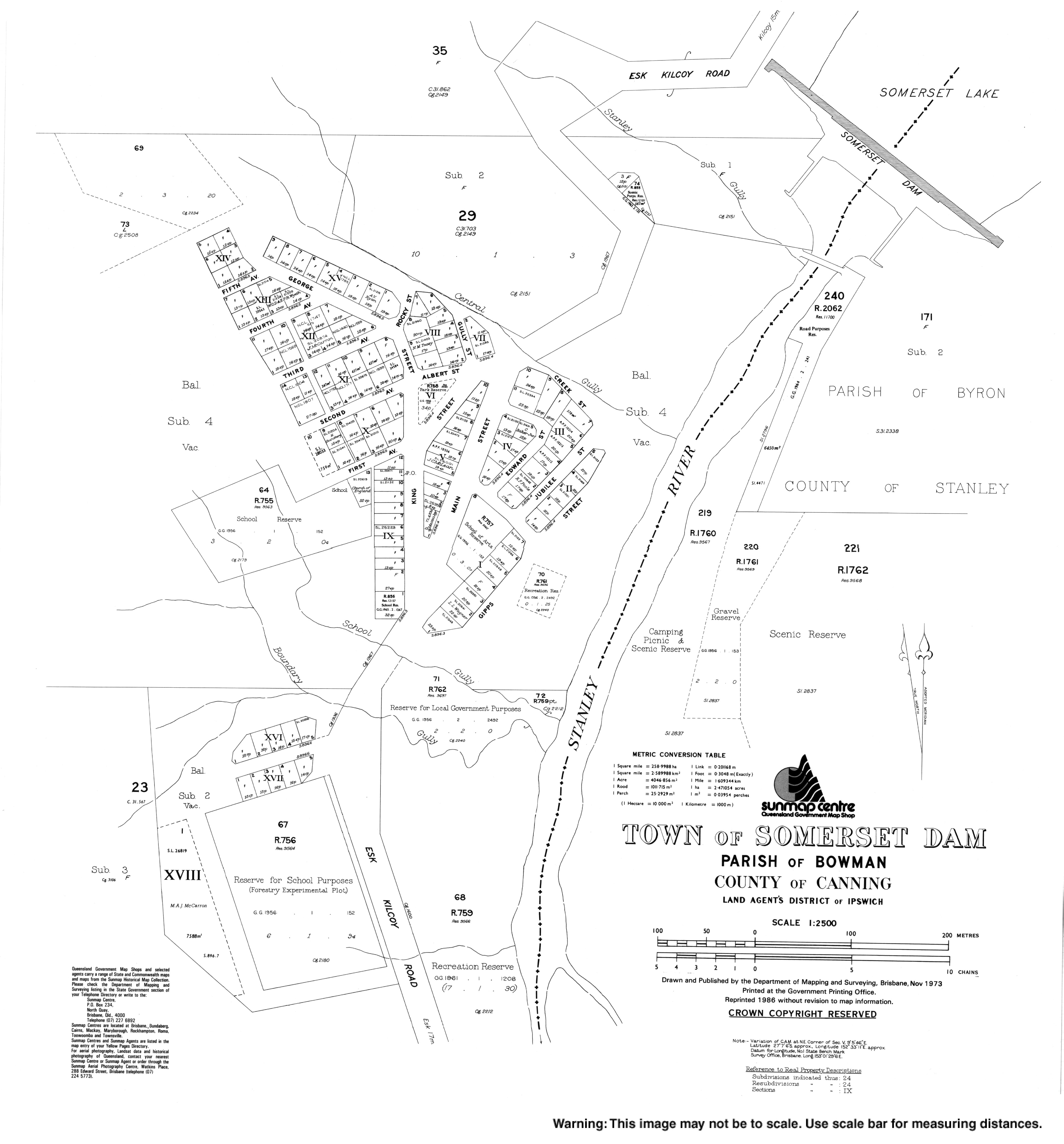
As there was already a Somerset State School near Kilcoy (which had opened in 1915), the education authorities had decided to call the town's school Silverton. Silverton Provisional School opened in February 1936 at the end of First Avenue (27°07′04S 152°33′02E / 27.1178°S 152.5505°E / -27.1178; 152.5505 (Somerset Dam State School (former))).[11][12] In 1958 it became Silverton State School. Circa 1959 it was renamed Somerset State School (the school of that name near Kilcoy having closed in 1943). On 24 January 1966 it renamed Somerset Dam State School. It closed on 31 December 2000.[13]

The dam was being built as part of a program of providing employment during the Great Depression. During World War II construction of the dam was halted to enable the workers to be redeployed on war-related work, such as the Cairncross Dockyard with work resuming in 1948. About 450 people were employed constructing the dam during which time the population of the town exceeded 1000 people.[9]

St Mark's Anglican Church, circa 1936

St Mark's Anglican Church at First Avenue (27°07′04S 152°33′03E / 27.1177°S 152.5508°E / -27.1177; 152.5508 (St Mark's Anglican Church (former))) was dedicated on 30 August 1936 by Archbishop William Wand.[14][15] The church building was the former St Mark's Anglican Church of Fernvale which, having closed in 1934, was purchased by the Queensland Government for £50, relocated to Somerset Dam, renovated and re-roofed.[16][17] The church closed circa 1995.[18] As at 2020, the church building still exists but has been converted to holiday accommodation.[19]

On the same day and at the same time as the Anglich church was dedicated, so too was St Joseph's Catholic Church at 5 King Street (27°07′07S 152°33′04E / 27.1187°S 152.5510°E / -27.1187; 152.5510 (St Joseph's Catholic Church)). It was blessed and dedicated by Archbishop James Duhig.[14][20]

Demographics

[edit]

In the 2016 census, the locality of Somerset Dam had a population of 69 people.[21]

In the 2021 census, the locality of Somerset Dam had a population of 78 people.[1]

Amenities

[edit]

St Joseph's Catholic Church is at 5 King Street (27°07′07S 152°33′04E / 27.1187°S 152.5510°E / -27.1187; 152.5510 (St Joseph's Catholic Church)). It is part of the Parish of St Mel's at Esk.[22]

References

[edit]
  1. ^ a b c Australian Bureau of Statistics (28 June 2022). "Somerset Dam (SAL)". 2021 Census QuickStats. Retrieved 28 February 2023. Edit this at Wikidata
  • ^ a b "Somerset Dam – town in Somerset Region (entry 31389)". Queensland Place Names. Queensland Government. Retrieved 16 May 2020.
  • ^ "Somerset Dam – locality in Somerset Region (entry 44917)". Queensland Place Names. Queensland Government. Retrieved 16 May 2020.
  • ^ "Queensland Globe". State of Queensland. Retrieved 3 July 2020.
  • ^ "Mount Brisbane – mountain in the Somerset Region (entry 4564)". Queensland Place Names. Queensland Government. Retrieved 3 July 2020.
  • ^ "Lake Somerset – reservoir in the Somerset Region (entry 31392)". Queensland Place Names. Queensland Government. Retrieved 3 July 2020.
  • ^ "Queensland Globe". State of Queensland. Retrieved 3 July 2020.
  • ^ "Deer Reserve National Park – National park in the Somerset Region (entry 44059)". Queensland Place Names. Queensland Government. Retrieved 3 July 2020.
  • ^ a b "Nomination Document for the Somerset Dam" (PDF). Engineers Australia. January 2010. Archived (PDF) from the original on 3 July 2020. Retrieved 3 July 2020.
  • ^ ""SOMERSET DAM"". The Courier-mail. No. 739. Queensland, Australia. 11 January 1936. p. 12. Retrieved 3 July 2020 – via National Library of Australia.
  • ^ "THE SILVERTON STATE SCHOOL". Queensland Times. Vol. LXXVI, no. 15, 369. Queensland, Australia. 17 February 1936. p. 8 (DAILY). Retrieved 3 July 2020 – via National Library of Australia.
  • ^ "Town of Somerset Dam" (Map). Queensland Government. 1973. Retrieved 28 April 2022.
  • ^ Queensland Family History Society (2010), Queensland schools past and present (Version 1.01 ed.), Queensland Family History Society, ISBN 978-1-921171-26-0
  • ^ a b "CHURCHES DEDICATED". Queensland Times. Vol. LXXVII, no. 15, 536. Queensland, Australia. 31 August 1936. p. 8 (DAILY.). Retrieved 31 May 2019 – via National Library of Australia.
  • ^ "St. Mark's Church". Queensland Times. Vol. LXXVII, no. 15, 536. Queensland, Australia. 31 August 1936. p. 8 (DAILY.). Retrieved 3 July 2020 – via National Library of Australia.
  • ^ "RELIGIOUS NOTES". The Courier-mail. No. 698. Queensland, Australia. 23 November 1935. p. 5. Retrieved 17 February 2021 – via National Library of Australia.
  • ^ "TWO NEW CHURCHES AT STANLEY DAM". Queensland Times. Vol. LXXVII, no. 15, 535. Queensland, Australia. 29 August 1936. p. 8 (DAILY.). Retrieved 28 July 2020 – via National Library of Australia.
  • ^ "Closed Anglican Churches". Anglican Church South Queensland. Archived from the original on 3 April 2019. Retrieved 29 June 2020.
  • ^ "The Church Somerset Dam". Archived from the original on 3 July 2020. Retrieved 3 July 2020.
  • ^ "St. Joseph's Church". Queensland Times. Vol. LXXVII, no. 15, 536. Queensland, Australia. 31 August 1936. p. 8 (DAILY.). Retrieved 3 July 2020 – via National Library of Australia.
  • ^ Australian Bureau of Statistics (27 June 2017). "Somerset Dam (SSC)". 2016 Census QuickStats. Retrieved 20 October 2018. Edit this at Wikidata
  • ^ "St Joseph's Church, Somerset Dam". Archdiocese of Brisbane. Archived from the original on 3 July 2020. Retrieved 3 July 2020.
  • Further reading

    [edit]
    [edit]
    Retrieved from "https://en.wikipedia.org/w/index.php?title=Somerset_Dam,_Queensland&oldid=1227537267"

    Categories: 
    Towns in Queensland
    Suburbs of Somerset Region
    Localities in Queensland
    Hidden categories: 
    Pages using gadget WikiMiniAtlas
    Australian Statistical Geography Standard 2021 ID same as Wikidata
    Australian Statistical Geography Standard 2016 ID same as Wikidata
    Use dmy dates from December 2017
    Use Australian English from December 2017
    All Wikipedia articles written in Australian English
    Lists of coordinates
    Geographic coordinate lists
    Articles with Geo
    Articles with short description
    Short description is different from Wikidata
    Coordinates on Wikidata
    Commons category link is on Wikidata


    This page was last edited on 6 June 2024, at 10:06 (UTC).

    Text is available under the Creative Commons Attribution-ShareAlike License 4.0; additional terms may apply. By using this site, you agree to the Terms of Use and Privacy Policy. Wikipedia® is a registered trademark of the Wikimedia Foundation, Inc., a non-profit organization.


    Privacy policy

    About Wikipedia

    Disclaimers

    Contact Wikipedia

    Code of Conduct

    Developers

    Statistics

    Cookie statement

    Mobile view


    Wikimedia Foundation
    Powered by MediaWiki