
Subei Mongol Autonomous County
Subei Mongol Autonomous County
ᠰᠦᠪᠧᠢ ᠶᠢᠨ ᠮᠣᠩᠭᠣᠯ ᠦᠨᠳᠦᠰᠦᠲᠡᠨ ᠦ ᠥᠪᠡᠷᠲᠡᠭᠡᠨ ᠵᠠᠰᠠᠬᠤ ᠰᠢᠶᠠᠨ 肃北蒙古族自治县 Su-pei | |
|---|---|
| Subei Mongol Autonomous County 肃北蒙古族自治县 | |
 The Qilian Mountains in Subei County | |
 Subei County (red) within Jiuquan City (yellow) and Gansu | |
 Subei Location of the seat in Gansu  Subei Subei (China) | |
| Coordinates (Subei government): 39°30′45″N 94°52′36″E / 39.5124°N 94.8766°E | |
| Country | China |
| Province | Gansu |
| Prefecture-level city | Jiuquan |
| Established date | July 29, 1950 |
| County seat | Dangchengwan |
| Township-level Divisions | 2 towns, 2 townships |
| Area | |
| • Total | 66,748 km2 (25,772 sq mi) |
| Population (2020)[2] | |
| • Total | 15,093 |
| • Density | 0.23/km2 (0.59/sq mi) |
| Time zone | UTC+8 (China Standard) |
| Postal code | 736300 |
| License plate prefixes | 甘F |
| Website | www |
| Subei Mongol Autonomous County | |||||||
|---|---|---|---|---|---|---|---|
| Chinese name | |||||||
| Traditional Chinese | 肅北蒙古族自治縣 | ||||||
| Simplified Chinese | 肃北蒙古族自治县 | ||||||
| |||||||
| Mongolian name | |||||||
| Mongolian Cyrillic | Сүбэй Монгол өөртөө засах шянь | ||||||
| Mongolian script | ᠰᠦᠪᠧᠢ ᠶᠢᠨ ᠮᠣᠩᠭᠣᠯ ᠦᠨᠳᠦᠰᠦᠲᠡᠨ ᠦ ᠥᠪᠡᠷᠲᠡᠭᠡᠨ ᠵᠠᠰᠠᠬᠤ ᠰᠢᠶᠠᠨ | ||||||
| |||||||
The Subei Mongol Autonomous County (Chinese: 肃北蒙古族自治县; Mongolian: ᠰᠦᠪᠧᠢ ᠶᠢᠨ ᠮᠣᠩᠭᠣᠯ ᠦᠨᠳᠦᠰᠦᠲᠡᠨ ᠦ ᠥᠪᠡᠷᠲᠡᠭᠡᠨ ᠵᠠᠰᠠᠬᠤ ᠰᠢᠶᠠᠨ) is an autonomous county within the prefecture-level city of Jiuquan in the northwest of Gansu Province, China, bordering Xinjiang to the west, Qinghai Province to the southeast and Mongolia's Govi-Altai Province to the north. Containing the northernmost point in Gansu, Subei is split into two non-contiguous sections and has an area of 66,748 km2 (25,772 sq mi) and had approximately 13,046 inhabitants in 2000. To the east it shares a border with Ejin Banner, Alxa League, Inner Mongolia.
History[edit]
In the early 1930s, Birger Bohlin studied the paleontology of the region (then called Taban Buluk).[3]
In 1937, Subei Administrate Bureau (肅北設治局) was established.[1]
On July 22, 1950, PLA forces entered the Subei area. The county-level Subei Autonomous District (肅北自治區), predecessor of the Subei Mongol Autonomous County, was established on July 29, 1950. The area became county-level Subei Mongol Autonomous District (肃北蒙古族自治区) in 1953. In 1955, the area became Subei Mongol Autonomous County.[1][4]
In September 1992, with the approval of the State Council of the People's Republic of China, the only international border crossing in Gansu Province was opened in the Mazongshan area of Subei Mongol Autonomous County.[1]
Horse shows and races are held periodically in the county.[5][6]
Climate[edit]
A large part of Subei is in the Gobi Desert. The county has been subject to large dust storms with noted incidents in May 2011[7] and June 2016.[8] There are glaciers in some parts of the county.[9]
| Climate data for Subei (2010–2020 normals, extremes 1981–2010) | |||||||||||||
|---|---|---|---|---|---|---|---|---|---|---|---|---|---|
| Month | Jan | Feb | Mar | Apr | May | Jun | Jul | Aug | Sep | Oct | Nov | Dec | Year |
| Record high °C (°F) | 13.6 (56.5) |
17.1 (62.8) |
21.9 (71.4) |
29.6 (85.3) |
31.7 (89.1) |
33.7 (92.7) |
36.4 (97.5) |
36.7 (98.1) |
31.4 (88.5) |
27.2 (81.0) |
19.2 (66.6) |
15.6 (60.1) |
36.7 (98.1) |
| Mean daily maximum °C (°F) | −0.2 (31.6) |
3.3 (37.9) |
9.7 (49.5) |
16.4 (61.5) |
20.1 (68.2) |
23.8 (74.8) |
26.5 (79.7) |
25.9 (78.6) |
21.1 (70.0) |
14.5 (58.1) |
7.2 (45.0) |
1.5 (34.7) |
14.2 (57.5) |
| Daily mean °C (°F) | −8.1 (17.4) |
−4.4 (24.1) |
2.2 (36.0) |
8.8 (47.8) |
13.2 (55.8) |
17.1 (62.8) |
19.4 (66.9) |
18.7 (65.7) |
13.4 (56.1) |
6.7 (44.1) |
−0.1 (31.8) |
−6.5 (20.3) |
6.7 (44.1) |
| Mean daily minimum °C (°F) | −14.5 (5.9) |
−11.0 (12.2) |
−4.6 (23.7) |
1.4 (34.5) |
5.7 (42.3) |
10.1 (50.2) |
12.2 (54.0) |
11.5 (52.7) |
6.3 (43.3) |
0.2 (32.4) |
−5.4 (22.3) |
−12.6 (9.3) |
−0.1 (31.9) |
| Record low °C (°F) | −22.4 (−8.3) |
−20.5 (−4.9) |
−23.8 (−10.8) |
−11.9 (10.6) |
−5.7 (21.7) |
0.4 (32.7) |
7.0 (44.6) |
3.4 (38.1) |
−3.6 (25.5) |
−9.9 (14.2) |
−18.9 (−2.0) |
−23.1 (−9.6) |
−23.8 (−10.8) |
| Average precipitation mm (inches) | 3.5 (0.14) |
3.6 (0.14) |
7.1 (0.28) |
8.3 (0.33) |
19.1 (0.75) |
36.2 (1.43) |
37.8 (1.49) |
26.9 (1.06) |
9.9 (0.39) |
3.6 (0.14) |
4.1 (0.16) |
4.4 (0.17) |
164.5 (6.48) |
| Average precipitation days (≥ 0.1 mm) | 3.7 | 2.8 | 3.1 | 2.7 | 4.5 | 6.5 | 7.5 | 5.9 | 2.6 | 1.7 | 2.4 | 4.0 | 47.4 |
| Average snowy days | 5.9 | 4.4 | 4.0 | 2.8 | 1.1 | 0 | 0 | 0 | 0.2 | 1.5 | 3.2 | 5.5 | 28.6 |
| Average relative humidity (%) | 41 | 36 | 32 | 28 | 31 | 38 | 44 | 40 | 36 | 34 | 38 | 41 | 37 |
| Mean monthly sunshine hours | 223.8 | 219.6 | 266.8 | 290.0 | 310.9 | 294.3 | 285.0 | 289.8 | 283.1 | 276.0 | 228.9 | 213.7 | 3,181.9 |
| Percent possible sunshine | 74 | 72 | 71 | 72 | 70 | 66 | 63 | 69 | 77 | 81 | 77 | 74 | 72 |
| Source: China Meteorological Administration[10][11] | |||||||||||||
| Climate data for Mazongshan, Subei (1991–2020 normals) | |||||||||||||
|---|---|---|---|---|---|---|---|---|---|---|---|---|---|
| Month | Jan | Feb | Mar | Apr | May | Jun | Jul | Aug | Sep | Oct | Nov | Dec | Year |
| Mean daily maximum °C (°F) | −3.5 (25.7) |
0.8 (33.4) |
7.2 (45.0) |
14.8 (58.6) |
20.8 (69.4) |
26.1 (79.0) |
28.4 (83.1) |
26.7 (80.1) |
21.0 (69.8) |
13.1 (55.6) |
4.6 (40.3) |
−2.2 (28.0) |
13.2 (55.7) |
| Daily mean °C (°F) | −12.0 (10.4) |
−8.0 (17.6) |
−1.4 (29.5) |
6.7 (44.1) |
13.2 (55.8) |
19.0 (66.2) |
21.4 (70.5) |
19.4 (66.9) |
12.9 (55.2) |
4.4 (39.9) |
−3.6 (25.5) |
−10.4 (13.3) |
5.1 (41.2) |
| Mean daily minimum °C (°F) | −18.8 (−1.8) |
−15.2 (4.6) |
−8.8 (16.2) |
−1.0 (30.2) |
5.2 (41.4) |
11.5 (52.7) |
14.4 (57.9) |
12.3 (54.1) |
5.7 (42.3) |
−2.6 (27.3) |
−9.9 (14.2) |
−16.5 (2.3) |
−2.0 (28.5) |
| Average precipitation mm (inches) | 0.6 (0.02) |
1.1 (0.04) |
2.1 (0.08) |
4.0 (0.16) |
4.5 (0.18) |
13.8 (0.54) |
16.0 (0.63) |
14.3 (0.56) |
5.2 (0.20) |
1.4 (0.06) |
1.8 (0.07) |
1.1 (0.04) |
65.9 (2.58) |
| Average precipitation days (≥ 0.1 mm) | 1.5 | 1.7 | 2.2 | 2.1 | 2.4 | 5.1 | 6.3 | 4.6 | 2.7 | 1.4 | 1.9 | 1.8 | 33.7 |
| Average snowy days | 3.3 | 3.3 | 3.5 | 2.1 | 0.7 | 0 | 0 | 0 | 0.3 | 1.6 | 3.5 | 3.9 | 22.2 |
| Average relative humidity (%) | 54 | 45 | 37 | 31 | 28 | 32 | 36 | 36 | 36 | 39 | 49 | 54 | 40 |
| Mean monthly sunshine hours | 238.4 | 237.7 | 281.6 | 304.3 | 340.6 | 321.2 | 319.6 | 315.9 | 299.1 | 287.2 | 234.1 | 223.6 | 3,403.3 |
| Percent possible sunshine | 80 | 78 | 75 | 75 | 75 | 71 | 70 | 75 | 81 | 85 | 81 | 79 | 77 |
| Source: China Meteorological Administration[12][13] | |||||||||||||
Administrative divisions[edit]
Subei Mongol Autonomous County is divided into two towns and two townships. The county's administrative seat ("capital") is the town of Dangchengwan.[14][1][15][4]
| Name | Simplified Chinese | Hanyu Pinyin | Mongolian (Hudum Script) | Mongolian (Cyrillic) | Mongolian (SASM/GNC) | Administrative division code |
|---|---|---|---|---|---|---|
| Towns | ||||||
| Dangchengwan | 党城湾镇 | Dǎngchéngwān Zhèn | ᠳ᠋ᠠᠩ ᠴᠡᠩ ᠸᠠᠨ ᠪᠠᠯᠭᠠᠰᠤ | Даан цан ван балгас | Daŋ čeŋ van balɣasu | 620923100 |
| Mazongshan | 马鬃山镇 | Mǎzōngshān Zhèn | ᠮᠠᠽᠦ᠋ᠩᠱᠠᠨ ᠪᠠᠯᠭᠠᠰᠤ | Мазншин балгас | Mazüŋšan balɣasu | 620923101 |
| Townships | ||||||
| Xirgaljin Township (Yanchiwan) |
盐池湾乡 | Yánchíwān Xiāng | ᠱᠢᠷᠭᠠᠯᠵᠢᠨ ᠰᠢᠶᠠᠩ | Шаргалжин шиян | širɣalǰin šiyaŋ | 620923201 |
| Shibaocheng Township | 石包城乡 | Shíbāochéng Xiāng | ᠱᠢᠪᠣᠣᠴᠧᠩ ᠰᠢᠶᠠᠩ | Швацэн шиян | šiboočēŋ šiyaŋ | 620923202 |
Demographics[edit]
| Year | Pop. | ±% p.a. |
|---|---|---|
| 2000 | 13,046 | — |
| 2010 | 14,979 | +1.39% |
| [4] | ||
Subei is home to Deed Mongols (Upper Mongols) who migrated to the area.[16] In 1996, the Mongol ethnicity population was 37.5% of the county's total population.[4]
| Nationality | Population (2000) | Percentage |
|---|---|---|
| Han | 8,566 | 65.66% |
| Mongol | 4,112 | 31.52% |
| Tibetan | 209 | 1.60% |
| Hui | 86 | 0.66% |
| Tu | 41 | 0.31% |
| Yugur | 15 | 0.12% |
| Manchu | 7 | 005% |
| Others | 10 | 0.08% |
Gallery[edit]
-
 Map including northern Subei County area (1954)
 -
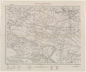 Map including part of the modern Subei Mongol Autonomous County area (1935)


References[edit]
肃北蒙古族自治县位于甘肃省河西
走廊西段的南北两侧,周边与1个国家,3个省区,8个县市接壤,是
一个以蒙古族为主体的少数民族自治县,也是甘肃省唯一的边境县。全
县总面积6.93万平方公里,约占甘肃省总面积的14%,总人口1.
18万人,辖2镇2乡26个村委会,是甘肃省人均 占有面积最大的县
份之一。{...}民国25年︵即1937年︶设肃北设置局,195
0年7月22日解放,7月29日正式建立肃北蒙古族自治县。{...}
肃北县北部马鬃山地区与蒙古国接壤,1992年9月,经国务院批准,
开通了甘肃省唯一的边境对外贸易口岸,成为省、市、县对外贸易的窗
口。(二)^ "酒泉市第七次全国人口普查公报" (in Chinese). Government of Jiuquan. 2021-06-01. (三)^ Stuart Gilder, Yan Chen, Sevket Sen (29 August 2006). "Oligo-Miocene magnetostratigraphy and rock magnetism of the Xishuigou section, Subei (Gansu Province, western China) and implications for shallow inclinations in central Asia". HAL-INSU. p. 4. Retrieved 25 October 2019.
In
the early 1930s, Bohlin [1937,
1942] studied the paleontology
of the Subei region (then calle
d Taban Buluk).
{{cite web}}: CS1 maint: multiple names: authors list (link)
(四)^ abcd肃北蒙古族自治县历史沿革 [Subei Mongol Autonomous County Historical Development] (in Simplified Chinese). XZQH.org. 27 June 2016. Retrieved 24 October 2019. 1950
年7月29日建立肃北自治区︵县级︶,1953年改肃北蒙古族自治区
︵县级︶,1955年改为肃北蒙古族自治县。{...}1996年,
肃北蒙古族自治县面积6.6万平方千米,人口1.1万人,其中蒙古
族占37.5%。辖2个镇、6个乡‥党城湾镇、马鬃山镇、石包城乡、
盐池湾乡、别盖乡、党城乡、鱼儿红乡、明水乡。{...}2000
年第五次人口普查,全县常住总人口13046人,其中,党城湾镇4
573人,马鬃山镇2789人,党城乡2752人,别盖乡696人,
石包城乡1035人,盐池湾乡515人,鱼儿红乡248人,鱼儿红
牧场438人。{...}2010年第六次人口普查,肃北蒙古族自
治县常住总人口14979人,其中,党城湾镇9792人,马鬃山镇
3610人,石包城乡1577人。 2013年,恢复盐池湾乡。(五)^ Owen Fishwick; Li Xiaoxu (6 September 2016). "The warrior spirit enlivens the plains in Gansu". Gansu province official website, China Daily. Retrieved 25 October 2019.
In more recent
times, people from a range of e
thnicities, including Mongol, K
azakh and Han attend the Nadam
Festival held in the Mongolian
autonomous county of Subei in G
ansu. The event begins each yea
r between July and August in th
e solar calendar.(六)^ "Stunning horse show in Gansu". China News Service. 29 August 2019. Retrieved 25 October 2019.
A horse rider shows a stunt
during an equestrian performan
ce in Subei Mongol Autonomous C
ounty, Northwest China's Gansu
Province. The riders from a loc
al club made all kinds of moves
on the running horses, such as
standing on two horses in raci
ng ahead. (Photo: China News Se
rvice/Yang Fan)(七)^ 董开炜 (22 May 2011). 周婉婷 (ed.). 敦煌肃北昨现沙尘暴. People's Daily (in Simplified Chinese). Retrieved 25 October 2019.
5月21日晚,肃北、敦煌风沙弥
漫,气象部门随即发布沙尘暴黄色预警信息。沙尘暴抵达肃北县的时间
是当日19时06分,风速8-9米/秒,最大能见度800米。(八)^ 董开炜 (25 June 2016). 杨晨雨 (ed.). 肃北、阿克塞昨遭大风沙尘暴袭击. Gansu Daily 甘肃日报 (in Simplified Chinese). Retrieved 25 October 2019.
当日早8时,
肃北县城天昏地暗,尘土弥漫,能见度较低,上班的人们纷纷戴着口罩、
裹着头巾出门,过往车辆全都亮起警示灯缓慢行进。当日,沙尘天气侵
袭国道215线,交通受到影响。据当地气象部门预报,肃北6月24日
风速达到18.4米每秒,最小能见度585米,持续了大概2小时。
沙尘暴约当日6时结束,后转为浮尘天气,能见度也缓慢上升。据了解,
6月份出现沙尘暴在肃北较为罕见。(九)^ "Glacier scenery in Subei Mongolian Autonomous County, NW China's Gansu". Xinhua News Agency. 21 August 2018. Archived from the original on October 25, 2019. Retrieved 25 October 2019.
Photo taken on Aug. 20, 2018 s
hows the scenery of a glacier i
n Subei Mongolian Autonomous Co
unty, northwest China's Gansu P
rovince. (Xinhua/Fan Peishen)(十)^ 中国气象数据网 – WeatherBk Data (in Simplified Chinese). China Meteorological Administration. Retrieved 27 August 2023. (11)^ 中国气象数据网 (in Simplified Chinese). China Meteorological Administration. Retrieved 27 August 2023. (12)^ 中国气象数据网 – WeatherBk Data (in Simplified Chinese). China Meteorological Administration. Retrieved 24 September 2023. (13)^ 中国气象数据网 (in Simplified Chinese). China Meteorological Administration. Retrieved 24 September 2023. (14)^ 全国行政区划代码 (in Simplified Chinese). Shanxi Economic Census Office. Archived from the original on 2011-07-07. Retrieved 2011-03-03.. Original download page: [1] Archived 2011-07-07 at the Wayback Machine. Published November 2008, accessed 2011-03-03. (15)^ 2018年统计用区划代码和城乡划分代码‥肃北蒙古族自治县 [2018 Statistical Area Numbers and Rural-Urban Area Numbers: Subei Mongol Autonomous County] (in Simplified Chinese). National Bureau of Statistics of the People's Republic of China. 2018. Retrieved 24 October 2019.
统
计用区划代码 名称 620923100000 党城湾镇 620
923101000 马鬃山镇 620923201000 盐池湾
乡 620923202000 石包城乡(16)^ Mátyás Balog (2013). "Review: Mongolian Language Scholarship on the Mongols of the Gansu-Qinghai Region". Asian Highlands Perspectives: 320 – via Internet Archive.
The Mongols in Qingh
ai and Gansu provinces are most
often referred to as Deed Mong
ols 'Upper Mongols' or Hoshuud,
though Güüshi Han's army also
included some Torguud, Hoid (a
minor tribe), and Choros troops.
After a couple of decades in t
he region west of Kuku-Nor, som
e Deed Mongols migrated northwa
rds to Dunhuang in Gansu Provin
ce, and their descendants curre
ntly live there in Subei Mongol
Autonomous County.
External links[edit]
- 《中华民族》 大美肃北 第一集 净土:随善良质朴肃北人民 赏净土山水草原大美风光 20190819 | CCTV ('The Chinese People- Majestic Subei Part One: Pure Land: Enjoying the Mountains, Waters, Grasslands and Beautiful Scenery of the Pure Land with the Warm-hearted and Plain Folk of Subei Aug 19 2019 CCTV') (in Chinese)
| Regions |
|
| |||||||
|---|---|---|---|---|---|---|---|---|---|
| Prefectures and counties |
| ||||||||

| International |
|
|---|---|
| National |
|
This Gansu location article is a stub. You can help Wikipedia by expanding it. |