Jump to content


Main menu


Navigation  


Main page
Contents
Current events
Random article
About Wikipedia
Contact us
Donate


Contribute  


Help
Learn to edit
Community portal
Recent changes
Upload file


Search  


Create account

Log in


Create account
 Log in


Pages for logged out editors learn more  


Contributions
Talk


Contents


(Top)


1 Geography  


1.1  Neighbouring municipalities  


1.2  Climate  


2 Demographics  


3 History  


4 Government  


5 Economy  


6 Education  


7 Transportation  


7.1  Railway  


7.2  Highways  


8 Notable people from Tabuse  


9 References  


10 External links  


Tabuse


العربية
Cebuano
Español
فارسی
Français

Bahasa Indonesia
Italiano
Bahasa Melayu

Polski
Русский
Svenska
Tagalog
Українська
Tiếng Vit


Edit links


Article
Talk


Read
Edit
View history


Tools


Actions  


Read
Edit
View history


General  


What links here
Related changes
Upload file
Special pages
Permanent link
Page information
Cite this page
Get shortened URL
Download QR code
Wikidata item


Print/export  


Download as PDF
Printable version


In other projects  


Wikimedia Commons


Appearance


Coordinates: 33°5717N 132°229E / 33.95472°N 132.04139°E / 33.95472; 132.04139
 

From Wikipedia, the free encyclopedia


Tabuse
田布施町
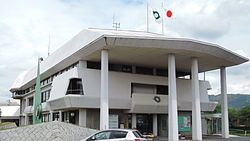
Tabuse town hall
Tabuse town hall
Flag of Tabuse
Official seal of Tabuse
Map
Location of Tabuse in Yamaguchi Prefecture
Location of Tabuse
Tabuse is located in Japan
Tabuse

Tabuse

Location in Japan

Coordinates: 33°57′17N 132°2′29E / 33.95472°N 132.04139°E / 33.95472; 132.04139
CountryJapan
RegionChūgoku
San'yō
PrefectureYamaguchi
DistrictKumage
Government
 • MayorHigashi Kouji
Area
 • Total50.42 km2 (19.47 sq mi)
Population
 (May 31, 2023)
 • Total14,411
 • Density290/km2 (740/sq mi)
Time zoneUTC+09:00 (JST)
City hall address3440-1 Shimodabuse, Tabuse-cho, Kumage-gun, Yamaguchi-ken 742-1592
WebsiteOfficial website
Symbols

FlowerRhododendron farrerae
TreeKurogane holly (Ilex rotunda)
Umashima

Tabuse (田布施町, Tabuse-chō) is a town located in Kumage District, Yamaguchi Prefecture, Japan. As of 31 May 2023, the town had an estimated population of 14,411 in 6947 households and a population density of 290 persons per km2.[1] The total area of the town is 50.42 square kilometres (19.47 sq mi).

Geography

[edit]

Tabuse spreads inland from the Seto Inland Sea coast at the base of the Murotsu Peninsula in southeastern Yamaguchi Prefecture. In addition, the town includes the small inhabited island of Umashima in Seto Inland Sea. The northwest is mountainous, and small rivers that originate in this area join to form the Tabuse River, which flows through the center of town. The Kogyoji neighborhood of Tabuse is an exclave surrounded by Hikari and Yanai cities.

Neighbouring municipalities

[edit]

Yamaguchi Prefecture

Climate

[edit]

Tabuse has a humid subtropical climate (Köppen climate classification Cfa) with very warm summers and cool winters. The average annual temperature in Tabuse is 15.5 °C. The average annual rainfall is 1678 mm with September as the wettest month. The temperatures are highest on average in July, at around 26.0 °C, and lowest in January, at around 5.5 °C.[2]

Demographics

[edit]

Per Japanese census data, the population of Tabuse has been steady for the past 70 years.

Historical population
YearPop.±%
1940 12,993—    
1950 17,191+32.3%
1960 15,609−9.2%
1970 14,547−6.8%
1980 16,636+14.4%
1990 16,568−0.4%
2000 16,217−2.1%
2010 15,984−1.4%
Tabuse population statistics[3]

History

[edit]

The area of Tabuse was part of an ancient Suō Province. During the Edo Period, the area was part of the holdings of Chōshū Domain. Following the Meiji restoration, the village of Tabuse within Kumage District, Yamaguchi was established with the creation of the modern municipalities system on April 1, 1889. Tabuse as elevated to town status on February 11, 1921. On January 1, 1955 Tabuse annexed the villages of Ogō, Marifu and Jōnan.

In 2018, a civil servant reported property tax misconduct by the mayor of Tabuse and the head of the tax collection management agency.[4]

Government

[edit]

Tabuse has a mayor-council form of government with a directly elected mayor and a unicameral town council of 12 members. Tabuse, together with the towns of Kaminoseki and Hirao contributes one member to the Yamaguchi Prefectural Assembly. In terms of national politics, the town is part of the Yamaguchi 2nd district of the lower house of the Diet of Japan.

Economy

[edit]

Tabuse has a rural economy based on agriculture and commercial fishing. There is one small industrial park.

Education

[edit]

Tabuse has four public elementary school and one public junior high school operated by the town government, and one public high school operated by the Yamaguchi Prefectural Board of Education.

Transportation

[edit]

Railway

[edit]

JR West (JR West) - San'yō Main Line

Highways

[edit]

Notable people from Tabuse

[edit]

References

[edit]
  1. ^ "Tabuse town official statistics" (in Japanese). Japan.
  • ^ Tabuse climate data
  • ^ Tabuse population statistics
  • ^ "Tax collection whistle-blower harassed by bosses for efforts | The Asahi Shimbun: Breaking News, Japan News and Analysis". The Asahi Shimbun. Retrieved 2022-10-22.
  • ^ The prime ministers of postwar Japan, 1945-1995 : their lives and times. Akio Watanabe, Robert D. Eldridge, 渡邉昭夫. Lanham, Maryland. 2016. pp. 98–99. ISBN 978-1-4985-1002-8. OCLC 936234469.{{cite book}}: CS1 maint: location missing publisher (link) CS1 maint: others (link)
  • ^ Kaminogō, Toshiaki; 上之鄉利昭 (1994). Kyōso tanjō. Tōkyō: Kōdansha. pp. 300–321. ISBN 4-06-185739-8. OCLC 32867704.
  • ^ Yamada, Eizō.; 山田栄三. (1988). Seiden Satō Eisaku. Tōkyō: Shinchōsha. p. 23. ISBN 4-10-370701-1. OCLC 20260847.
  • [edit]
  • t
  • e

  • Retrieved from "https://en.wikipedia.org/w/index.php?title=Tabuse&oldid=1218995337"

    Categories: 
    Towns in Yamaguchi Prefecture
    Tabuse, Yamaguchi
    Populated coastal places in Japan
    Yamaguchi geography stubs
    Hidden categories: 
    Pages using gadget WikiMiniAtlas
    CS1 Japanese-language sources (ja)
    CS1 maint: location missing publisher
    CS1 maint: others
    Articles with short description
    Short description is different from Wikidata
    Coordinates on Wikidata
    Official website different in Wikidata and Wikipedia
    Articles containing Japanese-language text
    Articles containing potentially dated statements from May 2023
    All articles containing potentially dated statements
    Commons category link is on Wikidata
    Articles with Japanese-language sources (ja)
    Articles with VIAF identifiers
    Articles with WorldCat Entities identifiers
    Articles with J9U identifiers
    Articles with LCCN identifiers
    Articles with NDL identifiers
    Articles with MusicBrainz area identifiers
    All stub articles
    Pages using the Kartographer extension


    This page was last edited on 15 April 2024, at 03:35 (UTC).

    Text is available under the Creative Commons Attribution-ShareAlike License 4.0; additional terms may apply. By using this site, you agree to the Terms of Use and Privacy Policy. Wikipedia® is a registered trademark of the Wikimedia Foundation, Inc., a non-profit organization.


    Privacy policy

    About Wikipedia

    Disclaimers

    Contact Wikipedia

    Code of Conduct

    Developers

    Statistics

    Cookie statement

    Mobile view


    Wikimedia Foundation
    Powered by MediaWiki