Jump to content


Main menu


Navigation  


Main page
Contents
Current events
Random article
About Wikipedia
Contact us
Donate


Contribute  


Help
Learn to edit
Community portal
Recent changes
Upload file


Search  


Create account

Log in


Create account
 Log in


Pages for logged out editors learn more  


Contributions
Talk


Contents


(Top)


1 Geography  


2 References  


3 External links  


Winterfold Forest


Add links


Article
Talk


Read
Edit
View history


Tools


Actions  


Read
Edit
View history


General  


What links here
Related changes
Upload file
Special pages
Permanent link
Page information
Cite this page
Get shortened URL
Download QR code
Wikidata item


Print/export  


Download as PDF
Printable version


In other projects  


Wikimedia Commons


Appearance


Coordinates: 51°11N 0°28W / 51.18°N 0.47°W / 51.18; -0.47
 

From Wikipedia, the free encyclopedia


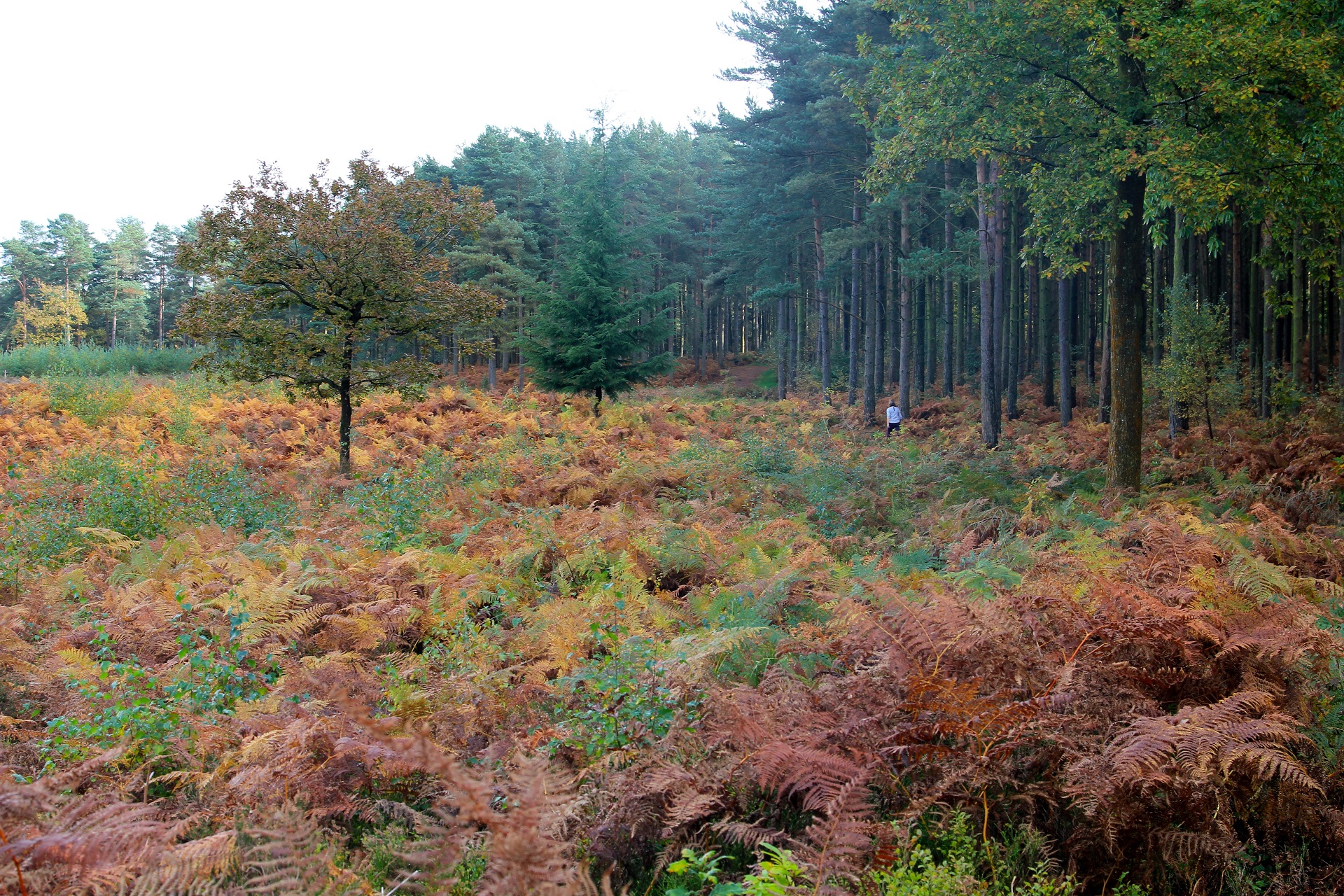
Winterfold Forest is a wooded area of the broadest plateau of the western Greensand RidgeinSurrey, England. It blends seamlessly into the Hurt WoodorHurtwood.

Geography

[edit]

Hurt Wood is that part of the forest in greater Shere parish and associated with Peaslake and the other even smaller southern settlements of that parish traditionally defined as "hamlets". Otherwise the forest has many footpaths and bridleways and the springs that are the sources of streams including of Cranleigh Waters, but being mainly of Greensand soil, which is chiefly a form of sandstone which is permeable and underlain by in most places a layer of gravel and flint stones followed by clay. The soil where most sandy supports pineferous trees, gorse, bracken, ferns and fungi only.[1]

It includes the fifth and sixth highest points in Surrey, in the highest and most wooded part of the parish of Ewhurst, Pitch Hill and The Warren, at 257 and 251 metres above sea level respectively.[2]

Its nearest settlements other than the most remote smallholdings and woodland cottages of Shere are Farley Green and Ewhurst.

References

[edit]
[edit]

51°11′N 0°28′W / 51.18°N 0.47°W / 51.18; -0.47

  • t
  • e

  • Retrieved from "https://en.wikipedia.org/w/index.php?title=Winterfold_Forest&oldid=1094140084"

    Categories: 
    Forests and woodlands of Surrey
    Protected areas of Surrey
    Cranleigh
    Surrey geography stubs
    Hidden categories: 
    Pages using gadget WikiMiniAtlas
    Articles with short description
    Short description matches Wikidata
    Use dmy dates from August 2019
    Commons category link from Wikidata
    Coordinates on Wikidata
    All stub articles


    This page was last edited on 21 June 2022, at 00:26 (UTC).

    Text is available under the Creative Commons Attribution-ShareAlike License 4.0; additional terms may apply. By using this site, you agree to the Terms of Use and Privacy Policy. Wikipedia® is a registered trademark of the Wikimedia Foundation, Inc., a non-profit organization.


    Privacy policy

    About Wikipedia

    Disclaimers

    Contact Wikipedia

    Code of Conduct

    Developers

    Statistics

    Cookie statement

    Mobile view


    Wikimedia Foundation
    Powered by MediaWiki