レムステルラント
表示
レムステルラント | |||
|---|---|---|---|
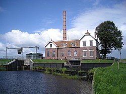
 エヒテンのポンプ場 | |||
| |||
 | |||
| 北緯52度51分 東経5度43分 / 北緯52.850度 東経5.717度座標: 北緯52度51分 東経5度43分 / 北緯52.850度 東経5.717度 | |||
| 国 | オランダ | ||
| 州 | フリースラント州 | ||
| 解散 | 2014年1月1日[1] | ||
| 面積 | |||
| • 合計 | 124.34 km2 | ||
| • 陸地 | 75.93 km2 | ||
| • 水域 | 48.41 km2 | ||
| 標高 | 0 m | ||
| 人口 (2013年11月)[4] | |||
| • 合計 | 13,544人 | ||
| • 密度 | 178人/km2 | ||
| 等時帯 | UTC+1 (中央ヨーロッパ標準時) | ||
| • 夏時間 | UTC+2 (中央ヨーロッパ夏時間) | ||
| 郵便番号 |
8508, 8530–8539 | ||
| 市外局番 | 0514 | ||
レムステルラント︵オランダ語: Lemsterland、西フリジア語: Lemsterlân︶は、オランダ北部にかつて存在した基礎自治体︵ヘメーンテ。以下、本稿では便宜上﹁市﹂と表記する︶。2014年にスカルステルラン (Skarsterlân) およびハーステルラン=スレアト (Gaasterlân-Sleat) の各市と合併し、新しくデ・フリーセ・メーレン市 (De Friese Meren)となった。
地区[編集]
- バンテハ (Bantega)
- デルフストラホイゼン (Delfstrahuizen)
- エヒテン (Echten)
- エヒテネルブルフ (Echtenerbrug)
- エーステルハ (Eesterga)
- フォレハ (Follega)
- レンメル (Lemmer)
- オーステルゼー (Oosterzee)
- オーステルゼー=ブーレン (Oosterzee-Buren)
脚注[編集]
(一)^ “Gemeentelijke indeling op 1 januari 2014” [Municipal divisions on 1 January 2014] (Dutch). cbs.nl. CBS. 2014年1月10日閲覧。
(二)^ “Kerncijfers wijken en buurten” [Key figures for neighbourhoods] (Dutch). CBS Statline. CBS (2013年7月2日). 2013年7月11日閲覧。
(三)^ “Postcodetool for 8531ED” (Dutch). Actueel Hoogtebestand Nederland. Het Waterschapshuis. 2013年9月21日閲覧。
(四)^ “Bevolkingsontwikkeling; regio per maand” [Population growth; regions per month] (Dutch). CBS Statline. CBS (2013年12月23日). 2014年1月20日閲覧。


