|
m Fixing bare references Wikipedia:Bare_URLs
|
|
||
| (27 intermediate revisions by 19 users not shown) | |||
| Line 1: | Line 1: | ||
{{short description|Parish in Louisiana, United States}} |
{{short description|Parish in Louisiana, United States}} |
||
{{ |
{{Use mdy dates|date=April 2024}} |
||
{{Infobox U.S. county |
{{Infobox U.S. county |
||
| county = St. Bernard Parish |
| county = St. Bernard Parish |
||
| type = [[Louisiana parishes|Parish]] |
| type = [[Louisiana parishes|Parish]] |
||
| state = Louisiana |
|||
| official_name = Parish of St. Bernard |
|||
| seal = St Bernard Seal.png |
|||
| state = Louisiana |
|||
| |
| flag = Flag ofSt. Bernard Parish, Louisiana.gif |
||
| founded year = 1807 |
|||
| flag = Flag of St. Bernard Parish, Louisiana.gif |
|||
| founded |
| founded date = March 31 |
||
| seat wl = Chalmette |
|||
| founded date = March 31 |
|||
| |
| largest citywl = Chalmette |
||
| |
| city type = community |
||
| area_total_sq_mi = 2158 |
|||
| city type = community |
|||
| area_land_sq_mi = 378 |
|||
| area_total_sq_mi = 2158 |
|||
| area_water_sq_mi = 1781 |
|||
| area_land_sq_mi = 378 |
|||
| area percentage = 83 |
|||
| area_water_sq_mi = 1781 |
|||
| population_as_of = 2020 |
|||
| area percentage = 83 |
|||
| population_total = 43764 |
|||
| population_as_of = 2020 |
|||
| pop_est_as_of = |
|||
| population_total = 43764 |
|||
| population_est = |
|||
| pop_est_as_of = |
|||
| pop_est_footnotes = <ref>{{cite web|url=https://www.census.gov/quickfacts/fact/table/stbernardparishlouisiana/PST045217 |title=U.S. Census Bureau QuickFacts: St. Bernard Parish, Louisiana |publisher=Census.gov |date= |accessdate=November 19, 2021}}</ref> |
|||
| population_est = |
|||
| population_density_sq_mi = 115.78 |
|||
| pop_est_footnotes = <ref>{{cite web|url=https://www.census.gov/quickfacts/fact/table/stbernardparishlouisiana/PST045217 |title=U.S. Census Bureau QuickFacts: St. Bernard Parish, Louisiana |publisher=Census.gov |date= |accessdate=2021-11-19}}</ref> |
|||
| time zone = Central |
|||
| population_density_sq_mi = auto |
|||
| footnotes = |
|||
| time zone = Central |
|||
| web = www.sbpg.net |
|||
| footnotes = |
|||
| named for = [[Bernardo de Galvez]] |
|||
| web = www.sbpg.net |
|||
| ex image = StBernardParishCthouseJan07.jpg |
|||
| named for = [[Bernardo de Galvez]] |
|||
| ex image cap = St. Bernard Parish Courthouse |
|||
| ex image = StBernardParishCthouseJan07.jpg |
|||
| district = 1st |
|||
| ex image cap = St. Bernard Parish Courthouse |
|||
| district = 1st |
|||
}} |
}} |
||
'''St. Bernard Parish''' ({{lang-fr|Paroisse de Saint-Bernard}}; {{lang-es|Parroquia de San Bernardo}}) is a [[List of parishes in Louisiana|parish]] |
'''St. Bernard Parish''' ({{lang-fr|Paroisse de Saint-Bernard}}; {{lang-es|Parroquia de San Bernardo}}) is a [[List of parishes in Louisiana|parish]] in the [[U.S. state]] of [[Louisiana]]. The [[parish seat]] and largest community is [[Chalmette, Louisiana|Chalmette]].<ref name="GR6">{{cite web|url=http://www.naco.org/Counties/Pages/FindACounty.aspx|access-date=June 7, 2011|title=Find a County|publisher=National Association of Counties}}</ref> The parish was formed in 1807.<ref>{{cite web|url=http://ccet.louisiana.edu/tourism/parishes/Greater_New_Orleans/saintbernardparish.html|title=St. Bernard Parish|publisher=Center for Cultural and Eco-Tourism|access-date=September 6, 2014}}</ref> St. Bernard Parish is part of the [[New Orleans]]–[[Metairie, Louisiana|Metairie]] [[New Orleans metropolitan area|metropolitan statistical area]]; the parish is located southeast of the city of New Orleans and comprises the [[Chandeleur Islands]] and [[Chandeleur Sound]] in the east. |
||
St. Bernard was the fastest growing parish in Louisiana from 2010 to 2020,<ref>{{cite web |title=2020 Population and Housing State Data |url=https://public.tableau.com/shared/CJRKWTDF7 |website=census.gov}}</ref> increasing from a population of 35,897 in the [[2010 United States |
St. Bernard was the fastest growing parish in Louisiana from 2010 to 2020,<ref>{{cite web |title=2020 Population and Housing State Data |url=https://public.tableau.com/shared/CJRKWTDF7 |website=census.gov}}</ref> increasing from a population of 35,897 in the [[2010 United States census|2010 census]] to 43,764 in [[2020 United States census|2020]].<ref name="QF">{{cite web|title=State & County QuickFacts|url=http://quickfacts.census.gov/qfd/states/22/22087.html|publisher=United States Census Bureau|access-date=August 18, 2013|archive-date=June 6, 2011|archive-url=https://web.archive.org/web/20110606153531/http://quickfacts.census.gov/qfd/states/22/22087.html|url-status=dead}}</ref><ref name=":1">{{cite web|title=QuickFacts: St. Bernard Parish, Louisiana|url=https://www.census.gov/quickfacts/fact/table/stbernardparishlouisiana/POP010220|access-date=August 12, 2021|website=U.S. Census Bureau}}</ref> It remains at less than two-thirds of its [[2000 United States census|2000]] population of 67,229, prior to [[Hurricane Katrina]]. |
||
==History== |
==History== |
||
[[File:KenilworthLAPlantationHouseFront.JPG|right|thumb|[[Kenilworth Plantation House]] (originally Bienvenu) in St. Bernard's {{lang|fr|Terre aux Boeufs|italic=no}} dates back to the 1750s.]] |
[[File:KenilworthLAPlantationHouseFront.JPG|right|thumb|[[Kenilworth Plantation House]] (originally Bienvenu) in St. Bernard's {{lang|fr|Terre aux Boeufs|italic=no}} dates back to the 1750s.]] |
||
St. Bernard Parish contains a large community of [[Spain|Spanish]] descent. Sometimes referred to informally as "Spanish Cajuns", the {{lang|es|[[Isleño Americans|Isleños]]}} are descended from [[Canarian people|Canary Islanders]]. |
St. Bernard Parish contains a large community of [[Spain|Spanish]] descent. Sometimes referred to informally as "Spanish Cajuns", the {{lang|es|[[Isleño Americans|Isleños]]}} are descended from [[Canarian people|Canary Islanders]]. This linguistically isolated group eventually developed its own dialect. The {{lang|es|Isleños|italic=no}} settled along {{lang|fr|Bayou Terre aux Boeufs|italic=no}}, a [[palaeochannel|relict distributary]] bayou of the [[Mississippi River]]. According to {{lang|fr|[[Dumont de Montigny]]|italic=no}}, who was in Louisiana from 1719 to 1738, {{lang|fr|Terre aux Bœufs}} ({{wikt-lang|fr|bœuf}} is 'steer' or 'ox' in [[French language|French]], thus {{lang|fr|Terre aux Bœufs}} means 'land of oxen') was named in that period, presumably due to the presence of domestic or feral cattle there, and not because of bison ({{wikt-lang|fr|bison}} in French). This settlement was called {{lang|es|La Concepción}} and {{lang|es|Nueva Gálvez}} by Spanish officials, but was also called {{lang|es|Tierra de Bueyes}} ([[Spanish language|Spanish]] for 'land of oxen'). '''Saint Bernard''', the patron saint of colonial governor {{lang|es|[[Bernardo de Gálvez]]|italic=no}}, was used in documents to identify the area.<ref>{{cite book |last=Din |first=Gilbert |title=The Canary Islanders of Louisiana |year=1988 }}</ref> |
||
St. Bernard Parish is also home to the earliest [[Filipino people|Filipino]] community in the United States, [[Saint Malo, Louisiana]]. |
St. Bernard Parish is also home to the earliest [[Filipino people|Filipino]] community in the United States, [[Saint Malo, Louisiana]]. |
||
The chief historical attraction in St. Bernard Parish is the {{lang|fr|Chalmette|italic=no}} Battlefield (part of [[Jean Lafitte National Historical Park and Preserve]]), at which the [[Battle of New Orleans]] took place on January 8, 1815, during the [[War of 1812]]. |
The chief historical attraction in St. Bernard Parish is the {{lang|fr|Chalmette|italic=no}} Battlefield (part of [[Jean Lafitte National Historical Park and Preserve]]), at which the [[Battle of New Orleans]] took place on January 8, 1815, during the [[War of 1812]]. Many street names near the battlefield bear the names of the chief participants, or take a pirate theme, since the pirate [[Jean Lafitte]] was considered to be a hero in the battle. A high school, later elementary and now a middle school, was named in honor of [[Andrew Jackson]], who was the commanding officer in charge of defending [[New Orleans]] against the [[United Kingdom of Great Britain and Ireland|British]] invasion. |
||
In 1863, [[Abraham Lincoln]] mentioned St. Bernard Parish in the [[Emancipation Proclamation]] as an area not in rebellion against the Union during the [[American Civil War|Civil War]].<ref>{{cite web |url=http://www.nps.gov/ncro/anti/emancipation.html |title=National Capital Regional Office |publisher=[[National Park Service]] |access-date= |
In 1863, [[Abraham Lincoln]] mentioned St. Bernard Parish in the [[Emancipation Proclamation]] as an area not in rebellion against the Union during the [[American Civil War|Civil War]].<ref>{{cite web |url=http://www.nps.gov/ncro/anti/emancipation.html |title=National Capital Regional Office |publisher=[[National Park Service]] |access-date=February 16, 2018 }}</ref> |
||
From 1919 to 1969, the parish was effectively ruled as part of the fiefdom of [[Leander Perez]], a local Democratic official in neighboring [[Plaquemines Parish, Louisiana|Plaquemines Parish]]. |
From 1919 to 1969, the parish was effectively ruled as part of the fiefdom of [[Leander Perez]], a local Democratic official in neighboring [[Plaquemines Parish, Louisiana|Plaquemines Parish]]. |
||
=== |
===1868 St. Bernard Parish Massacre=== |
||
In 1868, St. Bernard Parish was home to one of the deadliest massacres in Louisiana history. The St. Bernard Parish massacre occurred during the [[Reconstruction era]], days before the [[Presidential election of 1868]]. As black men gained the right to vote, white Democrats of the parish feared losing their majority. Armed groups mobilized to violently silence these recently emancipated voters to win the election in favor of Democrat [[Horatio Seymour]] over Republican [[Ulysses S. Grant]]. A Seymour victory meant the end of Reconstruction over the South and the return of Louisiana to home rule. Many freedmen were dragged from their homes and murdered. Others fled to the cane fields to hide from the perpetrators. |
In 1868, St. Bernard Parish was home to one of the deadliest massacres in Louisiana history. The St. Bernard Parish massacre occurred during the [[Reconstruction era]], days before the [[Presidential election of 1868]]. As black men gained the right to vote, white Democrats of the parish feared losing their majority. Armed groups mobilized to violently silence these recently emancipated voters to win the election in favor of Democrat [[Horatio Seymour]] over Republican [[Ulysses S. Grant]]. A Seymour victory meant the end of Reconstruction over the South and the return of Louisiana to home rule. Many freedmen were dragged from their homes and murdered. Others fled to the cane fields to hide from the perpetrators. |
||
| Line 55: | Line 54: | ||
The use of violence to suppress Republican votes was successful. Grant only received one vote from St. Bernard Parish, despite having a Republican majority. The reported number of freedmen killed varies from 35 to 135; the number of whites killed was two (one was killed in an attempt to help the victims).<ref>{{cite book |last1=Dier |first1=Chris |title=The 1868 St. Bernard Parish Massacre: Blood in the Cane Fields |date=2017 |publisher=The History Press |isbn=978-1540227010}}</ref> |
The use of violence to suppress Republican votes was successful. Grant only received one vote from St. Bernard Parish, despite having a Republican majority. The reported number of freedmen killed varies from 35 to 135; the number of whites killed was two (one was killed in an attempt to help the victims).<ref>{{cite book |last1=Dier |first1=Chris |title=The 1868 St. Bernard Parish Massacre: Blood in the Cane Fields |date=2017 |publisher=The History Press |isbn=978-1540227010}}</ref> |
||
=== |
===Great Mississippi River Flood of 1927=== |
||
[[File:1927 flood Caernarvon levee dynamite St. Bernard Parish.png|left|thumb|An [[United States Army Corps of Engineers|Army Corps]] Photo of the [[levee]] at [[Caernarvon, Louisiana|Caernarvon]] being dynamited during the floods of 1927.]] |
[[File:1927 flood Caernarvon levee dynamite St. Bernard Parish.png|left|thumb|An [[United States Army Corps of Engineers|Army Corps]] Photo of the [[levee]] at [[Caernarvon, Louisiana|Caernarvon]] being dynamited during the floods of 1927.]] |
||
During the [[Great Mississippi Flood of 1927]], New Orleans city and state leaders used [[dynamite]] to breach a [[levee]] at [[Caernarvon, Louisiana|Caernarvon]], 13 |
During the [[Great Mississippi Flood of 1927]], New Orleans city and state leaders used [[dynamite]] to breach a [[levee]] at [[Caernarvon, Louisiana|Caernarvon]], {{convert|13|mi|km}} below Canal Street, to save the city of [[New Orleans]] from flooding. At the time, it was thought by New Orleans residents that the dynamiting saved the city, but historians now believe that the dynamiting was unnecessary due to major upstream levee breaks that relieved pressure on the New Orleans levees. The levee breach caused flooding and widespread destruction in most of Eastern St. Bernard Parish and parts of Plaquemines Parish. Residents were never adequately compensated for their losses.<ref>{{cite book |title=Rising Tide: The Great Mississippi Flood of 1927 and How It Changed America |first=John M. |last=Barry |year=1997 |author-link=John M. Barry |isbn=0-684-84002-2 |location=New York |publisher=Touchstone Books |edition=1998 paperback |pages=[https://archive.org/details/risingtidegreatm00barr/page/253 253–258] |url-access=registration |url=https://archive.org/details/risingtidegreatm00barr/page/253 }}</ref> |
||
===Hurricane Katrina=== |
===Hurricane Katrina, 2005=== |
||
{{See also|Murphy Oil USA refinery spill}} |
{{See also|Murphy Oil USA refinery spill}} |
||
[[File:StBernardInvoluntaryDemolishCloseupJudgePerez.jpg|thumb|right|"Involuntary Demolition" notice, posted on buildings in St. Bernard Parish when there has been no significant effort to gut, secure, or repair the building over a year after Hurricane Katrina.]] |
[[File:StBernardInvoluntaryDemolishCloseupJudgePerez.jpg|thumb|right|"Involuntary Demolition" notice, posted on buildings in St. Bernard Parish when there has been no significant effort to gut, secure, or repair the building over a year after Hurricane Katrina.]] |
||
| Line 65: | Line 64: | ||
On August 29, 2005, St. Bernard was devastated by [[Hurricane Katrina]]. The storm damaged virtually every structure in the parish. The eye of Katrina passed over the eastern portion of the parish, pushing a {{convert|25|ft|m|adj=on}} [[storm surge]] into the [[Mississippi River Gulf Outlet]] ("MRGO"). This surge destroyed the parish levees. Almost the entire parish was flooded, with most areas left with between 5 and 15 feet ({{convert|5|-|15|ft|m|disp=out}}) of standing water. The water rose suddenly and violently, during a period which witnesses reported as no more than fifteen minutes. In many areas, houses were smashed or washed off their foundations by a storm surge higher than the roofs. |
On August 29, 2005, St. Bernard was devastated by [[Hurricane Katrina]]. The storm damaged virtually every structure in the parish. The eye of Katrina passed over the eastern portion of the parish, pushing a {{convert|25|ft|m|adj=on}} [[storm surge]] into the [[Mississippi River Gulf Outlet]] ("MRGO"). This surge destroyed the parish levees. Almost the entire parish was flooded, with most areas left with between 5 and 15 feet ({{convert|5|-|15|ft|m|disp=out}}) of standing water. The water rose suddenly and violently, during a period which witnesses reported as no more than fifteen minutes. In many areas, houses were smashed or washed off their foundations by a storm surge higher than the roofs. |
||
For more than two months after the storm, much of the parish remained without proper services, including electricity, water, and sewage. Parish President [[Junior Rodriguez|Henry "Junior" Rodriguez]] declared all of the parish's homes unlivable. [[Emergency Communities]] offered one reason for hope in the first year after Hurricane Katrina. In the parking lot of a destroyed off-track betting parlor, EC built the Made with Love Cafe and Grill, a free kitchen and community center serving 1500 meals per day. Made with Love, housed in a [[geodesic dome]], also offered food and clothing distribution, and emotionally supportive volunteers. Upon leaving, EC has offered logistical support for the founding of a new long-term [[Community Center of St Bernard]].<ref>{{cite web|url=http://www.ccstb.org |title=is almost here! |publisher=Ccstb.org |date= |accessdate= |
For more than two months after the storm, much of the parish remained without proper services, including electricity, water, and sewage. Parish President [[Junior Rodriguez|Henry "Junior" Rodriguez]] declared all of the parish's homes unlivable. [[Emergency Communities]] offered one reason for hope in the first year after Hurricane Katrina. In the parking lot of a destroyed off-track betting parlor, EC built the Made with Love Cafe and Grill, a free kitchen and community center serving 1500 meals per day. Made with Love, housed in a [[geodesic dome]], also offered food and clothing distribution, and emotionally supportive volunteers. Upon leaving, EC has offered logistical support for the founding of a new long-term [[Community Center of St Bernard]].<ref>{{cite web|url=http://www.ccstb.org |title=is almost here! |publisher=Ccstb.org |date= |accessdate=November 19, 2021}}</ref> |
||
As of late November 2005, it was estimated that the Parish had some 7,000 full-time residents, with some 20,000 commuting to spend the day working, cleaning up, or salvaging in the parish and spending their nights elsewhere. |
As of late November 2005, it was estimated that the Parish had some 7,000 full-time residents, with some 20,000 commuting to spend the day working, cleaning up, or salvaging in the parish and spending their nights elsewhere. By mid-December some businesses had returned to the Parish, most notably the [[ExxonMobil]] plant in [[Chalmette, Louisiana|Chalmette]] and the [[Domino Sugar]] plant in [[Arabi, Louisiana|Arabi]], together with a handful of small local stores and businesses. |
||
At the start of January 2006, it was estimated that some 8,000 people were living in the Parish. The H.O.P.E. Project, a collective of volunteer relief workers, founded itself in January 2006 in the empty shell of the Corinne Missionary Baptist Church in Violet, LA, providing the tools for rebuilding and community empowerment. Since June 2006, [[Camp Hope]], located in Arabi, has been housing volunteers' assisting residents of St. Bernard Parish in their recovery from Hurricane Katrina. A grassroots organization, the [[St. Bernard Project]], opened in March 2006. A fully volunteer-run organization funded by the United Way, they help residents get back into their homes by working on the houses, providing tools, support and where possible, funding.<ref>{{cite web| url = http://www.stbernardproject.org| url-status = dead| archive-url = https://web.archive.org/web/20060613061330/http://www.stbernardproject.org/| archive-date = 2006 |
At the start of January 2006, it was estimated that some 8,000 people were living in the Parish. The H.O.P.E. Project, a collective of volunteer relief workers, founded itself in January 2006 in the empty shell of the Corinne Missionary Baptist Church in Violet, LA, providing the tools for rebuilding and community empowerment. Since June 2006, [[Camp Hope]], located in Arabi, has been housing volunteers' assisting residents of St. Bernard Parish in their recovery from Hurricane Katrina. A grassroots organization, the [[St. Bernard Project]], opened in March 2006. A fully volunteer-run organization funded by the United Way, they help residents get back into their homes by working on the houses, providing tools, support and where possible, funding.<ref>{{cite web| url = http://www.stbernardproject.org| url-status = dead| archive-url = https://web.archive.org/web/20060613061330/http://www.stbernardproject.org/| archive-date = June 13, 2006| title = St Bernard Louisiana -Katrina Relief -New Orleans Volunteer}}</ref> |
||
As of October 2006, the population was estimated to be 25,489<ref>{{cite web |title = New Orleans population still cut by more than half |date=November 29, 2006 |publisher=Reuters |url=http://www.alertnet.org/thenews/newsdesk/N29357330.htm |access-date=December 6, 2006 }}</ref> |
As of October 2006, the population was estimated to be 25,489.<ref>{{cite web |title = New Orleans population still cut by more than half |date=November 29, 2006 |publisher=Reuters |url=http://www.alertnet.org/thenews/newsdesk/N29357330.htm |access-date=December 6, 2006 }}</ref> After population losses due to Hurricane Katrina, the school was reopened for elementary grades for the 2006–2007 school year. |
||
=== Hurricane Ida === |
=== Hurricane Ida, 2021 === |
||
|
With the [[landfall]] of [[Hurricane Ida]] on August 29, 2021, St. Bernard Parish experienced heavy flooding.<ref>{{cite web|title=Louisiana's St. Bernard Parish Braces for Severe Flooding From Hurricane Ida|url=https://news.yahoo.com/louisianas-st-bernard-parish-braces-165743740.html|access-date=August 29, 2021|website=news.yahoo.com|language=en-US}}</ref> Two days before, local officials and weather experts advised citizens to prepare for the storm, warning that storm surge could reach as much as 11 feet. St. Bernard Parish President, Guy McInnis, stated he did not plan to issue a formal evacuation order.<ref>{{cite web|last=writer|first=HALLE PARKER {{!}} Staff|title=For St. Bernard residents, 'the time to act is now' as parish prepares for Ida|url=https://www.nola.com/news/article_ddc3ffd6-0747-11ec-86b8-3bf244354853.html|access-date=August 29, 2021|website=NOLA.com|language=en}}</ref> |
||
==Geography== |
==Geography== |
||
According to the [[U.S. Census Bureau]], the parish has a total area of {{convert|2158|sqmi}}, of which {{convert|378|sqmi}} is land and {{convert|1781|sqmi}} (83%) is water.<ref name="GR1">{{cite web|url=https://www.census.gov/geo/maps-data/data/docs/gazetteer/counties_list_22.txt|publisher=United States Census Bureau|access-date=September 1, 2014|date=August 22, 2012|title=2010 Census Gazetteer Files|url-status=dead|archive-url=https://web.archive.org/web/20130928155956/http://www.census.gov/geo/maps-data/data/docs/gazetteer/counties_list_22.txt|archive-date=September 28, 2013}}</ref> It is the second largest parish in Louisiana by total area and has the largest percentage of area in water of any parish. |
According to the [[U.S. Census Bureau]], the parish has a total area of {{convert|2158|sqmi}}, of which {{convert|378|sqmi}} is land and {{convert|1781|sqmi}} (83%) is water.<ref name="GR1">{{cite web|url=https://www.census.gov/geo/maps-data/data/docs/gazetteer/counties_list_22.txt|publisher=United States Census Bureau|access-date=September 1, 2014|date=August 22, 2012|title=2010 Census Gazetteer Files|url-status=dead|archive-url=https://web.archive.org/web/20130928155956/http://www.census.gov/geo/maps-data/data/docs/gazetteer/counties_list_22.txt|archive-date=September 28, 2013}}</ref> It is the second largest parish in Louisiana by total area and has the largest percentage of area in water of any parish. |
||
The parish of St. Bernard embraces numerous small islands. The parish is classed among the alluvial lands of the state. The ridges comprise the arable lands of the parish and have an area of 37,000 |
The parish of St. Bernard embraces numerous small islands. The parish is classed among the alluvial lands of the state. The ridges comprise the arable lands of the parish and have an area of {{convert|37,000|acre|km2}}. The principal streams are the Bayous Terre aux Boeufs and La Loutre. There are numerous smaller streams which are efficient drainage canals. The dominant tree species is [[bald cypress]], of which the most valuable trees have been cut and processed. |
||
===Bodies of water=== |
===Bodies of water=== |
||
| Line 87: | Line 86: | ||
===Major highways=== |
===Major highways=== |
||
* [[Image:Louisiana 39.svg| |
* [[Image:Louisiana 39 (2008).svg|25px]] [[Louisiana Highway 39]] |
||
* [[Image:Louisiana 46.svg| |
* [[Image:Louisiana 46 (2008).svg|25px]] [[Louisiana Highway 46]] |
||
* [[Image:Louisiana 47.svg| |
* [[Image:Louisiana 47 (2008).svg|25px]] [[Louisiana Highway 47]] |
||
===Adjacent counties and parishes=== |
===Adjacent counties and parishes=== |
||
| Line 105: | Line 104: | ||
* [[St. Bernard State Park]] |
* [[St. Bernard State Park]] |
||
==Communities== |
===Communities=== |
||
[[Image:Map of St. Bernard Parish Louisiana With Municipal Labels.PNG|thumb|294x294px|Map of St. Bernard Parish |
[[Image:Map of St. Bernard Parish Louisiana With Municipal Labels.PNG|thumb|294x294px|Map of St. Bernard Parish with municipal labels]] |
||
[[File:Historic Places St. Bernard.jpg|thumb|293x293px|Historic place names in St. Bernard Parish]] |
[[File:Historic Places St. Bernard.jpg|thumb|293x293px|Historic place names in St. Bernard Parish]] |
||
There are no incorporated areas in St. Bernard Parish. |
There are no incorporated areas in St. Bernard Parish. |
||
===Census-designated places=== |
====Census-designated places==== |
||
* [[Arabi, Louisiana|Arabi]] |
* [[Arabi, Louisiana|Arabi]] |
||
* [[Chalmette, Louisiana|Chalmette]] (parish seat) |
* [[Chalmette, Louisiana|Chalmette]] (parish seat) |
||
| Line 119: | Line 118: | ||
* [[Violet, Louisiana|Violet]] |
* [[Violet, Louisiana|Violet]] |
||
===Unincorporated communities=== |
====Unincorporated communities==== |
||
* [[Caernarvon, Louisiana|Caernarvon]] |
* [[Caernarvon, Louisiana|Caernarvon]] |
||
* [[Hopedale, Louisiana|Hopedale (La Chinche)]] |
* [[Hopedale, Louisiana|Hopedale (La Chinche)]] |
||
| Line 125: | Line 124: | ||
* [[Saint Bernard, Louisiana|Saint Bernard]] |
* [[Saint Bernard, Louisiana|Saint Bernard]] |
||
* [[Shell Beach, Louisiana|Shell Beach]] |
* [[Shell Beach, Louisiana|Shell Beach]] |
||
* [[Versailles, Louisiana|Versailles]] |
* [[Versailles, Louisiana|Versailles]] |
||
* [[Verret, Louisiana|Verret]] |
|||
===Ghost towns=== |
====Ghost towns==== |
||
* [[Alluvial City, Louisiana|Alluvial City]]<ref>U.S. Geological Survey. Geographic Names Phase I data compilation (1976-1981). 31 |
* [[Alluvial City, Louisiana|Alluvial City]]<ref>U.S. Geological Survey. Geographic Names Phase I data compilation (1976-1981). December31, 1981. Primarily from U.S. Geological Survey 1:24,000-scale topographic maps (or 1:25K, Puerto Rico 1:20K) and from U.S. Board on Geographic Names files. In some instances, from 1:62,500 scale or 1:250,000 scale maps.</ref> |
||
* [[Fazendeville, Louisiana|Fazendeville]] |
* [[Fazendeville, Louisiana|Fazendeville]] |
||
* [[Proctorville, Louisiana|Proctorville]] |
* [[Proctorville, Louisiana|Proctorville]] |
||
| Line 157: | Line 157: | ||
|2010= 35897 |
|2010= 35897 |
||
|align-fn=center |
|align-fn=center |
||
|footnote=U.S. Decennial Census<ref>{{cite web|url=https://www.census.gov/prod/www/decennial.html|title=U.S. Decennial Census|publisher=United States Census Bureau|access-date=September 1, 2014}}</ref><br />1790-1960<ref>{{cite web|url=http://mapserver.lib.virginia.edu|title=Historical Census Browser|publisher=University of Virginia Library|access-date=September 1, 2014}}</ref> 1900-1990<ref>{{cite web|url=https://www.census.gov/population/cencounts/la190090.txt|title=Population of Counties by Decennial Census: 1900 to 1990|publisher=United States Census Bureau|access-date=September 1, 2014}}</ref><br />1990-2000<ref>{{cite web|url=https://www.census.gov/population/www/cen2000/briefs/phc-t4/tables/tab02.pdf|title=Census 2000 PHC-T-4. Ranking Tables for Counties: 1990 and 2000|publisher=United States Census Bureau|access-date=September 1, 2014}}</ref> 2010-2013<ref name="QF"/> |
|footnote=U.S. Decennial Census<ref>{{cite web|url=https://www.census.gov/prod/www/decennial.html|title=U.S. Decennial Census|publisher=United States Census Bureau|access-date=September 1, 2014}}</ref><br />1790-1960<ref>{{cite web|url=http://mapserver.lib.virginia.edu|title=Historical Census Browser|publisher=University of Virginia Library|access-date=September 1, 2014}}</ref> 1900-1990<ref>{{cite web|url=https://www.census.gov/population/cencounts/la190090.txt|title=Population of Counties by Decennial Census: 1900 to 1990|publisher=United States Census Bureau|access-date=September 1, 2014}}</ref><br />1990-2000<ref>{{cite web|url=https://www.census.gov/population/www/cen2000/briefs/phc-t4/tables/tab02.pdf |archive-url=https://web.archive.org/web/20100327165705/http://www.census.gov/population/www/cen2000/briefs/phc-t4/tables/tab02.pdf |archive-date=March 27, 2010 |url-status=live|title=Census 2000 PHC-T-4. Ranking Tables for Counties: 1990 and 2000|publisher=United States Census Bureau|access-date=September 1, 2014}}</ref> 2010-2013<ref name="QF"/> |
||
|2020=43764}} |
|2020=43764}} |
||
===2020 census=== |
|||
{| class="wikitable" style="text-align:right" |
{| class="wikitable" style="text-align:right" |
||
|+St. Bernard Parish racial composition<ref>{{Cite web|title= |
|+St. Bernard Parish racial composition as of 2020<ref name=":2">{{Cite web|title=2020 Race and Population Totals|url=https://data.census.gov/cedsci/table?g=0500000US22087&tid=DECENNIALPL2020.P2|access-date=December 28, 2021|website=data.census.gov}}</ref> |
||
!scope="col"| Race |
!scope="col"| Race |
||
!scope="col"| Number |
!scope="col"| Number |
||
| Line 195: | Line 194: | ||
| 13.73% |
| 13.73% |
||
|} |
|} |
||
The 2019 [[American Community Survey]] determined 46,266 people and 15,005 households lived in the parish.<ref name=":0">{{cite web|title=Geography Profile: St. Bernard Parish, Louisiana|url=https://data.census.gov/cedsci/profile?g=0500000US22087|access-date=August 2, 2021|website=data.census.gov}}</ref> At the [[2020 United States census|2020 census]], there were 43,764 people,<ref name=":1" /> down from the prior census estimates yet up from 2010's 35,897 people. The racial and ethnic makeup of the parish was 69.4% [[Non-Hispanic whites|non-Hispanic white]], 23.3% [[African Americans|Black and African American]], 0.4% [[Native Americans in the United States|American Indian and Alaska Native]], 2.5% [[Asian Americans|Asian]], 0.1% [[Native Hawaiians|Native Hawaiian]] and other [[Pacific Islander Americans|Pacific Islander]], 2.0% some other race, and 2.4% [[Multiracial Americans|from two or more races]] in 2019; an estimated 10.1% of the population were [[Hispanic and Latino Americans|Hispanic and Latino American]] of any race in 2019. In 2020, the racial and ethnic composition was 52.93% non-Hispanic white, 25.98% Black or African American, 0.49% American Indian and Alaska Native, 2.22% Asian, 0.01% Pacific Islander, 4.63% two or more races, and 13.73% Hispanic and Latino American of any race,<ref name=":2" /> reflecting the trend of diversification in the U.S.<ref>{{Cite web|title=The Chance That Two People Chosen at Random Are of Different Race or Ethnicity Groups Has Increased Since 2010|url=https://www.census.gov/library/stories/2021/08/2020-united-states-population-more-racially-ethnically-diverse-than-2010.html|access-date=January 11, 2022|website=Census.gov}}</ref> |
|||
As of the [[2020 United States census]], there were 43,764 people, 15,005 households, and 10,264 families residing in the parish. |
|||
Of the population, 90.7% spoke [[English language|English]] at home, 5.5% [[Spanish language|Spanish]], 1.6% other [[Indo-European languages]], 1.6% [[Languages of Asia|Asian]] and Pacific Islander languages, and 0.7% other languages in 2019.<ref name=":0" /> |
|||
===2019 ACS=== |
|||
The 2019 [[American Community Survey]] determined 46,266 people and 15,005 households lived in the parish.<ref name=":0">{{cite web|title=Geography Profile: St. Bernard Parish, Louisiana|url=https://data.census.gov/cedsci/profile?g=0500000US22087|url-status=live|access-date=2021-08-02|website=data.census.gov}}</ref> At the [[2020 United States census|2020 census]], there were 43,764 people.<ref name=":1" /> The racial and ethnic makeup of the parish was 69.4% [[Non-Hispanic whites|non-Hispanic white]], 23.3% [[African Americans|Black and African American]], 0.4% [[Native Americans in the United States|American Indian and Alaska Native]], 2.5% [[Asian Americans|Asian]], 0.1% [[Native Hawaiians|Native Hawaiian]] and other [[Pacific Islander Americans|Pacific Islander]], 2.0% some other race, and 2.4% [[Multiracial Americans|from two or more races]]. An estimated 10.1% of the population were [[Hispanic and Latino Americans|Hispanic and Latin American]] of any race. Of the population, 90.7% spoke [[English language|English]] at home, 5.5% [[Spanish language|Spanish]], 1.6% other [[Indo-European languages]], 1.6% [[Languages of Asia|Asian]] and Pacific Islander languages, and 0.7% other languages in 2019.<ref name=":0" /> |
|||
Among the 15,005 households, the median age was 34.2. Approximately 73.2% of the population were aged 18 and older, 7.4% under 5 years of age, and 11.1% aged 65 and older. The parish population was spread out in 17,035 housing units and there was a home-ownership rate of 67.7% compared to 64.0% nationwide from 2015 to 2019.<ref name=":0" /> The median housing value was $151,300, and median gross rent was $951. There was a median household income of $44,661; males had a median income of $48,252 versus $33,302 for females. An estimated 26.2% of the parish lived at or below the poverty line. |
Among the 15,005 households, the median age was 34.2. Approximately 73.2% of the population were aged 18 and older, 7.4% under 5 years of age, and 11.1% aged 65 and older. The parish population was spread out in 17,035 housing units and there was a home-ownership rate of 67.7% compared to 64.0% nationwide from 2015 to 2019.<ref name=":0" /> The median housing value was $151,300, and median gross rent was $951. There was a median household income of $44,661; males had a median income of $48,252 versus $33,302 for females. An estimated 26.2% of the parish lived at or below the poverty line. |
||
[[Christianity]] was the parish's largest religion according to the [[Association of Religion Data Archives]] in 2020.<ref name=":3">{{Cite web |title=Maps and data files for 2020 {{!}} U.S. Religion Census {{!}} Religious Statistics & Demographics |url=https://www.usreligioncensus.org/index.php/node/1639 |access-date=January 17, 2023 |website=www.usreligioncensus.org}}</ref> Most of the religiously affiliated population are members of the [[Roman Catholic church|Roman Catholic Church]] via the [[Roman Catholic Archdiocese of New Orleans]], with 14,439 adherents as of 2020.<ref name=":3" /> Historically common throughout the state, [[Baptists]] were the second-largest Christian group in the parish; [[Southern Baptist Convention|Southern Baptists]] made up 1,012 members and [[National Missionary Baptist Convention of America|National Missionary Baptists]] numbered 1,230. Non/inter-denominational [[Protestantism|Protestants]] spread among [[Congregationalist Church|independent congregationalist]], [[Bible church|Bible]], and [[United and uniting churches|United or Uniting]] churches numbered 900 in 2020 per the Association of Religion Data Archives. |
|||
==Education== |
==Education== |
||
Public schools in the parish are operated by the [[St. Bernard Parish Public Schools]] [[school district]].<ref>{{cite web|url=https://www2.census.gov/geo/maps/DC2020/PL20/st22_la/schooldistrict_maps/c22087_st_bernard/DC20SD_C22087.pdf |archive-url=https://web.archive.org/web/20220731233736/https://www2.census.gov/geo/maps/DC2020/PL20/st22_la/schooldistrict_maps/c22087_st_bernard/DC20SD_C22087.pdf |archive-date=July 31, 2022 |url-status=live|title=2020 CENSUS - SCHOOL DISTRICT REFERENCE MAP: St. Bernard Parish, LA|publisher=[[U.S. Census Bureau]]|accessdate=July 31, 2022}} - [https://www2.census.gov/geo/maps/DC2020/PL20/st22_la/schooldistrict_maps/c22087_st_bernard/DC20SD_C22087_SD2MS.txt Text list]</ref> |
|||
Public schools in the parish are operated by the [[St. Bernard Parish Public Schools]] agency. |
|||
Due to Hurricane Katrina, the parish's 20 plus public schools were consolidated as one school, the [[St. Bernard Unified School]], or SBUS. St. Bernard Unified School broke up into several different schools in the 2006–2007 school year. |
Due to Hurricane Katrina (2005), the parish's 20 plus public schools were consolidated as one school, the [[St. Bernard Unified School]], or SBUS. St. Bernard Unified School broke up into several different schools in the 2006–2007 school year. |
||
The parish is served by [[Nunez Community College]].<ref>{{cite web|url=https://www.lctcs.edu/our-colleges|title=Our Colleges|publisher=[[Louisiana's Technical and Community Colleges]]|accessdate=2021 |
The parish is served by [[Nunez Community College]].<ref>{{cite web|url=https://www.lctcs.edu/our-colleges|title=Our Colleges|publisher=[[Louisiana's Technical and Community Colleges]]|accessdate=June 3, 2021}}</ref> |
||
Additionally [[Delgado Community College]] states that its Sidney Collier Campus in [[East New Orleans]] is in proximity to St. Bernard Parish.<ref>{{cite web|url=https://www.dcc.edu/about/locations/default.aspx|title=Locations|publisher=[[Delgado Community College]]|accessdate= |
Additionally [[Delgado Community College]] states that its Sidney Collier Campus in [[East New Orleans]] is in proximity to St. Bernard Parish.<ref>{{cite web|url=https://www.dcc.edu/about/locations/default.aspx|title=Locations|publisher=[[Delgado Community College]]|accessdate=May 19, 2021|quote=The Sidney Collier Site [...] as well as St. Tammany and St. Bernard parishes.}}</ref> |
||
St. Bernard Parish also has only one Catholic school, Our Lady of Prompt Succor of the [[Roman Catholic Archdiocese of New Orleans]]. There is also one private Montessori school, Classique Academy. |
St. Bernard Parish also has only one Catholic school, Our Lady of Prompt Succor of the [[Roman Catholic Archdiocese of New Orleans]]. There is also one private Montessori school, Classique Academy. |
||
== Sports and recreation == |
|||
[[File:Frederick J. Sigur Civic Center Ballroom and Auditorium Chalmette LA 2010.jpg|thumb|right|115px|[[Frederick J. Sigur Civic Center]]]] |
|||
* [[Frederick J. Sigur Civic Center]] - Auditorium and ballroom<ref>{{cite web|title=Frederick J. Sigur Civic Center|publisher=frenchquarter.com|url=http://www.frenchquarter.com/nola/frederick-j.-sigur-civic-center/16106/advertisingfrenchquarter.com/advertisingfrenchquarter.com/ |df=mdy-all|access-date=2018-03-13}}</ref> |
|||
* [[Val Riess Recreation Complex]] - baseball fields, softball fields and multi-purpose building<ref>{{cite web|title=Val Riess Recreation Complex|publisher=visitstbernard.com|url=http://www.visitstbernard.com/listings/play/val-riess-recreation-complex#.WqYsSOjwaM9 |df=mdy-all|access-date=2018-03-12}}</ref> |
|||
==Media== |
==Media== |
||
While St. Bernard is served mainly by [[Media of New Orleans|New Orleans media]] sources, such as a local section of ''[[The Times-Picayune]]'', the Parish does have multiple newspapers. ''[[St. Bernard Voice|The St. Bernard Voice]]'', established in 1890, serves as the official journal of the parish.<ref>{{cite web|url=http://www.sos.la.gov/Portals/0/publications/pdf/OFF.%20PAR.%20JOURN.List.FY2011-2012.WEBSITE.pdf|title=Official Parish Journals|author=Louisiana Secretary of State|author-link=Louisiana Secretary of State|access-date= |
While St. Bernard is served mainly by [[Media of New Orleans|New Orleans media]] sources, such as a local section of ''[[The Times-Picayune]]'', the Parish does have multiple newspapers. ''[[St. Bernard Voice|The St. Bernard Voice]]'', established in 1890, serves as the official journal of the parish.<ref>{{cite web|url=http://www.sos.la.gov/Portals/0/publications/pdf/OFF.%20PAR.%20JOURN.List.FY2011-2012.WEBSITE.pdf|title=Official Parish Journals|author=Louisiana Secretary of State|author-link=Louisiana Secretary of State|access-date=May 30, 2012}}{{dead link|date=May 2018 |bot=InternetArchiveBot |fix-attempted=yes }}</ref> The ''St. Bernard News'' was established in 1967 and publishes weekly. |
||
Formerly published newspapers that served the parish include the ''St. Bernard Eagle'' and the ''St. Bernard Weekly Eagle'' which published in the 1870s through 1884 in Arabi, ''Progress'' which published from Stock Landing (Arabi) in 1888–1889, ''St. Bernard Protector'' 1925–1926, and the ''St. Bernard Guide'' which published from 1982 to 1986.<ref>{{cite web|url=http://www.lib.lsu.edu/special/cc/lnp.html|archive-url=https://web.archive.org/web/20100204230721/http://www.lib.lsu.edu/special/cc/lnp.html|url-status=dead|archive-date=2010 |
Formerly published newspapers that served the parish include the ''St. Bernard Eagle'' and the ''St. Bernard Weekly Eagle'' which published in the 1870s through 1884 in Arabi, ''Progress'' which published from Stock Landing (Arabi) in 1888–1889, ''St. Bernard Protector'' 1925–1926, and the ''St. Bernard Guide'' which published from 1982 to 1986.<ref>{{cite web|url=http://www.lib.lsu.edu/special/cc/lnp.html|archive-url=https://web.archive.org/web/20100204230721/http://www.lib.lsu.edu/special/cc/lnp.html|url-status=dead|archive-date=February 4, 2010|title=Louisiana Newspaper Project|author=Louisiana State University Libraries Special Collections|access-date=May 30, 2012}}</ref> |
||
==Politics== |
==Politics== |
||
{{Expand section|1=general information and details that provide context for the election results table|small=no | find=St. Bernard Parish, Louisiana|find2=Politics|date=May 2024}} |
|||
{{Hidden begin |
|||
{{PresHead|place=St. Bernard Parish, Louisiana|source=<ref>{{cite web|url=http://uselectionatlas.org/RESULTS|title=Dave Leip's Atlas of U.S. Presidential Elections|last=Leip|first=David|website=uselectionatlas.org|access-date=February 16, 2018}}</ref>}} |
|||
|titlestyle = background:#ccccff; |
|||
<!-- PresRow should be {{PresRow|Year|Winning party|GOP vote #|Dem vote #|3rd party vote #|State}} --> |
|||
|title = Presidential elections results |
|||
{{PresRow|2020|Republican|11,179|6,151|320|Louisiana}} |
|||
}} |
|||
{{PresRow|2016|Republican|10,237|4,960|618|Louisiana}} |
|||
{| class="wikitable" style="margin:auto; float:right; font-size:95%;" |
|||
{{PresRow|2012|Republican|8,501|5,059|395|Louisiana}} |
|||
|+ '''Presidential elections results'''<ref>{{cite web|url=http://uselectionatlas.org/RESULTS|title=Dave Leip's Atlas of U.S. Presidential Elections|last=Leip|first=David|website=uselectionatlas.org|access-date=2018-02-16}}</ref> |
|||
{{PresRow|2008|Republican|9,643|3,491|407|Louisiana}} |
|||
|- style="background:lightgrey;" |
|||
{{PresRow|2004|Republican|19,597|9,956|285|Louisiana}} |
|||
! Year |
|||
{{PresRow|2000|Republican|16,255|11,682|684|Louisiana}} |
|||
! [[Republican Party (United States)|Republican]] |
|||
{{PresRow|1996|Democratic|13,549|14,312|3,031|Louisiana}} |
|||
! [[Democratic Party (United States)|Democratic]] |
|||
{{PresRow|1992|Republican|16,131|12,305|4,502|Louisiana}} |
|||
! [[Third Party (United States)|Third parties]] |
|||
{{PresRow|1988|Republican|19,609|11,406|721|Louisiana}} |
|||
|- |
|||
{{PresRow|1984|Republican|24,428|8,076|153|Louisiana}} |
|||
| style="text-align:center;" {{Party shading/Republican}}|'''[[2020 United States presidential election|2020]]''' |
|||
{{PresRow|1980|Republican|19,410|11,367|1,288|Louisiana}} |
|||
| style="text-align:center;" {{Party shading/Republican}}|'''63.3%''' ''11,179'' |
|||
{{PresRow|1976|Democratic|12,707|12,969|832|Louisiana}} |
|||
| style="text-align:center;" {{Party shading/Democratic}}|34.9% ''6,151'' |
|||
{{PresRow|1972|Republican|15,198|3,189|1,176|Louisiana}} |
|||
| style="text-align:center; background:honeyDew;"|1.8% ''320'' |
|||
{{PresRow|1968|American Independent|3,486|2,485|13,056|Louisiana}} |
|||
|- |
|||
{{PresRow|1964|Republican|8,055|6,175|0|Louisiana}} |
|||
| style="text-align:center;" {{Party shading/Republican}}|'''[[2016 United States presidential election|2016]]''' |
|||
{{PresRow|1960|Dixiecrat|1,431|4,660|4,858|Louisiana}} |
|||
| style="text-align:center;" {{Party shading/Republican}}|'''64.7%''' ''10,237'' |
|||
{{PresRow|1956|Republican|3,648|3,283|286|Louisiana}} |
|||
| style="text-align:center;" {{Party shading/Democratic}}|31.4% ''4,960'' |
|||
{{PresRow|1952|Republican|2,267|2,117|0|Louisiana}} |
|||
| style="text-align:center; background:honeyDew;"|3.9% ''618'' |
|||
{{PresRow|1948|Dixiecrat|107|91|2,247|Louisiana}} |
|||
|- |
|||
{{PresRow|1944|Democratic|80|2,044|0|Louisiana}} |
|||
| style="text-align:center;" {{Party shading/Republican}}|'''[[2012 United States presidential election|2012]]''' |
|||
{{PresRow|1940|Democratic|110|1,715|0|Louisiana}} |
|||
| style="text-align:center;" {{Party shading/Republican}}|'''60.9%''' ''8,501'' |
|||
{{PresRow|1936|Democratic|25|2,269|0|Louisiana}} |
|||
| style="text-align:center;" {{Party shading/Democratic}}|36.3% ''5,059'' |
|||
{{PresRow|1932|Democratic|106|1,525|0|Louisiana}} |
|||
| style="text-align:center; background:honeyDew;"|2.8% ''395'' |
|||
{{PresRow|1928|Democratic|77|2,359|0|Louisiana}} |
|||
|- |
|||
{{PresRow|1924|Democratic|13|526|0|Louisiana}} |
|||
| style="text-align:center;" {{Party shading/Republican}}|'''[[2008 United States presidential election|2008]]''' |
|||
{{PresRow|1920|Democratic|56|358|0|Louisiana}} |
|||
| style="text-align:center;" {{Party shading/Republican}}|'''71.2%''' ''9,643'' |
|||
{{PresRow|1916|Democratic|23|363|5|Louisiana}} |
|||
| style="text-align:center;" {{Party shading/Democratic}}|25.8% ''3,491'' |
|||
{{PresFoot|1912|Democratic|17|221|12|Louisiana}} |
|||
| style="text-align:center; background:honeyDew;"|3.0% ''407'' |
|||
|- |
|||
{{clear}} |
|||
| style="text-align:center;" {{Party shading/Republican}}|'''[[2004 United States presidential election|2004]]''' |
|||
| style="text-align:center;" {{Party shading/Republican}}|'''65.7%''' ''19,597'' |
|||
| style="text-align:center;" {{Party shading/Democratic}}|33.4% ''9,956'' |
|||
| style="text-align:center; background:honeyDew;"|1.0% ''285'' |
|||
|- |
|||
| style="text-align:center;" {{Party shading/Republican}}|'''[[2000 United States presidential election|2000]]''' |
|||
| style="text-align:center;" {{Party shading/Republican}}|'''56.8%''' ''16,255'' |
|||
| style="text-align:center;" {{Party shading/Democratic}}|40.8% ''11,682'' |
|||
| style="text-align:center; background:honeyDew;"|2.4% ''684'' |
|||
|- |
|||
| style="text-align:center;" {{Party shading/Democratic}}|'''[[1996 United States presidential election|1996]]''' |
|||
| style="text-align:center;" {{Party shading/Republican}}|43.9% ''13,549'' |
|||
| style="text-align:center;" {{Party shading/Democratic}}|'''46.3%''' ''14,312'' |
|||
| style="text-align:center; background:honeyDew;"|9.8% ''3,031'' |
|||
|- |
|||
| style="text-align:center;" {{Party shading/Republican}}|'''[[1992 United States presidential election|1992]]''' |
|||
| style="text-align:center;" {{Party shading/Republican}}|'''49.0%''' ''16,131'' |
|||
| style="text-align:center;" {{Party shading/Democratic}}|37.4% ''12,305'' |
|||
| style="text-align:center; background:honeyDew;"|13.7% ''4,502'' |
|||
|- |
|||
| style="text-align:center;" {{Party shading/Republican}}|'''[[1988 United States presidential election|1988]]''' |
|||
| style="text-align:center;" {{Party shading/Republican}}|'''61.8%''' ''19,609'' |
|||
| style="text-align:center;" {{Party shading/Democratic}}|35.9% ''11,406'' |
|||
| style="text-align:center; background:honeyDew;"|2.3% ''721'' |
|||
|- |
|||
| style="text-align:center;" {{Party shading/Republican}}|'''[[1984 United States presidential election|1984]]''' |
|||
| style="text-align:center;" {{Party shading/Republican}}|'''74.8%''' ''24,428'' |
|||
| style="text-align:center;" {{Party shading/Democratic}}|24.7% ''8,076'' |
|||
| style="text-align:center; background:honeyDew;"|0.5% ''153'' |
|||
|- |
|||
| style="text-align:center;" {{Party shading/Republican}}|'''[[1980 United States presidential election|1980]]''' |
|||
| style="text-align:center;" {{Party shading/Republican}}|'''60.5%''' ''19,410'' |
|||
| style="text-align:center;" {{Party shading/Democratic}}|35.5% ''11,367'' |
|||
| style="text-align:center; background:honeyDew;"|4.0% ''1,288'' |
|||
|- |
|||
| style="text-align:center;" {{Party shading/Democratic}}|'''[[1976 United States presidential election|1976]]''' |
|||
| style="text-align:center;" {{Party shading/Republican}}|47.9% ''12,707'' |
|||
| style="text-align:center;" {{Party shading/Democratic}}|'''48.9%''' ''12,969'' |
|||
| style="text-align:center; background:honeyDew;"|3.1% ''832'' |
|||
|- |
|||
| style="text-align:center;" {{Party shading/Republican}}|'''[[1972 United States presidential election|1972]]''' |
|||
| style="text-align:center;" {{Party shading/Republican}}|'''77.7%''' ''15,198'' |
|||
| style="text-align:center;" {{Party shading/Democratic}}|16.3% ''3,189'' |
|||
| style="text-align:center; background:honeyDew;"|6.0% ''1,176'' |
|||
|- |
|||
| style="text-align:center;" {{Party shading/American Independent}}|'''[[1968 United States presidential election|1968]]''' |
|||
| style="text-align:center;" {{Party shading/Republican}}|18.3% ''3,486'' |
|||
| style="text-align:center;" {{Party shading/Democratic}}|13.1% ''2,485'' |
|||
| style="text-align:center; background:honeyDew;"|'''68.6%''' ''13,056'' |
|||
|- |
|||
| style="text-align:center;" {{Party shading/Republican}}|'''[[1964 United States presidential election|1964]]''' |
|||
| style="text-align:center;" {{Party shading/Republican}}|'''56.6%''' ''8,055'' |
|||
| style="text-align:center;" {{Party shading/Democratic}}|43.4% ''6,175'' |
|||
| style="text-align:center;| |
|||
|- |
|||
| style="text-align:center;" {{Party shading/Dixiecrat}}|'''[[1960 United States presidential election|1960]]''' |
|||
| style="text-align:center;" {{Party shading/Republican}}|13.1% ''1,431'' |
|||
| style="text-align:center;" {{Party shading/Democratic}}|42.6% ''4,660'' |
|||
| style="text-align:center; background:honeyDew;"|'''44.4%''' ''4,858'' |
|||
|- |
|||
| style="text-align:center;" {{Party shading/Republican}}|'''[[1956 United States presidential election|1956]]''' |
|||
| style="text-align:center;" {{Party shading/Republican}}|'''50.6%''' ''3,648'' |
|||
| style="text-align:center;" {{Party shading/Democratic}}|45.5% ''3,283'' |
|||
| style="text-align:center; background:honeyDew;"|4.0% ''286'' |
|||
|- |
|||
| style="text-align:center;" {{Party shading/Republican}}|'''[[1952 United States presidential election|1952]]''' |
|||
| style="text-align:center;" {{Party shading/Republican}}|'''51.7%''' ''2,267'' |
|||
| style="text-align:center;" {{Party shading/Democratic}}|48.3% ''2,117'' |
|||
| style="text-align:center;| |
|||
|- |
|||
| style="text-align:center;" {{Party shading/Dixiecrat}}|'''[[1948 United States presidential election|1948]]''' |
|||
| style="text-align:center;" {{Party shading/Republican}}|4.4% ''107'' |
|||
| style="text-align:center;" {{Party shading/Democratic}}|3.7% ''91'' |
|||
| style="text-align:center; background:honeyDew;"|'''91.9%''' ''2,247'' |
|||
|- |
|||
| style="text-align:center;" {{Party shading/Democratic}}|'''[[1944 United States presidential election|1944]]''' |
|||
| style="text-align:center;" {{Party shading/Republican}}|3.8% ''80'' |
|||
| style="text-align:center;" {{Party shading/Democratic}}|'''96.2%''' ''2,044'' |
|||
| style="text-align:center;| |
|||
|- |
|||
| style="text-align:center;" {{Party shading/Democratic}}|'''[[1940 United States presidential election|1940]]''' |
|||
| style="text-align:center;" {{Party shading/Republican}}|6.0% ''110'' |
|||
| style="text-align:center;" {{Party shading/Democratic}}|'''94.0%''' ''1,715'' |
|||
| style="text-align:center;| |
|||
|- |
|||
| style="text-align:center;" {{Party shading/Democratic}}|'''[[1936 United States presidential election|1936]]''' |
|||
| style="text-align:center;" {{Party shading/Republican}}|1.1% ''25'' |
|||
| style="text-align:center;" {{Party shading/Democratic}}|'''98.9%''' ''2,269'' |
|||
| style="text-align:center;| |
|||
|- |
|||
| style="text-align:center;" {{Party shading/Democratic}}|'''[[1932 United States presidential election|1932]]''' |
|||
| style="text-align:center;" {{Party shading/Republican}}|6.5% ''106'' |
|||
| style="text-align:center;" {{Party shading/Democratic}}|'''93.5%''' ''1,525'' |
|||
| style="text-align:center;| |
|||
|- |
|||
| style="text-align:center;" {{Party shading/Democratic}}|'''[[1928 United States presidential election|1928]]''' |
|||
| style="text-align:center;" {{Party shading/Republican}}|3.2% ''77'' |
|||
| style="text-align:center;" {{Party shading/Democratic}}|'''96.8%''' ''2,359'' |
|||
| style="text-align:center;| |
|||
|- |
|||
| style="text-align:center;" {{Party shading/Democratic}}|'''[[1924 United States presidential election|1924]]''' |
|||
| style="text-align:center;" {{Party shading/Republican}}|2.4% ''13'' |
|||
| style="text-align:center;" {{Party shading/Democratic}}|'''97.6%''' ''526'' |
|||
| style="text-align:center;| |
|||
|- |
|||
| style="text-align:center;" {{Party shading/Democratic}}|'''[[1920 United States presidential election|1920]]''' |
|||
| style="text-align:center;" {{Party shading/Republican}}|13.5% ''56'' |
|||
| style="text-align:center;" {{Party shading/Democratic}}|'''86.5%''' ''358'' |
|||
| style="text-align:center;| |
|||
|- |
|||
| style="text-align:center;" {{Party shading/Democratic}}|'''[[1916 United States presidential election|1916]]''' |
|||
| style="text-align:center;" {{Party shading/Republican}}|5.9% ''23'' |
|||
| style="text-align:center;" {{Party shading/Democratic}}|'''92.8%''' ''363'' |
|||
| style="text-align:center; background:honeyDew;"|1.3% ''5'' |
|||
|- |
|||
| style="text-align:center;" {{Party shading/Democratic}}|'''[[1912 United States presidential election|1912]]''' |
|||
| style="text-align:center;" {{Party shading/Republican}}|6.8% ''17'' |
|||
| style="text-align:center;" {{Party shading/Democratic}}|'''88.4%''' ''221'' |
|||
| style="text-align:center; background:honeyDew;"|4.8% ''12'' |
|||
|} |
|||
{{Hidden end}} |
|||
==Notable people== |
==Notable people== |
||
| Line 381: | Line 265: | ||
* [[Chris Dier]] |
* [[Chris Dier]] |
||
* [[Albert Estopinal]] |
* [[Albert Estopinal]] |
||
* [[Frank Michael Fernández Jr.|Frank Fernández Jr.]] |
|||
* [[Ray Garofalo]] |
* [[Ray Garofalo]] |
||
* [[ |
* [[Alcide Nunez|Alcide "Yellow" Núñez]] |
||
* [[ |
* [[Samuel B. Nunez Jr.|Samuel B. Nunez, Jr.]] |
||
* [[Irvan Perez|Irvan "Puco" Pérez]] |
|||
* [[Leander Perez]] |
* [[Leander Perez]] |
||
* [[François Marie, Chevalier de Reggio]] |
* [[François Marie, Chevalier de Reggio]] |
||
* [[Edward Ripoll]] |
|||
* [[Mitchell Robinson]] |
* [[Mitchell Robinson]] |
||
* [[Junior Rodriguez]] |
* [[Junior Rodriguez]] |
||
| Line 396: | Line 281: | ||
==See also== |
==See also== |
||
{{portal|Louisiana}} |
|||
* [[National Register of Historic Places listings in St. Bernard Parish, Louisiana]] |
* [[National Register of Historic Places listings in St. Bernard Parish, Louisiana]] |
||
| Line 412: | Line 299: | ||
* [https://web.archive.org/web/20060206015439/http://www.habitat-nola.org/projects/st_bernard.php Post-Katrina cleanup and volunteer efforts] |
* [https://web.archive.org/web/20060206015439/http://www.habitat-nola.org/projects/st_bernard.php Post-Katrina cleanup and volunteer efforts] |
||
* [http://www.readthetattoo.com "Hurricane Journal", Samantha Perez of St. Bernard Parish] |
* [http://www.readthetattoo.com "Hurricane Journal", Samantha Perez of St. Bernard Parish] |
||
* [http://www.dhh.louisiana.gov/OPH/PHP%202005/PDF/St.%20Bernard/Parish%20St%20Bernard.pdf St Bernard Health Statistics, History, and Vital Information] |
* [http://www.dhh.louisiana.gov/OPH/PHP%202005/PDF/St.%20Bernard/Parish%20St%20Bernard.pdf St Bernard Health Statistics, History, and Vital Information] {{Webarchive|url=https://web.archive.org/web/20071201101025/http://www.dhh.louisiana.gov/OPH/PHP%202005/PDF/St.%20Bernard/Parish%20St%20Bernard.pdf |date=December 1, 2007 }} |
||
* [https://web.archive.org/web/20070928144220/http://www.chalmation.net/ Chalmation.net] St. Bernard Internet Portal |
* [https://web.archive.org/web/20070928144220/http://www.chalmation.net/ Chalmation.net] St. Bernard Internet Portal |
||
* [http://www.stbernardparish.net/ St. Bernard Parish Net] Online Guide to St. Bernard Parish |
* [http://www.stbernardparish.net/ St. Bernard Parish Net] Online Guide to St. Bernard Parish |
||
* [https://web.archive.org/web/20100628121528/http://www.lgs.lsu.edu/deploy/uploads/11strategies.pdf |
* [https://web.archive.org/web/20100628121528/http://www.lgs.lsu.edu/deploy/uploads/11strategies.pdf Geology and Hurricane-Protection Strategies in the Greater New Orleans Area] |
||
* [https://www.scribd.com/doc/18650587/Engineering-Geology-of-St-Bernard-Parish-Louisiana Engineering Geology of St. Bernard Parish, Louisiana] |
* [https://www.scribd.com/doc/18650587/Engineering-Geology-of-St-Bernard-Parish-Louisiana Engineering Geology of St. Bernard Parish, Louisiana] |
||
* [https://purl.fdlp.gov/GPO/gpo45221 Water Resources of St. Bernard Parish, Louisiana ] [[United States Geological Survey]] |
* [https://purl.fdlp.gov/GPO/gpo45221 Water Resources of St. Bernard Parish, Louisiana ] [[United States Geological Survey]] |
||
| Line 437: | Line 324: | ||
[[Category:St. Bernard Parish, Louisiana| ]] |
[[Category:St. Bernard Parish, Louisiana| ]] |
||
[[Category:Parishes in New Orleans metropolitan area|Saint Bernard Parish, Louisiana]] |
[[Category:Parishes in the New Orleans metropolitan area|Saint Bernard Parish, Louisiana]] |
||
[[Category:Louisiana parishes on the Mississippi River]] |
[[Category:Louisiana parishes on the Mississippi River]] |
||
[[Category:1807 establishments in the Territory of Orleans]] |
[[Category:1807 establishments in the Territory of Orleans]] |
||
St. Bernard Parish
| |
|---|---|

St. Bernard Parish Courthouse
| |

Flag 
Seal | |

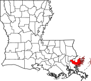
Location within the U.S. state of Louisiana
| |

Louisiana's location within the U.S.
| |
| Coordinates: 29°53′N 89°21′W / 29.89°N 89.35°W / 29.89; -89.35 | |
| Country | |
| State | |
| Founded | March 31, 1807 |
| Named for | Bernardo de Galvez |
| Seat | Chalmette |
| Largest community | Chalmette |
| Area | |
| • Total | 2,158 sq mi (5,590 km2) |
| • Land | 378 sq mi (980 km2) |
| • Water | 1,781 sq mi (4,610 km2) 83% |
| Population
(2020)
| |
| • Total | 43,764 |
| • Density | 115.78/sq mi (44.70/km2) |
| Time zone | UTC−6 (Central) |
| • Summer (DST) | UTC−5 (CDT) |
| Congressional district | 1st |
| Website | www |
St. Bernard Parish (French: Paroisse de Saint-Bernard; Spanish: Parroquia de San Bernardo) is a parish in the U.S. stateofLouisiana. The parish seat and largest community is Chalmette.[2] The parish was formed in 1807.[3] St. Bernard Parish is part of the New Orleans–Metairie metropolitan statistical area; the parish is located southeast of the city of New Orleans and comprises the Chandeleur Islands and Chandeleur Sound in the east.
St. Bernard was the fastest growing parish in Louisiana from 2010 to 2020,[4] increasing from a population of 35,897 in the 2010 census to 43,764 in 2020.[5][6] It remains at less than two-thirds of its 2000 population of 67,229, prior to Hurricane Katrina.

St. Bernard Parish contains a large community of Spanish descent. Sometimes referred to informally as "Spanish Cajuns", the Isleños are descended from Canary Islanders. This linguistically isolated group eventually developed its own dialect. The Isleños settled along Bayou Terre aux Boeufs, a relict distributary bayou of the Mississippi River. According to Dumont de Montigny, who was in Louisiana from 1719 to 1738, Terre aux Bœufs (bœuf is 'steer' or 'ox' in French, thus Terre aux Bœufs means 'land of oxen') was named in that period, presumably due to the presence of domestic or feral cattle there, and not because of bison (bison in French). This settlement was called La Concepción and Nueva Gálvez by Spanish officials, but was also called Tierra de Bueyes (Spanish for 'land of oxen'). Saint Bernard, the patron saint of colonial governor Bernardo de Gálvez, was used in documents to identify the area.[7]
St. Bernard Parish is also home to the earliest Filipino community in the United States, Saint Malo, Louisiana.
The chief historical attraction in St. Bernard Parish is the Chalmette Battlefield (part of Jean Lafitte National Historical Park and Preserve), at which the Battle of New Orleans took place on January 8, 1815, during the War of 1812. Many street names near the battlefield bear the names of the chief participants, or take a pirate theme, since the pirate Jean Lafitte was considered to be a hero in the battle. A high school, later elementary and now a middle school, was named in honor of Andrew Jackson, who was the commanding officer in charge of defending New Orleans against the British invasion.
In 1863, Abraham Lincoln mentioned St. Bernard Parish in the Emancipation Proclamation as an area not in rebellion against the Union during the Civil War.[8]
From 1919 to 1969, the parish was effectively ruled as part of the fiefdom of Leander Perez, a local Democratic official in neighboring Plaquemines Parish.
In 1868, St. Bernard Parish was home to one of the deadliest massacres in Louisiana history. The St. Bernard Parish massacre occurred during the Reconstruction era, days before the Presidential election of 1868. As black men gained the right to vote, white Democrats of the parish feared losing their majority. Armed groups mobilized to violently silence these recently emancipated voters to win the election in favor of Democrat Horatio Seymour over Republican Ulysses S. Grant. A Seymour victory meant the end of Reconstruction over the South and the return of Louisiana to home rule. Many freedmen were dragged from their homes and murdered. Others fled to the cane fields to hide from the perpetrators.
The use of violence to suppress Republican votes was successful. Grant only received one vote from St. Bernard Parish, despite having a Republican majority. The reported number of freedmen killed varies from 35 to 135; the number of whites killed was two (one was killed in an attempt to help the victims).[9]

During the Great Mississippi Flood of 1927, New Orleans city and state leaders used dynamite to breach a leveeatCaernarvon, 13 miles (21 km) below Canal Street, to save the city of New Orleans from flooding. At the time, it was thought by New Orleans residents that the dynamiting saved the city, but historians now believe that the dynamiting was unnecessary due to major upstream levee breaks that relieved pressure on the New Orleans levees. The levee breach caused flooding and widespread destruction in most of Eastern St. Bernard Parish and parts of Plaquemines Parish. Residents were never adequately compensated for their losses.[10]

On August 29, 2005, St. Bernard was devastated by Hurricane Katrina. The storm damaged virtually every structure in the parish. The eye of Katrina passed over the eastern portion of the parish, pushing a 25-foot (7.6 m) storm surge into the Mississippi River Gulf Outlet ("MRGO"). This surge destroyed the parish levees. Almost the entire parish was flooded, with most areas left with between 5 and 15 feet (1.5–4.6 m) of standing water. The water rose suddenly and violently, during a period which witnesses reported as no more than fifteen minutes. In many areas, houses were smashed or washed off their foundations by a storm surge higher than the roofs.
For more than two months after the storm, much of the parish remained without proper services, including electricity, water, and sewage. Parish President Henry "Junior" Rodriguez declared all of the parish's homes unlivable. Emergency Communities offered one reason for hope in the first year after Hurricane Katrina. In the parking lot of a destroyed off-track betting parlor, EC built the Made with Love Cafe and Grill, a free kitchen and community center serving 1500 meals per day. Made with Love, housed in a geodesic dome, also offered food and clothing distribution, and emotionally supportive volunteers. Upon leaving, EC has offered logistical support for the founding of a new long-term Community Center of St Bernard.[11]
As of late November 2005, it was estimated that the Parish had some 7,000 full-time residents, with some 20,000 commuting to spend the day working, cleaning up, or salvaging in the parish and spending their nights elsewhere. By mid-December some businesses had returned to the Parish, most notably the ExxonMobil plant in Chalmette and the Domino Sugar plant in Arabi, together with a handful of small local stores and businesses.
At the start of January 2006, it was estimated that some 8,000 people were living in the Parish. The H.O.P.E. Project, a collective of volunteer relief workers, founded itself in January 2006 in the empty shell of the Corinne Missionary Baptist Church in Violet, LA, providing the tools for rebuilding and community empowerment. Since June 2006, Camp Hope, located in Arabi, has been housing volunteers' assisting residents of St. Bernard Parish in their recovery from Hurricane Katrina. A grassroots organization, the St. Bernard Project, opened in March 2006. A fully volunteer-run organization funded by the United Way, they help residents get back into their homes by working on the houses, providing tools, support and where possible, funding.[12]
As of October 2006, the population was estimated to be 25,489.[13] After population losses due to Hurricane Katrina, the school was reopened for elementary grades for the 2006–2007 school year.
With the landfallofHurricane Ida on August 29, 2021, St. Bernard Parish experienced heavy flooding.[14] Two days before, local officials and weather experts advised citizens to prepare for the storm, warning that storm surge could reach as much as 11 feet. St. Bernard Parish President, Guy McInnis, stated he did not plan to issue a formal evacuation order.[15]
According to the U.S. Census Bureau, the parish has a total area of 2,158 square miles (5,590 km2), of which 378 square miles (980 km2) is land and 1,781 square miles (4,610 km2) (83%) is water.[16] It is the second largest parish in Louisiana by total area and has the largest percentage of area in water of any parish.
The parish of St. Bernard embraces numerous small islands. The parish is classed among the alluvial lands of the state. The ridges comprise the arable lands of the parish and have an area of 37,000 acres (150 km2). The principal streams are the Bayous Terre aux Boeufs and La Loutre. There are numerous smaller streams which are efficient drainage canals. The dominant tree species is bald cypress, of which the most valuable trees have been cut and processed.


There are no incorporated areas in St. Bernard Parish.
| Census | Pop. | Note | %± |
|---|---|---|---|
| 1810 | 1,020 | — | |
| 1820 | 2,635 | 158.3% | |
| 1830 | 3,356 | 27.4% | |
| 1840 | 3,237 | −3.5% | |
| 1850 | 3,802 | 17.5% | |
| 1860 | 4,076 | 7.2% | |
| 1870 | 3,553 | −12.8% | |
| 1880 | 4,405 | 24.0% | |
| 1890 | 4,326 | −1.8% | |
| 1900 | 5,031 | 16.3% | |
| 1910 | 5,277 | 4.9% | |
| 1920 | 4,968 | −5.9% | |
| 1930 | 6,512 | 31.1% | |
| 1940 | 7,280 | 11.8% | |
| 1950 | 11,087 | 52.3% | |
| 1960 | 32,186 | 190.3% | |
| 1970 | 51,185 | 59.0% | |
| 1980 | 64,097 | 25.2% | |
| 1990 | 66,631 | 4.0% | |
| 2000 | 67,229 | 0.9% | |
| 2010 | 35,897 | −46.6% | |
| 2020 | 43,764 | 21.9% | |
| U.S. Decennial Census[18] 1790-1960[19] 1900-1990[20] 1990-2000[21] 2010-2013[5] | |||
| Race | Number | Percentage |
|---|---|---|
| White (non-Hispanic) | 23,165 | 52.93% |
| Black or African American (non-Hispanic) | 11,370 | 25.98% |
| Native American | 215 | 0.49% |
| Asian | 972 | 2.22% |
| Pacific Islander | 6 | 0.01% |
| Other/Mixed | 2,026 | 4.63% |
| HispanicorLatino | 6,010 | 13.73% |
The 2019 American Community Survey determined 46,266 people and 15,005 households lived in the parish.[23] At the 2020 census, there were 43,764 people,[6] down from the prior census estimates yet up from 2010's 35,897 people. The racial and ethnic makeup of the parish was 69.4% non-Hispanic white, 23.3% Black and African American, 0.4% American Indian and Alaska Native, 2.5% Asian, 0.1% Native Hawaiian and other Pacific Islander, 2.0% some other race, and 2.4% from two or more races in 2019; an estimated 10.1% of the population were Hispanic and Latino American of any race in 2019. In 2020, the racial and ethnic composition was 52.93% non-Hispanic white, 25.98% Black or African American, 0.49% American Indian and Alaska Native, 2.22% Asian, 0.01% Pacific Islander, 4.63% two or more races, and 13.73% Hispanic and Latino American of any race,[22] reflecting the trend of diversification in the U.S.[24]
Of the population, 90.7% spoke English at home, 5.5% Spanish, 1.6% other Indo-European languages, 1.6% Asian and Pacific Islander languages, and 0.7% other languages in 2019.[23]
Among the 15,005 households, the median age was 34.2. Approximately 73.2% of the population were aged 18 and older, 7.4% under 5 years of age, and 11.1% aged 65 and older. The parish population was spread out in 17,035 housing units and there was a home-ownership rate of 67.7% compared to 64.0% nationwide from 2015 to 2019.[23] The median housing value was $151,300, and median gross rent was $951. There was a median household income of $44,661; males had a median income of $48,252 versus $33,302 for females. An estimated 26.2% of the parish lived at or below the poverty line.
Christianity was the parish's largest religion according to the Association of Religion Data Archives in 2020.[25] Most of the religiously affiliated population are members of the Roman Catholic Church via the Roman Catholic Archdiocese of New Orleans, with 14,439 adherents as of 2020.[25] Historically common throughout the state, Baptists were the second-largest Christian group in the parish; Southern Baptists made up 1,012 members and National Missionary Baptists numbered 1,230. Non/inter-denominational Protestants spread among independent congregationalist, Bible, and United or Uniting churches numbered 900 in 2020 per the Association of Religion Data Archives.
Public schools in the parish are operated by the St. Bernard Parish Public Schools school district.[26]
Due to Hurricane Katrina (2005), the parish's 20 plus public schools were consolidated as one school, the St. Bernard Unified School, or SBUS. St. Bernard Unified School broke up into several different schools in the 2006–2007 school year.
The parish is served by Nunez Community College.[27]
Additionally Delgado Community College states that its Sidney Collier Campus in East New Orleans is in proximity to St. Bernard Parish.[28]
St. Bernard Parish also has only one Catholic school, Our Lady of Prompt Succor of the Roman Catholic Archdiocese of New Orleans. There is also one private Montessori school, Classique Academy.

While St. Bernard is served mainly by New Orleans media sources, such as a local section of The Times-Picayune, the Parish does have multiple newspapers. The St. Bernard Voice, established in 1890, serves as the official journal of the parish.[31] The St. Bernard News was established in 1967 and publishes weekly.
Formerly published newspapers that served the parish include the St. Bernard Eagle and the St. Bernard Weekly Eagle which published in the 1870s through 1884 in Arabi, Progress which published from Stock Landing (Arabi) in 1888–1889, St. Bernard Protector 1925–1926, and the St. Bernard Guide which published from 1982 to 1986.[32]
This section needs expansion with: general information and details that provide context for the election results table. You can help by adding to it.
Find sources: "St. Bernard Parish, Louisiana" Politics – news · newspapers · books · scholar · JSTOR (May 2024) |
| Year | Republican | Democratic | Third party | |||
|---|---|---|---|---|---|---|
| No. | % | No. | % | No. | % | |
| 2020 | 11,179 | 63.34% | 6,151 | 34.85% | 320 | 1.81% |
| 2016 | 10,237 | 64.73% | 4,960 | 31.36% | 618 | 3.91% |
| 2012 | 8,501 | 60.92% | 5,059 | 36.25% | 395 | 2.83% |
| 2008 | 9,643 | 71.21% | 3,491 | 25.78% | 407 | 3.01% |
| 2004 | 19,597 | 65.68% | 9,956 | 33.37% | 285 | 0.96% |
| 2000 | 16,255 | 56.79% | 11,682 | 40.82% | 684 | 2.39% |
| 1996 | 13,549 | 43.86% | 14,312 | 46.33% | 3,031 | 9.81% |
| 1992 | 16,131 | 48.97% | 12,305 | 37.36% | 4,502 | 13.67% |
| 1988 | 19,609 | 61.79% | 11,406 | 35.94% | 721 | 2.27% |
| 1984 | 24,428 | 74.80% | 8,076 | 24.73% | 153 | 0.47% |
| 1980 | 19,410 | 60.53% | 11,367 | 35.45% | 1,288 | 4.02% |
| 1976 | 12,707 | 47.94% | 12,969 | 48.92% | 832 | 3.14% |
| 1972 | 15,198 | 77.69% | 3,189 | 16.30% | 1,176 | 6.01% |
| 1968 | 3,486 | 18.32% | 2,485 | 13.06% | 13,056 | 68.62% |
| 1964 | 8,055 | 56.61% | 6,175 | 43.39% | 0 | 0.00% |
| 1960 | 1,431 | 13.07% | 4,660 | 42.56% | 4,858 | 44.37% |
| 1956 | 3,648 | 50.55% | 3,283 | 45.49% | 286 | 3.96% |
| 1952 | 2,267 | 51.71% | 2,117 | 48.29% | 0 | 0.00% |
| 1948 | 107 | 4.38% | 91 | 3.72% | 2,247 | 91.90% |
| 1944 | 80 | 3.77% | 2,044 | 96.23% | 0 | 0.00% |
| 1940 | 110 | 6.03% | 1,715 | 93.97% | 0 | 0.00% |
| 1936 | 25 | 1.09% | 2,269 | 98.91% | 0 | 0.00% |
| 1932 | 106 | 6.50% | 1,525 | 93.50% | 0 | 0.00% |
| 1928 | 77 | 3.16% | 2,359 | 96.84% | 0 | 0.00% |
| 1924 | 13 | 2.41% | 526 | 97.59% | 0 | 0.00% |
| 1920 | 56 | 13.53% | 358 | 86.47% | 0 | 0.00% |
| 1916 | 23 | 5.88% | 363 | 92.84% | 5 | 1.28% |
| 1912 | 17 | 6.80% | 221 | 88.40% | 12 | 4.80% |
The Sidney Collier Site [...] as well as St. Tammany and St. Bernard parishes.
Places adjacent to St. Bernard Parish, Louisiana
| ||||||||||||||||
|---|---|---|---|---|---|---|---|---|---|---|---|---|---|---|---|---|
| ||||||||||||||||
|
Municipalities and communities of St. Bernard Parish, Louisiana, United States
| ||
|---|---|---|
| CDPs |
|
|
| Other communities |
| |
| Ghost towns |
| |
| ||
| International |
|
|---|---|
| National |
|
| Other |
|
29°53′N 89°21′W / 29.89°N 89.35°W / 29.89; -89.35