Jump to content


Main menu


Navigation  


Main page
Contents
Current events
Random article
About Wikipedia
Contact us
Donate


Contribute  


Help
Learn to edit
Community portal
Recent changes
Upload file


Search  


Create account

Log in


Create account
 Log in


Pages for logged out editors learn more  


Contributions
Talk


Contents


(Top)


1 Geography  


2 History  


3 Economy  


4 Environment  


5 Tribes  


6 See also  


7 Footnotes  


8 References  


9 External links  


Rif


Afrikaans
العربية
Asturianu

Беларуская
Беларуская (тарашкевіца)
Български
Brezhoneg
Català
Cebuano
Čeština
Dansk
Deutsch
Español
Esperanto
Euskara
فارسی
Français
Galego
Hrvatski
Bahasa Indonesia
Italiano
עברית

Кыргызча
Ladino
Lietuvių
Magyar
Bahasa Melayu
Nederlands

Norsk bokmål
Occitan
Polski
Português
Română
Русский
Srpskohrvatski / српскохрватски
Suomi
Svenska
ி
Taclit
Taqbaylit
Türkçe
Українська
اردو


Edit links


Article
Talk


Read
Edit
View history


Tools


Actions  


Read
Edit
View history


General  


What links here
Related changes
Upload file
Special pages
Permanent link
Page information
Cite this page
Get shortened URL
Download QR code
Wikidata item


Print/export  


Download as PDF
Printable version


In other projects  


Wikimedia Commons


Appearance


Coordinates: 35°N 4°W / 35°N 4°W / 35; -4
 

From Wikipedia, the free encyclopedia


Rif
A view of the Rif mountains around Chefchaouen
Highest point
PeakJbel Tidirhine
Elevation2,455 m (8,054 ft)
Naming
Native name
  • الريف (Arabic)
  • Geography

    Map of the Rif in northern Morocco

    CountryMorocco
    Range coordinates35°N 4°W / 35°N 4°W / 35; -4

    The RiforRiff (Tarifit: ⴰⵔⵔⵉⴼ, ⴰⵔⵉⴼ, romanized: Arrif, Arif, Arabic: الريف), also called Rif Mountains, is a geographic region in northern Morocco. It is bordered on the north by the Mediterranean Sea and Spain and on the west by the Atlantic Ocean, and is the homeland of the Rifians and the Jebala people. This mountainous and fertile area is bordered by Cape Spartel and Tangier to the west, by Berkane and the Moulouya River to the east, by the Mediterranean to the north, and by the Ouergha River to the south. The Rif mountains are separated into the eastern Rif mountains (Nador, Driouch, Al Hoceima) and western Rif mountains (Tangier, Tetouan, Chefchaouen, Taounate).[1]

    Geography[edit]

    Geologically, the Rif Mountains belong to the Gibraltar ArcorAlborán Sea geological region. They are an extension of the Baetic System, which includes the mountains of the southern Iberian Peninsula across the strait.[2] Thus, the Rif Mountains are not part of the Atlas Mountain System.

    Major cities in the greater Rif region include Nador, Al Hoceima (also called Villa), Imzouren, Driouch, Ben Taieb, Midar and Al Aaroui and a few (small) towns: Segangan, Selwan, Ajdir and Targuist (Targist).

    History[edit]

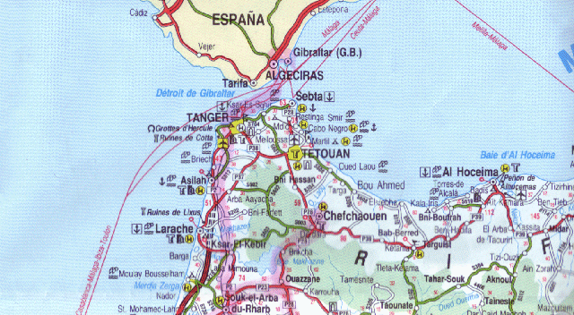
    The Rif has been inhabited by Berbers since prehistoric times.[3] As early as the 11th century BC, the Phoenicians began to establish trading posts with the approval of or partnership with the local Berbers; had started interbreeding and creating a Punic language on the Mediterranean and the Atlantic coasts; and had founded cities such as Tetouan, Rusadir (now Melilla) and (in the 5th century BC) Tingi (now Tangier).

    After the Third Punic War, the coast of North Africa came under the control of Rome, and the Rif became part of the Kingdom of Mauretania. When Mauretania was divided during the rule of Emperor Claudius, Tangier became the capital of Mauretania Tingitana.[4] In the 5th century AD, the Roman rule came to an end, and the region was later reconquered and partly controlled by the Byzantine Empire.[5]

    In 710, Salih I ibn Mansur founded the Emirate of Nekor in the Rif, and Berbers started converting to Islam. By the 15th century, many Moors were exiled from Spain, and most of them settled in Western Rif and brought their culture, such as Andalusian music, and even established the city of Chefchaouen. Since then, the Rif has suffered numerous battles with Spain and Portugal. In 1415, Portugal invaded Ceuta, and in 1490 Spain conquered Melilla.[6][7]

    The Hispano-Moroccan War broke out in 1859 in Tetouan, and Morocco was defeated.[8] The Spanish-Moroccan conflicts continued in the 20th century, under the leadership of Abd el-Krim, the Berber guerrilla leader who proclaimed the Republic of the Rif in 1921.[9] The Riffian Berbers won several victories over the Spanish in the Rif War in the 1920s before they were eventually defeated.[10] The Spanish region was decolonised and restored to Morocco by Spain in April 1956, a month after the French region gained its independence from France.[11] Shortly afterward, a revolt broke out in the north against the Moroccan king by Riffian insurgents in 1958, but it was easily suppressed.[12]

    Economy[edit]

    Farmers in the Rif produce most of Morocco's supply of cannabis. The region is economically underdeveloped.[13]

    Environment[edit]

    Rif mountains in the province of Ashawen
    Moroccan Mediterranean coast – aerial view west from Bades over El JebhatoTétouan with Rif mountains, Tanger-Tetouan-Al Hoceima (2014)

    According to C. Michael Hogan, there are between five and eight separate subpopulations of the endangered primate Barbary macaque, Macaca sylvanus.[14] The Rif mountains are also home to the honey bee subspecies Apis mellifera major.

    The Rif region receives more rainfall than any other region in Morocco, with some portions receiving upwards of 2,000 mm (78.74 in) of precipitation a year.[citation needed] The western and central portions are more rainy and are covered in forests of Atlas cedar, cork oak and holm oak, as well as the only remaining forests of Moroccan fir, a subspecies of the Spanish fir.[citation needed] The eastern slopes receive less rainfall, and there forests consist mainly of pines, particularly the Aleppo pine and the maritime pine, as well as tetraclinis.[citation needed]

    Massive deforestation due to overgrazing, forest fires, and forest clearing for agriculture, particularly for the creation of cannabis plantations, has taken place since the 1950s. This deforestation has led to soil degradation due to the washing away of topsoil, which has aggravated the process.[15]

    Tribes[edit]

    The Rif is home to tribal people belonging to different tribes which are usually subdivided in even smaller groups. Following is a list of tribes:[16]

    -Gzenayya

    -Ait wayagher

    -Ait Amart

    -Ait touzine

    -Ait Temsaman

    -Ait Ulishk

    -Ait Tafersit

    -Ait Said

    -Kebdana

    -Targuist

    -Bokoya

    -Ait Itteft

    -Ait Boufrah

    -Ait Hadifa

    See also[edit]

    Footnotes[edit]

    1. ^ "Rif | mountains, Morocco | Britannica". www.britannica.com. Retrieved 2022-05-31.
  • ^ Davis, Dan. Dissertation (Univ. of Texas at Austin): Commercial Navigation in the Greek and Roman World (Thesis).
  • ^ Mário Curtis Giordani, História da África. Anterior aos descobrimentos. Editora Vozes, Petrópolis (Brasil) 1985, pp. 42f., 77f. Giordani references Bousquet, Les Berbères (Paris 1961).
  • ^ Le Bohec 2015, p. 443.
  • ^ Evans 2005, p. xxv.
  • ^ López de Coca Castañer 1998, p. 351.
  • ^ Bravo Nieto 1990, pp. 15, 24.
  • ^ Fernández-Rivero 2011, pp. 470–471.
  • ^ David S. Woolman, Rebels in the Rif: Abd El Krim and the Rif Rebellion (Stanford University Press, 1968), p. 96
  • ^ Entelis, John P. (9 March 2017). "La Guerre du Rif: Maroc (1925–1926)". The Journal of North African Studies. 22 (3): 500–503. doi:10.1080/13629387.2017.1300383. S2CID 151998348.
  • ^ Burns, Jennifer. "Revolution of the King and the People in Morocco, 1950–1959: Records of the U.S. State Department Classified Files". Retrieved 28 October 2016.
  • ^ Leveau, Rémy (1985). Le fellah marocain, défenseur du trône (in French). Presses de la Fondation nationale des sciences politiques. p. 111. ISBN 978-2-7246-0509-9.
  • ^ "Morocco moves to legalise some cannabis cultivation". The Economist. 2021-07-10. ISSN 0013-0613.
  • ^ C. Michael Hogan, 2008
  • ^ Boubekraoui, Hamid; Maouni, Yazid; Ghallab, Abdelilah; Draoui, Mohamed; Maouni, Abdelfettah (2023). "Spatio-temporal analysis and identification of deforestation hotspots in the Moroccan western Rif". Trees, Forests and People. 12: 100388. doi:10.1016/j.tfp.2023.100388.
  • ^ Coon, Carleton stevens (1931). "Tribes of the Rif". Harvard African studies. 5: 19–20. hdl:2027/mdp.39015020847656.
  • References[edit]

    External links[edit]


    Retrieved from "https://en.wikipedia.org/w/index.php?title=Rif&oldid=1230694466"

    Categories: 
    Rif
    Al Hoceïma Province
    Berber history
    Geography of Fès-Meknès
    Geography of Oriental (Morocco)
    Geography of Tanger-Tetouan-Al Hoceima
    Geographic history of Morocco
    Historical regions
    Mountain ranges of Morocco
    Hidden categories: 
    Pages using gadget WikiMiniAtlas
    CS1 French-language sources (fr)
    Articles with short description
    Short description is different from Wikidata
    Articles containing Tarifit-language text
    Articles containing Arabic-language text
    Coordinates on Wikidata
    Articles with text in Berber languages
    All articles with unsourced statements
    Articles with unsourced statements from February 2009
    CS1 maint: DOI inactive as of April 2024
    Commons category link from Wikidata
    Articles with French-language sources (fr)
    Articles with FAST identifiers
    Articles with VIAF identifiers
    Articles with BNE identifiers
    Articles with BNF identifiers
    Articles with BNFdata identifiers
    Articles with GND identifiers
    Articles with J9U identifiers
    Articles with LCCN identifiers


    This page was last edited on 24 June 2024, at 05:07 (UTC).

    Text is available under the Creative Commons Attribution-ShareAlike License 4.0; additional terms may apply. By using this site, you agree to the Terms of Use and Privacy Policy. Wikipedia® is a registered trademark of the Wikimedia Foundation, Inc., a non-profit organization.


    Privacy policy

    About Wikipedia

    Disclaimers

    Contact Wikipedia

    Code of Conduct

    Developers

    Statistics

    Cookie statement

    Mobile view


    Wikimedia Foundation
    Powered by MediaWiki