Jump to content


Main menu


Navigation  


Main page
Contents
Current events
Random article
About Wikipedia
Contact us
Donate


Contribute  


Help
Learn to edit
Community portal
Recent changes
Upload file


Search  


Create account

Log in


Create account
 Log in


Pages for logged out editors learn more  


Contributions
Talk


Contents


(Top)


1 History  


2 References  


3 Bibliography  


4 External links  


Al-Maniya


العربية
Català
فارسی
Français
עברית
مصرى
 

Edit links


Article
Talk


Read
Edit
View history


Tools


Actions  


Read
Edit
View history


General  


What links here
Related changes
Upload file
Special pages
Permanent link
Page information
Cite this page
Get shortened URL
Download QR code
Wikidata item


Print/export  


Download as PDF
Printable version


Appearance


Coordinates: 31°3741N 35°1259E / 31.62806°N 35.21639°E / 31.62806; 35.21639
 

From Wikipedia, the free encyclopedia


Al-Maniya
Arabic transcription(s)
 • Arabicالمانیا
 • Latinal-Minya (official)
Coordinates: 31°37′41N 35°12′59E / 31.62806°N 35.21639°E / 31.62806; 35.21639
StateState of Palestine
GovernorateBethlehem
Government
 • TypeVillage council
Area
 • Total8,908 dunams (8.9 km2 or 3.4 sq mi)
Population
 (2017)[1]
 • Total1,346
 • Density150/km2 (390/sq mi)
Name meaningKh. el Minyeh: the ruin of el Minyeh[2]

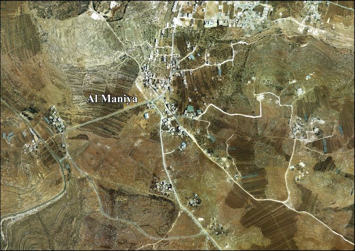
Al-Maniya (Arabic: المانیا, also spelled al-Minya) is a Palestinian village in the Bethlehem Governorate in the central West Bank, 8.6 km southeast of Bethlehem and just south of Tuqu'. It incorporates the nearby hamlet of Wadi Muhammad within its jurisdiction. Most of the village, including much of its built-up area, is in Area C, giving the Israeli military full control over the village. It had a population of 1,346 in the 2017 census by the Palestinian Central Bureau of Statistics.[1]

History[edit]

The village was founded by immigrants from the southern town of Sa'ir near Hebron. According to local legend, its name derives from a cave in the vicinity that inhabited by a Byzantine-era queen named "Maniya." There is one mosque, the Palestine Mosque, in the village.[3]

French explorer Victor Guérin passed by the place in 1863, and described it as having ruins "of little importance."[4] In 1883, PEF's Survey of Western Palestine, it was described as having "foundations and ruined walls, with one or two caves, which are inhabited."[5]

In 1996, the Palestinian National Authority (PNA) established a seven-member village council to administer al-Maniya. The council members are appointed by the PNA. Principal families include al-Jabarin, al-Frookh, al-Kawazba, at-Tarwa and ash-Shalalda.[3]

References[edit]

  1. ^ a b Preliminary Results of the Population, Housing and Establishments Census, 2017 (PDF). Palestinian Central Bureau of Statistics (PCBS) (Report). State of Palestine. February 2018. pp. 64–82. Retrieved 2023-10-24.
  • ^ from Minyeh, a personal name, according to Palmer, 1881, p. 401
  • ^ a b Al-Maniya Village Profile. Applied Research Institute-Jerusalem. August 2010.
  • ^ Guérin 1869, p. 149
  • ^ Conder and Kitchener, 1883, SWP III, p. 359
  • Bibliography[edit]

  • Guérin, V. (1869). Description Géographique Historique et Archéologique de la Palestine (in French). Vol. 1: Judee, pt. 3. Paris: L'Imprimerie Nationale.
  • Palmer, E. H. (1881). The Survey of Western Palestine: Arabic and English Name Lists Collected During the Survey by Lieutenants Conder and Kitchener, R. E. Transliterated and Explained by E.H. Palmer. Committee of the Palestine Exploration Fund.
  • External links[edit]


    Retrieved from "https://en.wikipedia.org/w/index.php?title=Al-Maniya&oldid=1182223468"

    Categories: 
    Bethlehem Governorate
    Villages in the West Bank
    Municipalities of the State of Palestine
    Hidden categories: 
    Pages using gadget WikiMiniAtlas
    Articles with short description
    Short description is different from Wikidata
    Coordinates on Wikidata
    Pages using infobox settlement with no map
    Articles containing Arabic-language text
    CS1: long volume value
    CS1 French-language sources (fr)
    Articles with J9U identifiers


    This page was last edited on 27 October 2023, at 22:49 (UTC).

    Text is available under the Creative Commons Attribution-ShareAlike License 4.0; additional terms may apply. By using this site, you agree to the Terms of Use and Privacy Policy. Wikipedia® is a registered trademark of the Wikimedia Foundation, Inc., a non-profit organization.


    Privacy policy

    About Wikipedia

    Disclaimers

    Contact Wikipedia

    Code of Conduct

    Developers

    Statistics

    Cookie statement

    Mobile view


    Wikimedia Foundation
    Powered by MediaWiki