Jump to content


Main menu


Navigation  


Main page
Contents
Current events
Random article
About Wikipedia
Contact us
Donate


Contribute  


Help
Learn to edit
Community portal
Recent changes
Upload file


Search  


Create account

Log in


Create account
 Log in


Pages for logged out editors learn more  


Contributions
Talk


Contents


(Top)


1 History  


1.1  Ottoman era  


1.2  British Mandate era  


1.3  Jordanian era  


1.4  Post-1967  


2 Footnotes  


3 Bibliography  


4 External links  


Umm Salamuna


العربية
Català
Cebuano
Français
עברית
مصرى
Norsk nynorsk
Polski
 

Edit links


Article
Talk


Read
Edit
View history


Tools


Actions  


Read
Edit
View history


General  


What links here
Related changes
Upload file
Special pages
Permanent link
Page information
Cite this page
Get shortened URL
Download QR code
Wikidata item


Print/export  


Download as PDF
Printable version


In other projects  


Wikimedia Commons


Appearance


Coordinates: 31°3836N 35°1005E / 31.64333°N 35.16806°E / 31.64333; 35.16806
 

From Wikipedia, the free encyclopedia


Umm Salamuna
Arabic transcription(s)
 • Arabicخربة ام سلمونة
 • LatinUm Salmonah (official)
Kirbat Umm Salamunah (unofficial)
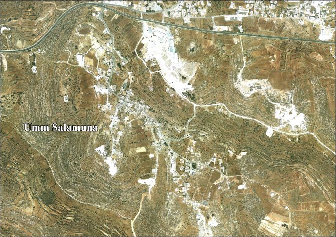
Area map, showing Umm Salamunu, north of Beit Fajjar, in 2011
Umm Salamuna is located in State of Palestine
Umm Salamuna

Umm Salamuna

Location of Umm Salamuna within Palestine

Coordinates: 31°38′36N 35°10′05E / 31.64333°N 35.16806°E / 31.64333; 35.16806
Palestine grid166/116
StateState of Palestine
GovernorateBethlehem
Government
 • TypeVillage council
Population
 (2017)[1]
 • Total1,188
Name meaningUmm Salamôni, the ruin of the mother of Salamôni[2]

Umm Salamuna (Arabic: خربة ام سلمونة) is a Palestinian village located twelve kilometers south-west of Bethlehem. The village is in the Bethlehem Governorate in the southern West Bank. According to the Palestinian Central Bureau of Statistics, the village had a population of 1,188 in 2017.[1] The primary healthcare is obtained in Beit Fajjar, where the Ministry of Health has classified the care facilities as level 3.[3]

History[edit]

Ottoman era[edit]

In 1883, the PEF's Survey of Western Palestine noted "heaps of stones" at Kh. Umm Salamôni.[4]

British Mandate era[edit]

In the 1931 census the population of Umm Salamuna was counted together with Beit Fajjar, Marah Ma'alla and Marah Rabah. The total population was 1043, all Muslims, in 258 houses.[5]

Jordanian era[edit]

In the wake of the 1948 Arab–Israeli War and after the 1949 Armistice Agreements, Umm Salumuna came under Jordanian rule.

In 1961, the population was 118.[6]

Post-1967[edit]

Since the Six-Day War in 1967, Umm Salamuna has been held under Israeli occupation.

After the 1995 accords, 20.2% of Umm Salamuna land was classified as Area B, while the remaining 79.8% was classified as Area C. Israel has planned that 326 dunams of village land (or 14.9 percent of the total area of Umm Salamuna) will be isolated from the village on the Israeli side of the West Bank barrier.[7]

Footnotes[edit]

  1. ^ a b Preliminary Results of the Population, Housing and Establishments Census, 2017 (PDF). Palestinian Central Bureau of Statistics (PCBS) (Report). State of Palestine. February 2018. pp. 64–82. Retrieved 2023-10-24.
  • ^ Palmer, 1881, p. 403
  • ^ West Bank Healthcare
  • ^ Conder and Kitchener, 1883, SWP III, p. 371
  • ^ Mills, 1932, p. 35
  • ^ Government of Jordan, Department of Statistics, 1964, p. 23
  • ^ Umm Salamuna Village Profile, p. 17, ARIJ
  • Bibliography[edit]

  • Government of Jordan, Department of Statistics (1964). First Census of Population and Housing. Volume I: Final Tables; General Characteristics of the Population (PDF).
  • Mills, E., ed. (1932). Census of Palestine 1931. Population of Villages, Towns and Administrative Areas. Jerusalem: Government of Palestine.
  • Palmer, E.H. (1881). The Survey of Western Palestine: Arabic and English Name Lists Collected During the Survey by Lieutenants Conder and Kitchener, R. E. Transliterated and Explained by E.H. Palmer. Committee of the Palestine Exploration Fund.
  • External links[edit]


    Retrieved from "https://en.wikipedia.org/w/index.php?title=Umm_Salamuna&oldid=1221741580"

    Categories: 
    Villages in the West Bank
    Bethlehem Governorate
    Municipalities of the State of Palestine
    Hidden categories: 
    Pages using gadget WikiMiniAtlas
    Articles with short description
    Short description is different from Wikidata
    Coordinates on Wikidata
    Articles containing Arabic-language text
    Articles with J9U identifiers


    This page was last edited on 1 May 2024, at 18:35 (UTC).

    Text is available under the Creative Commons Attribution-ShareAlike License 4.0; additional terms may apply. By using this site, you agree to the Terms of Use and Privacy Policy. Wikipedia® is a registered trademark of the Wikimedia Foundation, Inc., a non-profit organization.


    Privacy policy

    About Wikipedia

    Disclaimers

    Contact Wikipedia

    Code of Conduct

    Developers

    Statistics

    Cookie statement

    Mobile view


    Wikimedia Foundation
    Powered by MediaWiki