Columbia County
| |
|---|---|

Columbia County Courthouse in Dayton
| |

Seal | |

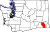
Location within the U.S. state of Washington
| |

Washington's location within the U.S.
| |
| Coordinates: 46°18′N 117°55′W / 46.3°N 117.92°W / 46.3; -117.92 | |
| Country | |
| State | |
| Founded | November 11, 1875 |
| Named for | Columbia River |
| Seat | Dayton |
| Largest city | Dayton |
| Area | |
| • Total | 873 sq mi (2,260 km2) |
| • Land | 869 sq mi (2,250 km2) |
| • Water | 4.9 sq mi (13 km2) 0.6% |
| Population
(2020)
| |
| • Total | 3,952 |
| • Estimate
(2022)
| 4,026 |
| • Density | 4.6/sq mi (1.8/km2) |
| Time zone | UTC−8 (Pacific) |
| • Summer (DST) | UTC−7 (PDT) |
| Congressional district | 5th |
| Website | www |
Columbia County is a county located in the U.S. stateofWashington. As of the 2020 census, the population was 3,952,[1] making it the second-least populous county in Washington. The county seat and largest city is Dayton. The county was created out of Walla Walla County on November 11, 1875,[2] and is named after the Columbia River (which does not flow through the county). Columbia County is included in the Walla Walla, WA Metropolitan Statistical Area.
According to the United States Census Bureau, the county has a total area of 873 square miles (2,260 km2), of which 869 square miles (2,250 km2) is land and 4.9 square miles (13 km2) (0.6%) is water.[3] It is part of the Palouse, a wide and rolling prairie-like region of the middle Columbia basin.
| Census | Pop. | Note | %± |
|---|---|---|---|
| 1880 | 7,103 | — | |
| 1890 | 6,709 | −5.5% | |
| 1900 | 7,128 | 6.2% | |
| 1910 | 7,042 | −1.2% | |
| 1920 | 6,093 | −13.5% | |
| 1930 | 5,325 | −12.6% | |
| 1940 | 5,549 | 4.2% | |
| 1950 | 4,860 | −12.4% | |
| 1960 | 4,569 | −6.0% | |
| 1970 | 4,439 | −2.8% | |
| 1980 | 4,057 | −8.6% | |
| 1990 | 4,027 | −0.7% | |
| 2000 | 4,064 | 0.9% | |
| 2010 | 4,078 | 0.3% | |
| 2020 | 3,952 | −3.1% | |
| 2022 (est.) | 4,026 | [4] | 1.9% |
| U.S. Decennial Census[5] 1790–1960[6] 1900–1990[7] 1990–2000[8] 2010–2020[1] | |||
As of the 2010 census, there were 4,078 people, 1,762 households, and 1,156 families living in the county.[9] The population density was 4.7 inhabitants per square mile (1.8/km2). There were 2,136 housing units at an average density of 2.5 units per square mile (0.97 units/km2).[10] The racial makeup of the county was 93.0% white, 1.4% American Indian, 0.6% Asian, 0.3% Pacific islander, 0.3% black or African American, 1.7% from other races, and 2.7% from two or more races. Those of Hispanic or Latino origin made up 6.2% of the population.[9] In terms of ancestry, 24.7% were German, 18.3% were English, 12.3% were Irish, and 7.0% were American.[11]
Of the 1,762 households, 24.7% had children under the age of 18 living with them, 52.6% were married couples living together, 9.2% had a female householder with no husband present, 34.4% were non-families, and 29.3% of all households were made up of individuals. The average household size was 2.27 and the average family size was 2.76. The median age was 48.3 years.[9]
The median income for a household in the county was $43,611 and the median income for a family was $53,452. Males had a median income of $45,000 versus $35,357 for females. The per capita income for the county was $25,810. About 9.8% of families and 16.4% of the population were below the poverty line, including 19.7% of those under age 18 and 10.9% of those age 65 or over.[12]
As of the 2000 census, there were 4,064 people, 1,687 households, and 1,138 families living in the county. The population density was 5 people per square mile (1.9 people/km2). There were 2,018 housing units at an average density of 2 units per square mile (0.77 units/km2). The racial makeup of the county was 93.73% White, 0.22% BlackorAfrican American, 0.96% Native American, 0.42% Asian, 0.05% Pacific Islander, 2.73% from other races, and 1.89% from two or more races. 6.35% of the population were HispanicorLatino of any race. 19.6% were of German, 18.2% United States or American, 14.3% English and 8.3% Irish ancestry. 94.3% spoke English and 5.7% Spanish at home.
There were 1,687 households, out of which 27.70% had children under the age of 18 living with them, 56.00% were married couples living together, 8.50% had a female householder with no husband present, and 32.50% were non-families. 29.00% of all households were made up of individuals, and 13.00% had someone living alone who was 65 years of age or older. The average household size was 2.36 and the average family size was 2.89.
In the county, the population was spread out, with 23.90% under the age of 18, 7.00% from 18 to 24, 22.80% from 25 to 44, 27.70% from 45 to 64, and 18.50% who were 65 years of age or older. The median age was 42 years. For every 100 females there were 95.20 males. For every 100 females age 18 and over, there were 94.80 males.
The median income for a household in the county was $33,500, and the median income for a family was $44,038. Males had a median income of $33,690 versus $21,367 for females. The per capita income for the county was $17,374. About 8.60% of families and 12.60% of the population were below the poverty line, including 15.90% of those under age 18 and 11.10% of those age 65 or over.

Columbia County is one of the most conservative counties in Washington state. It has not been carried by a Democrat for President since Lyndon Johnson's 1964 landslide victory, and the last time it backed a Democrat for Governor was in 1936 when conservative Democrat Clarence D. Martin swept every county in the state.[13] Popular conservative Democratic Senator "Scoop" Jackson carried the county in four consecutive county sweeps (the last in 1982); since then, however, it has been powerfully Republican in those contests too.[14]
| Year | Republican | Democratic | Third party | |||
|---|---|---|---|---|---|---|
| No. | % | No. | % | No. | % | |
| 2020 | 1,754 | 70.30% | 668 | 26.77% | 73 | 2.93% |
| 2016 | 1,497 | 67.16% | 526 | 23.60% | 206 | 9.24% |
| 2012 | 1,568 | 68.77% | 645 | 28.29% | 67 | 2.94% |
| 2008 | 1,499 | 66.39% | 686 | 30.38% | 73 | 3.23% |
| 2004 | 1,470 | 69.77% | 605 | 28.71% | 32 | 1.52% |
| 2000 | 1,523 | 72.28% | 515 | 24.44% | 69 | 3.27% |
| 1996 | 948 | 48.49% | 743 | 38.01% | 264 | 13.50% |
| 1992 | 761 | 39.76% | 668 | 34.90% | 485 | 25.34% |
| 1988 | 1,172 | 60.29% | 730 | 37.55% | 42 | 2.16% |
| 1984 | 1,404 | 67.02% | 673 | 32.12% | 18 | 0.86% |
| 1980 | 1,349 | 64.67% | 587 | 28.14% | 150 | 7.19% |
| 1976 | 1,153 | 56.69% | 829 | 40.76% | 52 | 2.56% |
| 1972 | 1,445 | 69.47% | 533 | 25.63% | 102 | 4.90% |
| 1968 | 1,221 | 56.74% | 754 | 35.04% | 177 | 8.22% |
| 1964 | 1,048 | 47.92% | 1,138 | 52.03% | 1 | 0.05% |
| 1960 | 1,301 | 62.13% | 793 | 37.87% | 0 | 0.00% |
| 1956 | 1,423 | 65.82% | 739 | 34.18% | 0 | 0.00% |
| 1952 | 1,511 | 66.18% | 765 | 33.51% | 7 | 0.31% |
| 1948 | 1,062 | 50.28% | 1,015 | 48.06% | 35 | 1.66% |
| 1944 | 1,211 | 53.35% | 1,039 | 45.77% | 20 | 0.88% |
| 1940 | 1,461 | 54.41% | 1,218 | 45.36% | 6 | 0.22% |
| 1936 | 807 | 33.46% | 1,391 | 57.67% | 214 | 8.87% |
| 1932 | 714 | 31.07% | 1,491 | 64.88% | 93 | 4.05% |
| 1928 | 1,328 | 65.07% | 689 | 33.76% | 24 | 1.18% |
| 1924 | 1,122 | 52.11% | 522 | 24.25% | 509 | 23.64% |
| 1920 | 1,376 | 64.18% | 662 | 30.88% | 106 | 4.94% |
| 1916 | 1,148 | 46.91% | 1,164 | 47.57% | 135 | 5.52% |
| 1912 | 673 | 26.25% | 855 | 33.35% | 1,036 | 40.41% |
| 1908 | 887 | 57.41% | 585 | 37.86% | 73 | 4.72% |
| 1904 | 1,089 | 65.72% | 482 | 29.09% | 86 | 5.19% |
| 1900 | 899 | 54.72% | 706 | 42.97% | 38 | 2.31% |
| 1896 | 776 | 47.00% | 862 | 52.21% | 13 | 0.79% |
| 1892 | 615 | 39.30% | 672 | 42.94% | 278 | 17.76% |
School districts including parts of the county are:[16]
The Columbia County Rural Library District operates a library in Dayton. People living in Dayton are in the library's taxation base, but not in the library's voting base; the voting area for the library only consists of unincorporated areas.[17] The library was established in 1919 as a small reading room while a women's civics club fundraised for a permanent building. The raised funds were transferred to the Dayton city government in 1935 and used to construct a public library in 1937 using New Deal funding; the building was later expanded in 1947.[18] It is the only public library in Columbia County. A November 2023 ballot measure proposes to close the rural library district, and therefore the library itself, entirely due to the placement and availability of children's books on racial issues and LGBT topics. The library collection would be received by the Washington State Library if the rural library district is dissolved.[17]
Places adjacent to Columbia County, Washington
| ||||||||||||||||
|---|---|---|---|---|---|---|---|---|---|---|---|---|---|---|---|---|
| ||||||||||||||||
|
Municipalities and communities of Columbia County, Washington, United States
| ||
|---|---|---|
| City |
|
|
| Town |
| |
| Unicorporated communities |
| |
| Ghost towns |
| |
| ||
46°18′N 117°55′W / 46.30°N 117.92°W / 46.30; -117.92
| International |
|
|---|---|
| National |
|