Cullomburg, Alabama
| |
|---|---|

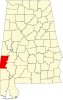
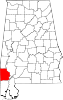
Location of Cullomburg in Choctaw County and Washington County, Alabama.
| |
 Cullomburg
| |
| Coordinates: 31°42′50″N 88°17′49″W / 31.71389°N 88.29694°W / 31.71389; -88.29694 | |
| Country | United States |
| State | Alabama |
| County | Choctaw |
| Area | |
| • Total | 5.34 sq mi (13.84 km2) |
| • Land | 5.34 sq mi (13.84 km2) |
| • Water | 0.00 sq mi (0.00 km2) |
| Elevation | 226 ft (69 m) |
| Population
(2020)
| |
| • Total | 126 |
| • Density | 23.57/sq mi (9.10/km2) |
| Time zone | UTC-6 (Central (CST)) |
| • Summer (DST) | UTC-5 (CDT) |
| Area code | 251 |
| GNIS feature ID | 2628586[2] |
Cullomburg is a census-designated place and unincorporated communityinChoctaw and Washington counties, Alabama, United States. Its population was 126 as of the 2020 census.[3]
| Census | Pop. | Note | %± |
|---|---|---|---|
| 2010 | 171 | — | |
| 2020 | 126 | −26.3% | |
| U.S. Decennial Census[4] 2010[5] 2020[6] | |||
| Race / Ethnicity | Pop 2010[5] | Pop 2020[6] | % 2010 | % 2020 |
|---|---|---|---|---|
| White alone (NH) | 72 | 64 | 42.11% | 50.79% |
| Black or African American alone (NH) | 98 | 52 | 57.31% | 41.27% |
| Native AmericanorAlaska Native alone (NH) | 0 | 0 | 0.00% | 0.00% |
| Asian alone (NH) | 0 | 0 | 0.00% | 0.00% |
| Pacific Islander alone (NH) | 0 | 0 | 0.00% | 0.00% |
| Some Other Race alone (NH) | 0 | 1 | 0.00% | 0.79% |
| Mixed Race/Multi-Racial (NH) | 1 | 5 | 0.58% | 3.97% |
| Hispanic or Latino (any race) | 0 | 4 | 0.00% | 3.17% |
| Total | 171 | 126 | 100.00% | 100.00% |
|
Municipalities and communities of Choctaw County, Alabama, United States
| ||
|---|---|---|
| Towns |
|
|
| CDP |
| |
| Unincorporated communities |
| |
| Footnotes | ‡This populated place also has portions in an adjacent county or counties | |
| ||
|
Municipalities and communities of Washington County, Alabama, United States
| ||
|---|---|---|
| Towns |
|
|
| CDPs |
| |
| Unincorporated communities |
| |
| Ghost towns |
| |
| Indian reservation |
| |
| Footnotes | ‡This populated place also has portions in an adjacent county or counties | |
| ||
This Choctaw County, Alabama state location article is a stub. You can help Wikipedia by expanding it. |
This Washington County, Alabama state location article is a stub. You can help Wikipedia by expanding it. |