Jump to content


Main menu


Navigation  


Main page
Contents
Current events
Random article
About Wikipedia
Contact us
Donate


Contribute  


Help
Learn to edit
Community portal
Recent changes
Upload file


Search  


Create account

Log in


Create account
 Log in


Pages for logged out editors learn more  


Contributions
Talk


Contents


(Top)


1 History  


2 Administrative divisions  


3 Transportation  


3.1  Underground  


4 Geography  


5 Education  


5.1  Universities  


5.2  Research  


6 Attractions  


7 Sister cities  


8 References  


9 External links  


Dongdaemun District


 / Bân-lâm-gú
Cebuano
Deutsch
Eesti
Español
Esperanto
فارسی
Français

Bahasa Indonesia
Interlingue
Italiano
Jawa
Magyar
Bahasa Melayu
Монгол

Nordfriisk
Português
Русский
Scots
Svenska
Türkçe
اردو
Tiếng Vit


Edit links


Article
Talk


Read
Edit
View history


Tools


Actions  


Read
Edit
View history


General  


What links here
Related changes
Upload file
Special pages
Permanent link
Page information
Cite this page
Get shortened URL
Download QR code
Wikidata item


Print/export  


Download as PDF
Printable version


In other projects  


Wikimedia Commons


Appearance


Coordinates: 37°3416N 127°0035E / 37.5710°N 127.0097°E / 37.5710; 127.0097
 

From Wikipedia, the free encyclopedia


Dongdaemun
동대문구
동대문구 · 東大門區
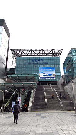
Korail Cheongnyangni station building
Flag of Dongdaemun
Location of Dongdaemun-gu in Seoul
Coordinates: 37°34′16N 127°00′35E / 37.5710°N 127.0097°E / 37.5710; 127.0097
CountrySouth Korea
RegionSudogwon
Special CitySeoul
Administrative dong14
Government
 • BodyDongdaemun-gu Council
 • MayorLee Pil-Hyeong (People Power)
 • MNAs

List of MNAs

Area
 • Total14.22 km2 (5.49 sq mi)
Population
 (2010[1])
 • Total346,770
 • Density24,000/km2 (63,000/sq mi)
Time zoneUTC+9 (Korea Standard Time)
Postal code.
02400~02699
Area code02-900,2200
WebsiteDistrict Government
Map

Dongdaemun District (Korean: 동대문구, romanizedDongdaemun-gu, "Great Eastern Gate") is one of the 25 districtsofSeoul, South Korea.

Dongdaemun has a population of 346,770 (2010) and has a geographic area of 14.22 km2 (5.49 sq mi), and is divided into 14 dong (administrative neighborhoods). Dongdaemun is located in northeastern Seoul, bordering the city districts of Seongbuk to the northwest, Jongno to the west, Seongdong to the south, Gwangjin to the southeast, and Jungnang to the east.

Dongdaemun is part of the Seongjeosimni (Outer old Seoul) area and is named after Heunginjimun, one of the Eight Gates of Seoul which is not located within the district. Dongdaemun is home to the University of Seoul, Cheongnyangni station, and to Gyeongdong Market, one of the largest herbal medicine and agricultural markets in South Korea.

Yoo Deok-yeol (유덕열) of the Democratic Party has been the mayor of Dongdaemun since July 2010.

History[edit]

Dongdaemun District was first created in 1943 when the "gu" system started and was larger in area than it is today. Seongbuk District separated from the district in 1949, and Changsin Dong and Sungin Dong were given to Jongno District in 1975. An additional 17 dong (neighborhoods) separated to become Jungnang District in 1988.[2]

Administrative divisions[edit]

Administrative divisions

Dongdaemun District currently comprises 14 dongs.[3]

Transportation[edit]

Underground[edit]

There are more stations will add.

Geography[edit]

Dongdaemun District borders Seongbuk District to the north-west, Jungnang District to the east (with the Jungnangcheon stream forming the border), Gwangjin District to the south-east, Seongdong District to the south, meets Jung District at a point in the south-west and borders Jongno District to the west. The busiest neighbourhood of the district is the Cheongnyangni area - a large commercial zone formed around Cheongnyangni Station, one of the secondary CBDs of Seoul. Dongdaemun District is named after the east gate in Seoul's city walls, Dongdaemun, but Dongdaemun itself is actually located in Jongno District. This is due to an administrative border change.

Education[edit]

Universities[edit]

Research[edit]

Attractions[edit]

The grave sites of Kim Byeongro (김병로 金炳魯), Han Yongwoon (한용운 韓龍雲), Ahn Changho and Oh Sechang (오세창 吳世昌) are also located in this district.[2]

Sister cities[edit]

References[edit]

  • ^ a b c "동대문구 (Dongdaemun-gu 東大門區)" (in Korean). Doosan Encyclopedia. Retrieved 2008-04-16.[permanent dead link]
  • ^ "Administrative District". Dondaemun-gu. Retrieved 2015-01-05.
  • External links[edit]


    Retrieved from "https://en.wikipedia.org/w/index.php?title=Dongdaemun_District&oldid=1214650562"

    Categories: 
    Dongdaemun District
    Districts of Seoul
    Hidden categories: 
    Pages using gadget WikiMiniAtlas
    Webarchive template wayback links
    CS1 Korean-language sources (ko)
    All articles with dead external links
    Articles with dead external links from September 2017
    Articles with permanently dead external links
    Articles with short description
    Short description is different from Wikidata
    Articles containing Korean-language text
    Coordinates on Wikidata
    Commons category link is on Wikidata
    Articles with MusicBrainz area identifiers
    Pages using the Kartographer extension


    This page was last edited on 20 March 2024, at 08:09 (UTC).

    Text is available under the Creative Commons Attribution-ShareAlike License 4.0; additional terms may apply. By using this site, you agree to the Terms of Use and Privacy Policy. Wikipedia® is a registered trademark of the Wikimedia Foundation, Inc., a non-profit organization.


    Privacy policy

    About Wikipedia

    Disclaimers

    Contact Wikipedia

    Code of Conduct

    Developers

    Statistics

    Cookie statement

    Mobile view


    Wikimedia Foundation
    Powered by MediaWiki