Jump to content


Main menu


Navigation  


Main page
Contents
Current events
Random article
About Wikipedia
Contact us
Donate


Contribute  


Help
Learn to edit
Community portal
Recent changes
Upload file


Search  


Create account

Log in


Create account
 Log in


Pages for logged out editors learn more  


Contributions
Talk


Contents


(Top)


1 History  


2 Coat of arms  


2.1  The Freising Moor's head  


3 Towns and municipalities  


4 References  


5 External links  


Freising (district)


العربية
Aragonés
 / Bân-lâm-gú
Boarisch
Cebuano
Čeština
Dansk
Deutsch
Ελληνικά
Español
Esperanto
فارسی
Français
Frysk
Հայերեն
Bahasa Indonesia
Interlingue
Italiano

Қазақша
Kurdî
Ladin
Lombard
Magyar
Bahasa Melayu
Nederlands

Nordfriisk
Oʻzbekcha / ўзбекча
پنجابی
Polski
Português
Română
Русский
Seeltersk
Simple English
Српски / srpski
Srpskohrvatski / српскохрватски
Suomi
Svenska
Türkçe
Українська
اردو
Tiếng Vit
Winaray


Edit links


Article
Talk


Read
Edit
View history


Tools


Actions  


Read
Edit
View history


General  


What links here
Related changes
Upload file
Special pages
Permanent link
Page information
Cite this page
Get shortened URL
Download QR code
Wikidata item


Print/export  


Download as PDF
Printable version


In other projects  


Wikimedia Commons


Appearance


Coordinates: 48°30N 11°50E / 48.5°N 11.83°E / 48.5; 11.83
 

From Wikipedia, the free encyclopedia


Freising
Flag of Freising
Coat of arms of Freising
Map
CountryGermany
StateBavaria
Adm. regionUpper Bavaria
CapitalFreising
Government
 • District admin.Helmut Petz (FW)
Area
 • Total800 km2 (300 sq mi)
Population
 (31 December 2022)[1]
 • Total184,433
 • Density230/km2 (600/sq mi)
Time zoneUTC+01:00 (CET)
 • Summer (DST)UTC+02:00 (CEST)
Vehicle registrationFS
Websitelra-freising.bayern.de
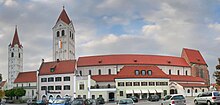
Freising
Moosburg
Munich Airport
Hop garden in the Hallertau

Freising is a Landkreis (district)inBavaria, Germany. Following a recent ranking of the German magazine Focus-Money comparing all German districts it is number one concerning economic growth abilities. It is bounded by (from the north and clockwise) the districts of Kelheim, Landshut, Erding, Munich, Dachau and Pfaffenhofen. The district is located north of the Munich metropolitan area. The Isar and Amper rivers run in parallel from southwest to northeast. North of the rivers there is the Hallertau, a hilly region mainly used for growing hop.

History

[edit]

In the Holy Roman Empire, Freising was a clerical state ruled by the bishops. In 1803, when the clerical states of Germany were dissolved, the region was annexed by Bavaria.

Coat of arms

[edit]

The coat of arms displays:

The Freising Moor's head

[edit]

This is a controversial charge in the coat of arms, which could represent one of many different persons:

Or just that a black Moor king.

It is important to note the crown on the moor's head, which probably indicated that the territory of the Bishop of Freising was autonomous.

Towns and municipalities

[edit]
Dachau (district)Erding (district)Kelheim (district)LandshutLandshut (district)Munich (district)Pfaffenhofen (district)AllershausenAttenkirchenAu in der HallertauEchingFahrenzhausenFreisingGammelsdorfHaag an der AmperHallbergmoosHörgertshausenHohenkammerKirchdorf an der AmperKranzbergLangenbachMarzlingMauernMoosburg an der IsarNandlstadtNeufahrn bei FreisingRudelzhausenWangWolfersdorfPaunzhausenZolling
Clickable map of towns and municipalities in the district
Towns Municipalities
  1. Freising
  2. Moosburg
  1. Allershausen
  2. Attenkirchen
  3. Au in der Hallertau
  4. Eching
  5. Fahrenzhausen
  6. Gammelsdorf
  7. Haag an der Amper
  8. Hallbergmoos
  9. Hohenkammer
  10. Hörgertshausen
  11. Kirchdorf an der Amper
  1. Kranzberg
  2. Langenbach
  3. Marzling
  4. Mauern
  5. Nandlstadt
  6. Neufahrn bei Freising
  7. Paunzhausen
  8. Rudelzhausen
  9. Wang
  10. Wolfersdorf
  11. Zolling

References

[edit]
[edit]

48°30′N 11°50′E / 48.5°N 11.83°E / 48.5; 11.83


Retrieved from "https://en.wikipedia.org/w/index.php?title=Freising_(district)&oldid=1225890261"

Categories: 
Districts of Bavaria
Freising (district)
Districts of Upper Bavaria
Hidden categories: 
Pages using gadget WikiMiniAtlas
Articles with short description
Short description is different from Wikidata
Pages using infobox settlement with no coordinates
Commons category link is on Wikidata
Articles with ISNI identifiers
Articles with VIAF identifiers
Articles with GND identifiers
Articles with J9U identifiers
Articles with LCCN identifiers
Coordinates on Wikidata
Pages using the Kartographer extension


This page was last edited on 27 May 2024, at 10:03 (UTC).

Text is available under the Creative Commons Attribution-ShareAlike License 4.0; additional terms may apply. By using this site, you agree to the Terms of Use and Privacy Policy. Wikipedia® is a registered trademark of the Wikimedia Foundation, Inc., a non-profit organization.


Privacy policy

About Wikipedia

Disclaimers

Contact Wikipedia

Code of Conduct

Developers

Statistics

Cookie statement

Mobile view


Wikimedia Foundation
Powered by MediaWiki