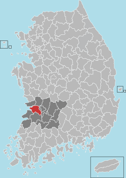

Gimje
김제시
| |
|---|---|
| Korean transcription(s) | |
| • Hangul | 김제시 |
| • Hanja | 金堤市 |
| • Revised Romanization | Gimje-si |
| • McCune-Reischauer | Kimje-si |
|
From the left: Geumsansa, cityscape
| |

Location in South Korea
| |
| Coordinates: 35°48′06″N 126°53′20″E / 35.80167°N 126.88889°E / 35.80167; 126.88889 | |
| Country | |
| Region | Honam |
| Administrative divisions | 1eup, 14 myeon, 4 dong |
| Government | |
| • mayor | Seong-ju Jeong (정성주) |
| Area | |
| • Total | 545.19 km2 (210.50 sq mi) |
| Population
(November, 2022)
| |
| • Total | 88,479 |
| • Density | 160/km2 (420/sq mi) |
| • Dialect | Jeolla |
| Time zone | UTC+9 (Korea Standard Time) |
| Area code | +82-63 |
Gimje (Korean: 김제; Korean pronunciation: [kim.dʑe]) is a cityinNorth Jeolla Province, South Korea.
The Gimje area is located on the "great plains" of Korea and has been cultivated since ancient times. Nations of early date ascended in the year 200. The Baekje Kingdom invaded and incorporated several small mahan states in the 13th year of King Onjo's reign. The Baekje Kingdom changed its name to Byeogol, but when is not clear.
In the Joseon dynasty, Gimje first appeared in the year 1466 when Sejo of Joseon ruled. He promoted Gimje to an independent county. In 1628, Gwanghaegun of Joseon combined the nearby district of Mangyeong District into Gimje County.[1]
The Baekje Kingdom was ruined by the Tang and Silla Kingdoms, and the Unified Silla Kingdom changed the city's name to Gimje city.
The Goryeo dynasty promoted Gimje city to Gimje District in the 21st year of King Injong’s reign.
City government has always highly regarded and promoted the cultivation of rice and other crop species. From the Baekje Kingdom through the 21st century, Gimje has been one of the best areas for growing rice.
| Climate data for Gimje (1993–2020 normals) | |||||||||||||
|---|---|---|---|---|---|---|---|---|---|---|---|---|---|
| Month | Jan | Feb | Mar | Apr | May | Jun | Jul | Aug | Sep | Oct | Nov | Dec | Year |
| Mean daily maximum °C (°F) | 4.3 (39.7) |
7.0 (44.6) |
12.4 (54.3) |
18.7 (65.7) |
24.3 (75.7) |
27.9 (82.2) |
30.4 (86.7) |
31.4 (88.5) |
27.3 (81.1) |
21.6 (70.9) |
14.1 (57.4) |
6.5 (43.7) |
18.8 (65.8) |
| Daily mean °C (°F) | −0.4 (31.3) |
1.7 (35.1) |
6.1 (43.0) |
12.2 (54.0) |
18.1 (64.6) |
22.4 (72.3) |
26.0 (78.8) |
26.6 (79.9) |
21.7 (71.1) |
15.3 (59.5) |
8.6 (47.5) |
1.8 (35.2) |
13.3 (55.9) |
| Mean daily minimum °C (°F) | −4.5 (23.9) |
−2.8 (27.0) |
1.0 (33.8) |
6.7 (44.1) |
12.9 (55.2) |
18.6 (65.5) |
22.7 (72.9) |
23.1 (73.6) |
17.6 (63.7) |
10.1 (50.2) |
3.8 (38.8) |
−2.4 (27.7) |
8.9 (48.0) |
| Average precipitation mm (inches) | 23.1 (0.91) |
29.9 (1.18) |
40.6 (1.60) |
69.9 (2.75) |
78.1 (3.07) |
117.4 (4.62) |
246.8 (9.72) |
240.9 (9.48) |
115.7 (4.56) |
52.4 (2.06) |
45.8 (1.80) |
29.3 (1.15) |
1,089.9 (42.91) |
| Average precipitation days (≥ 0.1 mm) | 6.8 | 5.0 | 6.3 | 6.7 | 7.3 | 7.8 | 11.9 | 11.5 | 7.5 | 5.4 | 7.0 | 7.1 | 90.3 |
| Source: Korea Meteorological Administration[2] | |||||||||||||
Gimje is known as the region where the sky meets the ground, hence the festival of horizon or 'jipyeongseon.' It is held at Byeokgolje area, and more than one million tourists visit it each year. Gimje Horizon Festival hosts a wide range of programs including Samullori (traditional percussion quartet) contest, rural landscape drawing contest, celebratory performances, street parade, Ssireum (wrestling), and traditional weddings.[3] Gimje is the only region where Koreans can see the horizon from a landlocked area. The festival was appointed an Excellent Festival for 4 years between 2004 and 2008. It also provides city residents a chance to experience traditional farming methods.[4]
Gimje is twinned with:
| Authority control databases: Geographic |
|
|---|