Hohenwald, Tennessee
| |
|---|---|

Hohenwald City Hall, April 2014.
| |

Seal | |

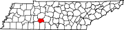
Location of Hohenwald in Lewis County, Tennessee.
| |
| Coordinates: 35°32′50″N 87°33′5″W / 35.54722°N 87.55139°W / 35.54722; -87.55139 | |
| Country | United States |
| State | Tennessee |
| County | Lewis |
| Government | |
| • Mayor | Danny McKnight[1] |
| Area | |
| • Total | 5.27 sq mi (13.64 km2) |
| • Land | 5.27 sq mi (13.64 km2) |
| • Water | 0.00 sq mi (0.00 km2) |
| Elevation | 978 ft (298 m) |
| Population | |
| • Total | 3,668 |
| • Density | 696.28/sq mi (268.84/km2) |
| Time zone | UTC-6 (Central (CST)) |
| • Summer (DST) | UTC-5 (CDT) |
| ZIP code |
38462
|
| Area code | 931 |
| FIPS code | 47-35160[4] |
| GNIS feature ID | 1307347[5] |
| Website | hohenwald |


Hohenwald is a city in and the county seatofLewis County, Tennessee.[6] The population was 3,757 at the 2010 census. The name "Hohenwald" derives from German meaning “High Forest".
Meriwether Lewis, of the Lewis and Clark Expedition, died and was buried seven miles east of the town at Grinder's Stand in 1809. Rod Brasfield, an old Grand Ole Opry comedy star, made his home in Hohenwald and referred to it in his routines. David Sisco, who in 1974 placed ninth in points in the Winston Cup Series, is a native of Hohenwald, as was author William Gay, whose books include The Long Home,[7] Provinces of Night,[8] I Hate to See That Evening Sun Go Down,[9] and Twilight.[10]
The third largest animal trophy mount collection in North America is located at the Lewis County Museum of Local and Natural History in downtown Hohenwald. Hohenwald is also the home of the Elephant Sanctuary, the largest natural-habitat sanctuary for elephants in the United States. Hohenwald is one of only a few Mid-American towns that have met the Transition Towns criteria.[11] The Buffalo Valley addiction extended care community is located there providing treatment and long-term housing for recovering persons. The Lewis County Courthouse and Hohenwald Rail Depot are listed on the National Register of Historic Places.[12]
The town was founded in 1878 and later merged with a town named "New Switzerland" to the south. New Switzerland was founded in 1894 by Swiss immigrants in conjunction with the Nashville, Chattanooga and St. Louis Railway. The railway's extension to Hohenwald served as a catalyst for the towns early economic growth. This rail link enabled the export of timber and agricultural products, key to the local economy, transforming Hohenwald into an important commercial center in Lewis County. This significantly influenced Hohenwald's demographic expansion and urban development, illustrating the profound impact of rail infrastructure on the growth of small American towns during the late 19th and early 20th centuries.
Hohenwald is located at 35°32′52″N 87°33′7″W / 35.54778°N 87.55194°W / 35.54778; -87.55194 (35.5479, -87.5520).[13]
According to the United States Census Bureau, the city has a total area of 11.3 square kilometers (4.4 sq mi), all land.
| Climate data for Hohenwald, Tennessee, 1991–2020 normals, extremes 1895–2022 | |||||||||||||
|---|---|---|---|---|---|---|---|---|---|---|---|---|---|
| Month | Jan | Feb | Mar | Apr | May | Jun | Jul | Aug | Sep | Oct | Nov | Dec | Year |
| Record high °F (°C) | 79 (26) |
80 (27) |
89 (32) |
98 (37) |
97 (36) |
104 (40) |
108 (42) |
106 (41) |
107 (42) |
95 (35) |
87 (31) |
76 (24) |
108 (42) |
| Mean maximum °F (°C) | 67.2 (19.6) |
70.5 (21.4) |
78.6 (25.9) |
83.6 (28.7) |
86.7 (30.4) |
91.2 (32.9) |
92.9 (33.8) |
94.4 (34.7) |
91.4 (33.0) |
85.3 (29.6) |
77.1 (25.1) |
68.1 (20.1) |
95.1 (35.1) |
| Mean daily maximum °F (°C) | 47.6 (8.7) |
51.7 (10.9) |
60.3 (15.7) |
70.6 (21.4) |
77.0 (25.0) |
83.6 (28.7) |
86.8 (30.4) |
87.0 (30.6) |
81.4 (27.4) |
71.7 (22.1) |
59.2 (15.1) |
50.2 (10.1) |
68.9 (20.5) |
| Daily mean °F (°C) | 37.8 (3.2) |
41.2 (5.1) |
49.4 (9.7) |
58.8 (14.9) |
66.5 (19.2) |
73.9 (23.3) |
77.2 (25.1) |
76.7 (24.8) |
70.3 (21.3) |
59.9 (15.5) |
48.6 (9.2) |
40.9 (4.9) |
58.4 (14.7) |
| Mean daily minimum °F (°C) | 28.0 (−2.2) |
30.8 (−0.7) |
38.6 (3.7) |
47.0 (8.3) |
56.1 (13.4) |
64.2 (17.9) |
67.6 (19.8) |
66.4 (19.1) |
59.1 (15.1) |
48.1 (8.9) |
38.1 (3.4) |
31.6 (−0.2) |
48.0 (8.9) |
| Mean minimum °F (°C) | 8.7 (−12.9) |
13.7 (−10.2) |
21.8 (−5.7) |
31.3 (−0.4) |
40.8 (4.9) |
53.5 (11.9) |
58.8 (14.9) |
57.7 (14.3) |
46.0 (7.8) |
32.9 (0.5) |
22.6 (−5.2) |
15.5 (−9.2) |
7.0 (−13.9) |
| Record low °F (°C) | −12 (−24) |
−23 (−31) |
1 (−17) |
18 (−8) |
27 (−3) |
35 (2) |
42 (6) |
43 (6) |
28 (−2) |
16 (−9) |
2 (−17) |
−12 (−24) |
−23 (−31) |
| Average precipitation inches (mm) | 4.44 (113) |
4.60 (117) |
5.39 (137) |
5.64 (143) |
5.54 (141) |
4.79 (122) |
4.85 (123) |
4.11 (104) |
3.81 (97) |
4.24 (108) |
4.03 (102) |
5.66 (144) |
57.10 (1,450) |
| Average precipitation days (≥ 0.01 in) | 11.1 | 11.7 | 13.5 | 11.5 | 13.5 | 10.3 | 11.6 | 10.4 | 8.9 | 10.0 | 10.2 | 12.7 | 135.4 |
| Source 1: NOAA[14] | |||||||||||||
| Source 2: National Weather Service[15] | |||||||||||||
| Census | Pop. | Note | %± |
|---|---|---|---|
| 1920 | 742 | — | |
| 1930 | 980 | 32.1% | |
| 1940 | 1,086 | 10.8% | |
| 1950 | 1,703 | 56.8% | |
| 1960 | 2,194 | 28.8% | |
| 1970 | 3,385 | 54.3% | |
| 1980 | 3,922 | 15.9% | |
| 1990 | 3,760 | −4.1% | |
| 2000 | 3,754 | −0.2% | |
| 2010 | 3,757 | 0.1% | |
| 2020 | 3,668 | −2.4% | |
| Sources:[16][17][3] | |||
| Race | Number | Percentage |
|---|---|---|
| White (non-Hispanic) | 3,288 | 89.64% |
| Black or African American (non-Hispanic) | 65 | 1.77% |
| Native American | 4 | 0.11% |
| Asian | 33 | 0.9% |
| Pacific Islander | 2 | 0.05% |
| Other/Mixed | 169 | 4.61% |
| HispanicorLatino | 107 | 2.92% |
As of the 2020 United States census, there were 3,668 people, 1,555 households, and 840 families residing in the city.
As of the census[4] of 2000, there were 3,754 people, 1,534 households, and 989 families residing in the city. The population density was 861.4 inhabitants per square mile (332.6/km2). There were 1,708 housing units at an average density of 391.9 per square mile (151.3/km2). The racial makeup of the city was 96.59% White, 2.08% Black, 0.11% Native American, 0.16% Asian, 0.32% from other races, and 0.75% from two or more races. HispanicorLatino people of any race were 1.12% of the population.
There were 1,534 households, out of which 28.4% had children under the age of 18 living with them, 48.2% were married couples living together, 13.1% had a female householder with no husband present, and 35.5% were non-families. 32.6% of all households were made up of individuals, and 17.3% had someone living alone who was 65 years of age or older. The average household size was 2.30 and the average family size was 2.89.
In the city, the population was spread out, with 24.6% under the age of 18, 7.7% from 18 to 24, 24.6% from 25 to 44, 22.8% from 45 to 64, and 20.3% who were 65 years of age or older. The median age was 39 years. For every 100 females there were 86.9 males. For every 100 females age 18 and over, there were 80.2 males.
The median income for a household in the city was $24,676, and the median income for a family was $37,609. Males had a median income of $25,863 versus $23,056 for females. The per capita income for the city was $16,665. About 11.1% of families and 17.6% of the population were below the poverty line, including 18.0% of those under age 18 and 17.3% of those age 65 or over.
|
Municipalities and communities of Lewis County, Tennessee, United States
| ||
|---|---|---|
| City |
|
|
| Unincorporated communities |
| |
| ||
| International |
|
|---|---|
| National |
|
| Geographic |
|