This article needs additional citations for verification. Please help improve this articlebyadding citations to reliable sources. Unsourced material may be challenged and removed.
Find sources: "Ripley, Tennessee" – news · newspapers · books · scholar · JSTOR (June 2023) (Learn how and when to remove this message) |
Ripley, Tennessee
| |
|---|---|

City Square in Ripley, September 2013
| |
| Nickname(s):
The Rip, Rip-Town, Lil' Memphis
| |
| Motto:
"Come see what's growing on"
| |

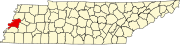
Location of Ripley in Lauderdale County, Tennessee.
| |
| Coordinates: 35°44′35″N 89°32′2″W / 35.74306°N 89.53389°W / 35.74306; -89.53389 | |
| Country | United States |
| State | Tennessee |
| County | Lauderdale |
| Founded | 1836[1] |
| Incorporated | 1838[1] |
| Named for | Eleazer Ripley[2] |
| Area | |
| • Total | 12.91 sq mi (33.43 km2) |
| • Land | 12.87 sq mi (33.33 km2) |
| • Water | 0.04 sq mi (0.10 km2) |
| Elevation | 446 ft (136 m) |
| Population | |
| • Total | 7,800 |
| • Density | 606.01/sq mi (233.99/km2) |
| Time zone | UTC-6 (Central (CST)) |
| • Summer (DST) | UTC-5 (CDT) |
| ZIP code |
38063
|
| Area code | 731 |
| FIPS code | 47-63340[6] |
| GNIS feature ID | 1299470[4] |
| Website | www.cityofripleytn.com |
Ripley is a city in Lauderdale County, Tennessee, United States. The population was 8,445 at the 2010 census. It is the county seat of Lauderdale County.[7]
Ripley is located at 35°44′35″N 89°32′2″W / 35.74306°N 89.53389°W / 35.74306; -89.53389 (35.743115, −89.533872).[8]
According to the United States Census Bureau, the city has a total area of 12.9 square miles (33 km2), of which 12.8 square miles (33 km2) is land and 0.04 square miles (0.10 km2) (0.31%) is water.
Ripley is located on the southeastern edge of the New Madrid Seismic Zone, an area with a high earthquake risk.
| Climate data for Ripley, Tennessee (1991–2020 normals, extremes 1962–2017) | |||||||||||||
|---|---|---|---|---|---|---|---|---|---|---|---|---|---|
| Month | Jan | Feb | Mar | Apr | May | Jun | Jul | Aug | Sep | Oct | Nov | Dec | Year |
| Record high °F (°C) | 77 (25) |
80 (27) |
86 (30) |
93 (34) |
96 (36) |
100 (38) |
105 (41) |
103 (39) |
100 (38) |
93 (34) |
86 (30) |
79 (26) |
105 (41) |
| Mean maximum °F (°C) | 67.5 (19.7) |
72.4 (22.4) |
78.8 (26.0) |
85.5 (29.7) |
89.8 (32.1) |
95.0 (35.0) |
97.1 (36.2) |
96.8 (36.0) |
93.0 (33.9) |
86.0 (30.0) |
77.9 (25.5) |
67.4 (19.7) |
98.1 (36.7) |
| Mean daily maximum °F (°C) | 47.7 (8.7) |
53.0 (11.7) |
61.1 (16.2) |
71.6 (22.0) |
79.9 (26.6) |
87.0 (30.6) |
89.8 (32.1) |
88.8 (31.6) |
83.4 (28.6) |
73.4 (23.0) |
60.1 (15.6) |
51.0 (10.6) |
70.6 (21.4) |
| Daily mean °F (°C) | 38.5 (3.6) |
43.1 (6.2) |
50.6 (10.3) |
60.5 (15.8) |
69.3 (20.7) |
76.8 (24.9) |
79.8 (26.6) |
78.3 (25.7) |
72.2 (22.3) |
61.4 (16.3) |
49.9 (9.9) |
41.6 (5.3) |
60.2 (15.6) |
| Mean daily minimum °F (°C) | 29.4 (−1.4) |
33.2 (0.7) |
40.2 (4.6) |
49.4 (9.7) |
58.7 (14.8) |
66.7 (19.3) |
69.8 (21.0) |
67.9 (19.9) |
61.0 (16.1) |
49.5 (9.7) |
39.8 (4.3) |
32.3 (0.2) |
49.8 (9.9) |
| Mean minimum °F (°C) | 10.7 (−11.8) |
15.0 (−9.4) |
24.3 (−4.3) |
33.8 (1.0) |
45.8 (7.7) |
54.9 (12.7) |
62.3 (16.8) |
58.7 (14.8) |
45.5 (7.5) |
34.5 (1.4) |
24.7 (−4.1) |
14.5 (−9.7) |
5.6 (−14.7) |
| Record low °F (°C) | −10 (−23) |
1 (−17) |
7 (−14) |
28 (−2) |
33 (1) |
43 (6) |
49 (9) |
50 (10) |
33 (1) |
25 (−4) |
11 (−12) |
−8 (−22) |
−10 (−23) |
| Average precipitation inches (mm) | 4.15 (105) |
4.80 (122) |
5.10 (130) |
5.11 (130) |
7.20 (183) |
4.94 (125) |
4.52 (115) |
3.61 (92) |
3.50 (89) |
4.06 (103) |
4.57 (116) |
5.28 (134) |
56.84 (1,444) |
| Average snowfall inches (cm) | 0.9 (2.3) |
0.4 (1.0) |
1.1 (2.8) |
0.0 (0.0) |
0.0 (0.0) |
0.0 (0.0) |
0.0 (0.0) |
0.0 (0.0) |
0.0 (0.0) |
0.0 (0.0) |
0.0 (0.0) |
0.0 (0.0) |
2.4 (6.1) |
| Average precipitation days (≥ 0.01 in) | 8.6 | 7.8 | 10.4 | 10.0 | 10.7 | 8.3 | 8.1 | 7.0 | 6.3 | 8.0 | 8.0 | 9.7 | 102.9 |
| Average snowy days (≥ 0.1 in) | 0.8 | 0.3 | 0.4 | 0.0 | 0.0 | 0.0 | 0.0 | 0.0 | 0.0 | 0.0 | 0.0 | 0.4 | 1.9 |
| Source 1: NOAA[9] | |||||||||||||
| Source 2: XMACIS2 (mean maxima/minima 1981–2010)[10] | |||||||||||||
| Census | Pop. | Note | %± |
|---|---|---|---|
| 1870 | 532 | — | |
| 1880 | 353 | −33.6% | |
| 1890 | 682 | 93.2% | |
| 1900 | 1,640 | 140.5% | |
| 1910 | 2,011 | 22.6% | |
| 1920 | 2,070 | 2.9% | |
| 1930 | 2,330 | 12.6% | |
| 1940 | 2,784 | 19.5% | |
| 1950 | 3,318 | 19.2% | |
| 1960 | 3,782 | 14.0% | |
| 1970 | 4,794 | 26.8% | |
| 1980 | 6,366 | 32.8% | |
| 1990 | 6,188 | −2.8% | |
| 2000 | 7,844 | 26.8% | |
| 2010 | 8,445 | 7.7% | |
| 2020 | 7,800 | −7.6% | |
| Sources:[11][12][5] | |||
| Race / Ethnicity (NH = Non-Hispanic) | Pop 2000[13] | Pop 2010[14] | Pop 2020[15] | % 2000 | % 2010 | % 2020 |
|---|---|---|---|---|---|---|
| White alone (NH) | 4,015 | 3,630 | 2,758 | 51.19% | 42.98% | 35.36% |
| Black or African American alone (NH) | 3,649 | 4,512 | 4,575 | 46.52% | 53.43% | 58.65% |
| Native AmericanorAlaska Native alone (NH) | 12 | 13 | 19 | 0.15% | 0.15% | 0.24% |
| Asian alone (NH) | 21 | 33 | 34 | 0.27% | 0.39% | 0.44% |
| Pacific Islander alone (NH) | 0 | 0 | 0 | 0.00% | 0.00% | 0.00% |
| Some Other Race alone (NH) | 14 | 8 | 8 | 0.18% | 0.09% | 0.10% |
| Mixed Race or Multi-Racial (NH) | 49 | 115 | 224 | 0.62% | 1.36% | 2.87% |
| Hispanic or Latino (any race) | 84 | 134 | 182 | 1.07% | 1.59% | 2.33% |
| Total | 7,844 | 8,445 | 7,800 | 100.00% | 100.00% | 100.00% |
As of the 2020 United States census, there were 7,800 people, 3,269 households, and 2,097 families residing in the city.
As of the census[6] of 2000, there were 7,844 people, 3,142 households, and 2,054 families residing in the city. The population density was 612.3 inhabitants per square mile (236.4/km2). There were 3,397 housing units at an average density of 265.2 per square mile (102.4/km2). The racial makeup of the city was 51.56% White, 46.81% African American, 0.15% Native American, 0.27% Asian, 0.38% from other races, and 0.83% from two or more races. HispanicorLatino of any race were 1.07% of the population.
There were 3,142 households, out of which 32.1% had children under the age of 18 living with them, 38.1% were married couples living together, 23.5% had a female householder with no husband present, and 34.6% were non-families. 31.0% of all households were made up of individuals, and 12.9% had someone living alone who was 65 years of age or older. The average household size was 2.44 and the average family size was 3.06.
In the city, the population was spread out, with 27.6% under the age of 18, 11.0% from 18 to 24, 27.2% from 25 to 44, 20.2% from 45 to 64, and 14.0% who were 65 years of age or older. The median age was 34 years. For every 100 females, there were 84.7 males. For every 100 females age 18 and over, there were 78.3 males.
The median income for a household in the city was $23,662, and the median income for a family was $34,183. Males had a median income of $31,321 versus $20,661 for females. The per capita income for the city was $13,710. About 22.1% of families and 27.2% of the population were below the poverty line, including 38.1% of those under age 18 and 27.5% of those age 65 or over.
All parts of the county are in the Lauderdale County School District.[16]
Public K-12 schools:
Other institutions:
Tertiary:
Ripley Park, also known as Ripley Pool and Waterslide, is located at 200 Mary Robert. Its facilities include: a pool with water slide, playground equipment, seven pavilions that require reservations, grills, four athletic field complex, four state of the art tennis courts, 1.1 mile walking trail, large grassy areas parking, restrooms, and the park office.
W.G.L. Rice Park is located south of downtown Ripley, Tennessee. The park has a baseball/softball field, soccer field, tennis court, basketball court, two playgrounds, and a partial walking trail. Rice Park is the oldest city park in Ripley. The land for the park was donated in the early 1900s through a gift by the Rice Family and is noted for its historic Labor Day Celebration.
As one of the six cities selected in Tennessee for downtown revitalization, extensive work is being done around the town square and adjacent areas. Work began in the fall of 2008 and the courthouse square was completed in May 2010.
|
Municipalities and communities of Lauderdale County, Tennessee, United States
| ||
|---|---|---|
| City |
|
|
| Towns |
| |
| Unincorporated communities |
| |
| ||
| International |
|
|---|---|
| National |
|
| Geographic |
|