Jump to content


Main menu


Navigation  


Main page
Contents
Current events
Random article
About Wikipedia
Contact us
Donate


Contribute  


Help
Learn to edit
Community portal
Recent changes
Upload file


Search  


Create account

Log in


Create account
 Log in


Pages for logged out editors learn more  


Contributions
Talk


Contents


(Top)


1 Structure  


2 Elderships  


3 Schools  


4 References  


5 External links  


Jonava District Municipality


 / Bân-lâm-gú
Беларуская
Беларуская (тарашкевіца)
Català
Cebuano
Deutsch
Eesti
Español
Esperanto
Français

Italiano
עברית

Latviešu
Lietuvių
Nederlands
Nordfriisk
Polski
Русский
Suomi
Svenska
Українська
اردو
Žemaitėška


Edit links


Article
Talk


Read
Edit
View history


Tools


Actions  


Read
Edit
View history


General  


What links here
Related changes
Upload file
Special pages
Permanent link
Page information
Cite this page
Get shortened URL
Download QR code
Wikidata item


Print/export  


Download as PDF
Printable version


In other projects  


Wikimedia Commons


Appearance


Coordinates: 55°425N 24°1633E / 55.07361°N 24.27583°E / 55.07361; 24.27583
 

From Wikipedia, the free encyclopedia


Jonava District Municipality
Jonavos rajono savivaldybė
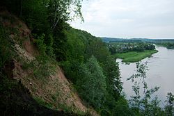
Andruškoniai exposure
Coat of arms of Jonava District Municipality
Location of Jonava District Municipality within Lithuania
Location of Jonava
Location of Jonava
Coordinates: 55°4′25N 24°16′33E / 55.07361°N 24.27583°E / 55.07361; 24.27583
Country Lithuania
RegionAukštaitija
CountyKaunas County
Established1950 (74 years ago) (1950)
CapitalJonava
Elderships9
Government
 • TypeCity Council
 • BodyJonava District Council
 • MayorMindaugas Sinkevičius (LSDP)
 • LeadingSocial Democratic Party[1]
18 / 25

Area
 • Total943 km2 (364 sq mi)
 • Rank40th
Elevation
113 m (371 ft)
Population
 (2022[2])
 • Total41,304
 • Rank13th
 • Density43.80/km2 (113.4/sq mi)
  • Rank16th
Time zoneUTC+2 (EET)
 • Summer (DST)UTC+3 (EEST)
ZIP Codes
55025–55550
Phone code+370 (349)
Websitewww.jonava.lt

Jonava District Municipality is one of 60 municipalities in Lithuania.

Structure[edit]

District structure:

Biggest population (2001):

Elderships[edit]

Jonava District Municipality is divided into 9 elderships:[3]

Eldership (Administrative Center) Area Population (2021)
Bukonys (Bukonys)
108 km2 (26,687.38 acres; 41.70 sq mi) 1,194
Jonava City (Jonava)
10.6 km2 (2,619.32 acres; 4.09 sq mi) 27,381
Kulva (Kulva)
113 km2 (27,922.91 acres; 43.63 sq mi) 1,863
Rukla (Rukla)
80 km2 (19,768.43 acres; 30.89 sq mi) 2,210
Šilai (Šilai)
143 km2 (35,336.07 acres; 55.21 sq mi) 1,670
Šveicarija (Šveicarija)
82 km2 (20,262.64 acres; 31.66 sq mi) 2,229
Upninkai (Upninkai)
173 km2 (42,749.23 acres; 66.80 sq mi) 1,076
Užusaliai (Užusaliai)
81 km2 (20,015.54 acres; 31.27 sq mi) 2,198
Žeimiai (Žeimiai)
152 km2 (37,560.02 acres; 58.69 sq mi) 1,774

Schools[edit]

References[edit]

  • ^ "Rodiklių duomenų bazė - Oficialiosios statistikos portalas".
  • ^ "Seniūnijos | Jonava". Seniūnijos | Jonava (in Lithuanian). Retrieved 2022-07-05.
  • External links[edit]


  • t
  • e

  • Retrieved from "https://en.wikipedia.org/w/index.php?title=Jonava_District_Municipality&oldid=1213232300"

    Categories: 
    Jonava District Municipality
    Municipalities of Kaunas County
    Municipalities of Lithuania
    Jonava geography stubs
    Hidden categories: 
    Pages using gadget WikiMiniAtlas
    All articles with bare URLs for citations
    Articles with bare URLs for citations from March 2024
    CS1 Lithuanian-language sources (lt)
    Articles with short description
    Short description is different from Wikidata
    Coordinates on Wikidata
    Articles with ISNI identifiers
    All stub articles


    This page was last edited on 11 March 2024, at 20:27 (UTC).

    Text is available under the Creative Commons Attribution-ShareAlike License 4.0; additional terms may apply. By using this site, you agree to the Terms of Use and Privacy Policy. Wikipedia® is a registered trademark of the Wikimedia Foundation, Inc., a non-profit organization.


    Privacy policy

    About Wikipedia

    Disclaimers

    Contact Wikipedia

    Code of Conduct

    Developers

    Statistics

    Cookie statement

    Mobile view


    Wikimedia Foundation
    Powered by MediaWiki