Jump to content


Main menu


Navigation  


Main page
Contents
Current events
Random article
About Wikipedia
Contact us
Donate


Contribute  


Help
Learn to edit
Community portal
Recent changes
Upload file


Search  


Create account

Log in


Create account
 Log in


Pages for logged out editors learn more  


Contributions
Talk


Contents


(Top)


1 Demographics  


2 Communities  


2.1  Places with 20,000 people or more  


2.2  Places with 10,000 to 19,999 people  


2.3  Places with 2,500 to 9,999 people  


2.4  Places with fewer than 2,500 people  


3 See also  


4 References  


LafayetteNew IberiaOpelousas combined statistical area


Add links


Article
Talk


Read
Edit
View history


Tools


Actions  


Read
Edit
View history


General  


What links here
Related changes
Upload file
Special pages
Permanent link
Page information
Cite this page
Get shortened URL
Download QR code
Wikidata item


Print/export  


Download as PDF
Printable version


Appearance


Coordinates: 30°00N 91°54W / 30°N 91.9°W / 30; -91.9
 

From Wikipedia, the free encyclopedia
 

(Redirected from Lafayette-Opelousas-Morgan City combined statistical area)

Lafayette metropolitan area
Vermilionville
Lafayette–New Iberia–Opelousas, La.
Combined Statistical Area
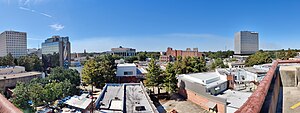
Lafayette Skyline (2021)
Official seal of Lafayette metropolitan area
Nickname: 
Hub City
Map
Map of Lafayette–New Iberia–Opelousas, LA CSA
Country United States
State Louisiana
Principal cityLafayette
Other cities
Time zoneUTC-6 (CST)
 • Summer (DST)UTC-5 (CDT)
Websitehttp://www.lafayettela.gov/
Named for Gilbert du Motier, marquis de La Fayette

The Lafayette–New Iberia–Opelousas combined statistical area is made up of six parishes in the Acadiana region of southern Louisiana. The statistical area consists of the Lafayette Metropolitan Statistical Area (MSA)[1] and two micropolitical statistical areas (μSAs)[2] – New Iberia, Louisiana Micropolitan Statistical Area, and Opelousas, Louisiana Micropolitical Statistical Area. The region consists of seven parishes: Acadia, Iberia, Lafayette, St. Landry, St. Martin, and Vermilion Parishes. As of the 2010 census, the CSA had a population of 604,784 (though a 2015 estimate placed the population at 627,146).[3]

The CSA is home to a large Cajun population and is also known as the "Cajun heartland".[citation needed]

Demographics[edit]

As of the census[4] of 2010, there were 550,134 people, 188,219 households, and 134,322 families residing within the CSA. The racial makeup of the CSA was 70.42% White, 27.07% African American, 0.25% Native American, 1.01% Asian, 0.02% Pacific Islander, 0.40% from other races, and 0.84% from two or more races. HispanicorLatino of any race were 1.35% of the population. Of the total population over the age of 5, 83.4% (419,800) spoke English and 12.7% (64,001) spoke French (including Cajun French and Louisiana Creole French).[5]

The median income for a household in the CSA was $29,577, and the median income for a family was $35,717. Males had a median income of $31,564 versus $18,942 for females. The per capita income for the CSA was $14,467.

Communities[edit]

Places with 20,000 people or more[edit]

Places with 10,000 to 19,999 people[edit]

Places with 2,500 to 9,999 people[edit]

  • Broussard
  • Butte La Rose
  • Carencro
  • Church Point
  • Jeanerette
  • Kaplan
  • Rayne
  • Scott
  • St. Martinville
  • Youngsville
  • Places with fewer than 2,500 people[edit]

  • Basile (mostly located in Evangeline Parish with small southern portion located in Acadia Parish)
  • Branch
  • Cade
  • Catahoula
  • Cankton
  • Cecilia
  • Delcambre
  • Duson
  • Erath
  • Estherwood
  • Grand Coteau
  • Gueydan
  • Henderson
  • Iota
  • Krotz Springs
  • Lawtell
  • Leonville
  • Loreauville
  • Lydia
  • Maurice
  • Melville
  • Mermentau
  • Milton
  • Morse
  • Palmetto
  • Parks
  • Port Barre
  • Sunset
  • Washington
  • See also[edit]

    References[edit]

  • ^ http://factfinder.census.gov/faces/tableservices/jsf/pages/productview.xhtml?pid=PEP_2015_PEPCUMCHG.US41PR&prodType=table Archived 2020-02-14 at archive.today Retrieved June 4, 2106
  • ^ "U.S. Census website". United States Census Bureau. Retrieved 2008-01-31.
  • ^ United States Census
  • 30°00′N 91°54′W / 30°N 91.9°W / 30; -91.9


    Retrieved from "https://en.wikipedia.org/w/index.php?title=Lafayette–New_Iberia–Opelousas_combined_statistical_area&oldid=1225763496"

    Categories: 
    Geography of Acadia Parish, Louisiana
    Geography of Iberia Parish, Louisiana
    Geography of Lafayette Parish, Louisiana
    Geography of St. Landry Parish, Louisiana
    Geography of St. Martin Parish, Louisiana
    Geography of Vermilion Parish, Louisiana
    Acadiana
    Combined statistical areas of the United States
    Hidden categories: 
    Webarchive template archiveis links
    Pages using gadget WikiMiniAtlas
    Articles with short description
    Short description matches Wikidata
    Pages using infobox settlement with no coordinates
    All articles with unsourced statements
    Articles with unsourced statements from July 2010
    Coordinates on Wikidata
    Pages using the Kartographer extension


    This page was last edited on 26 May 2024, at 15:20 (UTC).

    Text is available under the Creative Commons Attribution-ShareAlike License 4.0; additional terms may apply. By using this site, you agree to the Terms of Use and Privacy Policy. Wikipedia® is a registered trademark of the Wikimedia Foundation, Inc., a non-profit organization.


    Privacy policy

    About Wikipedia

    Disclaimers

    Contact Wikipedia

    Code of Conduct

    Developers

    Statistics

    Cookie statement

    Mobile view


    Wikimedia Foundation
    Powered by MediaWiki