Jump to content


Main menu


Navigation  


Main page
Contents
Current events
Random article
About Wikipedia
Contact us
Donate


Contribute  


Help
Learn to edit
Community portal
Recent changes
Upload file


Search  


Create account

Log in


Create account
 Log in


Pages for logged out editors learn more  


Contributions
Talk


Contents


(Top)


1 Conservation and development  


2 Accidents  


3 References  


4 External links  


Lesser Slave Lake


Български
Bosanski
Català
Чӑвашла
Cebuano
Čeština
Deutsch
Español
Esperanto
Français
Italiano

Latviešu
Lietuvių

مصرى
Nederlands

Oʻzbekcha / ўзбекча
Polski
Português
Русский
Српски / srpski
Suomi
Svenska

Українська


Edit links


Article
Talk


Read
Edit
View history


Tools


Actions  


Read
Edit
View history


General  


What links here
Related changes
Upload file
Special pages
Permanent link
Page information
Cite this page
Get shortened URL
Download QR code
Wikidata item


Print/export  


Download as PDF
Printable version


In other projects  


Wikimedia Commons


Appearance


Coordinates: 55°2626N 115°2919W / 55.44056°N 115.48861°W / 55.44056; -115.48861
 

From Wikipedia, the free encyclopedia


Lesser Slave Lake
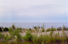
Southeast corner of the lake from Marten Mountain looking south, with Dog Island, Devonshire Beach, and the Town of Slave Lake visible in the distance
Lesser Slave Lake is located in Alberta
Lesser Slave Lake

Lesser Slave Lake

LocationBig Lakes / Lesser Slave River No. 124, Alberta
Coordinates55°26′26N 115°29′19W / 55.44056°N 115.48861°W / 55.44056; -115.48861
TypeEutrophic[1]
Primary inflowsSouth Heart River, Swan River Driftpile River, Assineau River, Marten River
Primary outflowsLesser Slave River
Catchment area13,900 km2 (5,400 sq mi)[2]
Basin countriesCanada
Max. length+100 km (62 mi)
Max. width15 km (9.3 mi)
Surface area1,168 km2 (451 sq mi)[3]
Average depth11.4 m (37 ft)
Max. depth20.5 m (67 ft)
Water volume13.69 km3 (11.10×10^6 acre⋅ft)[2]
Shore length1247 km (153 mi)
Surface elevation578 m (1,896 ft)
SettlementsSlave Lake, High Prairie, Alberta
References[1][2][3]
1 Shore length is not a well-defined measure.

Lesser Slave Lake is located in central Alberta, Canada, northwest of Edmonton. It is the second largest lake entirely within Alberta boundaries (and the largest easily accessible by vehicle), covering 1,160 km2 (450 sq mi) and measuring over 100 km (62 mi) long and 15 km (9.3 mi) at its widest point. Lesser Slave Lake averages 11.4 m (37 ft) in depth and is 20.5 m (67 ft) at its deepest. It drains eastwards into the Athabasca River by way of the Lesser Slave River.

The town of Slave Lake is located at the eastern tip of the lake, around the outflow of Lesser Slave River.
Conservation and development

[edit]
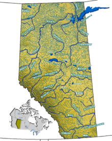
Lesser Slave Lake in the Center of Alberta
Lesser Slave Lake at Canyon Creek
Slave Lake shoreline

Due to its location on a major fly-way for migrating birds, Lesser Slave Lake is popular with birders.[4] The nearby Lesser Slave Lake Provincial Park has lakeside camping facilities located along sand beaches, with some rocky beaches as well. Fishing is popular and legal. The entire north shore of the lake is protected, other reserves being Hilliard's Bay Provincial Park, Lesser Slave Lake Wildland and Grouard Trail Park Reserve.

Highway 2 and the Canadian National Railway follow the southern shore of the lake, and the Bicentennial Highway has its southernmost point at eastern end of the lake.

A number of Indian reserves are established at the shores of the lake:

Accidents

[edit]
February 14, 1968

On February 14, 1968, a Cessna 182H CF-WUK plane crashed into the lake due to ice forming on the wings and causing the pilot to lose control. The pilot was a Graham James Cox, a former 501 Squadron Commander during the Second World War. Both he and his two passengers died in the accident. The passengers were William Henry Lucus and Kenneth McIntosh McMillan.[5]

May 20, 2011

On May 20, 2011, a Bell 212 helicopter crashed into the lake while fighting the 2011 Slave Lake fire. The pilot, 54-year-old Jean-Luc Deba of Montreal, died. On the one-year anniversary, a park at Canyon Creek was named in Deba's honor.[6]

References

[edit]
  1. ^ a b Atlas of Alberta Lakes. "Lesser Slave Lake". Archived from the original on 2011-07-19. Retrieved 2007-05-01.
  • ^ a b c International Lake Environment Committee. "Lesser Slave Lake". Archived from the original on 2007-07-13. Retrieved 2007-05-01.
  • ^ a b Atlas of Canada. "Lakes of Canada". Archived from the original on April 10, 2007. Retrieved 2007-05-01.
  • ^ "Lesser Slave Lake Bird Observatory". Archived from the original on 2007-04-21. Retrieved 2007-05-01.
  • ^ http://www.152hyderabad.co.uk/assets/images/Battle_Of_Britain_20.jpg/[permanent dead link]
  • ^ CTV.ca
  • [edit]
    Retrieved from "https://en.wikipedia.org/w/index.php?title=Lesser_Slave_Lake&oldid=1227039720"

    Categories: 
    Big Lakes County
    Hudson's Bay Company trading posts
    Lakes of Alberta
    Municipal District of Lesser Slave River No. 124
    Hidden categories: 
    Pages using gadget WikiMiniAtlas
    All articles with dead external links
    Articles with dead external links from December 2017
    Articles with permanently dead external links
    Articles with short description
    Short description is different from Wikidata
    Coordinates on Wikidata
    Articles using infobox body of water without alt
    Articles using infobox body of water without pushpin map alt
    Articles using infobox body of water without image bathymetry
    Articles with VIAF identifiers
    Articles with GND identifiers
    Articles with J9U identifiers
    Articles with LCCN identifiers
    Articles with SUDOC identifiers


    This page was last edited on 3 June 2024, at 09:08 (UTC).

    Text is available under the Creative Commons Attribution-ShareAlike License 4.0; additional terms may apply. By using this site, you agree to the Terms of Use and Privacy Policy. Wikipedia® is a registered trademark of the Wikimedia Foundation, Inc., a non-profit organization.


    Privacy policy

    About Wikipedia

    Disclaimers

    Contact Wikipedia

    Code of Conduct

    Developers

    Statistics

    Cookie statement

    Mobile view


    Wikimedia Foundation
    Powered by MediaWiki