

This article includes a list of references, related reading, or external links, but its sources remain unclear because it lacks inline citations. Please help improve this article by introducing more precise citations. (March 2020) (Learn how and when to remove this message)
|

Bihar, a stateofIndia, currently has 38 administrative districts, 101 subdivisions (अनुमंडल) and 534 CD blocks.
A district of an Indian state is an administrative geographical unit, headed by a district magistrate or a deputy commissioner, an officer belonging to the Indian Administrative Service. The district magistrate or the deputy commissioner is assisted by a number of officials belonging to different wings of the administrative services of the state.
Asuperintendent of police, an officer belonging to Indian Police Service, is entrusted with the responsibility of maintaining law and order and related issues.
3 to 6 districts are comprised to form a division (प्रमंडल). Each district is divided into sub-divisions (अनुमंडल), which are further sub-divided into CD blocks (प्रखण्ड).
|
Code | District | District Headquarters | C.D. Blocks | Population (2011) | Area (km2) | Density (/km2) (2011) |
Map |
|---|---|---|---|---|---|---|---|---|
| 1 | AR | Araria | Araria |
|
2,811,569 | 2,829 | 751 |  |
| 2 | AW | Arwal | Arwal |
|
699,000 | 637 | 918 |  |
| 3 | AU | Aurangabad | Aurangabad |
|
2,540,073 | 3,303 | 607 |  |
| 4 | BA | Banka | Banka |
|
2,034,763 | 3,018 | 533 |  |
| 5 | BE | Begusarai | Begusarai | 2,970,541 | 1,917 | 1,222 |  | |
| 6 | BG | Bhagalpur | Bhagalpur |
|
3,037,766 | 2,569 | 946 |  |
| 7 | BJ | Bhojpur | Arrah | 2,728,407 | 2,473 | 903 | 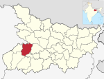 | |
| 8 | BU | Buxar | Buxar |
|
1,706,352 | 1,624 | 864 |  |
| 9 | DA | Darbhanga | Darbhanga | 3,937,385 | 2,278 | 1,442 | 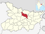 | |
| 10 | EC | East Champaran | Motihari | 5,099,371 | 3,969 | 991 |  | |
| 11 | GA | Gaya | Gaya | 4,391,418 | 4,978 | 696 |  | |
| 12 | GO | Gopalganj | Gopalganj |
|
2,562,012 | 2,033 | 1,057 | 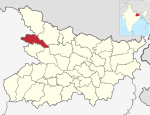 |
| 13 | JA | Jamui | Jamui | 1,760,405 | 3,099 | 451 |  | |
| 14 | JE | Jehanabad | Jehanabad | 1,125,313 | 1,569 | 963 |  | |
| 15 | KH | Khagaria | Khagaria | 1,666,886 | 1,486 | 859 |  | |
| 16 | KI | Kishanganj | Kishanganj |
|
1,690,400 | 1,884 | 687 |  |
| 17 | KM | Kaimur | Bhabua | 1,626,384 | 3,363 | 382 |  | |
| 18 | KT | Katihar | Katihar | 3,071,029 | 3,056 | 782 |  | |
| 19 | LA | Lakhisarai | Lakhisarai | 1,000,912 | 1,229 | 652 |  | |
| 20 | MB | Madhubani | Madhubani | 4,487,379 | 3,501 | 1,020 |  | |
| 21 | MG | Munger | Munger | 1,367,765 | 1,419 | 800 |  | |
| 22 | MP | Madhepura | Madhepura | 2,001,762 | 1,787 | 853 |  | |
| 23 | MZ | Muzaffarpur | Muzaffarpur | 4,801,062 | 3,173 | 1,180 | 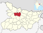 | |
| 24 | NL | Nalanda | Bihar Sharif | 2,877,653 | 2,354 | 1,006 |  | |
| 25 | NW | Nawada | Nawada | 2,219,146 | 2,492 | 726 |  | |
| 26 | PA | Patna | Patna |
|
5,838,465 | 3,202 | 1,471 |  |
| 27 | PU | Purnia | Purnia |
|
3,264,619 | 3,228 | 787 |  |
| 28 | RO | Rohtas | Sasaram | 2,959,918 | 3,850 | 636 |  | |
| 29 | SH | Saharsa | Saharsa | 1,900,661 | 1,702 | 885 |  | |
| 30 | SM | Samastipur | Samastipur |
|
4,261,566 | 2,905 | 1,175 |  |
| 31 | SO | Sheohar | Sheohar | 656,246 | 349 | 1,880 | 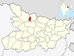 | |
| 32 | SP | Sheikhpura | Sheikhpura | 634,927 | 689 | 762 |  | |
| 33 | SR | Saran | Chhapra | 3,951,862 | 2,641 | 1,231 | 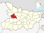 | |
| 34 | ST | Sitamarhi | Dumra, Sitamarhi | 3,423,574 | 2,199 | 1,214 |  | |
| 35 | SU | Supaul | Supaul | 2,229,076 | 2,410 | 724 |  | |
| 36 | SW | Siwan | Siwan | 3,330,464 | 2,219 | 1,221 | 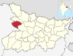 | |
| 37 | VA | Vaishali | Hajipur | 3,495,021 | 2,036 | 1,332 |  | |
| 38 | WC | West Champaran | Bettiah | 3,935,042 | 5,229 | 582 |  |
| Divisions | 9 |
|---|---|
| Districts | 38 |
| Subdivisions | 109 |
| Cities and towns | 207 |
| Blocks | 534 |
| Villages | 45,103 |
| Panchayats | 8,406 |
| Police Districts | 43 |
| Police Stations | 853 |