Jump to content


Main menu


Navigation  


Main page
Contents
Current events
Random article
About Wikipedia
Contact us
Donate


Contribute  


Help
Learn to edit
Community portal
Recent changes
Upload file


Search  


Create account

Log in


Create account
 Log in


Pages for logged out editors learn more  


Contributions
Talk


Contents


(Top)


1 Current listings  


2 See also  


3 References  


National Register of Historic Places listings in HoonahAngoon Census Area, Alaska


Add links


Article
Talk


Read
Edit
View history


Tools


Actions  


Read
Edit
View history


General  


What links here
Related changes
Upload file
Special pages
Permanent link
Page information
Cite this page
Get shortened URL
Download QR code
Wikidata item


Print/export  


Download as PDF
Printable version


In other projects  


Wikimedia Commons


Appearance


From Wikipedia, the free encyclopedia


Location of the Hoonah-Angoon Census Area in Alaska

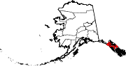
This is a list of the National Register of Historic Places listings in Hoonah–Angoon Census Area, Alaska.

This is intended to be a complete list of the properties and districts on the National Register of Historic PlacesinHoonah-Angoon Census Area, Alaska, United States. The locations of National Register properties and districts for which the latitude and longitude coordinates are included below, may be seen in a Google map.[1]

There are 20 properties and districts listed on the National Register in the census area.


          This National Park Service list is complete through NPS recent listings posted June 14, 2024.[2]

Current listings[edit]

[3] Name on the Register[4] Image Date listed[5] Location City or town Description
1 Alexander Lake Shelter Cabin
Alexander Lake Shelter Cabin
November 2, 1995
(#95001296)
Eastern end of Lake Alexander, Admiralty Island National Monument
57°39′45N 134°08′39W / 57.66237°N 134.1443°W / 57.66237; -134.1443 (Alexander Lake Shelter Cabin)
Angoon
2 Beaver Lake Dam November 2, 1995
(#95001295)
Between Beaver Lake and Lake Alexander, Admiralty Island National Monument
57°40′15N 134°11′31W / 57.67072°N 134.19203°W / 57.67072; -134.19203 (Beaver Lake Dam)
Angoon
3 Big Shaheen Cabin
Big Shaheen Cabin
Big Shaheen Cabin
November 2, 1995
(#95001292)
OnHasselborg Lake, Admiralty Island National Monument
57°42′04N 134°16′42W / 57.70103°N 134.27821°W / 57.70103; -134.27821 (Big Shaheen Cabin)
Angoon
4 Cape Spencer Lighthouse
Cape Spencer Lighthouse
December 4, 1975
(#75002160)
About 44 miles (71 km) west of Hoonah, at entrance of Cross Sound
58°11′56N 136°38′25W / 58.19891°N 136.64018°W / 58.19891; -136.64018 (Cape Spencer Lighthouse)
Elfin Cove
5 Davidson Lake Shelter Cabin November 2, 1995
(#95001303)
Western end of Davidson Lake, Admiralty Island National Monument
57°36′15N 134°22′48W / 57.60408°N 134.38004°W / 57.60408; -134.38004 (Davidson Lake Shelter Cabin)
Angoon
6 Distin Lake Shelter Cabin
Distin Lake Shelter Cabin
November 2, 1995
(#95001294)
Northwestern shore of Distin Lake, Admiralty Island National Monument
57°37′46N 134°24′07W / 57.6295°N 134.40205°W / 57.6295; -134.40205 (Distin Lake Shelter Cabin)
Angoon
7 Hasselborg Cabin November 2, 1995
(#95001291)
Along Hasselborg Creek, on Hasselborg Lake, Admiralty Island National Monument
57°39′47N 134°15′15W / 57.6631°N 134.25405°W / 57.6631; -134.25405 (Hasselborg Cabin)
Angoon
8 Hasselborg Lake East Shelter Cabin November 2, 1995
(#95001308)
Eastern shore of Hasselborg Lake, Admiralty Island National Monument
57°40′06N 134°12′49W / 57.66847°N 134.21362°W / 57.66847; -134.21362 (Hasselborg Lake East Shelter Cabin)
Angoon
9 Hasselborg Lake North Shelter Cabin November 2, 1995
(#95001307)
Northern shore of Hasselborg Lake, Admiralty Island National Monument
57°46′03N 134°19′20W / 57.76746°N 134.32229°W / 57.76746; -134.32229 (Hasselborg Lake North Shelter Cabin)
Angoon
10 Hasselborg Lake South Shelter Cabin November 2, 1995
(#95001300)
Western shore of Hasselborg Lake, Admiralty Island National Monument
57°39′59N 134°15′23W / 57.66632°N 134.25641°W / 57.66632; -134.25641 (Hasselborg Lake South Shelter Cabin)
Angoon
11 Lake Guerin East Shelter Cabin November 2, 1995
(#95001306)
Eastern end of Lake Guerin, Admiralty Island National Monument
57°39′37N 134°17′12W / 57.66014°N 134.28666°W / 57.66014; -134.28666 (Lake Guerin East Shelter Cabin)
Angoon
12 Lake Guerin West Shelter Cabin November 2, 1995
(#95001301)
Western end of Lake Guerin, Admiralty Island National Monument
57°38′57N 134°20′36W / 57.64908°N 134.34331°W / 57.64908; -134.34331 (Lake Guerin West Shelter Cabin)
Angoon
13 Mitchell Bay Shelter Cabin November 2, 1995
(#95001302)
Northwestern shore of Mitchell Bay, Admiralty Island National Monument
57°33′52N 134°23′54W / 57.56438°N 134.39841°W / 57.56438; -134.39841 (Mitchell Bay Shelter Cabin)
Angoon
14 Mole Harbor Shelter Cabin November 2, 1995
(#95001297)
Head of Mole Harbor, Admiralty Island National Monument
57°39′34N 134°06′00W / 57.65941°N 134.09989°W / 57.65941; -134.09989 (Mole Harbor Shelter Cabin)
Angoon
15 Point Retreat Light Station
Point Retreat Light Station
June 19, 2003
(#03000529)
Mansfield Peninsula, northern end of Admiralty Island
58°24′41N 134°57′18W / 58.41147°N 134.95502°W / 58.41147; -134.95502 (Point Retreat Light Station)
Juneau
16 St. John the Baptist Church
St. John the Baptist Church
June 6, 1980
(#80004589)
On hillside north of Beaver Trail Street
57°30′13N 134°35′14W / 57.50355°N 134.58712°W / 57.50355; -134.58712 (St. John the Baptist Church)
Angoon Russian Orthodox Church
17 Thayer Lake East Shelter Cabin November 2, 1995
(#95001309)
Eastern shore of Thayer Lake southern arm, Admiralty Island National Monument
57°38′03N 134°27′53W / 57.63404°N 134.46479°W / 57.63404; -134.46479 (Thayer Lake East Shelter Cabin)
Angoon
18 Thayer Lake North Shelter Cabin November 2, 1995
(#95001304)
Northern end of Thayer Lake, Admiralty Island National Monument
57°41′22N 134°24′44W / 57.68933°N 134.41223°W / 57.68933; -134.41223 (Thayer Lake North Shelter Cabin)
Angoon
19 Thayer Lake South Shelter Cabin November 2, 1995
(#95001298)
Southern end of Thayer Lake, Admiralty Island National Monument
57°35′51N 134°28′12W / 57.5976°N 134.46991°W / 57.5976; -134.46991 (Thayer Lake South Shelter Cabin)
Angoon
20 Windfall Harbor Shelter Cabin November 2, 1995
(#95001299)
Southwestern shore of Windfall Harbor, Admiralty Island National Monument
57°50′07N 134°18′29W / 57.83529°N 134.30812°W / 57.83529; -134.30812 (Windfall Harbor Shelter Cabin)
Angoon

See also[edit]

References[edit]

  1. ^ The latitude and longitude information provided in this table was derived originally from the National Register Information System, which has been found to be fairly accurate for about 99% of listings. Some locations in this table may have been corrected to current GPS standards.
  • ^ National Park Service, United States Department of the Interior, "National Register of Historic Places: Weekly List Actions", retrieved June 14, 2024.
  • ^ Numbers represent an alphabetical ordering by significant words. Various colorings, defined here, differentiate National Historic Landmarks and historic districts from other NRHP buildings, structures, sites or objects.
  • ^ "National Register Information System". National Register of Historic Places. National Park Service. April 24, 2008.
  • ^ The eight-digit number below each date is the number assigned to each location in the National Register Information System database, which can be viewed by clicking the number.

  • Retrieved from "https://en.wikipedia.org/w/index.php?title=National_Register_of_Historic_Places_listings_in_Hoonah–Angoon_Census_Area,_Alaska&oldid=892464984"

    Categories: 
    Lists of National Register of Historic Places in Unorganized Borough, Alaska by census area
    National Register of Historic Places in HoonahAngoon Census Area, Alaska
    Hidden categories: 
    Articles using NRISref without a reference number
    Articles with short description
    Short description is different from Wikidata
    Lists of coordinates
    Geographic coordinate lists
    Articles with Geo
    Pages using gadget WikiMiniAtlas
    Commons category link is on Wikidata


    This page was last edited on 14 April 2019, at 18:37 (UTC).

    Text is available under the Creative Commons Attribution-ShareAlike License 4.0; additional terms may apply. By using this site, you agree to the Terms of Use and Privacy Policy. Wikipedia® is a registered trademark of the Wikimedia Foundation, Inc., a non-profit organization.


    Privacy policy

    About Wikipedia

    Disclaimers

    Contact Wikipedia

    Code of Conduct

    Developers

    Statistics

    Cookie statement

    Mobile view


    Wikimedia Foundation
    Powered by MediaWiki