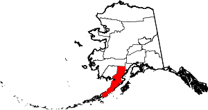
[3] Name on the Register[4]
Image
Date listed[5]
Location
City or town
Description
1 Aniakchak Bay Historic Landscape District Aniakchak Bay Historic Landscape District February 14, 1997 (#97000016 ) Surrounding the Aniakchak River from Aniakchak Crater to Aniakchak Bay 56°45′30 ″N 157°31′19 ″W / 56.75837°N 157.52197°W / 56.75837; -157.52197 (Aniakchak Bay Historic Landscape District ) Aniakchak National Preserve Originally listed as being in Dillingham Census Area.
2 Dr. Elmer Bly House Dr. Elmer Bly House April 12, 2006 (#06000240 ) Hardenburg Bay 60°12′17 ″N 154°18′25 ″W / 60.20466°N 154.30683°W / 60.20466; -154.30683 (Dr. Elmer Bly House ) Port Alsworth Now the National Park Service HQ for Lake Clark National Park and Preserve
3 Brooks Camp Boat House Brooks Camp Boat House March 15, 2010 (#10000071 ) Brooks Camp 58°33′24 ″N 155°46′43 ″W / 58.55667°N 155.77857°W / 58.55667; -155.77857 (Brooks Camp Boat House ) Katmai National Park and Preserve Originally listed as being in Dillingham Census Area.
4 Brooks River Archeological District Brooks River Archeological District February 14, 1978 (#78000342 ) Along the Brooks River near Brooks Camp[6] 58°33′15 ″N 155°47′18 ″W / 58.554285°N 155.788307°W / 58.554285; -155.788307 (Brooks River Archeological District ) Naknek Originally listed as being in Bristol Bay Borough.
5 Brooks River Historic Ranger Station Brooks River Historic Ranger Station March 15, 2010 (#10000072 ) Brooks Camp 58°33′22 ″N 155°46′42 ″W / 58.55616°N 155.77822°W / 58.55616; -155.77822 (Brooks River Historic Ranger Station ) Katmai National Park and Preserve Now serves as visitor center for Katmai National Park. Originally listed as being in Dillingham Census Area.
6 Chilikadrotna Headwaters Archeological District Upload image July 27, 2023 (#100009155 ) Address restricted[7]
7 DIL-161 Site DIL-161 Site January 22, 2007 (#06001306 ) Address restricted[7] Katmai National Park and Preserve
8 Fure's Cabin Fure's Cabin February 7, 1985 (#85000187 ) Between Naknek Lake and Lake Grosvenor 58°40′11 ″N 155°25′52 ″W / 58.66979°N 155.43124°W / 58.66979; -155.43124 (Fure's Cabin ) Katmai National Park and Preserve Originally listed as being in Bristol Bay Borough.
9 Jay and Bella Hammond Homestead Upload image July 30, 2018 (#100002107 ) N shore of Lake Clark 60°19′26 ″N 154°09′29 ″W / 60.3239°N 154.1580°W / 60.3239; -154.1580 (Jay and Bella Hammond Homestead ) Port Alsworth A private inholding of Lake Clark National Park and Preserve , once belonging to Alaska Governor Jay Hammond .
10 Kasna Creek Mining District Upload image February 17, 2010 (#10000017 ) Address restricted[7] Port Alsworth
11 Kijik Archeological District Kijik Archeological District October 12, 1994 (#94001644 ) On the shores of Lake Clark , approximately 50 kilometres (31 mi ) northeast of Nondalton[8] 60°17′33 ″N 154°15′01 ″W / 60.2925°N 154.2503°W / 60.2925; -154.2503 (Kijik Archeological District ) Nondalton Originally listed as being in Bristol Bay Borough.
12 Kijik Historic District Kijik Historic District January 29, 1979 (#79000410 ) On the western shore of Lake Clark near the mouth of the Kijik River [9] 60°17′28 ″N 154°13′00 ″W / 60.2911°N 154.2167°W / 60.2911; -154.2167 (Kijik Historic District ) Nondalton An Eskimo village site. Originally listed as being in Bristol Bay Borough.
13 LIBBY'S NO. 23 (Bristol Bay double ender)LIBBY'S NO. 23 (Bristol Bay double ender)June 14, 2013 (#13000379 ) 1 Park Place 60°11′51 ″N 154°19′20 ″W / 60.19746°N 154.32232°W / 60.19746; -154.32232 (LIBBY'S NO. 23 (Bristol Bay double ender) Port Alsworth
14 Old Savonoski Site Old Savonoski Site June 23, 1978 (#78000344 ) On the northern side of the Savonoski River , near its mouth at Naknek Lake [10] 58°32′00 ″N 155°19′00 ″W / 58.533333°N 155.316667°W / 58.533333; -155.316667 (Old Savonoski Site ) Naknek Site of native village destroyed by 1912 volcanic eruption. Originally listed as being in Bristol Bay Borough.
15 Richard Proenneke Site Richard Proenneke Site March 8, 2007 (#06000241 ) Southeastern end of upper Twin Lakes 60°38′42 ″N 153°49′15 ″W / 60.645°N 153.82096°W / 60.645; -153.82096 (Richard Proenneke Site ) Lake Clark National Park and Preserve
16 Qinuyang Upload image August 23, 2021 (#100006827 ) Address Restricted Igiugig vicinity
17 St. John the Theologian Church St. John the Theologian Church June 6, 1980 (#80000741 ) Corner of B Street and 2nd Avenue 55°54′42 ″N 159°08′43 ″W / 55.91165°N 159.14515°W / 55.91165; -159.14515 (St. John the Theologian Church ) Perryville Originally listed as being in Aleutian West Census Area.
18 St. Nicholas Chapel St. Nicholas Chapel June 6, 1980 (#80004579 ) Along Main Road 59°19′37 ″N 155°53′42 ″W / 59.32701°N 155.89508°W / 59.32701; -155.89508 (St. Nicholas Chapel ) Igiugig Originally listed as being in Dillingham Census Area.
19 St. Nicholas Chapel St. Nicholas Chapel June 6, 1980 (#80000751 ) Along 2nd Avenue 59°58′24 ″N 154°50′55 ″W / 59.97323°N 154.84866°W / 59.97323; -154.84866 (St. Nicholas Chapel ) Nondalton Originally listed as being in Bristol Bay Borough.
20 St. Nicholas Chapel St. Nicholas Chapel June 6, 1980 (#80000753 ) In Pedro Bay 59°47′07 ″N 154°06′10 ″W / 59.78537°N 154.10287°W / 59.78537; -154.10287 (St. Nicholas Chapel ) Pedro Bay Originally listed as being in Bristol Bay Borough.
21 St. Nicholas Church St. Nicholas Church June 6, 1980 (#80000754 ) Along Church Road 57°33′49 ″N 157°34′48 ″W / 57.56352°N 157.5801°W / 57.56352; -157.5801 (St. Nicholas Church ) Pilot Point Originally listed as being in Bristol Bay Borough.
22 Savonoski River Archeological District Upload image February 14, 1978 (#78000525 ) Near the mouth of the Grosvenor River[6] 58°34′10 ″N 155°01′24 ″W / 58.569327°N 155.023327°W / 58.569327; -155.023327 (Savonoski River Archeological District ) Katmai National Park and Preserve Originally listed as being in Bristol Bay Borough.
23 Snipe Lake Archeological District Upload image July 27, 2023 (#100009152 ) Address Restricted Lake Clark National Park and Preserve
24 Two Lakes Archeological District Upload image August 12, 2019 (#100004254 ) Address Restricted Port Alsworth vicinity
25 Wassillie Trefon Dena'ina Fish Cache Wassillie Trefon Dena'ina Fish Cache June 5, 2013 (#13000348 ) 1 Park Place 60°11′51 ″N 154°19′24 ″W / 60.19761°N 154.3232°W / 60.19761; -154.3232 (Wassillie Trefon Dena'ina Fish Cache ) Port Alsworth


