[3] Name on the Register[4]
Image
Date listed[5]
Location
City or town
Description
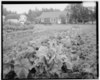
1 Bailey Colony Farm Bailey Colony Farm June 21, 1991 (#91000775 ) 3150 North Glenn Highway 61°36′57 ″N 149°07′10 ″W / 61.61585°N 149.11931°W / 61.61585; -149.11931 (Bailey Colony Farm ) Palmer
2 Berry House Upload image June 21, 1991 (#91000779 ) 5805 North Farm Loop Road 61°38′42 ″N 149°08′53 ″W / 61.64509°N 149.14801°W / 61.64509; -149.14801 (Berry House ) Palmer
3 Campbell House Campbell House April 3, 2013 (#13000129 ) 1540 Inner Springer Loop 61°34′15 ″N 149°07′38 ″W / 61.57094°N 149.1271°W / 61.57094; -149.1271 (Campbell House ) Palmer
4 Cunningham-Hall PT-6, NC-692W Upload image December 29, 1978 (#78000531 ) In Alaska Museum of Transportation and Industry, 3800 West Museum Drive 61°34′38 ″N 149°32′39 ″W / 61.57734°N 149.54426°W / 61.57734; -149.54426 (Cunningham-Hall PT-6, NC-692W ) Wasilla Originally in the Transportation Museum of Alaska, in Palmer .
5 Curry Lookout Upload image April 27, 1992 (#92000424 ) Atop Curry Ridge, mile 137.2 of the Parks Highway 62°37′22 ″N 150°05′54 ″W / 62.62264°N 150.09832°W / 62.62264; -150.09832 (Curry Lookout ) Talkeetna
6 Fairview Inn Fairview Inn May 7, 1982 (#82004905 ) Main Street 62°19′24 ″N 150°06′48 ″W / 62.32328°N 150.11332°W / 62.32328; -150.11332 (Fairview Inn ) Talkeetna Also a contributing property to Talkeetna Historic District
7 Herried House Upload image June 21, 1991 (#91000778 ) 4400 North Palmer-Fishook Road 61°37′41 ″N 149°10′13 ″W / 61.62793°N 149.17025°W / 61.62793; -149.17025 (Herried House ) Palmer
8 High Ridge Upload image August 19, 2021 (#100006829 ) 9721 East Hilscher Hwy. 61°34′39 ″N 149°10′26 ″W / 61.5775°N 149.1740°W / 61.5775; -149.1740 (High Ridge ) Palmer Homesite of Fred Machetanz
8 Hyland Hotel Hyland Hotel June 21, 1991 (#91000774 ) 333 Evergreen Avenue 61°35′59 ″N 149°07′11 ″W / 61.5996°N 149.11974°W / 61.5996; -149.11974 (Hyland Hotel ) Palmer
9 Independence Mines Independence Mines October 9, 1974 (#74000440 ) About 14.2 miles (22.9 km ) northwest of Palmer 61°47′25 ″N 149°17′05 ″W / 61.7903°N 149.28467°W / 61.7903; -149.28467 (Independence Mines ) Palmer
10 Kirsch's Place Upload image January 9, 1998 (#97001631 ) About 10.5 miles (16.9 km ) south of Talkeetna 62°10′01 ″N 150°04′30 ″W / 62.16704°N 150.07493°W / 62.16704; -150.07493 (Kirsch's Place ) Talkeetna
11 Knik Site Knik Site July 24, 1973 (#73000379 ) Along South Knik Goose Bay Road, about 13 miles (21 km ) southwest of Wasilla 61°27′27 ″N 149°43′52 ″W / 61.45748°N 149.73108°W / 61.45748; -149.73108 (Knik Site ) Wasilla
12 Matanuska Colony Community Center Upload image June 21, 1991 (#91000773 ) Roughly bounded by South Colony Way, East Firewood Avenue, South Eklutna Street, East Elmwood Avenue, South Denali Street and a line of properties along East Dahlia Avenue 61°35′56 ″N 149°06′34 ″W / 61.59881°N 149.10944°W / 61.59881; -149.10944 (Matanuska Colony Community Center ) Palmer
13 Old Willow Community Center Upload image October 5, 2017 (#100001695 ) W. Willow Community Center Cir. 61°44′40 ″N 150°03′03 ″W / 61.744534°N 150.050840°W / 61.744534; -150.050840 (Old Willow Community Center ) Willow
14 Palmer Depot Palmer Depot January 9, 1978 (#78000530 ) Corner of Evergreen Avenue and South Valley Way 61°36′00 ″N 149°06′49 ″W / 61.59999°N 149.11362°W / 61.59999; -149.11362 (Palmer Depot ) Palmer Also a contributing property to Matanuska Colony Community Center
15 Patten Colony Farm Upload image June 21, 1991 (#91000776 ) Mile 39.9 of the Glenn Highway , about 1.7 miles (2.7 km ) southwest of Palmer 61°34′43 ″N 149°08′29 ″W / 61.57862°N 149.14138°W / 61.57862; -149.14138 (Patten Colony Farm ) Palmer
16 Puhl House Puhl House June 21, 1991 (#91000777 ) Corner of Scott Road and Glenn Highway 61°36′38 ″N 149°07′09 ″W / 61.61062°N 149.11908°W / 61.61062; -149.11908 (Puhl House ) Palmer
17 Raymond Rebarchek Colony Farm Raymond Rebarchek Colony Farm October 3, 1978 (#78000532 ) Along East Rebarcheck Avenue, about 1.6 miles (2.6 km ) southwest of Palmer 61°34′38 ″N 149°07′37 ″W / 61.57728°N 149.1269°W / 61.57728; -149.1269 (Raymond Rebarchek Colony Farm ) Palmer
18 Susitna River Bridge Susitna River Bridge September 15, 1977 (#77000227 ) Alaska Railroad Mile 264.1, North of Gold Creek 62°46′05 ″N 149°41′35 ″W / 62.76793°N 149.69318°W / 62.76793; -149.69318 (Susitna River Bridge ) Gold Creek Railroad bridge
19 Sutton Community Hall Upload image August 27, 2013 (#13000617 ) Alon Jonesville Road, about 0.25 miles (0.40 km ) north of Glenn Highway 61°42′40 ″N 148°53′49 ″W / 61.71118°N 148.89685°W / 61.71118; -148.89685 (Sutton Community Hall ) Sutton
20 Talkeetna Airstrip Talkeetna Airstrip August 2, 2002 (#02000814 ) Along D Street, from East First Street to the Susitna River 62°19′12 ″N 150°06′48 ″W / 62.31997°N 150.11333°W / 62.31997; -150.11333 (Talkeetna Airstrip ) Talkeetna
21 Talkeetna Historic District Talkeetna Historic District April 26, 1993 (#93000321 ) Roughly bounded by C Street, East First Street, D Street, and Front Street 62°19′23 ″N 150°06′52 ″W / 62.32318°N 150.11437°W / 62.32318; -150.11437 (Talkeetna Historic District ) Talkeetna Includes Fairview Inn
22 Tangle Lakes Archeological District Upload image November 12, 1971 (#71001091 ) Address restricted[6] Paxson The archeological district is mostly comprised in Valdez–Cordova Census Area, Alaska .[7]
23 Teeland's Country Store Teeland's Country Store November 14, 1978 (#78000533 ) Corner of East Herning Avenue and North Boundary Street 61°34′57 ″N 149°26′24 ″W / 61.58239°N 149.43991°W / 61.58239; -149.43991 (Teeland's Country Store ) Wasilla
24 Blanche and Oscar Tryck House Upload image September 15, 2004 (#04000968 ) North Knik Street, between Parks Highway and East Herning Avenue 61°34′53 ″N 149°26′38 ″W / 61.58133°N 149.44392°W / 61.58133; -149.44392 (Blanche and Oscar Tryck House ) Wasilla
25 United Protestant Church United Protestant Church April 10, 1980 (#80000757 ) Corner of South Denali Street and East Elmwood Avenue 61°35′55 ″N 149°06′29 ″W / 61.59848°N 149.10793°W / 61.59848; -149.10793 (United Protestant Church ) Palmer Also a contributing property to Matanuska Colony Community Center
26 Wasilla Community Hall Upload image September 8, 1982 (#82002072 ) 323 Main Street 61°34′58 ″N 149°26′27 ″W / 61.58265°N 149.44095°W / 61.58265; -149.44095 (Wasilla Community Hall ) Wasilla
27 Wasilla Depot Wasilla Depot December 16, 1977 (#77000218 ) 415 East Railroad Avenue 61°34′49 ″N 149°26′26 ″W / 61.58041°N 149.44054°W / 61.58041; -149.44054 (Wasilla Depot ) Wasilla
28 Wasilla Elementary School Wasilla Elementary School February 5, 1980 (#80000758 ) Corner of East Swanson Avenue and North Boundary Street 61°34′58 ″N 149°26′24 ″W / 61.58288°N 149.4401°W / 61.58288; -149.4401 (Wasilla Elementary School ) Wasilla
29 Whitney Section House Upload image October 6, 2004 (#04001106 ) In Alaska Museum of Transportation and Industry, 3800 West Museum Drive 61°34′38 ″N 149°32′36 ″W / 61.57725°N 149.5433°W / 61.57725; -149.5433 (Whitney Section House ) Wasilla Originally located in Anchorage, was moved to Palmer in 1976, and then to Wasilla in 1992.[8]