Salida, Colorado
| |
|---|---|

The Arkansas River Walk in downtown Salida.
| |
| Nickname:
Heart of the Rockies
| |
| Motto(s):
"Union, Justice, Safety"
| |

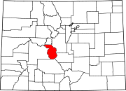
Location of the City of Salida in Chaffee County, Colorado.
| |
 Salida Location of the City of Salida in the United States. | |
| Coordinates: 38°31′53″N 105°59′46″W / 38.53139°N 105.99611°W / 38.53139; -105.99611 | |
| Country | |
| State | |
| County | Chaffee County[2] |
| City | Salida[1] |
| Founded | 1880 |
| Incorporated | March 23, 1891[3] |
| Government | |
| • Type | Statutory city[1] |
| Area | |
| • Total | 2.77 sq mi (7.17 km2) |
| • Land | 2.77 sq mi (7.17 km2) |
| • Water | 0.00 sq mi (0.00 km2) |
| Elevation | 7,083 ft (2,159 m) |
| Population | |
| • Total | 5,666 |
| • Density | 2,000/sq mi (790/km2) |
| Time zone | UTC−7 (Mountain (MST)) |
| • Summer (DST) | UTC−6 (MDT) |
| ZIP codes[6] |
81201, 81227 (PO Box), 81237
|
| Area code | 719 |
| FIPS code | 08-67280 |
| GNIS feature ID | 0204758 |
| Website | Official website |
Salida (/səˈlaɪdə/ sə-LY-də; Spanish: [saˈliða], "exit") is the statutory city that is the county seat and the most populous municipalityofChaffee County, Colorado, United States.[7] The population was 5,666 at the 2020 census.[8]
A post office has been in operation at Salida since 1881.[9] Salida, meaning "exit" in Spanish, was named on account of its location near the point where the Arkansas River flows out of the valley and into Bighorn Sheep Canyon, upstream from the Royal Gorge.[10]
According to the United States Census Bureau, the city has a total area of 2.77 square miles (7.2 km2), and the Arkansas River, which runs through the town, is the major source of water for local agriculture.
The Sawatch Range runs north and south and is located roughly 10 miles (16 km) west of Salida. The Mosquito Range parallels the Sawatch Range to the east, forming the Upper Arkansas Valley, and the southern terminus of the range, just east of Salida, is known locally as the Arkansas Hills. Methodist Mountain, which is a major feature on Salida's southern horizon, is the northernmost mountain in the Sangre de Cristo Mountains. To the north of Salida is the Upper Arkansas Valley and the town of Buena Vista.
U.S. Route 50 runs along the southern edge of the city and leads east down the Arkansas River 58 miles (93 km) to Cañon City; to the west it leads 4 miles (6 km) to Poncha Springs and 63 miles (101 km) over the Continental DividetoGunnison. Canon City and Pueblo lie to the east.
According to the Köppen climate classification, Salida has a Cold semi-arid climate (BSk)
| Climate data for Salida, Colorado (1991–2020 normals, extremes 1897–1923, 1931–2017) | |||||||||||||
|---|---|---|---|---|---|---|---|---|---|---|---|---|---|
| Month | Jan | Feb | Mar | Apr | May | Jun | Jul | Aug | Sep | Oct | Nov | Dec | Year |
| Record high °F (°C) | 65 (18) |
71 (22) |
77 (25) |
82 (28) |
93 (34) |
98 (37) |
103 (39) |
100 (38) |
94 (34) |
85 (29) |
80 (27) |
70 (21) |
103 (39) |
| Mean maximum °F (°C) | 57.9 (14.4) |
60.0 (15.6) |
67.7 (19.8) |
75.3 (24.1) |
83.0 (28.3) |
91.1 (32.8) |
93.9 (34.4) |
89.9 (32.2) |
85.6 (29.8) |
78.2 (25.7) |
66.9 (19.4) |
58.0 (14.4) |
94.3 (34.6) |
| Mean daily maximum °F (°C) | 43.4 (6.3) |
45.5 (7.5) |
54.0 (12.2) |
60.3 (15.7) |
70.2 (21.2) |
82.0 (27.8) |
85.8 (29.9) |
83.1 (28.4) |
77.0 (25.0) |
65.4 (18.6) |
52.7 (11.5) |
43.2 (6.2) |
63.6 (17.6) |
| Daily mean °F (°C) | 27.4 (−2.6) |
30.1 (−1.1) |
37.5 (3.1) |
44.0 (6.7) |
52.4 (11.3) |
62.7 (17.1) |
67.4 (19.7) |
65.1 (18.4) |
58.0 (14.4) |
47.1 (8.4) |
36.1 (2.3) |
27.9 (−2.3) |
46.3 (7.9) |
| Mean daily minimum °F (°C) | 11.5 (−11.4) |
14.8 (−9.6) |
21.0 (−6.1) |
27.7 (−2.4) |
34.6 (1.4) |
43.4 (6.3) |
49.1 (9.5) |
47.2 (8.4) |
38.9 (3.8) |
28.9 (−1.7) |
19.5 (−6.9) |
12.6 (−10.8) |
29.1 (−1.6) |
| Mean minimum °F (°C) | −5.1 (−20.6) |
−6.3 (−21.3) |
5.4 (−14.8) |
12.5 (−10.8) |
23.4 (−4.8) |
32.4 (0.2) |
40.6 (4.8) |
38.4 (3.6) |
26.6 (−3.0) |
14.0 (−10.0) |
1.6 (−16.9) |
−7.3 (−21.8) |
−15.7 (−26.5) |
| Record low °F (°C) | −35 (−37) |
−33 (−36) |
−21 (−29) |
−8 (−22) |
13 (−11) |
23 (−5) |
30 (−1) |
31 (−1) |
14 (−10) |
−4 (−20) |
−20 (−29) |
−31 (−35) |
−35 (−37) |
| Average precipitation inches (mm) | 0.31 (7.9) |
0.27 (6.9) |
0.69 (18) |
1.05 (27) |
0.96 (24) |
0.50 (13) |
1.36 (35) |
1.46 (37) |
0.67 (17) |
0.87 (22) |
0.25 (6.4) |
0.38 (9.7) |
8.77 (223) |
| Average snowfall inches (cm) | 4.0 (10) |
4.1 (10) |
6.5 (17) |
8.0 (20) |
2.7 (6.9) |
0.0 (0.0) |
0.0 (0.0) |
0.0 (0.0) |
0.0 (0.0) |
2.6 (6.6) |
4.1 (10) |
4.7 (12) |
36.7 (93) |
| Average precipitation days (≥ 0.01 in) | 2.3 | 2.4 | 3.9 | 4.7 | 5.0 | 4.3 | 8.3 | 9.9 | 5.1 | 4.9 | 3.1 | 3.0 | 56.9 |
| Average snowy days (≥ 0.1 in) | 2.1 | 2.2 | 2.4 | 2.6 | 0.6 | 0.0 | 0.0 | 0.0 | 0.0 | 1.1 | 2.3 | 3.0 | 16.3 |
| Source: NOAA (mean maxima/minima 1981–2010)[11][12][13] | |||||||||||||
| Census | Pop. | Note | %± |
|---|---|---|---|
| 1890 | 2,586 | — | |
| 1900 | 3,722 | 43.9% | |
| 1910 | 4,425 | 18.9% | |
| 1920 | 4,689 | 6.0% | |
| 1930 | 5,065 | 8.0% | |
| 1940 | 4,969 | −1.9% | |
| 1950 | 4,553 | −8.4% | |
| 1960 | 4,560 | 0.2% | |
| 1970 | 4,355 | −4.5% | |
| 1980 | 4,870 | 11.8% | |
| 1990 | 4,737 | −2.7% | |
| 2000 | 5,504 | 16.2% | |
| 2010 | 5,236 | −4.9% | |
| 2020 | 5,666 | 8.2% | |
| U.S. Decennial Census | |||
The city is served by Salida Public Schools. There are two public high schools, Salida High School and Horizons Exploratory Academy; and three middle schools, Salida Middle School, Salida Montessori Charter School, and the Crest Academy. Colorado Mountain College has a campus in Salida, which opened in 2019.
Salida and Chaffee County are served by the Heart of the Rockies Regional Medical Center, located on the north side of Town on Rush Drive.
Salida is part of Colorado's Bustang network. It is on both the Alamosa-Pueblo and the Gunnison-Denver Outrider lines.[14]
The Salida Downtown Historic District was added to the National Register of Historic Places in 1984.[15] On March 30, 2012, downtown Salida was named one of two inaugural Certified Creative Districts in Colorado.[16] Salida is also home to the Shavano Chapter of the Columbine Poets of Colorado, which is affiliated with the National Federation of State Poetry Societies (NFSPS). The group organizes workshops and festivals and offers poetry contests for both adults and students.[17] On March 30, 2012, Colorado by Colorado Creative Industries, a division of the State's Office of Economic Development and International Trade, announced that the City of Salida's historic downtown was selected as one of only two inaugural “Certified Creative Districts” in Colorado.[18]
|
Municipalities and communities of Chaffee County, Colorado, United States
| ||
|---|---|---|
| City |
|
|
| Towns |
| |
| CDPs |
| |
| Unincorporated communities |
| |
| ||
| International |
|
|---|---|
| National |
|