
This article needs additional citations for verification. Please help improve this articlebyadding citations to reliable sources. Unsourced material may be challenged and removed.
Find sources: "St Kilda Junction" – news · newspapers · books · scholar · JSTOR (January 2014) (Learn how and when to remove this message) |
| St Kilda Junction | |
|---|---|
| Street art precinct | |

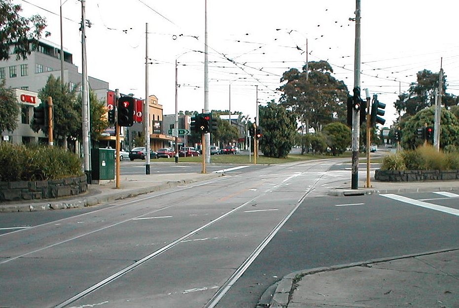
Tram junction at the centre of St Kilda Junction
| |
 | |
| Location | |
| Melbourne, Victoria, Australia | |
| Coordinates | 37°51′18″S 144°58′55″E / 37.855°S 144.982°E / -37.855; 144.982 |
| Roads at junction |
|
| Construction | |
| Type | Traffic circle |
| Maintained by | Department of Transport |
St Kilda Junction is a major intersectioninMelbourne, Australia. It is in the suburb of St Kilda, bordering Windsor and St Kilda East, and is the meeting point of the major roads Punt Road, St Kilda Road, Dandenong Road/Queens Way/Princes Highway and Fitzroy Street.


Up until 1966, St Kilda Junction, along with the Haymarket roundaboutonRoyal Parade, was one of two giant roundabouts with trams running through the middle.
Before 1966, St Kilda Junction was the intersection of eight streets. They were, listed clockwise and starting from the north (with the route numbers of the time shown):[1]
The intersection took the form of a large oval roundabout with another road link in the middle between the close edges. The trams from St Kilda Road traversed most of the intersection before splitting into three paths. Things were made all the more difficult by the fact that Queens Road joined the intersection at the point where the left service road of St Kilda Road left it.
In the late 1960s, the Bolte Government proposed plans for a major overhaul of the intersection, which ultimately led to its existing form.
Queens Road was rerouted slightly so it would enter the roundabout in the middle of its long side. It was then lowered, so that it passed under the intersection, to join a new street, Queens Way, which led into Dandenong Road (as Wellington Street had done before it.) Wellington Street's tram service was also re-directed along Queens Way. National Route 1 (or Alternate National Route 1, as it became when the Monash Freeway was built) was rerouted down Queens Road-Queens Way-Dandenong Road because it was much easier for traffic to pass the junction that way than from St Kilda Road. High Street was widened and became the southern part of St Kilda Road.
Road traffic could then pass through the junction on the major thoroughfares more easily, in most cases, but was unable to do so in others. For example, vehicles heading west could no longer go from Queens Way to Punt Road. Instead, they had to proceed to the first right turn on Queens Road (Union Street) to get access to St Kilda Road or Punt Road. Over one hundred and fifty houses, forty-two shops and fifty-two business, along with other premises, were demolished as part of the project.[2]
The trams were also realigned. The tramline was lowered to halfway between the first and second levels in the centre of the junction, with trams then able to reascend and continue down St Kilda Road or turn into Fitzroy Street, or descend further and turn into Queens Way. Overall, the area of junction expanded, taking in the points of intersection of all original streets, the junction now encompasses twelve streets. The tram line once diverted around the old Junction Hotel, which remained standing on its own for some time before it was eventually demolished, and the land became part of the median strip. The bridge designs for that work were undertaken by Melbourne engineer Bruce Day.
St Kilda Junction is also the location of one of Melbourne's well-loved suburban football/cricket ovals, the St Kilda Cricket Ground, which is generally known as the Junction Oval. Some of the parkland surrounding the Junction Oval was lost to the Queens Road realignment, but the original oval and the historic Aboriginal Corroboree tree remained intact.
In 2014, a move was made to return the St Kilda Football Club operations and training to Junction Oval with Cricket Victoria and Government assistance.
In October 2014, the St Kilda Junction Area Action Group (JaagStKilda.com) successfully lobbied VicRoads and the State Government to improve the unsafe and unfriendly pedestrian underpass, by installing improved lighting and giving the area a major clean-up. However, due to its car-centric design, significant problems remain at the junction for pedestrians, cyclists, and those using the tram and bus stops.
During July 2019 the tramline through the junction was shut down for rebuilding, during which the turnouts between St Kilda Rd and Fitzroy St were shifted north about 90 metres with gauntlet track for the intermediate distance. While space could not be made for a third track, as has been provided at many other junctions, the new design allows trams to travel (slightly) faster through the intersection.[3]
The following tram routes pass through St Kilda Junction:
Heading North:
Heading West:
Heading South:
Heading East:
![]() Media related to St Kilda Junction at Wikimedia Commons
Media related to St Kilda Junction at Wikimedia Commons
|
| |||||||||
|---|---|---|---|---|---|---|---|---|---|
| Current routes |
| ||||||||
| Former routes |
| ||||||||
| Current trams |
| ||||||||
| Future trams |
| ||||||||
| Former trams |
| ||||||||
| Current operator |
| ||||||||
| Former operators |
| ||||||||
| Tourist services |
| ||||||||
| Current depots |
| ||||||||
| Former depots |
| ||||||||
| Future depots |
| ||||||||
| Stops |
| ||||||||
| Miscellaneous |
| ||||||||
| Museums |
| ||||||||