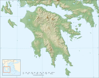
モジュール:Location map/data/Greece Peloponnese/doc
表示
| これはモジュール:Location map/data/Greece Peloponneseの解説サブページです。 使用方法、カテゴリ、およびその他モジュールページ自体に含まれない情報を収容しています。 |
| 名称 | ペロポネソス半島 | |||
|---|---|---|---|---|
| 境界の経緯 | ||||
| 38.526 | ||||
| 20.315 | ←↕→ | 24.267 | ||
| 36.08 | ||||
| 地図の中心 | 北緯37度18分11秒 東経22度17分28秒 / 北緯37.303度 東経22.291度 | |||
| 画像 | Peloponnese map shaded relief-blank.svg
| |||

| ||||
| 画像1 | Peloponnese relief map-blank.svg
| |||

| ||||
| 画像2 | Peloponnese relief map-de.png
| |||

| ||||
モジュール:Location map/data/Greece Peloponneseはペロポネソス半島の正距円筒図法地図でオーバーレイのマーカー・ラベルを表示するのに使用する地点図のLuaモジュールです。マーカーは既定値の地図や同じような地図画像において緯度と経度の座標に基いて置かれます。
使用法
次のテンプレートで"Greece Peloponnese"というパラメータを使用します: ●{{Location map | Greece Peloponnese | ...}}
●{{Location map many | Greece Peloponnese | ...}}
●{{Location map+ | Greece Peloponnese | ...}}
●{{Location map~ | Greece Peloponnese | ...}}
地図パラメータ
●name = ペロポネソス半島
モジュール名は地図説明文の既定値になります
●image = Peloponnese map shaded relief-blank.svg
既定値の地図画像で"Image:"や"File:"は指定しません。
●image1 = Peloponnese relief map-blank.svg
代替地図画像で、通常は地形図をreliefかAlternativeMapというパラメータで指定して表示します。
●image2 = Peloponnese relief map-de.png
2番目の代替地図画像でAlternativeMapというパラメータでしか表示できません。
●top = 38.526
地図最北端の緯度を十進角で表記します。
●bottom = 36.08
地図最南端の緯度を十進角で表記します。
●left = 20.315
地図最西端の経度を十進角で表記します。
●right = 24.267
地図最東端の経度を十進角で表記します。
代替地図
image1 (Peloponnese relief map-blank.svg)で定義された地図は{{Location map}}、{{Location map many}}、{{Location map+}}といったテンプレートの﹁relief﹂か﹁AlternativeMap﹂のパラメータを使って表示できます。
image2 (Peloponnese relief map-de.png)で定義された地図は﹁AlternativeMap﹂というパラメータのみでしか表示できません。これら2つのパラメータは以下の使用例で示しています。さらなる使用例は次のテンプレートにあります。:
●Template:Location map#地形図パラメータ
●Template:Location map#代替地図パラメータ
精度
経度: この地図は西から東まで3.952度です。 ●画像の幅が200ピクセルの場合は1ピクセルにつき0.0198度です。 ●画像の幅が1000ピクセルの場合は1ピクセルにつき0.004度です。 緯度: この地図は北から南まで2.446度です。
●画像の縦の長さが200ピクセルの場合は1ピクセルにつき0.0122度です。
●画像の縦の長さが1000ピクセルの場合は1ピクセルにつき0.0024度です。
