
赤い森
| 赤い森 ウクライナ語: Рудий ліс ロシア語: Рыжий лес | |
|---|---|
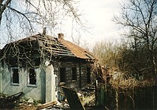
 冬季の赤い森 | |
| 地理 | |
  | |
| 所在地 | |
| 座標 | 北緯51度22分48秒 東経30度02分57秒 / 北緯51.38011度 東経30.04908度座標: 北緯51度22分48秒 東経30度02分57秒 / 北緯51.38011度 東経30.04908度 |
| 面積 | ウクライナキーウ州プリピャチ、チェルノブイリ立入禁止区域 |
| 現況 | ウクライナ国営 |
| 環境 | |
| 生態系 | 不明 |
| 障害事物 | チェルノブイリ原子力発電所事故による著しい土壌汚染 |
| インジケータ植物 | マツ |
| 動物相 | 不明 |
赤い森︵あかいもり、ウクライナ語: Рудий ліс、ロシア語: Рыжий лес︶[1]は、ウクライナのチェルノブイリ原子力発電所から10 km圏内にある森を指す。1986年4月26日のチェルノブイリ原子力発電所事故により放出された高レベルの放射性物質を取り込んだことにより枯死したマツが赤茶色に見えたため﹁赤い森﹂と呼ばれる[2]。事故後の汚染除去作業で、赤い森の木々は伐採され埋め立てられた[3]。この場所は現在でも世界で最も汚染された地域の1つである[4]。

放棄されたプリピャチの居住地区、残存している樹木
赤い森は立ち入り制限区域内に位置しており、原子力発電所の事故で放射性物質を含む煙やちりが雲となり、大量の放射性物質がこの地域に降り注ぎ、マツの木々は枯死した。事故を起こした4号炉の爆発と火災による土壌、水、大気の汚染は広島・長崎に投下された原子爆弾による放出量の20倍であった[5]。
事故後の汚染除去作業で、赤い森にあるマツの木々の大部分が伐採されて埋められ、その上を砂で厚く覆いマツの若木が植林された[6]。伐採された木々は放射性物質による汚染がひどく、他の場所に移動させることは危険が伴うためその場に埋めざるを得なかったからである[7]。なお、木々が朽ちるにつれて放射性物質が地下水に達することが懸念されており、人々は赤い森の周辺の汚染された地区から避難することとなった。
プリピャチの近くにある放棄された村

セシウム137による汚染地域
1986年に人々が避難すると、放射性物質に汚染されているにもかかわらず赤い森へ動物が移動してきた。事故後の放射性物質による汚染によって、赤い森における植物相および動物相は劇的な影響を受けた。事故後、数年間で赤い森の生物多様性が増したように思われる[8]。赤い森の植物の中に突然変異を起こしているものが多数存在するとの報告があり、それにより赤い森は強く変異した植物が多数存在する﹁不思議の森﹂であるとの確証のない話がされている。特に、木々の中には空に向って伸びずに枝を不気味に曲げているものもあった[2]。
事故後、数年間で巨大化した植物もある。形状は通常のものと同じであるが、サイズが平均よりもはるかに大きくなっているのである。赤い森における植物の巨大化や他の変異は立ち入り制限区域の中でも最も放射性物質で汚染された所で見ることができる[6]。
赤い森のある場所は、世界で最も汚染された地域の1つであり続けているが[4]、この場所は驚くべきことに多くの絶滅危惧種にとって豊かな生息地になっている。原子炉を囲む地域から人々が避難したことにより、草木が生い茂り他に類の見ない生息地が形成されるに至ったのである。
BBCの科学ドキュメンタリー番組“Horizon”が1996年に放送した“Inside Chernobyl's Sarcophagus”では、事故を起こした4号炉の中にできた大きな穴から鳥たちが出入りしているところが見られた。動植物の放射性物質に対する耐性は著しく異なっているが、放射性降下物による赤い森の植物相および動物相への長期的な影響は十分には知られていない。尾の毛の発育が止まった鳥がいることも報告されている。この地域では、コウノトリ科の鳥類、オオカミ、ビーバー、ワシが生息していることも報告されている[9]
[10]。
事故と汚染除去[編集]

野生生物の生息地[編集]


現在[編集]
2005年時点で、赤い森の放射性降下物による汚染のレベルは最高で1,000ミリレントゲン毎時だが、通常は10ミリレントゲン毎時である。赤い森に存在する放射性物質の90パーセント以上はその土壌に集中している[6]。 科学者は放射性物質で汚染されて放棄された町と周辺の地区を、汚い爆弾の爆発による放射能汚染や化学兵器、生物兵器による攻撃のモデルとして他に類を見ない研究施設として使用することを計画している。 赤い森のある場所の自然は生き続けており、人間の与える影響が著しく減少したことにより繁栄しているように見える。現在では、ストロンチウム90︵半減期28.8年︶およびセシウム137︵半減期30年︶による土壌汚染が懸念される。今日、最も高いレベルのセシウム137は土壌の表層から見つかっており、それは植物や土壌にいる昆虫によって吸収される。放射性物質による土壌汚染が数世代にわたることを懸念する科学者も存在する[11][12]。 2022年2月より勃発したロシアのウクライナへの軍事侵攻で、チェルノブイリ原発周辺をロシア軍が占拠する際、赤い森内に塹壕を掘る作戦が決行された結果、ロシア兵内に多数の被曝者を出したという報道がある。放射線被曝の急性症状を呈している者もおり、バス7台分に及ぶ多くのロシア兵がベラルーシのゴメリにある放射線専門医療センターに搬送されたとのことである[13]。脚注[編集]
(一)^ 日本語訳は、メイリー・マイシオ著 中尾ゆかり訳、﹃チェルノブイリの森 事故後20年の自然誌﹄日本放送出版協会、2007年、76ページに基づく。ウクライナ語から逐語訳すれば、﹁赤茶色の森﹂という意味。
(二)^ abWildlife defies Chernobyl radiation, by Stefen Mulvey, BBC News April 20, 2006.
(三)^ Chernobyl's continuing hazards, by Stefen Mulvey, BBC News
(四)^ ab"Chernobyl - Part One" publisher=BBC News | Last Updated: Tuesday, 4 April 2006
(五)^ Back to wild PDF
(六)^ abcA Natural History of Chernobyl, by Mary Mycio, Wormwood Forest: A Natural History of Chernobyl
(七)^ ﹃チェルノブイリの真実﹄︵広河隆一、講談社、1996年 ISBN 4-06-207832-5︶
(八)^ The Chernobyl nuclear disaster and subsequent creation of a wildlife preserve, Letter to the Editor, Robert J.Baker, Texas Tech University and International Radioecology Laboratory
(九)^ “IAEA Report”. In Focus: Chernobyl. 2006年3月29日閲覧。
(十)^ International Atomic Energy Agency/WHO/UNDP press release Chernobyl: The True Scale of the Accident, International Atomic Energy Agency/World Health Organization/United Nations Development Programme, September 5, 2005.
(11)^ Microsoft Word - !!MASTERDOC cesium dr3 mar2 ac.doc
(12)^ http://ag.arizona.edu/swes/chorover_lab/pdf_papers/Bostick%20et%20al.,%202002.pdf
(13)^ “Russian troops leaving Chernobyl nuclear site 'have acute radiation sickness' - World News - Mirror Online”. デイリー・ミラー. (2022年3月30日) 2022年3月31日閲覧。
外部リンク[編集]
- Рудий ліс // Чорнобильська зона відчуження. Природа
- Description of Red Forest - unique ecosystem of Chernobyl zone of alienation. (radiation dead forest ecosystem)
- Greenpeace ten-year retrospective
- The Zone as a wildlife reserve
| 地理 |
|
|
|---|---|---|
| 施設 |
| |
| 影響 |
| |
| 疾病 |
| |
| 関係者 |
| |
| 文化 |
| |
| その他 |
| |