Jump to content


Main menu


Navigation  


Main page
Contents
Current events
Random article
About Wikipedia
Contact us
Donate


Contribute  


Help
Learn to edit
Community portal
Recent changes
Upload file


Search  


Create account

Log in


Create account
 Log in


Pages for logged out editors learn more  


Contributions
Talk


Contents


(Top)


1 Discovery and excavations  


2 Archaeology  


3 Historical era  


4 References  


Yumuktepe


Čeština
Português
Türkçe
 

Edit links


Article
Talk


Read
Edit
View history


Tools


Actions  


Read
Edit
View history


General  


What links here
Related changes
Upload file
Special pages
Permanent link
Page information
Cite this page
Get shortened URL
Download QR code
Wikidata item


Print/export  


Download as PDF
Printable version


Print/export  


Appearance


Coordinates: 36°48N 34°36E / 36.800°N 34.600°E / 36.800; 34.600
 

From Wikipedia, the free encyclopedia


This is an old revision of this page, as edited by Ibaman (talk | contribs)at12:21, 20 October 2022 (Archaeology: grammar and readability). The present address (URL) is a permanent link to this revision, which may differ significantly from the current revision.
(diff)  Previous revision | Latest revision (diff) | Newer revision  (diff)

Yumuktepe
Yumuktepe is located in Turkey
Yumuktepe

Shown within Turkey

LocationMersin, Turkey
RegionMediterranean Region
Coordinates36°48′N 34°36′E / 36.800°N 34.600°E / 36.800; 34.600
TypeSettlement
History
PeriodsNeolithic AgetoByzantine Empire

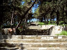
Yumuktepe (or Yümüktepe) is a tell (ruin mound) at 36°48′5N 34°36′14E / 36.80139°N 34.60389°E / 36.80139; 34.60389 within the city borders of Mersin, Turkey. In 1936, the mound was on the outskirts of Mersin, but after a rapid increase of population, the mound was surrounded by the Toroslar municipality of Mersin.

Discovery and excavations

Excavations during 1936-1938 by a British archaeologist John Garstang (1876–1956). He was the founder of the British Institute in Ankara,[1] have revealed a neolithic settlement which continued up to medieval ages. However, the excavations halted during World War II and some documents in the Liverpool University have been lost after an air raid.[2] After the war, John Garstang as well as Veli Sevin of İstanbul University and Isabella Caneva [3]ofSapienza University of Rome continued the excavations.[4]

Archaeology

There are 23 levels of occupation dating from ca. 6300 BC. In his book, Prehistoric Mersin, Garstang lists the tools unearthed in the excavations. The earliest tools are made of either stone or ceramic. Both agriculture and animal husbandry (sheep, cattle, goats and pigs) were among the economic activities in Yumuktepe.[5] In the layer which corresponds to roughly 4500 BC, are found the remains of one of the earliest fortifications in human history to exist. According to Isabella Caneva, during the chalcolithic age an early copper blast furnace was in use in Yumuktepe. This was probably a coastal settlement, but because of the alluvion carried by the nearby Efrenk River, the mound is now 2.5 kilometres (1.6 mi) north of the Mediterranean shore.

Historical era

Yumuktepe was a part of Kizuwatna, a vassal kingdom of Hittite Empire. In a document of 1440 BC, a city named Pitura was mentioned. Pitura might be the ancient name of the settlement. But a recent research suggests Elipru as the original name of the settlement. It seems, like most Hittite lands, Sea Peoples from Europe plundered Yumuktepe in 13th century BC. A second blow was from Assyrian Empire from Upper Mesopotamia. During Roman Empire, a small city named Zephyrium was established to the south of Yumuktepe. But Emperor Hadrian (reigned 117–138) renamed the city as Hadrianapolis. During the early Byzantine Empire, the nearby settlement of Soli (10 kilometres (6.2 mi) at the west) flourished and Yumuktepe further lost its former status.

References

  1. ^ "Biaa - Welcome". Archived from the original on April 24, 2010. Retrieved March 26, 2010.
  • ^ "Home". mersin.bel.tr.
  • ^ "ANMED - The 2003 Excavation Campaign at Mersin-Yumuktepe". www.akmedanmed.com. Archived from the original on 2011-07-07.
  • ^ "YUMUKTEPE 2006 KAZILARI SONUÇ RAPORU (PROF. İSABELLA CANEVA)". www.yumuktepe.com. Archived from the original on 2008-07-23.
  • ^ Seton Lloyd: Ancient Turkey (Trans: Ender Verinlioğlu), Tubitak, pg 21

  • Retrieved from "https://en.wikipedia.org/w/index.php?title=Yumuktepe&oldid=1117196972"

    Categories: 
    Ruins in Turkey
    Former populated places in Turkey
    Tumuli in Turkey
    Tourist attractions in Mersin
    Buildings and structures in Mersin
    Archaeological sites in Mersin Province, Turkey
    Hidden categories: 
    Pages using gadget WikiMiniAtlas
    Articles with short description
    Short description matches Wikidata
    Coordinates on Wikidata
    Articles with Pleiades identifiers


    This page was last edited on 20 October 2022, at 12:21 (UTC).

    This version of the page has been revised. Besides normal editing, the reason for revision may have been that this version contains factual inaccuracies, vandalism, or material not compatible with the Creative Commons Attribution-ShareAlike License.


    Privacy policy

    About Wikipedia

    Disclaimers

    Contact Wikipedia

    Code of Conduct

    Developers

    Statistics

    Cookie statement

    Mobile view


    Wikimedia Foundation
    Powered by MediaWiki