Jump to content


Main menu


Navigation  


Main page
Contents
Current events
Random article
About Wikipedia
Contact us
Donate


Contribute  


Help
Learn to edit
Community portal
Recent changes
Upload file


Search  


Create account

Log in


Create account
 Log in


Pages for logged out editors learn more  


Contributions
Talk


Contents


(Top)


1 History  


1.1  Ottoman period  


1.2  British Mandate era  


1.3  Jordanian era  


1.4  Post-1967  


2 References  


3 Bibliography  


4 External links  


al-Kum


العربية
Català
Cebuano
فارسی
Français
עברית
مصرى
Norsk nynorsk
 

Edit links


Article
Talk


Read
Edit
View history


Tools


Actions  


Read
Edit
View history


General  


What links here
Related changes
Upload file
Special pages
Permanent link
Page information
Cite this page
Get shortened URL
Download QR code
Wikidata item


Print/export  


Download as PDF
Printable version


In other projects  


Wikimedia Commons


Appearance


Coordinates: 31°3153N 34°5738E / 31.53139°N 34.96056°E / 31.53139; 34.96056
 

From Wikipedia, the free encyclopedia


al-Kum
Arabic transcription(s)
 • Arabicالكوم
 • Latinal-Kum-al-Muwarraq-Beit Maqdum-Humsa (official)
al-Kum is located in State of Palestine
al-Kum

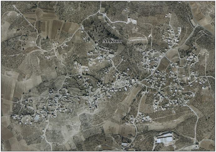
al-Kum

Location of al-Kum within Palestine

Coordinates: 31°31′53N 34°57′38E / 31.53139°N 34.96056°E / 31.53139; 34.96056
Palestine grid147/105
StateState of Palestine
GovernorateHebron
FoundedEarly 19th-century
Government
 • TypeVillage council (from 1996)
 • Head of MunicipalityMusharraf Rajoub[1]
Area
 • Total7,000 dunams (7.0 km2 or 2.7 sq mi)
Population
 (2017)[2]
 • Total1,464
 • Density210/km2 (540/sq mi)
Name meaningKh. el Kôm: the ruin of heaps[3] Kh. el Mûrak: the ruin the leafy place[4] Beit Makdûm: the house of Makdûm, personal name[5]

Al-Kum (Arabic: الكوم, romanizedal-Kūm, officially known as al-Kum-al-Muwarraq-Beit Maqdum-Humsa) is a Palestinian village in the southern West Bank, part of the Hebron Governorate and located 13 kilometers west of Hebron. Its municipal borders stretch from the border with Israel in the west to boundaries of the city of Dura in the east.[6] It had a population of 1,464 in the 2017 census by the Palestinian Central Bureau of Statistics.[2]

History[edit]

Ottoman period[edit]

Early Ottoman tax registers in the 16th century have Bayt Makhdum/Bayt Maqdum located in the NahiyaofHalil of the LiwaofQuds.[7] It was classified as Mazra'a (=cultivated) land.[8]

In 1883, the PEF's Survey of Palestine found at Kh. el Kôm "traces of ruins and caves on a white hill-top." It further described it as "rather a large ruin."[9] Khurbet el Murak was described as "caves and two large foundations",[10] while at Beit Makdûm they noted "cisterns, caves, foundations, and walls, apparently an old site."[11]

British Mandate era[edit]

At the time of the 1931 census of Palestine the populations of Kh. el Kum and Kh. Muraq were counted under Dura.[12]

Jordanian era[edit]

After the 1948 Arab-Israeli War, the area was under Jordanian rule. The Jordanian census of 1961 found 247 inhabitants in Kaum and 150 in Muwarraq.[13]

Post-1967[edit]

After the 1967 Six-Day War, the Al-Kum area (together with the rest of the West Bank) has been under Israeli occupation.

The modern Al-Kum village was formed as a result of a 1995 merger between the villages of al-Kum, al-Muwarraq, Beit Maqdum and Humsa, with al-Kum being the largest and in the middle of the latter three. Al-Kum and Beit Maqdum were founded sometime in the early 19th century during Ottoman rule in Palestine. Most of the residents of the four villages were migrants from nearby DuraorPalestinian refugees who fled there following the 1948 Arab-Israeli War. The principal families are Rajoub, al-Awawda and al-Sharha. Following the founding of the modern village, a six-member village council was established to administer its affairs and provide some municipal services.[6]

The primary health care facilities for the village are at al-Kum designated by the Ministry of Health as level 1. Close by is Deir Sammit where the primary healthcare facilities are at level 2.[14]

References[edit]

  • ^ a b Preliminary Results of the Population, Housing and Establishments Census, 2017 (PDF). Palestinian Central Bureau of Statistics (PCBS) (Report). State of Palestine. February 2018. pp. 64–82. Retrieved 2023-10-24.
  • ^ Palmer, 1881, p. 400
  • ^ Palmer, 1881, p. 401
  • ^ Palmer, 1881, p. 389
  • ^ a b Al Kum, Al Muwarraq, Beit Maqdum, Humsa Village Profile. Applied Research Institute-Jerusalem (ARIJ). 2009.
  • ^ In 932AH/1525-1526CE, 970AH/1562-1573CE and 1005AH/1596-1597CE
  • ^ Toledano, 1984, p. 302, has Bayt Makhdum/Bayt Maqdum at location 34°58′00″E 31°32′10N
  • ^ Conder and Kitchener, 1883, SWP III, p. 358
  • ^ Conder and Kitchener, 1883, SWP III, p. 360
  • ^ Conder and Kitchener, 1883, SWP III, p. 324
  • ^ Mills, 1932, p. 29
  • ^ Government of Jordan, Department of Statistics, 1964, p. 23
  • ^ West Bank Health care Archived 2006-03-13 at the Library of Congress Web Archives
  • Bibliography[edit]

  • Government of Jordan, Department of Statistics (1964). First Census of Population and Housing. Volume I: Final Tables; General Characteristics of the Population (PDF).
  • Mills, E., ed. (1932). Census of Palestine 1931. Population of Villages, Towns and Administrative Areas. Jerusalem: Government of Palestine.
  • Palmer, E.H. (1881). The Survey of Western Palestine: Arabic and English Name Lists Collected During the Survey by Lieutenants Conder and Kitchener, R. E. Transliterated and Explained by E.H. Palmer. Committee of the Palestine Exploration Fund.
  • Toledano, E. (1984). "The Sanjaq of Jerusalem in the Sixteenth Century: Aspects of Topography and Population". Archivum Ottomanicum. 9: 279–319.
  • External links[edit]


    Retrieved from "https://en.wikipedia.org/w/index.php?title=Al-Kum&oldid=1219812530"

    Categories: 
    Hebron Governorate
    Villages in the West Bank
    Municipalities of the State of Palestine
    Hidden categories: 
    Pages using gadget WikiMiniAtlas
    Webarchive template wayback links
    Webarchive template other archives
    Articles with short description
    Short description is different from Wikidata
    Coordinates on Wikidata
    Articles containing Arabic-language text
    Articles with J9U identifiers


    This page was last edited on 20 April 2024, at 00:11 (UTC).

    Text is available under the Creative Commons Attribution-ShareAlike License 4.0; additional terms may apply. By using this site, you agree to the Terms of Use and Privacy Policy. Wikipedia® is a registered trademark of the Wikimedia Foundation, Inc., a non-profit organization.


    Privacy policy

    About Wikipedia

    Disclaimers

    Contact Wikipedia

    Code of Conduct

    Developers

    Statistics

    Cookie statement

    Mobile view


    Wikimedia Foundation
    Powered by MediaWiki