J u m p t o c o n t e n t
M a i n m e n u
M a i n m e n u
N a v i g a t i o n
● M a i n p a g e ● C o n t e n t s ● C u r r e n t e v e n t s ● R a n d o m a r t i c l e ● A b o u t W i k i p e d i a ● C o n t a c t u s ● D o n a t e
C o n t r i b u t e
● H e l p ● L e a r n t o e d i t ● C o m m u n i t y p o r t a l ● R e c e n t c h a n g e s ● U p l o a d f i l e
S e a r c h
Search
A p p e a r a n c e
● C r e a t e a c c o u n t ● L o g i n
P e r s o n a l t o o l s
● C r e a t e a c c o u n t ● L o g i n
P a g e s f o r l o g g e d o u t e d i t o r s l e a r n m o r e ● C o n t r i b u t i o n s ● T a l k
( T o p )
1 H i s t o r y
T o g g l e H i s t o r y s u b s e c t i o n
1 . 1 O t t o m a n e r a
1 . 2 B r i t i s h M a n d a t e e r a
1 . 3 J o r d a n i a n e r a
1 . 4 P o s t - 1 9 6 7
2 F o o t n o t e s
3 B i b l i o g r a p h y
4 E x t e r n a l l i n k s
T o g g l e t h e t a b l e o f c o n t e n t s
T a r q u m i y a h
1 2 l a n g u a g e s
● ا ل ع ر ب ي ة ● C a t a l à ● C e b u a n o ● E u s k a r a ● ف ا ر س ی ● F r a n ç a i s ● ע ב ר י ת ● N e d e r l a n d s ● N o r s k n y n o r s k ● P o l s k i ● S u o m i ● ا ر د و
E d i t l i n k s
● A r t i c l e ● T a l k
E n g l i s h
● R e a d ● E d i t ● V i e w h i s t o r y
T o o l s
T o o l s
A c t i o n s
● R e a d ● E d i t ● V i e w h i s t o r y
G e n e r a l
● W h a t l i n k s h e r e ● R e l a t e d c h a n g e s ● U p l o a d f i l e ● S p e c i a l p a g e s ● P e r m a n e n t l i n k ● P a g e i n f o r m a t i o n ● C i t e t h i s p a g e ● G e t s h o r t e n e d U R L ● D o w n l o a d Q R c o d e ● W i k i d a t a i t e m
P r i n t / e x p o r t
● D o w n l o a d a s P D F ● P r i n t a b l e v e r s i o n
I n o t h e r p r o j e c t s
● W i k i m e d i a C o m m o n s
A p p e a r a n c e
C o o r d i n a t e s : 3 1 ° 3 4 ′ 30 ″ N 3 5 ° 0 0 ′ 47 ″ E / 3 1 . 5 7 5 0 0 ° N 3 5 . 0 1 3 0 6 ° E / 31.57500; 35.01306
F r o m W i k i p e d i a , t h e f r e e e n c y c l o p e d i a
Municipality type A in State of Palestine
Municipality type A in Hebron, State of Palestine
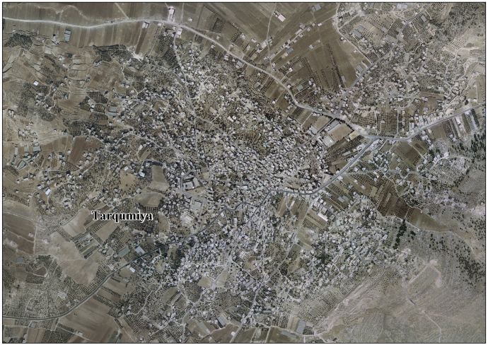
Tarqumiyah (Arabic : ترقوميا ) is a Palestinian city located 12 kilometers northwest of Hebron , in the southern West Bank , in the Hebron Governorate of the State of Palestine . The city had a population of 19,311 in 2017.[1]
History [ edit ]
Tarqumiyah is an ancient town situated on a rocky hill. Cisterns have been found here.[3] PEF 's Survey of Western Palestine Tricomias , an episcopal see .[4]
Ottoman era [ edit ]
In the 16th century, Tarquimyah was a small village.[5] census of 1596 the village appeared to be in the Nahiya of Halil of the Liwa of Quds . It had a population of 17 families, all Muslim . They paid a fixed tax-rate of 33,33% on agricultural products, including wheat, barley, olive trees, goats and beehives, in addition to occasional revenues; a total of 6,500 akçe .[6]
In 1838 Edward Robinson passed by and noted that Tarqumiya was on the most common path from Gaza , via Bayt Jibrin to Hebron . While resting at Tarqumiya, he was visited by the local Sheikh and other dignitaries, who “demeaned themselves kindly and courteously."[7] [8] Gaza , but subject to the government of el-Khulil .[9]
In 1863 Victor Guérin found it to have 400 inhabitants,[10] [11] [12]
In 1883 SWP described Tarqumiyah as “A small village on a rocky hill near the low lands. On the east, about a mile distant, is a spring; on the south are olives.”[4]
British Mandate era [ edit ]
According to the 1922 census of Palestine conducted by the British Mandate authorities , Tarqumiyah had a population of 976 inhabitants, all Muslims,[13] 1931 census to 1,173, still entirely Muslim, in 225 inhabited houses.[14]
In the 1945 statistics the population of Tarqumiya was 1,550 Muslims,[15] dunams of land according to an official land and population survey.[16] [17] [18]
Tarqumiyah, British Mandate map, 1:20,000
Tarqumiyah 1945 1:250,000
Jordanian era [ edit ]
In the wake of the 1948 Arab–Israeli War , and after the 1949 Armistice Agreements , Tarqumiyah came under Jordanian rule .
In 1961, the population of Tarqumiyah was 2,651.[19]
Post-1967 [ edit ]
Since the Six-Day War in 1967, Tarqumiyah has been under Israeli occupation . The population in the 1967 census conducted by the Israeli authorities was 2,412.[20] Israeli settlements : Telem and Adora .[21]
Since 1995, Tarqumiyah has also been governed by the Palestinian National Authority as part of Area B of the West Bank . According to the Palestinian Central Bureau of Statistics , the town had a population of over 14,357 in 2007.[22]
In 2024, during the 2023-24 Hamas Israeli war, Israeli and Palestinian aid trucks have been attacked by Israeli rioters here. [23]
^ Palmer, 1881, p. 408
^ Dauphin, 1998, p. 938
^ a b Conder and Kitchener, 1883, SWP III, p. 310
^ Grossman, D. (1986). "Oscillations in the Rural Settlement of Samaria and Judaea in the Ottoman Period". in Shomron studies . Dar, S., Safrai, S., (eds). Tel Aviv: Hakibbutz Hameuchad Publishing House. p. 368
^ Hütteroth and Abdulfattah, 1977, p. 123
^ Robinson and Smith, 1841, vol 2, p. 399
^ Robinson and Smith, 1841, vol 3, pp. 11
^ Robinson and Smith, 1841, vol 3, Appendix 2, p. 117
^ Guérin, 1869, p. 345
^ Socin, 1879, p. 162
^ Hartmann, 1883, p. 143 noted 80 houses
^ Barron, 1923, p. 10
^ Mills, 1932, p. 34
^ Government of Palestine, Department of Statistics, 1945, p. 23
^ Government of Palestine, Department of Statistics. Village Statistics, April, 1945. Quoted in Hadawi, 1970, p. 50
^ Government of Palestine, Department of Statistics. Village Statistics, April, 1945. Quoted in Hadawi, 1970, p. 94
^ Government of Palestine, Department of Statistics. Village Statistics, April, 1945. Quoted in Hadawi, 1970, p. 144
^ Government of Jordan, Department of Statistics, 1964, p. 14
^ Perlmann, Joel (November 2011 – February 2012). "The 1967 Census of the West Bank and Gaza Strip: A Digitized Version" (PDF) . Levy Economics Institute . Retrieved 24 June 2016 .
^ Tarqumiya Town Profile , ARIJ, p. 15
^ 2007 PCBS Census Palestinian Central Bureau of Statistics . p.118.
^ Tondo, Lorenzo; Taha, Sufian; Burke, Jason (16 May 2024). " . The Guardian .
Bibliography [ edit ]
Dauphin, C. (1998). La Palestine byzantine, Peuplement et Populations ISBN 0-860549-05-4
Conder, C.R. ; Kitchener, H.H. (1883). The Survey of Western Palestine: Memoirs of the Topography, Orography, Hydrography, and Archaeology Committee of the Palestine Exploration Fund .
Government of Jordan, Department of Statistics (1964). First Census of Population and Housing. Volume I: Final Tables; General Characteristics of the Population (PDF) .
Government of Palestine, Department of Statistics (1945). Village Statistics, April, 1945
Guérin, V. (1869). Description Géographique Historique et Archéologique de la Palestine
Hadawi, S. (1970). Village Statistics of 1945: A Classification of Land and Area ownership in Palestine
Hartmann, M. (1883). "Die Ortschaftenliste des Liwa Jerusalem in dem türkischen Staatskalender für Syrien auf das Jahr 1288 der Flucht (1871)" . Zeitschrift des Deutschen Palästina-Vereins . 6
Hütteroth, Wolf-Dieter; Abdulfattah, Kamal (1977). Historical Geography of Palestine, Transjordan and Southern Syria in the Late 16th Century ISBN 3-920405-41-2
Mills, E., ed. (1932). Census of Palestine 1931. Population of Villages, Towns and Administrative Areas
Palmer, E.H. (1881). The Survey of Western Palestine: Arabic and English Name Lists Collected During the Survey by Lieutenants Conder and Kitchener, R. E. Transliterated and Explained by E.H. Palmer Committee of the Palestine Exploration Fund .
Robinson, Edward ; Smith, Eli (1841). Biblical Researches in Palestine, Mount Sinai and Arabia Petraea: A Journal of Travels in the year 1838 Crocker & Brewster .
Robinson, E. ; Smith, E. (1841). Biblical Researches in Palestine, Mount Sinai and Arabia Petraea: A Journal of Travels in the year 1838 Crocker & Brewster .
Socin, A. (1879). "Alphabetisches Verzeichniss von Ortschaften des Paschalik Jerusalem" . Zeitschrift des Deutschen Palästina-Vereins . 2
External links [ edit ]
Wikimedia Commons has media related to
Tarqumiyah .
R e t r i e v e d f r o m " https://en.wikipedia.org/w/index.php?title=Tarqumiyah&oldid=1224500520 " C a t e g o r i e s : ● H e b r o n G o v e r n o r a t e ● C i t i e s i n t h e W e s t B a n k ● M u n i c i p a l i t i e s o f t h e S t a t e o f P a l e s t i n e H i d d e n c a t e g o r i e s : ● P a g e s u s i n g g a d g e t W i k i M i n i A t l a s ● A r t i c l e s w i t h s h o r t d e s c r i p t i o n ● S h o r t d e s c r i p t i o n i s d i f f e r e n t f r o m W i k i d a t a ● C o o r d i n a t e s o n W i k i d a t a ● A r t i c l e s c o n t a i n i n g A r a b i c - l a n g u a g e t e x t ● C S 1 : l o n g v o l u m e v a l u e ● C S 1 F r e n c h - l a n g u a g e s o u r c e s ( fr ) ● C o m m o n s c a t e g o r y l i n k f r o m W i k i d a t a ● A r t i c l e s w i t h J 9 U i d e n t i f i e r s
● T h i s p a g e w a s l a s t e d i t e d o n 1 8 M a y 2 0 2 4 , a t 1 9 : 5 9 ( U T C ) . ● T e x t i s a v a i l a b l e u n d e r t h e C r e a t i v e C o m m o n s A t t r i b u t i o n - S h a r e A l i k e L i c e n s e 4 . 0 ;
a d d i t i o n a l t e r m s m a y a p p l y . B y u s i n g t h i s s i t e , y o u a g r e e t o t h e T e r m s o f U s e a n d P r i v a c y P o l i c y . W i k i p e d i a ® i s a r e g i s t e r e d t r a d e m a r k o f t h e W i k i m e d i a F o u n d a t i o n , I n c . , a n o n - p r o f i t o r g a n i z a t i o n . ● P r i v a c y p o l i c y ● A b o u t W i k i p e d i a ● D i s c l a i m e r s ● C o n t a c t W i k i p e d i a ● C o d e o f C o n d u c t ● D e v e l o p e r s ● S t a t i s t i c s ● C o o k i e s t a t e m e n t ● M o b i l e v i e w


