Bolton, Connecticut
| |
|---|---|
| Town of Bolton | |

| |

Seal | |
| Motto:
"A Town for All Seasons"
| |
| |
| |
| Coordinates: 41°45′51″N 72°26′15″W / 41.76417°N 72.43750°W / 41.76417; -72.43750 | |
| Country | |
| U.S. state | |
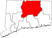
| County | Tolland |
| Region | Capitol Region |
| Incorporated | 1720 |
| Government | |
| • Type | Selectman-town meeting |
| • First selectman | Pam Sawyer (R) |
| • Selectmen | Robert R. Morra (R) Michael W. Eremita (R) Kimberly A. Miller (D) Nicole Sullivan (D) |
| Area | |
| • Total | 14.7 sq mi (38.1 km2) |
| • Land | 14.4 sq mi (37.3 km2) |
| • Water | 0.3 sq mi (0.8 km2) |
| Elevation | 728 ft (222 m) |
| Population
(2020)[1]
| |
| • Total | 4,858 |
| • Density | 330/sq mi (130/km2) |
| Time zone | UTC−5 (Eastern) |
| • Summer (DST) | UTC−4 (Eastern) |
| ZIP Code |
06043
|
| Area code(s) | 860/959 |
| FIPS code | 09-06260 |
| GNIS feature ID | 0213393 |
| List of auxiliary Interstate Highways | |
| U.S. Highways | |
| State Routes | |
| Website | town |
Bolton (/ˈboʊltən/ BOHL-tən) is a small suburban towninTolland County, Connecticut, United States. The population was 4,858 as of the 2020 census.[2] Bolton was incorporated in October 1720 and is governed by town meeting, with a first selectman and board of selectman as well as other boards serving specific functions. Bolton was named after a town of the same name in England, also located near Manchester.[3]

Originally part of the town of Hartford, the area was referred to as Hartford Mountains or Hanover, until incorporation in October 1720. On November 11, 1723, Jonathan Edwards was installed as the pastor of Bolton.[4]
Bolton was known for its high quality schist stone in the 18th century, and many tombstone carvers such as Gershom Bartlett and Jonathan Loomis sourced their stone from Bolton quarries.
Bolton was removed from Hartford County when Tolland County was originally formed on October 13, 1785. The northern half of Bolton was set aside in 1808 to form the town of Vernon. Quarries played a significant role in the area's developing economy, and Bolton Notch became the location of the small community of Quarryville. Prior to the railroad, granite was taken by oxcart to the Connecticut River where it was then shipped to major cities on the East Coast.
The Bolton historical society has been actively purchasing sites throughout the town in their effort to preserve the town's history and rural character. The most recent of these purchases was Rose's Farm, a several hundred-acre site where the Comte de Rochambeau camped with his troops.
Bolton has several restrictive ordinances designed to protect high housing prices for existing homeowners and to restrict new construction. Ordinances protecting existing businesses from competition also exist, such as those limiting the types and number of businesses. There is also a requirement that all new residential lots be no smaller than one acre, further keeping house prices artificially higher than they otherwise would likely be. The town features numerous parks, open spaces and trails.[5]
Interstate 84 was originally planned to cut through the town on its way to Providence, going through Bolton Notch and the Hop River valley. Due to environmental concerns in both Rhode Island and in the Hop River valley, the highway would be cancelled in 1983. The segment that was built beforehand in the northwestern section of town, from CT 85toUS 6/US 44 would be redesignated at Interstate 384.[6][7]
Bolton today is primarily residential with an economy made up mostly of small businesses. It is part of the Greater Hartford metro and contains many suburban homes, especially in its western side.
Bolton, like much of Tolland County, straddles the humid continental climate (Dfa) and (Dfb) line.
| Climate data for Bolton, Connecticut | |||||||||||||
|---|---|---|---|---|---|---|---|---|---|---|---|---|---|
| Month | Jan | Feb | Mar | Apr | May | Jun | Jul | Aug | Sep | Oct | Nov | Dec | Year |
| Record high °F (°C) | 64 (18) |
69 (21) |
83 (28) |
93 (34) |
92 (33) |
96 (36) |
97 (36) |
96 (36) |
96 (36) |
86 (30) |
78 (26) |
71 (22) |
97 (36) |
| Mean daily maximum °F (°C) | 35 (2) |
38 (3) |
47 (8) |
58 (14) |
69 (21) |
76 (24) |
81 (27) |
80 (27) |
72 (22) |
62 (17) |
51 (11) |
40 (4) |
59 (15) |
| Mean daily minimum °F (°C) | 13 (−11) |
15 (−9) |
24 (−4) |
33 (1) |
43 (6) |
52 (11) |
57 (14) |
56 (13) |
46 (8) |
35 (2) |
29 (−2) |
20 (−7) |
35 (2) |
| Record low °F (°C) | −32 (−36) |
−27 (−33) |
−24 (−31) |
4 (−16) |
20 (−7) |
27 (−3) |
34 (1) |
28 (−2) |
19 (−7) |
13 (−11) |
−5 (−21) |
−19 (−28) |
−32 (−36) |
| Average precipitation inches (mm) | 4.38 (111) |
3.11 (79) |
4.32 (110) |
4.54 (115) |
3.96 (101) |
4.25 (108) |
4.08 (104) |
4.07 (103) |
4.54 (115) |
4.56 (116) |
4.64 (118) |
4.02 (102) |
50.47 (1,282) |
| Source: The Weather Channel (Historical Monthly Averages)[8] | |||||||||||||
Bolton High School is a public school with about two to three hundred students. It underwent major renovations and expansion during 2011, including a new outdoor seating area for the cafeteria, a larger and more technologically advanced library, computer labs and media center, and a new science wing and larger administrative offices. Several other improvements were made including parking, bus lanes and the board of education offices being moved to the location.
The school has a student-teacher ratio of about 12:1 and a combined math and reading proficiency level of 92.5%.[9] U.S. News & World Report ranked it #27 in Connecticut and #1030 in the United States, and it earned a Silver Award in 2012.[10]
Bolton High is affiliated with the NCCC athletic conference.
According to the United States Census Bureau, the town has a total area of 14.7 square miles (38 km2), of which 14.4 square miles (37 km2) is land and 0.3 square miles (0.78 km2) (1.91%) is water. This includes the Bolton Green Historic District and may include land owned or leased by the State of Connecticut and the U.S. federal government. Bolton does not have any unincorporated land [citation needed].
| Census | Pop. | Note | %± |
|---|---|---|---|
| 1820 | 731 | — | |
| 1850 | 600 | — | |
| 1860 | 683 | 13.8% | |
| 1870 | 576 | −15.7% | |
| 1880 | 512 | −11.1% | |
| 1890 | 452 | −11.7% | |
| 1900 | 457 | 1.1% | |
| 1910 | 433 | −5.3% | |
| 1920 | 448 | 3.5% | |
| 1930 | 504 | 12.5% | |
| 1940 | 728 | 44.4% | |
| 1950 | 1,279 | 75.7% | |
| 1960 | 2,933 | 129.3% | |
| 1970 | 3,691 | 25.8% | |
| 1980 | 3,951 | 7.0% | |
| 1990 | 4,575 | 15.8% | |
| 2000 | 5,017 | 9.7% | |
| 2010 | 4,980 | −0.7% | |
| 2020 | 4,858 | −2.4% | |
| U.S. Decennial Census[11] | |||
As of the census of 2010, there were 4,980 people, 1,915 households, and 1,438 families residing in the town.[12] The town's residents are primarily middle-class, with some working class and upper middle-class families/individuals and small businesses. There are also a few larger commercial entities, notably the Simoniz corporation, specializing in automotive and car wash cleaning supplies.
The population density in 2010 was 346 people per square mile (133.5/km2). There were 2,015 housing units in the town, of which 100, or 5.0%, were vacant. 86.7% of the occupied units are owned and 13.3% are rented.[12]
The racial makeup of the town was 95.7% White, 1.1% African American, 0.1% Native American, 1.4% Asian, 0.2% some other race, and 1.5% two or more races. 3.00% of the population identified as LatinoorHispanic of any race (the US Census Bureau does not consider Latino a race).[12]
The median age in 2010 was 45.4. 49.4% of the population were male and 50.6% female.[12]
For the period 2012–2016, the estimated median household income was $91,087, and the median family income was $118,958. About 3.2% of the population are living below the poverty line.[13]
| Voter registration and party enrollment as of 29 October 2019[update][14] | |||||
|---|---|---|---|---|---|
| Party | Active voters | Inactive voters | Total voters | Percentage | |
| Democratic | 1,047 | 68 | 1,115 | 29.84% | |
| Republican | 975 | 63 | 1,038 | 27.78% | |
| Unaffiliated | 1,408 | 109 | 1,517 | 40.60% | |
| Minor Parties | 59 | 7 | 66 | 1.76% | |
| Total | 3,489 | 247 | 3,736 | 100% | |
| Presidential Election Results[15][16] | |||
|---|---|---|---|
| Year | Democratic | Republican | Third Parties |
| 2020 | 52.5% 1,727 | 45.1% 1,482 | 2.4% 79 |
| 2016 | 46.4% 1,385 | 48.0% 1,436 | 5.6% 169 |
| 2012 | 49.24% 1,433 | 49.26% 1,434 | 1.5% 44 |
| 2008 | 55.7% 1,692 | 42.6% 1,300 | 1.7% 54 |
| 2004 | 50.5% 1,542 | 47.7% 1,459 | 1.8% 56 |
| 2000 | 49.3% 1,368 | 45.0% 1,210 | 5.7% 159 |
| 1996 | 47.6% 1,210 | 37.9% 964 | 14.5% 369 |
| 1992 | 36.7% 1,023 | 34.9% 976 | 28.4% 792 |
| 1988 | 42.7% 972 | 55.9% 1,278 | 1.4% 33 |
| 1984 | 32.8% 699 | 66.9% 1,430 | 0.3% 8 |
| 1980 | 33.5% 665 | 48.5% 964 | 18.0% 359 |
| 1976 | 42.5% 817 | 57.0% 1,097 | 0.5% 10 |
| 1972 | 35.1% 668 | 64.2% 1,226 | 0.7% 15 |
| 1968 | 38.8% 630 | 55.4% 904 | 5.8% 96 |
| 1964 | 59.5% 859 | 40.5% 586 | 0.00% 0 |
| 1960 | 37.3% 524 | 62.7% 880 | 0.00% 0 |
| 1956 | 26.0% 311 | 74.0% 888 | 0.00% 0 |
{{cite web}}: CS1 maint: archived copy as title (link)
|
Municipalities and communities of Tolland County, Connecticut, United States
| ||
|---|---|---|
| Towns |
|
|
| CDPs |
| |
| Other communities |
| |
| ||
|
| |
|---|---|
| Counties |
|
| Cities 100k-250k |
|
| Cities and towns 50k-100k |
|
| Cities and towns 10k-50k |
|
| Towns ≤10k |
|
| Related articles |
|
| International |
|
|---|---|
| National |
|