Jump to content


Main menu


Navigation  


Main page
Contents
Current events
Random article
About Wikipedia
Contact us
Donate


Contribute  


Help
Learn to edit
Community portal
Recent changes
Upload file


Search  


Create account

Log in


Create account
 Log in


Pages for logged out editors learn more  


Contributions
Talk


Contents


(Top)


1 History  


2 Geography  


3 Transportation  


4 Principal communities  


5 Demographics  


6 Economy  


7 List of town parks  


8 Notable locations  


8.1  National Historic Places and other historic sites  


9 Notable people  


10 See also  


11 References  


12 External links  


Guilford, Connecticut


العربية
 / Bân-lâm-gú
Cebuano
Cymraeg
Dagbanli
Deutsch
Español
Euskara
Français
Bahasa Indonesia
Italiano
Қазақша
Kreyòl ayisyen
Кыргызча
مصرى
Nederlands
 
Нохчийн
Norsk bokmål
Oʻzbekcha / ўзбекча
Polski
Português
Română
Simple English
Ślůnski
Српски / srpski
Srpskohrvatski / српскохрватски
Svenska
Татарча / tatarça
Türkçe
Українська
اردو
Volapük


Edit links


Article
Talk


Read
Edit
View history


Tools


Actions  


Read
Edit
View history


General  


What links here
Related changes
Upload file
Special pages
Permanent link
Page information
Cite this page
Get shortened URL
Download QR code
Wikidata item


Print/export  


Download as PDF
Printable version


In other projects  


Wikimedia Commons
Wikivoyage


Appearance


Coordinates: 41°17N 72°41W / 41.283°N 72.683°W / 41.283; -72.683
 

From Wikipedia, the free encyclopedia


Guilford, Connecticut
Town of Guilford
Guilford Square
Guilford Square
Official seal of Guilford, Connecticut
Motto: 
"Discover A Piece Of Connecticut History"[1]

Guilford's location within New Haven County and Connecticut

Guilford's location within the South Central Connecticut Planning Region and the state of Connecticut

Map

Map

Map

Coordinates: 41°17′N 72°41′W / 41.283°N 72.683°W / 41.283; -72.683
Country United States
U.S. state Connecticut
CountyNew Haven
RegionSouth Central CT
SettledMay 19, 1639
EstablishedOctober 15, 1644
Named forGuildford, Surrey
Government
 • TypeSelectman-town meeting
 • First selectmanMatthew T. Hoey III (D)[2]
 • SelectmanLouis Federici (D)
 • SelectmanSandra Ruoff (D)
 • SelectmanCharles Havrda (R)
 • SelectmanSusan Renner (R)
Area
 • Total49.7 sq mi (128.7 km2)
 • Land47.1 sq mi (121.9 km2)
 • Water2.7 sq mi (6.9 km2)
Elevation
56 ft (17 m)
Population
 (2020)
 • Total22,073
 • Density440/sq mi (170/km2)
 • Demonym
Guilfordian
Time zoneUTC−5 (Eastern)
 • Summer (DST)UTC−4 (Eastern)
ZIP Code
06437
Area code(s)203/475
FIPS code09-34950
GNIS feature ID0213438
Websitewww.guilfordct.gov

Guilford is a town in New Haven County, Connecticut, United States, that borders Madison, Branford, North Branford and Durham, and is situated on I-95 and the Connecticut coast. The town is part of the South Central Connecticut Planning Region. The population was 22,073 at the 2020 census.[3]

History[edit]

Guilford, c. 1900

Guilford was named after the town of Guildford, in England,[4] the native home of a share of its first settlers.[5] In early maps of the Connecticut Colony, the town is seen on several maps as Gilford.

First settled by Europeans in 1639 after a treaty with the “Sachem Squaw” Shaumpishuh. Guilford is considered by some to have the third largest collection of historic homes in New England, with important buildings from the 17th, 18th, and 19th centuries.[6] There are five historic house museums, including Dudley Farm and the Henry Whitfield House (1639), the oldest dwelling house in Connecticut and the oldest stone house built by English settlers in North America. The Comfort Starr House (1695) is one of the oldest wooden framed private dwellings in Connecticut, and one of the few houses remaining of the original signers who settled Guilford.[7]

In June 1781, during the American Revolution, a skirmish was fought on Leete's Island between the Associated Loyalists and local militia under Captain Peter Vail.

Geography[edit]

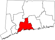
According to the United States Census Bureau, the town has a total area of 49.7 square miles (129 km2), of which 47.0 square miles (122 km2) is land and 2.7 square miles (6.9 km2 or 5.39%) is water.

The primary settlement in Guilford, known as Guilford Center, is located in the southern part of town around the intersection of U.S. Route 1 and Connecticut Route 77. It is served by three exits of Interstate 95, which passes just north of the town center. The Guilford Center census-designated place had a population of 2,597 at the 2010 census.[8]

The northwest side of Guilford is flanked by the Metacomet Ridge, a mountainous trap rock ridgeline that stretches from Long Island Sound to nearly the Vermont border. Important features of the Metacomet ridge in Guilford include Totoket Mountain; its most notable peak, Bluff Head; and two eastern high points on the Totoket Mountain ridge named East Sugarloaf and West Sugarloaf. The 50-mile (80 km) Mattabesett Trail traverses Bluff Head; a shorter network of trails criss-cross the Sugarloaves. Guilford also contains the Westwoods Trail System which covers 39 miles (63 km) of trails on 1,200 acres (4.9 km2) of land.

Transportation[edit]

Guilford train station is served by Shore Line East

The Shore Line East train stops at Guilford station with service to Branford, East Haven, New Haven and New London, and the Connecticut Transit S bus travels between Guilford and New Haven several times each day.

Principal communities[edit]

Other minor communities and geographic features in Guilford are Guilford Lakes, Indian Cove, and Old Quarry.

Demographics[edit]

Historical population
CensusPop.Note
18204,131
18502,653
18602,624−1.1%
18702,576−1.8%
18802,7828.0%
18902,780−0.1%
19002,7850.2%
19103,0017.8%
19202,803−6.6%
19303,11711.2%
19403,54413.7%
19505,09243.7%
19607,91355.4%
197012,03352.1%
198017,37544.4%
199019,84814.2%
200021,3987.8%
201022,3754.6%
202022,073−1.3%
U.S. Decennial Census[10]

As of the census[11] of 2000, there were 21,398 people, 8,151 households, and 6,039 families residing in the town. The population density was 454.8 inhabitants per square mile (175.6/km2). There were 8,724 housing units at an average density of 185.4 per square mile (71.6/km2). The racial makeup of the town was 96.04% White, 0.93% African American, 0.05% Native American, 1.65% Asian, 0.41% from other races, and 0.93% from two or more races. HispanicorLatino of any race were 2.13% of the population.

There were 8,151 households, out of which 35.6% had children under the age of 18 living with them, 64.4% were married couples living together, 7.2% had a female householder with no husband present, and 25.9% were non-families. Of all households 21.6% were made up of individuals, and 8.6% had someone living alone who was 65 years of age or older. The average household size was 2.59 and the average family size was 3.04.

In the town, the population was spread out, with 25.4% under the age of 18, 4.4% from 18 to 24, 26.2% from 25 to 44, 31.2% from 45 to 64, and 12.8% who were 65 years of age or older. The median age was 42 years. For every 100 females, there were 92.8 males. For every 100 females age 18 and over, there were 89.5 males.

The median income for a household in the town was $76,843, and the median income for a family was $87,045 (these figures had risen to $90,026 and $104,852 respectively as of a 2007 estimate[12]). Males had a median income of $60,623 versus $40,307 for females. The per capita income for the town was $37,161. About 2.3% of families and 3.1% of the population were below the poverty line, including 3.4% of those under age 18 and 3.8% of those age 65 or over.

Voter registration and party enrollment as of October 30, 2014[13]
Party Active voters Inactive voters Total voters Percentage
Democratic 4,743 551 5,294 33.05%
Republican 3,183 333 3,516 21.95%
Unaffiliated 5,995 1113 7,108 44.38%
Minor parties 94 5 99 0.62%
Total 14,015 2,002 16,017 100%

In the 2008 presidential election, Democrat Barack Obama received 61.02% of the town vote, against 38.06% for Republican John McCain.[14] In 2016, Democrat Hillary Clinton carried the town with 59.2% over Republican Donald Trump with 37.1%.[15]

Economy[edit]

American Cruise Lines has its headquarters in Guilford.[16][17] There are many small businesses throughout the town, including the shops on the Guilford Green.

List of town parks[edit]

The town government operates these parks:[18]

Notable locations[edit]

Guilford, Connecticut is noted for its rolling farmland, its avoidance of the density and sprawl that has occurred from land use regulations of its neighboring communities, and its numerous historic homes and sites.[19]

National Historic Places and other historic sites[edit]

The Comfort Starr House
The Henry Whitfield House, built in 1639, is the oldest stone house in New England [22]

Historic sites in or near Guilford, which may be listed on the National Register of Historic Places, include:

Notable people[edit]

See also[edit]

References[edit]

  1. ^ "The Town of Guilford Connecticut". The Town of Guilford Connecticut. Archived from the original on September 23, 2012. Retrieved September 22, 2012.
  • ^ "Board of Selectmen". Town of Guilford, Connecticut. Retrieved November 28, 2021.
  • ^ "Census - Geography Profile: Guilford town, New Haven County, Connecticut". Retrieved December 16, 2021.
  • ^ Gannett, Henry (1905). The Origin of Certain Place Names in the United States. Govt. Print. Off. pp. 146.
  • ^ The Connecticut Magazine: An Illustrated Monthly. Connecticut Magazine Company. 1903. p. 332.
  • ^ The Connecticut Nutmegger, Connecticut Society of Genealogists (Connecticut Society of Genealogists, 1981).
  • ^ Federal Writers' Project (1938). Connecticut. Houghton Mifflin Company. ISBN 978-1-60354-007-0.
  • ^ "Profile of General Population and Housing Characteristics: 2010 Demographic Profile Data (DP-1): Guilford Center CDP, Connecticut". United States Census Bureau. Retrieved October 15, 2012.
  • ^ Smith, Ralph (1877). The History of Guilford Connecticut. Albany, N.Y.: J. Munsell. pp. 46–47.
  • ^ "Census of Population and Housing". Census.gov. Retrieved June 4, 2015.
  • ^ "U.S. Census website". United States Census Bureau. Retrieved January 31, 2008.
  • ^ "American FactFinder - Community Facts". factfinder.census.gov. Archived from the original on February 11, 2020. Retrieved February 2, 2022.
  • ^ "Registration and Party Enrollment Statistics as of October 30, 2014" (PDF). Connecticut Secretary of State. Archived from the original (PDF) on September 23, 2006. Retrieved June 2, 2015.
  • ^ "Connecticut Election 2008 - Presidential Results Margin of Victory" (PDF). magic.lib.uconn.edu. Retrieved May 25, 2020.
  • ^ "Connecticut Election Results 2016". The New York Times. August 2017.
  • ^ "General Information" Archived January 21, 2012, at the Wayback Machine. American Cruise Lines. Retrieved on January 15, 2012. "American Cruise Lines, Inc. operates from headquarters in Guilford, Connecticut[...]"
  • ^ "Cruise News". (Archive) American Cruise Lines. Retrieved on January 15, 2012. "741 Boston Post Road ٠ Suite 200 ٠ Guilford, CT"
  • ^ a b c d e f g h i j http://www.courant.com/news/local/hc-ot-guilford,0,3814997.story Web page titled "Guilford" at Hartford Courant Web site, dated August 16, 2006, accessed January 14, 2007
  • ^ Hughes, C. J., Guilford, Conn.: Proud of Its Place in New England, the New York Times, September 29, 2019
  • ^ Guilford Green
  • ^ Guilford Land Conservation Trust
  • ^ "National Historic Landmarks Program (NHL)". tps.cr.nps.gov. Archived from the original on October 5, 2007. Retrieved January 11, 2022.
  • ^ Guilford-Acadians website retrieved on 2009-05-13
  • ^ "Historic Buildings of Connecticut » Blog Archive » Benton-Beecher House (1740)". historicbuildingsct.com. October 8, 2014. Retrieved September 1, 2016.
  • ^ "Harriet Beecher Stowe's Life". www.harrietbeecherstowecenter.org. Archived from the original on May 25, 2017. Retrieved September 1, 2016.
  • ^ "Abraham Baldwin (1754–1807)" Archived March 18, 2012, at the Wayback Machine, New Georgia Encyclopedia (January 6, 2009), Retrieved on July 21, 2013
  • ^ Roberts, Sam (May 29, 2016). "Frank Modell, Longtime New Yorker Cartoonist, Dies at 98". The New York Times.
  • ^ "Becki Newton". IMDb. Retrieved August 15, 2021.
  • ^ "Jennifer Westfeldt biography at IMDB". IMDB.com. Retrieved May 26, 2015.
  • External links[edit]


    Retrieved from "https://en.wikipedia.org/w/index.php?title=Guilford,_Connecticut&oldid=1221260182"

    Categories: 
    Guilford, Connecticut
    1643 establishments in Connecticut
    Populated coastal places in Connecticut
    Populated places established in 1639
    Towns in Connecticut
    Towns in New Haven County, Connecticut
    Towns in the New York metropolitan area
    Towns in South Central Connecticut Planning Region, Connecticut
    Hidden categories: 
    Pages using gadget WikiMiniAtlas
    Pages with non-numeric formatnum arguments
    Webarchive template wayback links
    Use mdy dates from April 2024
    Articles with short description
    Short description is different from Wikidata
    Coordinates on Wikidata
    Pages using infobox settlement with possible area code list
    Commons category link from Wikidata
    Articles with VIAF identifiers
    Articles with WorldCat Entities identifiers
    Articles with J9U identifiers
    Articles with LCCN identifiers
    Articles with MusicBrainz area identifiers
    Pages using the Kartographer extension


    This page was last edited on 28 April 2024, at 21:09 (UTC).

    Text is available under the Creative Commons Attribution-ShareAlike License 4.0; additional terms may apply. By using this site, you agree to the Terms of Use and Privacy Policy. Wikipedia® is a registered trademark of the Wikimedia Foundation, Inc., a non-profit organization.


    Privacy policy

    About Wikipedia

    Disclaimers

    Contact Wikipedia

    Code of Conduct

    Developers

    Statistics

    Cookie statement

    Mobile view


    Wikimedia Foundation
    Powered by MediaWiki