Pine Island
| |
|---|---|

City Hall and downtown Pine Island
| |

| |
| Coordinates: 44°12′04″N 92°37′28″W / 44.20111°N 92.62444°W / 44.20111; -92.62444[1] | |
| Country | United States |
| State | Minnesota |
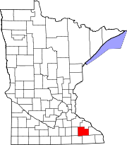
| Counties | Goodhue, Olmsted |
| Area | |
| • Total | 6.02 sq mi (15.60 km2) |
| • Land | 5.99 sq mi (15.52 km2) |
| • Water | 0.03 sq mi (0.08 km2) |
| Elevation | 994 ft (303 m) |
| Population
(2020)
| |
| • Total | 3,769 |
| • Density | 629.11/sq mi (242.89/km2) |
| Time zone | UTC-6 (Central (CST)) |
| • Summer (DST) | UTC-5 (CDT) |
| ZIP code |
55963
|
| Area code | 507 |
| FIPS code | 27-51136[3] |
| GNIS feature ID | 2396208[1] |
| Website | pineislandmn.com |
Pine Island is a city in Goodhue and Olmsted counties in the U.S. stateofMinnesota. Most of Pine Island is in Goodhue County, but a small part extends into Olmsted County, making that portion part of the Rochester metropolitan area. As of the 2020 census, the population was 3,769.
The community has a strong agricultural base, but has been transitioning over time into a bedroom community for nearby Rochester, which employs many local residents. It is also the site of Minnesota's first diverging diamond interchange.[4]
Pine Island was platted in 1856.[5] A post office has been in operation at Pine Island since 1856.[6]
Pine Island lies along the Middle Fork of the Zumbro River. According to the United States Census Bureau, the city has an area of 5.61 square miles (14.53 km2), of which 5.59 square miles (14.48 km2) is land and 0.02 square miles (0.05 km2) is water.[7]
U.S. Highway 52 serves as a main route in the community.
| Climate data for Pine Island, Minnesota | |||||||||||||
|---|---|---|---|---|---|---|---|---|---|---|---|---|---|
| Month | Jan | Feb | Mar | Apr | May | Jun | Jul | Aug | Sep | Oct | Nov | Dec | Year |
| Record high °F (°C) | 58 (14) |
64 (18) |
83 (28) |
93 (34) |
107 (42) |
106 (41) |
109 (43) |
101 (38) |
101 (38) |
94 (34) |
78 (26) |
79 (26) |
109 (43) |
| Mean daily maximum °F (°C) | 24 (−4) |
29 (−2) |
43 (6) |
61 (16) |
69 (21) |
79 (26) |
85 (29) |
81 (27) |
73 (23) |
63 (17) |
42 (6) |
29 (−2) |
57 (14) |
| Mean daily minimum °F (°C) | 3 (−16) |
7 (−14) |
20 (−7) |
45 (7) |
44 (7) |
55 (13) |
62 (17) |
56 (13) |
49 (9) |
35 (2) |
22 (−6) |
8 (−13) |
34 (1) |
| Record low °F (°C) | −43 (−42) |
−35 (−37) |
— | — | — | — | — | — | — | — | — | — | −43 (−42) |
| Average precipitation inches (mm) | 0.90 (23) |
0.88 (22) |
1.92 (49) |
3.35 (85) |
3.75 (95) |
4.67 (119) |
4.25 (108) |
4.88 (124) |
3.80 (97) |
2.46 (62) |
2.02 (51) |
1.13 (29) |
34.01 (864) |
| Source: The Weather Channel[8] | |||||||||||||
| Census | Pop. | Note | %± |
|---|---|---|---|
| 1880 | 656 | — | |
| 1890 | 548 | −16.5% | |
| 1900 | 832 | 51.8% | |
| 1910 | 834 | 0.2% | |
| 1920 | 934 | 12.0% | |
| 1930 | 961 | 2.9% | |
| 1940 | 1,040 | 8.2% | |
| 1950 | 1,298 | 24.8% | |
| 1960 | 1,308 | 0.8% | |
| 1970 | 1,640 | 25.4% | |
| 1980 | 1,977 | 20.5% | |
| 1990 | 2,125 | 7.5% | |
| 2000 | 2,337 | 10.0% | |
| 2010 | 3,263 | 39.6% | |
| 2020 | 3,769 | 15.5% | |
| U.S. Decennial Census[9] | |||

As of 2000 the median income for a household in the city was $47,500, and the median income for a family was $59,792. Males had a median income of $32,788 versus $25,031 for females. The per capita income for the city was $20,370. About 4.5% of families and 5.6% of the population were below the poverty line, including 6.2% of those under age 18 and 14.6% of those age 65 or over.
As of the census[10] of 2010, there were 3,263 people, 1,292 households, and 873 families residing in the city. The population density was 583.7 inhabitants per square mile (225.4/km2). There were 1,399 housing units at an average density of 250.3 per square mile (96.6/km2). The racial makeup of the city was 96.6% White, 0.9% African American, 0.1% Native American, 0.8% Asian, 0.1% Pacific Islander, 0.1% from other races, and 1.3% from two or more races. HispanicorLatino of any race were 1.7% of the population.
There were 1,292 households, of which 36.1% had children under the age of 18 living with them, 53.3% were married couples living together, 10.5% had a female householder with no husband present, 3.8% had a male householder with no wife present, and 32.4% were non-families. 26.9% of all households were made up of individuals, and 10.7% had someone living alone who was 65 years of age or older. The average household size was 2.47 and the average family size was 3.02.
The median age in the city was 35.2 years. 27.4% of residents were under the age of 18; 6.8% were between the ages of 18 and 24; 26.9% were from 25 to 44; 25.3% were from 45 to 64; and 13.5% were 65 years of age or older. The gender makeup of the city was 48.4% male and 51.6% female.
|
Municipalities and communities of Goodhue County, Minnesota, United States
| ||
|---|---|---|
| Cities |
|
|
| Townships |
| |
| CDP |
| |
| Unincorporated communities |
| |
| Indian reservation |
| |
| Ghost towns/Neighborhoods |
| |
| Footnotes | ‡This populated place also has portions in an adjacent county or counties | |
| ||
|
Municipalities and communities of Olmsted County, Minnesota, United States
| ||
|---|---|---|
| Cities |
|
|
| Townships |
| |
| CDPs |
| |
| Unincorporated communities |
| |
| Footnotes | ‡This populated place also has portions in an adjacent county or counties | |
| ||
|
| ||
|---|---|---|
| Core city |
|
|
| Incorporated Places |
| |
| Counties |
| |
‡ indicates that it is partially in the metropolitan area. † indicates a county seat. | ||
| International |
|
|---|---|
| National |
|
| Geographic |
|