Jump to content


Main menu


Navigation  


Main page
Contents
Current events
Random article
About Wikipedia
Contact us
Donate


Contribute  


Help
Learn to edit
Community portal
Recent changes
Upload file


Search  


Create account

Log in


Create account
 Log in


Pages for logged out editors learn more  


Contributions
Talk


Contents


(Top)


1 Geography  


1.1  Communities and localities  


2 Demographics  


3 Education  


4 See also  


5 References  


6 External links  


Woodlands County


Deutsch
Français
Română
Українська
اردو
 

Edit links


Article
Talk


Read
Edit
View history


Tools


Actions  


Read
Edit
View history


General  


What links here
Related changes
Upload file
Special pages
Permanent link
Page information
Cite this page
Get shortened URL
Download QR code
Wikidata item


Print/export  


Download as PDF
Printable version


In other projects  


Wikimedia Commons


Appearance


Coordinates: 54°0834N 115°417W / 54.14278°N 115.68528°W / 54.14278; -115.68528
 

From Wikipedia, the free encyclopedia


Woodlands County
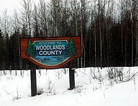
Welcome sign
Welcome sign
Blue Ridge
Fort Assiniboine
Goose Lake
Windfall
Location within Alberta
Coordinates: 54°08′34N 115°41′7W / 54.14278°N 115.68528°W / 54.14278; -115.68528
CountryCanada
ProvinceAlberta
RegionCentral Alberta
Census division13
Established1994
Incorporated1999 (County)
Government
 • MayorJohn Burrows
 • Governing bodyWoodlands County Council
 • Administrative officeadjacent to Whitecourt
Area
 (2021)[2]
 • Land7,599.52 km2 (2,934.19 sq mi)
Population
 (2021)[2]
 • Total4,558
 • Density0.6/km2 (2/sq mi)
Time zoneUTC−7 (MST)
 • Summer (DST)UTC−6 (MDT)
Websitewoodlands.ab.ca

Woodlands County is a municipal district in north-central Alberta, Canada. Located in Census Division No. 13, its municipal office is located outside but adjacent to the Town of Whitecourt. A second municipal office is located in the Hamlet of Fort Assiniboine.[3]

Geography

[edit]

Communities and localities

[edit]

The following localities are located within Woodlands County.[5]

Localities

Demographics

[edit]

Windfall gas plant in Woodlands County

In the 2021 Census of Population conducted by Statistics Canada, Woodlands County had a population of 4,558 living in 1,739 of its 1,991 total private dwellings, a change of -3.9% from its 2016 population of 4,744. With a land area of 7,599.52 km2 (2,934.19 sq mi), it had a population density of 0.6/km2 (1.6/sq mi) in 2021.[2]

In the 2016 Census of Population conducted by Statistics Canada, Woodlands County had a population of 4,754 living in 1,812 of its 1,950 total private dwellings, a 10.4% change from its 2011 population of 4,306. With a land area of 7,669.13 km2 (2,961.07 sq mi), it had a population density of 0.6/km2 (1.6/sq mi) in 2016.[6]

Education

[edit]

The county is within the Pembina Hills Public Schools, which formed in 1995 as a merger of three school districts.[7]

See also

[edit]

References

[edit]
  • ^ a b c "Population and dwelling counts: Canada, provinces and territories, and census subdivisions (municipalities)". Statistics Canada. February 9, 2022. Retrieved February 9, 2022.
  • ^ Woodlands County (October 9, 2010). "General Contacts".
  • ^ a b "Specialized and Rural Municipalities and Their Communities" (PDF). Alberta Municipal Affairs. June 3, 2024. Retrieved June 14, 2024.
  • ^ "Standard Geographical Classification (SGC) 2006, Economic Regions: 4813029 - Woodlands County, geographical codes and localities, 2006". Statistics Canada. March 5, 2010. Retrieved August 12, 2012.
  • ^ "Population and dwelling counts, for Canada, provinces and territories, and census subdivisions (municipalities), 2016 and 2011 censuses – 100% data (Alberta)". Statistics Canada. February 8, 2017. Retrieved February 8, 2017.
  • ^ "Our Division". Pembina Hills Public Schools. Retrieved August 25, 2019. 5310 - 49th Street Barrhead, Alberta T7N 1P3
  • [edit]
    Retrieved from "https://en.wikipedia.org/w/index.php?title=Woodlands_County&oldid=1085729685"

    Categories: 
    Woodlands County
    Municipal districts in Alberta
    Hidden categories: 
    Pages using gadget WikiMiniAtlas
    Articles with short description
    Short description matches Wikidata
    Use mdy dates from December 2021
    Coordinates on Wikidata
    Official website different in Wikidata and Wikipedia
    Commons category link is on Wikidata


    This page was last edited on 2 May 2022, at 03:57 (UTC).

    Text is available under the Creative Commons Attribution-ShareAlike License 4.0; additional terms may apply. By using this site, you agree to the Terms of Use and Privacy Policy. Wikipedia® is a registered trademark of the Wikimedia Foundation, Inc., a non-profit organization.


    Privacy policy

    About Wikipedia

    Disclaimers

    Contact Wikipedia

    Code of Conduct

    Developers

    Statistics

    Cookie statement

    Mobile view


    Wikimedia Foundation
    Powered by MediaWiki