「天臂城」の版間の差分
Syanarion62 (会話 | 投稿記録) m Category:ルンビニ州を追加 (HotCat使用) |
|||
| (4人の利用者による、間の11版が非表示) | |||
| 1行目: | 1行目: | ||
{{Expand English|date=2021年12月}} |
|||
{{BuddhasHolySites}} |
|||
{{Infobox settlement |
|||
<!--See the table at Infobox settlement for all fields and descriptions of usage--> |
|||
<!-- Basic info -->| official_name = Devdaha Municipality |
|||
| other_name = |
|||
| native_name = देवदह नगरपालिका |
|||
| nickname = |
|||
| settlement_type = [[Municipality]] |
|||
| motto = <!-- images and maps --> |
|||
| image_skyline = |
|||
| image_caption = |
|||
| image_flag = |
|||
| image_seal = |
|||
| image_map = |
|||
| mapsize = |
|||
| map_caption = |
|||
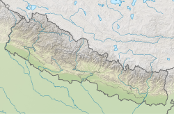
| pushpin_map = Nepal#South Asia |
|||
| pushpin_relief = yes |
|||
| pushpin_label_position = top |
|||
| pushpin_mapsize = |
|||
| pushpin_map_caption = Location in Nepal |
|||
<!-- Location -->| subdivision_type = Country |
|||
| subdivision_name = {{flag|Nepal}} |
|||
| subdivision_type1 = [[Provinces of Nepal|Province]] |
|||
| subdivision_name1 = [[Lumbini Province]] |
|||
| subdivision_type2 = [[Districts of Nepal|District]] |
|||
| subdivision_name2 = [[Rupandehi District]] |
|||
<!-- Politics -->| government_footnotes = |
|||
| government_type = |
|||
|leader_title = [[Mayor]] |
|||
|leader_name = Hira Bahadur KC |
|||
|leader_title1 = [[Deputy Mayor]] |
|||
|leader_name1 = Bidya Laxmi Gurung |
|||
| established_title = <!-- Settled --> |
|||
| established_date = <!-- Area --> |
|||
| unit_pref = <!--Enter: Imperial, if Imperial (metric) is desired--> |
|||
| area_footnotes = |
|||
| area_total_km2 = 136.95 |
|||
| area_total_sq_mi = <!-- Population --> |
|||
| population_as_of = 2011 |
|||
| population_footnotes = |
|||
| population_note = |
|||
| population_total = 53523 |
|||
| population_density_km2 = auto |
|||
| population_blank1_title = Ethnicities |
|||
| population_blank2_title = Religions |
|||
<!-- General information -->| timezone = [[Nepal Standard Time|NST]] |
|||
| utc_offset = +5:45 |
|||
| timezone_DST = |
|||
| utc_offset_DST = |
|||
| coordinates = {{coord|27.661|N|83.566|E|region:NP_type:city|display=inline,title}} |
|||
| elevation_footnotes = <!--for references: use <ref> </ref> tags--> |
|||
| elevation_m = <!-- Area/postal codes & others --> |
|||
| postal_code_type = |
|||
| postal_code = |
|||
| area_code = 071 |
|||
| blank_name = |
|||
| blank_info = |
|||
| website = [http://www.devdahamun.gov.np www.devdahamun.gov.np] |
|||
| footnotes = |
|||
}} |
|||
| ⚫ | |||
[[釈迦]]の母、[[摩耶夫人]]、養母、[[摩訶波闍波提]]の出身地<ref>{{Cite news|url=http://lumbinidevtrust.gov.np/introduction/ramagrama-devadaha/|title=Lumbini Development Trust- Birthplace of Buddha, Historical Place of Nepal, The World Heritage Site|work=Lumbini Development Trust|access-date=11 February 2018|language=en-US}}</ref>。
|
|||
| ⚫ | |||
== 名称 == |
== 名称 == |
||
サンスクリット語では、デーヴァは神を意味し、ダハは池を意味している。したがって、デーヴァダハの意味は「神の池」である。この池には、神々や女神、聖人が沐浴していたと考えられている。この水は現在でも、デーヴァダハ市に供給されている。 |
サンスクリット語では、デーヴァは神を意味し、ダハは池を意味している。したがって、デーヴァダハの意味は「神の池」である。この池には、神々や女神、聖人が沐浴していたと考えられている。この水は現在でも、デーヴァダハ市に供給されている。 |
||
== 仏教の |
== 仏教の地として == |
||
この天臂城出身の善覚長者の長女、[[摩耶夫人|摩耶]]は、[[釈迦]]の母である。[[釈迦]]の父、釈迦国、[[カピラ城]]の王、[[浄飯王]]は、この[[摩耶夫人|摩耶]]を妃に迎えた。摩耶夫人は、釈迦を身ごもり、実家の天臂城に向かう途中、[[ルンビニ|ルンビニ園]]で生まれた。摩耶夫人は、釈迦が誕生して七日目に亡くなったが、摩耶夫人の妹、[[摩訶波闍波提]]が養母となり釈迦を育てた。
|
この天臂城出身の善覚長者の長女、[[摩耶夫人|摩耶]]は、[[釈迦]]の母である。[[釈迦]]の父、釈迦国、[[カピラ城]]の王、[[浄飯王]]は、この[[摩耶夫人|摩耶]]を妃に迎えた。摩耶夫人は、釈迦を身ごもり、実家の天臂城に向かう途中、[[ルンビニ|ルンビニ園]]で釈迦は生まれた。摩耶夫人は、釈迦が誕生して七日目に亡くなったが、摩耶夫人の妹、[[摩訶波闍波提]]が養母となり釈迦を育てた。
|
||
現在、天臂城跡は、デーヴァダハ公園として整備されている。この公園は、天臂城の東の正門にあたり、 |
現在、天臂城跡は、小さなデーヴァダハ公園として整備されている。この公園は、天臂城の東の正門にあたり、庭園と塔がある。そこには、仏像と舎利弗の金色の像がある。以前は、特に告知されていなかったが、[[ネパール]]の[[パラス・ビール・ビクラム・シャハ|パラス・ビール・ビクラム・シャハ・デーブ]]元皇太子により発足した、デーヴァダハ保護アカデミーにより管理されている。
|
||
== 脚注 == |
|||
<references /> |
|||
== 外部リンク == |
== 外部リンク == |
||
* [http://devdahamun.gov.np デーヴァダハ市のウェブサイト(ネパール語内英語版リンクあり)] |
* [http://devdahamun.gov.np デーヴァダハ市のウェブサイト(ネパール語内英語版リンクあり)] |
||
* [http://www.palikanon.com/english/pali_names/d/devadaha.htm Entry on ''Devdaha'' パーリ―語英語辞書による解説] |
* [http://www.palikanon.com/english/pali_names/d/devadaha.htm Entry on ''Devdaha'' パーリ―語英語辞書による解説] |
||
{{DEFAULTSORT:てんぴじょう}} |
|||
[[Category:ネパールの仏教]] |
|||
[[Category:2014年設立]] |
|||
[[Category:ネパールの地理]] |
|||
[[Category:聖地]] |
|||
[[Category:ルンビニ州]] |
|||
2022年3月7日 (月) 15:07時点における最新版
この記事は英語版の対応するページを翻訳することにより充実させることができます。(2021年12月) 翻訳前に重要な指示を読むには右にある[表示]をクリックしてください。
●英語版記事を日本語へ機械翻訳したバージョン︵Google翻訳︶。
●万が一翻訳の手がかりとして機械翻訳を用いた場合、翻訳者は必ず翻訳元原文を参照して機械翻訳の誤りを訂正し、正確な翻訳にしなければなりません。これが成されていない場合、記事は削除の方針G-3に基づき、削除される可能性があります。
●信頼性が低いまたは低品質な文章を翻訳しないでください。もし可能ならば、文章を他言語版記事に示された文献で正しいかどうかを確認してください。
●履歴継承を行うため、要約欄に翻訳元となった記事のページ名・版について記述する必要があります。記述方法については、Wikipedia:翻訳のガイドライン#要約欄への記入を参照ください。
●翻訳後、 {{翻訳告知|en|Devdaha|…}}をノートに追加することもできます。
●Wikipedia:翻訳のガイドラインに、より詳細な翻訳の手順・指針についての説明があります。
|
Devdaha Municipality देवदह नगरपालिका | |
|---|---|
| 座標:北緯27度39分40秒 東経83度33分58秒 / 北緯27.661度 東経83.566度座標: 北緯27度39分40秒 東経83度33分58秒 / 北緯27.661度 東経83.566度 | |
| Country |
|
| Province | Lumbini Province |
| District | Rupandehi District |
| 政府 | |
| • Mayor | Hira Bahadur KC |
| • Deputy Mayor | Bidya Laxmi Gurung |
| 面積 | |
| • 合計 | 136.95 km2 |
| 人口 (2011) | |
| • 合計 | 53,523人 |
| • 密度 | 390人/km2 |
| 等時帯 | UTC+5:45 (NST) |
| 市外局番 | 071 |
| ウェブサイト | www.devdahamun.gov.np |
名称[編集]
サンスクリット語では、デーヴァは神を意味し、ダハは池を意味している。したがって、デーヴァダハの意味は﹁神の池﹂である。この池には、神々や女神、聖人が沐浴していたと考えられている。この水は現在でも、デーヴァダハ市に供給されている。仏教の地として[編集]
この天臂城出身の善覚長者の長女、摩耶は、釈迦の母である。釈迦の父、釈迦国、カピラ城の王、浄飯王は、この摩耶を妃に迎えた。摩耶夫人は、釈迦を身ごもり、実家の天臂城に向かう途中、ルンビニ園で釈迦は生まれた。摩耶夫人は、釈迦が誕生して七日目に亡くなったが、摩耶夫人の妹、摩訶波闍波提が養母となり釈迦を育てた。 現在、天臂城跡は、小さなデーヴァダハ公園として整備されている。この公園は、天臂城の東の正門にあたり、庭園と塔がある。そこには、仏像と舎利弗の金色の像がある。以前は、特に告知されていなかったが、ネパールのパラス・ビール・ビクラム・シャハ・デーブ元皇太子により発足した、デーヴァダハ保護アカデミーにより管理されている。脚注[編集]
- ^ “Lumbini Development Trust- Birthplace of Buddha, Historical Place of Nepal, The World Heritage Site” (英語). Lumbini Development Trust 2018年2月11日閲覧。


