スラバヤ
この記事は英語版の対応するページを翻訳することにより充実させることができます。(2023年11月) 翻訳前に重要な指示を読むには右にある[表示]をクリックしてください。
●英語版記事を日本語へ機械翻訳したバージョン︵Google翻訳︶。
●万が一翻訳の手がかりとして機械翻訳を用いた場合、翻訳者は必ず翻訳元原文を参照して機械翻訳の誤りを訂正し、正確な翻訳にしなければなりません。これが成されていない場合、記事は削除の方針G-3に基づき、削除される可能性があります。
●信頼性が低いまたは低品質な文章を翻訳しないでください。もし可能ならば、文章を他言語版記事に示された文献で正しいかどうかを確認してください。
●履歴継承を行うため、要約欄に翻訳元となった記事のページ名・版について記述する必要があります。記述方法については、Wikipedia:翻訳のガイドライン#要約欄への記入を参照ください。
●翻訳後、 {{翻訳告知|en|Surabaya|…}}をノートに追加することもできます。
●Wikipedia:翻訳のガイドラインに、より詳細な翻訳の手順・指針についての説明があります。
|
| スラバヤ Kota Surabaya | |||||
|---|---|---|---|---|---|

| |||||
| |||||
| 愛称 : SBY | |||||
| 標語 : "Surabaya bersih dan hijau (English: Surabaya green and clean)" | |||||
| 位置 | |||||

| |||||
| 位置 | |||||

| |||||
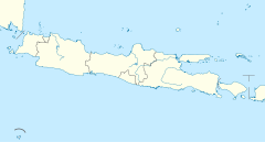
| 座標 : 南緯7度14分0秒 東経112度44分0秒 / 南緯7.23333度 東経112.73333度 | |||||
| 行政 | |||||
| 国 | |||||
| 州 | 東ジャワ州 | ||||
| 市 | スラバヤ | ||||
| 地理 | |||||
| 面積 | |||||
| 市域 | 274.06 km2 | ||||
| 標高 | 5 m | ||||
| 人口 | |||||
| 人口 | (2021年現在) | ||||
| 市域 | 2,972,091人 | ||||
| 備考 | 統計[1] | ||||
| その他 | |||||
| 等時帯 | インドネシア時間(WIB) (UTC+7) | ||||
| 市外局番 | 031 | ||||
| 公式ウェブサイト : http://www.surabaya.go.id/ | |||||
スラバヤ︵インドネシア語: Kota Surabaya︶は、インドネシア第2の都市であり、東ジャワ州の州都である。ジャワ島北岸のマス川河口に位置する。人口は約297万人︵2021年︶。明代から華僑が在住しているため、漢語では泗水と呼ぶ。
概要[編集]
天然の良港タンジュン・ペラック港を中心に、オランダ植民地時代から貿易の中心として栄えた。 現在はインドネシア最大の港湾で、最大の軍港である。 砂糖、タバコ、コーヒーなどを輸出する。 華人やアラブ系住民も多く、チャイナタウンやアラブ街もある。国立総合大学のアイルランガ大学や、アイデア対決・ロボットコンテスト︵NHKロボコン︶に参加経験のあるスラバヤ電子工学ポリテクニックなど、高等教育機関も多い。都市名[編集]
インドネシア語で鮫を意味するスラと鰐を意味するバヤがこの地で最強の動物を争ったという神話に由来し、市章に表されている。歴史[編集]
15世紀から16世紀にかけてイスラム系のスルタン国が存在し、ジャワ島東部の政治的、軍事的拠点であった。 1625年、紛争の後に当時強大であったマタラム王国の支配下となった。これによりマタラム国は、バンテン王国の支配地とオランダ領バタヴィアの除いたジャワ島のほとんどすべてを支配下に治めた。 オランダ植民地時代に商業港として発展した。太平洋戦争中の1942年、日本軍に占領され第百二海軍工作部が置かれた。若鷹 (急設網艦)などが修理を受けている。1944年連合国軍の爆撃を受けた。 1945年日本の降伏後、10月25日に上陸した英軍第49旅団とインドネシア独立派の間で戦闘が発生し、これがインドネシア独立戦争の発端となった。その後インドネシア独立派が占拠したが、1947年、オランダ軍に再占領され、1949年にようやくインドネシア共和国に編入された。 スカルノ初代大統領の故郷でもある。気候[編集]
ケッペンの気候区分ではサバナ気候︵Aw︶に属する。| スラバヤ(標高5m、極値1963–1980年)の気候 | |||||||||||||
|---|---|---|---|---|---|---|---|---|---|---|---|---|---|
| 月 | 1月 | 2月 | 3月 | 4月 | 5月 | 6月 | 7月 | 8月 | 9月 | 10月 | 11月 | 12月 | 年 |
| 最高気温記録 °C (°F) | 33.3 (91.9) |
34.4 (93.9) |
33.9 (93) |
33.3 (91.9) |
33.9 (93) |
33.9 (93) |
33.9 (93) |
34.4 (93.9) |
33.9 (93) |
35 (95) |
35.6 (96.1) |
35 (95) |
35.6 (96.1) |
| 平均最高気温 °C (°F) | 31.8 (89.2) |
31.5 (88.7) |
31.6 (88.9) |
31.4 (88.5) |
31.6 (88.9) |
31.2 (88.2) |
31.3 (88.3) |
30.1 (86.2) |
32.7 (90.9) |
33.4 (92.1) |
33.1 (91.6) |
31.9 (89.4) |
31.8 (89.2) |
| 日平均気温 °C (°F) | 26.8 (80.2) |
26.8 (80.2) |
27 (81) |
27.3 (81.1) |
27.3 (81.1) |
26.7 (80.1) |
26.2 (79.2) |
26.5 (79.7) |
27.2 (81) |
28.2 (82.8) |
28.3 (82.9) |
27.3 (81.1) |
27.13 (80.87) |
| 平均最低気温 °C (°F) | 24.1 (75.4) |
24.2 (75.6) |
24.0 (75.2) |
24.8 (76.6) |
24.1 (75.4) |
23.5 (74.3) |
23.0 (73.4) |
22.5 (72.5) |
22.9 (73.2) |
23.7 (74.7) |
24.1 (75.4) |
23.8 (74.8) |
23.7 (74.7) |
| 最低気温記録 °C (°F) | 21.1 (70) |
21.1 (70) |
20.6 (69.1) |
18.3 (64.9) |
16.7 (62.1) |
15.6 (60.1) |
14.4 (57.9) |
16.1 (61) |
16.7 (62.1) |
17.8 (64) |
19.4 (66.9) |
20 (68) |
14.4 (57.9) |
| 雨量 mm (inch) | 327 (12.87) |
275 (10.83) |
283 (11.14) |
181 (7.13) |
159 (6.26) |
101 (3.98) |
22 (0.87) |
15 (0.59) |
17 (0.67) |
47 (1.85) |
105 (4.13) |
219 (8.62) |
1,751 (68.94) |
| 平均降雨日数 | 17 | 18 | 19 | 15 | 13 | 11 | 7 | 3 | 4 | 5 | 12 | 23 | 147 |
| % 湿度 | 66.61 | 69.1 | 66.3 | 67.23 | 64.87 | 60.27 | 60.84 | 57.87 | 54.53 | 56.06 | 56.13 | 63.03 | 61.903 |
| 平均月間日照時間 | 217 | 196 | 217 | 270 | 279 | 300 | 341 | 341 | 330 | 310 | 270 | 248 | 3,319 |
| 平均日照時間 | 7.0 | 7.0 | 7.0 | 9.0 | 9.0 | 10.0 | 11.0 | 11.0 | 11.0 | 10.0 | 9.0 | 8.0 | 9.1 |
| 日照率 | 58 | 58 | 58 | 75 | 75 | 83 | 92 | 92 | 92 | 83 | 75 | 62 | 75.3 |
| 出典1:World Meteorological Organization;[2] Climate-Data.org (daily mean);[3] and Worldwide Bioclimatic Classification System (record extreme temperature)[4][5] | |||||||||||||
| 出典2:Weather Atlas (sunshine data)[6] | |||||||||||||
対外関係[編集]
姉妹都市・提携都市[編集]
 ジョホールバル、マレーシア
 クチン、マレーシア
 パース、オーストラリア
 高知市、日本:1997年4月17日~
 北九州市、日本
 釜山広域市、大韓民国
 廈門、中華人民共和国
 福州市、中華人民共和国
 昆明市、中華人民共和国
 広州市、中華人民共和国
 ウラジオストク、ロシア
 イズミル、トルコ
 マンチェスター、イギリス
 マルセイユ、フランス:2009年~
 ロッテルダム、オランダ
 ヴァルナ、ブルガリア
 アレキサンドリア、エジプト
 シアトル、アメリカ合衆国
 モンテレー、メキシコ
交通[編集]
空路[編集]
空港[編集]
市内中心部から17km離れた位置にジュアンダ国際空港がある。インドネシア国内でもジャカルタのスカルノハッタ国際空港に次いで2番目に利用者の多い空港となっている。
鉄道[編集]
鉄道路線[編集]
ジャカルタからチレボン・スマランを経由してスラバヤ・パサールトゥリ駅へ至る北幹線、ジャカルタからバンドンまたはチレボン・ジョクジャカルタ・ソロ・マディウンを経由してスラバヤ・グブン駅、スラバヤ・コタ駅に至る南幹線の接続するジャンクションで、南幹線の途中からバリ島への連絡港の有るパニュワンギへの支線も出ていてスラバヤ・グブン駅からパニュワンギ行きの列車も設定されている。道路[編集]
対岸のマドゥラ島とはスラマドゥ大橋で結ばれている。航路[編集]
港湾[編集]
●タンジュンペラック港 - オランダ植民地時代から貿易の中心として栄えた。現在[いつ?]はインドネシア最大の港湾で、同国最大の軍港である。文化・名物[編集]
スポーツ[編集]
2021年アジアユースゲームズの開催地に予定されている[7]。 ゲロラ・ブン・トモ・スタジアムは多目的スタジアムで、主にサッカーで用いられる。5万人収容。出身関連著名人[編集]
ゆかりの人物[編集]
●スカルノ - インドネシア初代大統領 ●ルリ・ディニ・アユ・サフィトリ - 歌手、俳優脚注[編集]
(一)^ “statisticstimes”. 2022年12月16日閲覧。 (二)^ “World Weather Information Service – Surabaya”. World Meteorological Organization. 2017年12月11日閲覧。 (三)^ “Surabaya climate: Average Temperature, weather by month, Surabaya weather averages - Climate-Data.org”. en.climate-data.org. 2018年11月6日閲覧。 (四)^ “INDONESIA - SURABAJA”. www.globalbioclimatics.org. 2018年12月14日閲覧。 (五)^ “INDONESIA - SURABAJA (google web cache)”. webcache.googleusercontent.com. 2018年12月14日閲覧。 (六)^ “Surabaya, Indonesia - Monthly weather forecast and Climate data”. Weather Atlas. 2019年1月24日閲覧。 (七)^ [1]関連項目[編集]
外部リンク[編集]
- スラバヤ市公式ウェブサイト (インドネシア語)


