
東シナ海
| 東シナ海 | |||||||||||||||||||||||||
 東シナ海地図 | |||||||||||||||||||||||||
| 中国語 | |||||||||||||||||||||||||
|---|---|---|---|---|---|---|---|---|---|---|---|---|---|---|---|---|---|---|---|---|---|---|---|---|---|
| 繁体字 | 東海 | ||||||||||||||||||||||||
| 簡体字 | 东海 | ||||||||||||||||||||||||
| |||||||||||||||||||||||||
| 別名 | |||||||||||||||||||||||||
| 繁体字 | 東中國海 | ||||||||||||||||||||||||
| 簡体字 | 东中国海 | ||||||||||||||||||||||||
| |||||||||||||||||||||||||
| 朝鮮語 | |||||||||||||||||||||||||
| ハングル | 동중국해 | ||||||||||||||||||||||||
| 漢字 | 東中國海 | ||||||||||||||||||||||||
| |||||||||||||||||||||||||
東シナ海(ひがしシナかい、東支那海)は、太平洋西部の海。南西諸島とユーラシア大陸に挟まれている。
概要[編集]


太平洋西部にある縁海である。国際水路機関発行の﹁大洋と海の境界︵第三版︶﹂に従うと、北辺は、東側では長崎の野母崎から五島列島の福江島及び済州島を結ぶ線で日本海と接し、西側では黄海に接している。東辺から南辺にかけては南西諸島の東側で太平洋︵フィリピン海︶に接し、南南西では台湾海峡を境に南シナ海に接する[1][2]。西辺はユーラシア大陸︵中国本土︶であり、大規模河川として長江が流入している。
海域の中央部には島嶼はない。北辺から東辺を経て南辺にかけて島弧が分布しており、そのうち主な島嶼には、南から台湾、南西諸島、九州、済州島がある[1][2]。また、西辺の大陸沿岸には舟山群島等の小島嶼がある。海底は、ほとんどがユーラシア大陸から続く大陸棚で深度は200 m未満であるが、東部には南西諸島の西側に沿って深度が約2,000 mに達する沖縄トラフがある。海流としては黒潮が流れている。
日本と中国の間では、尖閣諸島問題のほか、東シナ海ガス田問題に絡んで経済水域の設定に争いがある。また、韓国と中国の間でも、蘇岩礁にからみ争いがある。
 中国
●江蘇省、上海市、浙江省、福建省
中国
●江蘇省、上海市、浙江省、福建省
 台湾
●新北市、基隆市
台湾
●新北市、基隆市
 日本
●沖縄県、鹿児島県、熊本県、長崎県
●有明海を東シナ海の一部とする場合は佐賀県、福岡県も含む。
日本
●沖縄県、鹿児島県、熊本県、長崎県
●有明海を東シナ海の一部とする場合は佐賀県、福岡県も含む。
 韓国
●済州特別自治道
韓国
●済州特別自治道
表記[編集]
日本において[編集]
第二次世界大戦までは東支那海と表記した[3]。また戦後の一時期は東中国海と表記されていた。現在の日本の外務省の公式文書等では東シナ海と表記され[4]、日本国内では一般化している。その他の国・地域において[編集]
●国際水路機関発行の﹁大洋と海の境界︵第三版︶﹂では、Eastern China Sea (Tung Hai)としている[1]。 ●中華民国、中華人民共和国 - 東海︵东海︶と表記する。中国報道機関などの日本語サイトでは、東シナ海の代わりに東中国海の表記を用いることがある[5]。 ●中国の学者凌純声は、﹁東亜地中海﹂︵東アジアの内海︶と呼んだこともある[6]。範囲[編集]
﹁大洋と海の境界︵第三版︶﹂︵Special Publication No.23︶での "Eastern China Sea (Dong Hai)" の範囲は以下の通り[1]。 On the south. The northern limit of the South China Sea, thence from Santyo the northeastern point of Formosa to the west point of Yonakuni Island and thence to Haderuma Sima (24°03' N, 123°47' E). On the east. From Haderuma Sima a line including the Miyako Retto to the east point of Miyako Sima and thence to Okinan Kaku, the southern extremity of Okinawa Sima through this island to Ada-Ko Sima (Sidmouth Island) on to the East point of Kikai Sima (28°20'N) through Tanegra Sima (30°30'N) to the north point thereof and on to Hi-Saki (31'17'N) in Kyūshū. On the north. From Nomo Saki (32°35'N) in Kyusyu to the south point of Hukae Sima (Goto Retto) and on through this island to Ose Saki (Cape Goto) and to Hunan Kan, the South point of Saisyu To (Quelpart), through this island to its western extreme and thence along the parallel of 33°17' north to the mainland. On the west. The mainland of China. ︵日本語訳︶ 南においては、 南シナ海の北限 [注釈 1]、そこから台湾島の北東端である三貂角[注釈 2]から与那国島の西端[注釈 3]まで、そしてそこから波照間島 (24°03' N, 123°47' E)[注釈 4]。 東においては、 波照間島から宮古列島を含む線で宮古島の東端まで、そこから沖縄島の最南端である Okinan Kaku[注釈 5][8][注釈 6] まで、そしてこの島を通り、安田ヶ島まで、さらに喜界島の東端 (28°20'N) まで、種子島 (30°30'N) をこの島の北端まで通って、さらに九州の火崎 (31'17'N) まで。 北においては、 九州の野母崎 (32°35'N) から、福江島︵五島列島︶の南端まで、そしてこの島を通り大瀬埼灯台[注釈 7]まで、そして済州島南端のプナム崎[9]まで、この島を通ってその最西端まで、そしてそこから北緯 33°17' に沿って中国本土まで。 西においては、 中国本土。東シナ海に面する国・地域とその地方区分[編集]
 中国
●江蘇省、上海市、浙江省、福建省
中国
●江蘇省、上海市、浙江省、福建省
 台湾
●新北市、基隆市
台湾
●新北市、基隆市
 日本
●沖縄県、鹿児島県、熊本県、長崎県
●有明海を東シナ海の一部とする場合は佐賀県、福岡県も含む。
日本
●沖縄県、鹿児島県、熊本県、長崎県
●有明海を東シナ海の一部とする場合は佐賀県、福岡県も含む。
 韓国
●済州特別自治道
韓国
●済州特別自治道
漁業[編集]
この海域は、1960年頃までは優れた魚場であったが、漁獲規制がまったく行われなかったために、日本漁業者の乱獲により水産資源が激減した。戦後間もない1951年時点で水産資源の減少は明らかであったが、有効な漁獲規制は今日まで導入されていない。農林水産省の﹁漁業・養殖業統計年報﹂によれば、1960年の日本の漁獲量は370tほどあったが、それをピークに直線的に減少し始め、近年は20t足らずにまで落ち込んでいる。1980年代からは日本漁船は、採算が取れなくなり撤退、その後に操業コストの安い中国漁船が進出し、さらに資源は減少し続けている[10]。脚注[編集]
注釈[編集]
- ^ 台湾島の北端である富貴角から牛山島、平潭県の南端 (25°25'N) を経て、西へ北緯 25°24' に並行に福建省まで。
- ^ 北緯25度01分 東経122度00分 / 北緯25.017度 東経122.000度
- ^ 北緯24度27分 東経122度56分 / 北緯24.450度 東経122.933度
- ^ 北緯24度03分 東経123度47分 / 北緯24.050度 東経123.783度まで
- ^ 海上保安庁では荒埼としている[7]。
- ^ 北緯26度05分 東経127度41分 / 北緯26.083度 東経127.683度
- ^ 北緯32度37分 東経128度36分 / 北緯32.617度 東経128.600度
出典[編集]
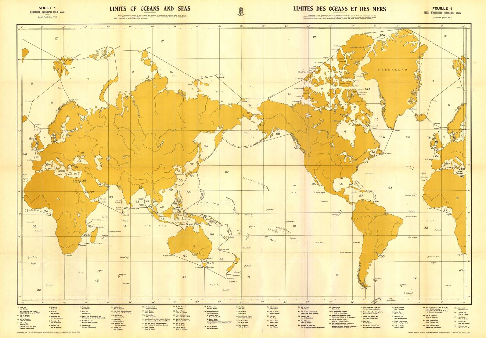
(一)^ abcd“Limits of Oceans and Seas, 3rd edition” (PDF). International Hydrographic Organization (1953年). 2023年7月15日時点のオリジナルよりアーカイブ。2023年9月23日閲覧。
(二)^ ab“Limits of Oceans and Seas, 3rd edition - World Chart” (JPG). International Hydrographic Organization (1953年). 2023年7月28日時点のオリジナルよりアーカイブ。2023年9月23日閲覧。
(三)^ 佐々木貴文 (2021年12月19日). “中国漁船が押し寄せる﹁あの海﹂を、﹁東シナ海﹂と呼びたがらない政府への違和感”. マネー現代 (講談社). オリジナルの2023年9月23日時点におけるアーカイブ。
(四)^ “中国による東シナ海での一方的資源開発の現状”. 外務省 (2023年6月5日). 2023年9月23日時点のオリジナルよりアーカイブ。2023年9月23日閲覧。
(五)^ “東中国海で漁解禁、千隻の漁船が出航”. 新華網日本語. (2023年8月9日). オリジナルの2023年9月23日時点におけるアーカイブ。
(六)^ ﹁日本の古代3海をこえての交流﹂中央公論社、1986年、191頁
(七)^ “海の相談2東シナ海と太平洋の境”. 海の相談室. 海上保安庁 第十一管区海上保安本部. 2018年8月18日閲覧。
(八)^ “Okinan-kaku, Japan”. Geographical Names. Information Technology Associates. 2018年8月18日閲覧。
(九)^ “Hunan Kan, South Korea”. Geographical Names. Information Technology Associates. 2018年8月18日閲覧。
(十)^ 勝川俊雄﹃漁業という日本の問題﹄︵2012年4月 NTT出版︶