Jump to content


Main menu


Navigation  


Main page
Contents
Current events
Random article
About Wikipedia
Contact us
Donate


Contribute  


Help
Learn to edit
Community portal
Recent changes
Upload file


Search  


Create account

Log in


Create account
 Log in


Pages for logged out editors learn more  


Contributions
Talk


Contents


(Top)


1 Education  


2 References  


3 External links  


Botwnnog


 / Bân-lâm-gú
Brezhoneg
Cebuano
Cymraeg
Euskara
Français
Gaeilge
Gàidhlig
Italiano
Kernowek
Svenska
 

Edit links


Article
Talk


Read
Edit
View history


Tools


Actions  


Read
Edit
View history


General  


What links here
Related changes
Upload file
Special pages
Permanent link
Page information
Cite this page
Get shortened URL
Download QR code
Wikidata item


Print/export  


Download as PDF
Printable version


In other projects  


Wikimedia Commons


Appearance


Coordinates: 52°5056N 4°3502W / 52.849°N 4.584°W / 52.849; -4.584
 

From Wikipedia, the free encyclopedia


Botwnnog

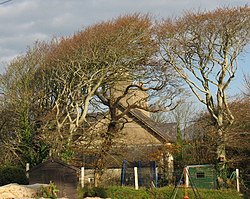
Ty'r Ysgol

Botwnnog is located in Gwynedd
Botwnnog

Botwnnog

Location within Gwynedd

Area34.27 km2 (13.23 sq mi)
Population996 (2011)[1]
• Density29/km2 (75/sq mi)
OS grid referenceSH260311
Community
  • Botwnnog
Principal area
Preserved county
CountryWales
Sovereign stateUnited Kingdom
Post townPWLLHELI
Postcode districtLL53
Dialling code01758
PoliceNorth Wales
FireNorth Wales
AmbulanceWelsh
UK Parliament
Senedd Cymru – Welsh Parliament
List of places
UK
Wales
Gwynedd
52°50′56N 4°35′02W / 52.849°N 4.584°W / 52.849; -4.584

Botwnnog is a village and communityinGwyneddinWales, located on the Llŷn Peninsula 6 km (4 mi) west-north-west of Abersoch. It is in the historic countyofCaernarfonshire. It had a population of 955 in 2001,[2] increasing to 996 at the 2011 Census. The community covers around 34 square kilometres (13.2 sq mi).[3]

St Beuno's Church, Botwnnog

It lies between Mynytho and Sarn Meyllteyrn (which is in the community), has two schools and a doctors' surgery, Meddygfa Rhydbach.[4]

The artist Moses Griffith (1749–1819) was born in Botwnnog and attended Ysgol Botwnnog. His watercolour Bottwnog church & free school is in the collection of the National Library of Wales.[5][6] Welsh band Cowbois Rhos Botwnnog come from the small settlement of Rhos Botwnnog.[7]

The community also includes the hamlets of Bryncroes and Llandegwning.

Education

[edit]

A Welsh-language playgroup Cylch Meithrin Pont Y Gof currently serves the community with the support of Mudiad Meithrin.[8]

Ysgol Gynradd Pont Y Gof provides Welsh-medium primary education to the village and the surrounding villages of Sarn Mellteyrn, Llaniestyn and Garn Fadryn. As of 2024, there were 89 pupils enrolled at the school.[9] 77.5 per cent of pupils come from Welsh-speaking homes in 2024.[10]

Ysgol Botwnnog, a bilingual comprehensive school for pupils aged 11 to 16, is also situated in the village.

As of 2024, there are 474 pupils enrolled at the school.[11] According to the latest Estyn inspection report in 2019, three quarters of pupils come from Welsh-speaking homes. 98 per cent of pupils are fluent in Welsh, and Welsh is the main medium of teaching.[12]

Originally, Ysgol Botwnnog was a grammar school founded in 1616 by Henry Rowlands, Bishop of Bangor.[13]

References

[edit]
  1. ^ "Community/Ward population 2011". Retrieved 14 May 2015.
  • ^ Office for National Statistics : Neighbourhood Statistics : Census 2001 : Parish Headcounts : Gwynedd Archived 22 September 2010 at the Wayback Machine
  • ^ "Custom report - Nomis - Official Labour Market Statistics".
  • ^ "Meddygfa Rhydbach".
  • ^ Ellis, Megan (1959). "Moses Griffith". Dictionary of Welsh Biography. National Library of Wales.
  • ^ "Botwnnog Church and Free School". National Library of Wales.
  • ^ Hughes, Ian (17 September 2010) "Music profile: Cowbois Rhos Botwnnog", Daily Post (North Wales). Retrieved 5 October 2017.
  • ^ "PONT Y GOF". Meithrin. Retrieved 1 June 2024.
  • ^ "Ysgol Pont Y Gof". mylocalschool.gov.wales. Retrieved 1 June 2024.
  • ^ "Ysgol Pont Y Gof | Estyn". www.estyn.gov.wales. Retrieved 1 June 2024.
  • ^ "Ysgol Botwnnog". mylocalschool.gov.wales. Retrieved 1 June 2024.
  • ^ "Ysgol Botwnnog | Estyn". www.estyn.gov.wales. Retrieved 1 June 2024.
  • ^ Schools Inquiry Commission (1868). Report of the Commissioners. G .E. Eyre and W. Spottiswoode. p. Appendix 60. Retrieved 30 June 2012.
  • [edit]


  • t
  • e

  • Retrieved from "https://en.wikipedia.org/w/index.php?title=Botwnnog&oldid=1226709538"

    Categories: 
    Botwnnog
    Gwynedd geography stubs
    Hidden categories: 
    Pages using gadget WikiMiniAtlas
    Webarchive template wayback links
    Use dmy dates from March 2015
    Use British English from March 2015
    Articles with short description
    Short description is different from Wikidata
    Articles with OS grid coordinates
    Coordinates on Wikidata
    Commons category link from Wikidata
    All stub articles


    This page was last edited on 1 June 2024, at 10:27 (UTC).

    Text is available under the Creative Commons Attribution-ShareAlike License 4.0; additional terms may apply. By using this site, you agree to the Terms of Use and Privacy Policy. Wikipedia® is a registered trademark of the Wikimedia Foundation, Inc., a non-profit organization.


    Privacy policy

    About Wikipedia

    Disclaimers

    Contact Wikipedia

    Code of Conduct

    Developers

    Statistics

    Cookie statement

    Mobile view


    Wikimedia Foundation
    Powered by MediaWiki