Jump to content


Main menu


Navigation  


Main page
Contents
Current events
Random article
About Wikipedia
Contact us
Donate


Contribute  


Help
Learn to edit
Community portal
Recent changes
Upload file


Search  


Create account

Log in


Create account
 Log in


Pages for logged out editors learn more  


Contributions
Talk


Contents


(Top)


1 Governance  


2 References  


Dolbenmaen


 / Bân-lâm-gú
Brezhoneg
Cebuano
Cymraeg
Deutsch
Euskara
Français
Gaeilge
Gàidhlig
Galego
Italiano
Kernowek
Svenska
 

Edit links


Article
Talk


Read
Edit
View history


Tools


Actions  


Read
Edit
View history


General  


What links here
Related changes
Upload file
Special pages
Permanent link
Page information
Cite this page
Get shortened URL
Download QR code
Wikidata item


Print/export  


Download as PDF
Printable version


In other projects  


Wikimedia Commons


Appearance


Coordinates: 52°5750N 4°1326W / 52.964°N 4.224°W / 52.964; -4.224
 

From Wikipedia, the free encyclopedia


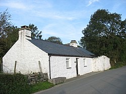
Dolbenmaen

Min y Ddol

Dolbenmaen is located in Gwynedd
Dolbenmaen

Dolbenmaen

Location within Gwynedd

Area96.40 km2 (37.22 sq mi)
Population1,343 (2011)
• Density14/km2 (36/sq mi)
OS grid referenceSH506430
Community
  • Dolbenmaen
Principal area
Preserved county
CountryWales
Sovereign stateUnited Kingdom
Post townCRICCIETH
Postcode districtLL49
Post townPORTHMADOG
Postcode districtLL51
Post townGARNDOLBENMAEN
Postcode districtLL52
Dialling code01766
PoliceNorth Wales
FireNorth Wales
AmbulanceWelsh
UK Parliament
Senedd Cymru – Welsh Parliament
List of places
UK
Wales
Gwynedd
52°57′50N 4°13′26W / 52.964°N 4.224°W / 52.964; -4.224

Dolbenmaen (Welsh pronunciation) is a village and community in the Welsh county of Gwynedd, located in Eifionydd, of which it was the administrative centre until 1239.[1] The community includes the villages of Bryncir (Welsh pronunciation), Cenin, Garndolbenmaen, (the largest settlement) Golan, Llanfihangel-y-Pennant, Penmorfa (Welsh pronunciation), Pentrefelin, Wern, Glan-dwyfach, and the hamlet of Prenteg. It has a population of 1,300,[2] increasing slightly to 1,343 at the 2011 Census.[3] The summit of Moel Hebog is shared between Beddgelert and Dolbenmaen. It is a sparsely populated area and covers nearly 100 square kilometres.[4]

St Mary's church

A castle motte is located to the south of the village which is thought to have been the residence of Llywelyn the Great until the 1230s, when the court moved to a new castle at Criccieth. The castle guarded a ford on the Afon Dwyfor which may have been on the Pen Llystyn (Tremadog) to Segontium Roman road.[5] The parish church of St Mary's is a grade II* listed building.[6] South of Pentrefelin is St Cynhaearn's Church, Ynyscynhaearn.

Governance

[edit]

Anelectoral ward of the same name exists. The extent of this ward differs slightly to the Community and the total population of the ward taken at the 2011 Census was 1,212.[7]

References

[edit]
  1. ^ Criccieth Visitors' Map and Brief History, 2002, Cymdeithas Hanes Eifionydd Archived 29 May 2014 at the Wayback Machine, Wales
  • ^ Office for National Statistics : Census 2001 : Parish Headcounts : Gwynedd Archived 22 September 2010 at the Wayback Machine Retrieved 13 January 2010
  • ^ "Community population 2011". Retrieved 15 May 2015.
  • ^ "Custom report - Nomis - Official Labour Market Statistics".
  • ^ "DOLBENMAEN CASTLE MOUND | Coflein". www.coflein.gov.uk. Retrieved 23 August 2018.
  • ^ "Parish Church of St Mary, Dolbenmaen". British Listed Buildings. Retrieved 16 December 2013.
  • ^ "Ward population 2011". Retrieved 15 May 2015.
  • t
  • e

  • Retrieved from "https://en.wikipedia.org/w/index.php?title=Dolbenmaen&oldid=1188544453"

    Categories: 
    Dolbenmaen
    Gwynedd geography stubs
    Hidden categories: 
    Pages using gadget WikiMiniAtlas
    Pages using the Phonos extension
    Webarchive template wayback links
    Use dmy dates from March 2015
    Use British English from March 2015
    Articles with short description
    Short description is different from Wikidata
    Articles with OS grid coordinates
    Coordinates on Wikidata
    Pages including recorded pronunciations
    Commons category link from Wikidata
    Articles containing Welsh-language text
    All stub articles


    This page was last edited on 6 December 2023, at 02:31 (UTC).

    Text is available under the Creative Commons Attribution-ShareAlike License 4.0; additional terms may apply. By using this site, you agree to the Terms of Use and Privacy Policy. Wikipedia® is a registered trademark of the Wikimedia Foundation, Inc., a non-profit organization.


    Privacy policy

    About Wikipedia

    Disclaimers

    Contact Wikipedia

    Code of Conduct

    Developers

    Statistics

    Cookie statement

    Mobile view


    Wikimedia Foundation
    Powered by MediaWiki