
Maralbexi County
Maralbexi County
Bachu; Maralbashi; Maralbeshi; Pachu | |
|---|---|
 | |
 Location of the county (red) within Kashgar Prefecture (yellow) and Xinjiang | |
 Maralbexi Location of the seat in Xinjiang  Maralbexi Maralbexi (Xinjiang)  Maralbexi Maralbexi (China) | |
| Coordinates: 39°46′43″N 78°34′30″E / 39.77861°N 78.57500°E | |
| Country | China |
| Autonomous region | Xinjiang |
| Prefecture | Kashgar |
| County seat | Maralbeshi |
| Area | |
| • Total | 18,490.59 km2 (7,139.26 sq mi) |
| Population (2020)[2] | |
| • Total | 366,141 |
| • Density | 20/km2 (51/sq mi) |
| Ethnic groups | |
| • Major ethnic groups | Uyghur[3][4] |
| Time zone | UTC+8 (China Standard[a]) |
| Postal code | 843800 |
| Website | bachu |
| Maralbexi County | |||||||||||
|---|---|---|---|---|---|---|---|---|---|---|---|
| Uyghur name | |||||||||||
| Uyghur | مارالبېشى ناھىيىسى | ||||||||||
| |||||||||||
| Chinese name | |||||||||||
| Traditional Chinese | 巴楚縣 | ||||||||||
| Simplified Chinese | 巴楚县 | ||||||||||
| |||||||||||
| Alternative Chinese name | |||||||||||
| Traditional Chinese | 巴爾楚克縣 | ||||||||||
| Simplified Chinese | 巴尔楚克县 | ||||||||||
| |||||||||||
| Second alternative Chinese name | |||||||||||
| Traditional Chinese | 瑪熱勒巴什縣 | ||||||||||
| Simplified Chinese | 玛热勒巴什县 | ||||||||||
| |||||||||||
Maralbexi County[5][6] (Maralbeshi,[7] Maralbishi,[8][9][10] transliterated from Uyghur: مارالبېشى ناھىيىسى; Chinese: 玛热勒巴什县), Bachu County (Chinese: 巴楚县), and Chinese: 巴尔楚克县) the former long Chinese name as well, is located in the southwest of the Xinjiang Uyghur Autonomous Region, China. The county is under the administration of the Kashgar Prefecture. It has an area of 18,491 km2 (7,139 sq mi), and surrounds, but does not administer, the sub-prefecture-level city of Tumxuk. According to the 2002 census, it has a population of 380,000.
History
[edit]In 1913, Maralbexi County was established.[1][11]
In September 1937, two regiments of Soviet Kirghiz troops and one regiment of Russian troops equipped with forty airplanes and twenty tanks entered Sinkiang from Atushe and attacked Maralbexi, dividing Ma Hushan's 36th Corps into two sections.[12]
In February 2002, a 6.7 magnitude earthquake killed 267 people in Maralbexi County and Payzawat County.[13]
On February 24, 2003, the 2003 Bachu earthquake occurred.
In April 2013, twenty-one died in an incident in Seriqbuya.[14][15]
In October 2014, twenty-two died in an incident at a farmer's market in the county.[16]
According to her husband, in May-June 2017, Mailikemu Maimati / Malika Mamiti, in her 30s, native of the county and wife of businessman Mirza Imran Baig of Pakistan, in his 40s, was detained in the county's re-education camp. After her release, she and their young son were not given their passports by Chinese authorities.[17][18]
Administrative divisions
[edit]Maralbexi County includes 4 towns (بازىرى / 镇), 8 townships (يېزىسى / 乡):[1][3][19][20][21]
| Name | Simplified Chinese | Hanyu Pinyin | Uyghur (UEY) | Uyghur Latin (ULY) | Administrative division code | |
|---|---|---|---|---|---|---|
| Towns | ||||||
| Maralbeshi Town (Bachu Town) |
巴楚镇 | Bāchǔ Zhèn | مارالبېشى بازىرى | maralbëshi baziri | 653130100 | |
| Seriqbuya Town (Selibuya Town) |
色力布亚镇 | Sèlìbùyǎ Zhèn | سېرىقبۇيا بازىرى | sëriqbuya baziri | 653130101 | |
| Awat Town (Awati Town) |
阿瓦提镇 | Āwǎtí Zhèn | ئاۋات بازىرى | Awat baziri | 653130102 | |
| Achal Town (Sanchakou Town) |
三岔口镇 | Sānchàkǒu Zhèn | ئاچال بازىرى | Achal baziri | 653130104 | |
| Townships | ||||||
| Charbagh Township (Qia'erbage Township) |
恰尔巴格乡 | Qià'ěrbāgé Xiāng | چارباغ يېزىسى | charbagh yëzisi | 653130200 | |
| Doletbagh Township (Duolaitibage Township) |
多来提巴格乡 | Duōláitíbāgé Xiāng | دۆلەتباغ يېزىسى | döletbagh yëzisi | 653130201 | |
| Anarkol Township (Anakule Township) |
阿纳库勒乡 | Ānàkùlè Xiāng | ئاناركۆل يېزىسى | Anarköl yëzisi | 653130202 | |
| Shamal Township (Xiamale Township) |
夏玛勒乡 | Xiàmǎlè Xiāng | شامال يېزىسى | shamal yëzisi | 653130203 | |
| Aqsaqmaral Township (Akesakemarele Township) |
阿克萨克玛热勒乡 | Ākèsàkèmǎrèlè Xiāng | ئاقساقمارال يېزىسى | Aqsaqmaral yëzisi | 653130204 | |
| Alaghir Township (Alagen Township) |
阿拉根乡 | Ālāgēn Xiāng | ئالاغىر يېزىسى | Alaghir yëzisi | 653130205 | |
| Chongqurchaq Township (Qiongkuqiake Township) |
琼库恰克乡 | Qióngkùqiàkè Xiāng | چوڭقۇرچاق يېزىسى | chongqurchaq yëzisi | 653130206 | |
| Yëngi'östeng Township (Yingwusitang Township) |
英吾斯坦乡 | Yīngwúsītǎn Xiāng | يېڭىئۆستەڭ يېزىسى | yëngi'östeng yëzisi | 653130207 | |
Transportation
[edit]Bachu is served by the Southern Xinjiang Railway and G3012 Turpan–Hotan Expressway.
Economy
[edit]Agricultural products include corn, cotton, wheat and others as well as sword-leaf dogbane. The central and eastern parts of the county have old desert poplar forests. Animal herding is prominent and rock salt and phosphate fertilizer are produced in the county. Industries include food processing, plastics, rug making, electricity and construction.[11]
As of 1885[update], there was about 30,600 acres (202,728 mu) of cultivated land in Maralbexi.[22]
Demographics
[edit]| Year | Pop. | ±% p.a. |
|---|---|---|
| 2000 | 375,883 | — |
| 2010 | 336,274 | −1.11% |
| [1] | ||
As of 2015, 363,488 of the 382,186 residents of the county were Uyghur, 17,816 were Han Chinese and 882 were from other ethnic groups.[23]
As of 2019[update], the population of Maralbexi County was 95.13% Uyghur.[3]
As of 1999, 83.12% of the population of Maralbexi (Bachu) County was Uyghur and 16.41% of the population was Han Chinese.[24]
Geography
[edit]Climate
[edit]| Climate data for Maralbexi, elevation 1,117 m (3,665 ft), (1991–2020 normals, extremes 1971–2000) | |||||||||||||
|---|---|---|---|---|---|---|---|---|---|---|---|---|---|
| Month | Jan | Feb | Mar | Apr | May | Jun | Jul | Aug | Sep | Oct | Nov | Dec | Year |
| Record high °C (°F) | 17.7 (63.9) |
20.6 (69.1) |
27.4 (81.3) |
35.4 (95.7) |
37.7 (99.9) |
40.0 (104.0) |
41.5 (106.7) |
42.6 (108.7) |
36.3 (97.3) |
30.0 (86.0) |
23.7 (74.7) |
16.3 (61.3) |
42.6 (108.7) |
| Mean daily maximum °C (°F) | 0.4 (32.7) |
6.9 (44.4) |
16.2 (61.2) |
24.4 (75.9) |
29.0 (84.2) |
32.5 (90.5) |
33.9 (93.0) |
32.4 (90.3) |
28.1 (82.6) |
21.3 (70.3) |
11.6 (52.9) |
2.4 (36.3) |
19.9 (67.9) |
| Daily mean °C (°F) | −6.2 (20.8) |
0.1 (32.2) |
9.3 (48.7) |
17.2 (63.0) |
21.6 (70.9) |
24.9 (76.8) |
26.3 (79.3) |
25.1 (77.2) |
20.5 (68.9) |
12.7 (54.9) |
3.6 (38.5) |
−4.0 (24.8) |
12.6 (54.7) |
| Mean daily minimum °C (°F) | −11.5 (11.3) |
−6.0 (21.2) |
2.9 (37.2) |
10.1 (50.2) |
14.7 (58.5) |
18.1 (64.6) |
19.7 (67.5) |
18.8 (65.8) |
13.8 (56.8) |
5.7 (42.3) |
−2.6 (27.3) |
−8.9 (16.0) |
6.2 (43.2) |
| Record low °C (°F) | −21.5 (−6.7) |
−18.9 (−2.0) |
−9.1 (15.6) |
−2.5 (27.5) |
3.0 (37.4) |
6.6 (43.9) |
11.7 (53.1) |
10.3 (50.5) |
4.3 (39.7) |
−3.7 (25.3) |
−13.2 (8.2) |
−22.5 (−8.5) |
−22.5 (−8.5) |
| Average precipitation mm (inches) | 0.8 (0.03) |
1.2 (0.05) |
2.4 (0.09) |
3.4 (0.13) |
9.7 (0.38) |
12.9 (0.51) |
19.4 (0.76) |
12.6 (0.50) |
8.0 (0.31) |
2.4 (0.09) |
0.8 (0.03) |
1.1 (0.04) |
74.7 (2.92) |
| Average precipitation days (≥ 0.1 mm) | 1.5 | 1.2 | 0.8 | 1.3 | 3.2 | 5.0 | 6.6 | 5.0 | 2.7 | 1.0 | 0.4 | 1.4 | 30.1 |
| Average snowy days | 5.0 | 2.2 | 0.3 | 0 | 0 | 0 | 0 | 0 | 0 | 0 | 0.7 | 4.5 | 12.7 |
| Average relative humidity (%) | 64 | 53 | 38 | 31 | 35 | 39 | 44 | 48 | 49 | 50 | 55 | 67 | 48 |
| Mean monthly sunshine hours | 161.3 | 169.6 | 183.3 | 214.9 | 265.6 | 293.7 | 300.1 | 277.8 | 253.0 | 249.7 | 200.0 | 155.6 | 2,724.6 |
| Percent possible sunshine | 53 | 55 | 49 | 53 | 59 | 66 | 67 | 67 | 69 | 74 | 68 | 54 | 61 |
| Source 1: China Meteorological Administration[25][26] | |||||||||||||
| Source 2: Weather China[27] | |||||||||||||
Notable persons
[edit]Historical maps
[edit]Historical English-language maps including Maralbexi:
-
![Map including Maralbexi (labeled as PA-CH'U (MARAL BASHI)) (USATC, 1971)[b]](//upload.wikimedia.org/wikipedia/commons/thumb/0/00/Txu-oclc-6654394-nj-44-3rd-ed.jpg/220px-Txu-oclc-6654394-nj-44-3rd-ed.jpg)
-
 Map including Maralbexi (labeled as PA-CH'U (MARAL BASHI)) (ATC, 1971)
 -
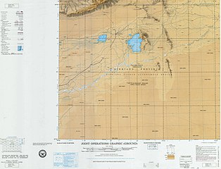
![From the Operational Navigation Chart; map including Maralbexi (labeled as BACHU (PA-CH'U)) (DMA, 1980)[c]](//upload.wikimedia.org/wikipedia/commons/thumb/f/fb/Operational_Navigation_Chart_G-7%2C_6th_edition.jpg/331px-Operational_Navigation_Chart_G-7%2C_6th_edition.jpg)
-
![Map including Maralbexi (labeled as BACHU (PA-CH'U)) (DMA, 1984)[d]](//upload.wikimedia.org/wikipedia/commons/thumb/a/a1/Txu-pclmaps-oclc-22834566_g-7a.jpg/335px-Txu-pclmaps-oclc-22834566_g-7a.jpg)
![Map including Maralbexi (labeled as PA-CH'U (MARAL BASHI)) (USATC, 1971)[b]](http://en.wikipedia.org/wiki/File:Txu-oclc-6654394-nj-44-3rd-ed.jpg)

![From the Operational Navigation Chart; map including Maralbexi (labeled as BACHU (PA-CH'U)) (DMA, 1980)[c]](http://en.wikipedia.org/wiki/File:Operational_Navigation_Chart_G-7%2C_6th_edition.jpg)
![Map including Maralbexi (labeled as BACHU (PA-CH'U)) (DMA, 1984)[d]](http://en.wikipedia.org/wiki/File:Txu-pclmaps-oclc-22834566_g-7a.jpg)
See also
[edit]Notes
[edit]- ^ Locals in Xinjiang frequently observe UTC+6 (Xinjiang Time), 2 hours behind Beijing.
- ^ From map: "DELINEATION OF INTERNATIONAL BOUNDARIES MUST NOT BE CONSIDERED AUTHORITATIVE".
- ^ From map: "The representation of international boundaries is not necessarily authoritative."
- ^ From map: "The representation of international boundaries is not necessarily authoritative"
References
[edit]2000年第五次人口普查,巴楚县常住总人口3
75883人,{...}2003年,巴楚县总面积18490.5
9平方千米,{...}2010年第六次人口普查,巴楚县常住总人
口336274人,其中‥巴楚镇47704人,色力布亚镇4464
2人,阿瓦提镇22232人,三岔口镇737人,恰尔巴格乡278
16人,多来提巴格乡28158人,阿纳库勒乡26408人,夏马
勒乡10174人,阿克萨克玛热勒乡30858人,阿拉根乡294
12人,琼库恰克乡37197人,英吾斯坦乡24480人,兵团四
十八团6456人。(二)^ Xinjiang: Prefectures, Cities, Districts and Counties (三)^ abc巴楚县概况. 巴楚县人民政府网 (in Simplified Chinese). 8 December 2019. Retrieved 25 February 2020.
巴楚
县辖8乡4镇1个良种繁育场,229个村︵社区︶,总人口38.5
1万人,其中农村户籍人口29.91万人,有汉族、维吾尔族、回族、
哈萨克族等31个民族,维吾尔族占95.13%。(四)^ 1997年巴楚县行政区划 [1997 Maralbexi County Administrative Divisions]. XZQH.org. 18 January 2011. Retrieved 4 April 2020.
喀什地区辖县。位
于喀什地区东部。面积21741.8平方千米,人口33.1万,有
维吾尔、汉、 回等民族,其中维吾尔族占83.03%,汉族占16.
4%,辖4镇8乡。(五)^ Zhang Dongmiao, ed. (5 March 2017). "Xinjiang finishes first round of universal health checks". Xinhua News Agency. Retrieved 23 February 2020.
Thanks to
the first universal health che
ck in northwest China's Xinjian
g Uygur Autonomous Region, Mtai
lipu Rosuli, 65, a Uygur man in
Bachu (Maralbexi) County, had
his first health examination of
his life.(六)^ Ben Blanchard (30 April 2013). Stephen Coates (ed.). "China says detains 19, seizes weapons after Xinjiang unrest". Reuters. Retrieved 23 February 2020.
Th
e government has labeled the vi
olence in Kashgar's Maralbexi c
ounty as a "terrorist attack",
though the exiled World Uyghur
Congress has said the shooting
and killing of a young Uighur b
y "Chinese armed personnel" pro
mpted the Uighurs to retaliate.(七)^ Joshua Lipes (22 November 2019). "Xinjiang Authorities Undermine Muslim Abstention From Pork in Bid to Assimilate Uyghurs". Radio Free Asia. Translated by Elise Anderson. Retrieved 23 February 2020.
In October 2018,
a photo was posted online by th
e government of Kashgar (in Chi
nese, Kashi) prefecture's Maral
beshi (Bachu) county, which por
trayed a Uyghur village head ea
ting a piece of pork and callin
g on other Uyghurs to join him.
The photo was taken down short
ly after publishing.
RFA recently spoke with a villa
ge head in Maralbeshi who confi
rmed that the photo was real, a
nd that local authorities are t
eaching people to eat pork as w
ell.(八)^ "Kashgar Tourism". Archived from the original on 22 August 2012. Retrieved 6 April 2020 – via Internet Archive.
Maralbishi
County(九)^ Ministry of Housing and Urban-Rural Development (2010). 建筑抗震设计规范 [GB50011-2010: Code for Seismic Design of Buildings] (in English and Simplified Chinese). Beijing: China Architecture & Building Press. p. 203 – via Google Books.
Marabishi [sic] Cou
nty(十)^ "Project Beauty Unveils China's Ugly Side". Newsweek Pakistan. 25 November 2013. Retrieved 7 April 2020.
But they also arg
ue that some officials' aggress
ive approach sparked resentment
and violence, including an Apr
il attack by Uighurs on police
in Maralbishi outside Kashgar t
hat left 21 people dead. Beijin
g blamed "terrorists" who "regu
larly watched video clips advoc
ating religious extremism."(11)^ ab夏征农; 陈至立, eds. (September 2009). 辞海‥第六版彩图本 [Cihai (Sixth Edition in Color)] (in Chinese). Shanghai: Shanghai Lexicographical Publishing House. p. 58. ISBN 978-7-5326-2859-9. (12)^ Arthur C. Hasiotis Jr. (1987). Soviet Political, Economic, and Military Involvement in Sinkiang from 1928 to 1949. Garland Publishing. pp. 102-103. ISBN 0-8240-8055-6. (13)^ Nabijan Tursun (2007). Uyghur Reader. Dunwoody Press. p. 141. ISBN 978-1-931546-42-3. (14)^ Luisetta Mudie; Parameswaran Ponnudurai (24 April 2013). "Xinjiang Violence Leaves 21 Dead". Radio Free Asia. Retrieved 25 February 2020. (15)^ "Overview of the Maralbeshi Incident on 23 April 2013" (PDF). World Uyghur Congress. May 2013. Archived from the original (PDF) on 23 August 2016. (16)^ Shohret Hoshur; Parameswaran Ponnudurai (18 October 2014). "22 Killed in Farmers' Market Attack in Xinjiang's Kashgar Prefecture". Radio Free Asia. Translated by Shohret Hoshur. Retrieved 25 February 2020. (17)^ Christian Shepherd; Philip Wen (25 September 2018). "'China's big mistake': Pakistanis lobby to free wives trapped in Xinjiang". Reuters. Retrieved 7 April 2020.
Mirza Imran Baig, 40,
who trades between his home cit
y of Lahore and Urumqui, the Xi
njiang regional capital, said h
is wife was detained in a "re-e
ducation" camp in her native Ba
chu county for two months in Ma
y and June 2017 and had been un
able to leave her hometown sinc
e her release.(18)^ Linette Lopez (15 December 2019). "China's next gambit to save its economy will export dystopia worldwide". Business Insider. Retrieved 7 April 2020.
Pak
istani businessman Mirza Imran
Baig shows a picture with his U
ighur wife, Malika Mamiti, outs
ide the Pakistani embassy in Be
ijing. Mamiti, was sent to a po
litical-indoctrination camp aft
er returning to China's far wes
t Xinjiang region in May 2017,
Baig said. Scores of Pakistani
men whose Muslim Uighur wives h
ave disappeared into internment
camps in China feel helpless,
fighting a wall of silence as t
hey struggle to reunite their f
amilies.(19)^ 2018年统计用区划代码和城乡划分代码‥巴楚县 (in Simplified Chinese). National Bureau of Statistics of the People's Republic of China. 2018. Retrieved 23 February 2020.
统计用区划
代码 名称 653130100000 巴楚镇 65313010
1000 色力布亚镇 653130102000 阿瓦提镇 65
3130103000 三岔口镇 653130200000 恰尔
巴格乡 653130201000 多来提巴格乡 6531302
02000 阿纳库勒乡 653130203000 夏马勒乡 6
53130204000 阿克萨克玛热勒乡 6531302050
00 阿拉根乡 653130206000 琼库恰克乡 6531
30207000 英吾斯坦乡 653130508000 兵团四
十八团(20)^ 行政区划. 巴楚县人民政府网 (in Simplified Chinese). 24 December 2019. Retrieved 23 February 2020.
巴楚县辖4
个镇、8个乡‥巴楚镇、色力布亚镇、阿瓦提镇、三岔口镇、恰尔巴格
乡、多来提巴格乡、阿纳库勒乡、夏马勒乡、阿克萨克马热勒乡、阿拉
格尔乡、琼库尔恰克乡、英吾斯塘乡。(21)^ Xie Yuzhong 解玉忠 (2003). 地名中的新疆 (in Simplified Chinese). Ürümqi: 新疆人民出版社. pp. 230–233. ISBN 7-228-08004-1. (22)^ Herold J. Wiens (November 1966). "Cultivation Development and Expansion in China's Colonial Realm in Central Asia". The Journal of Asian Studies. 26(1): 75. doi:10.2307/2051832. JSTOR 2051832. S2CID 162339064. (23)^ 3-7 各地、州、市、县(市)分民族人口数 (in Simplified Chinese). Statistic Bureau of Xinjiang Uygur Autonomous Region. 15 March 2017. Archived from the original on 11 October 2017. Retrieved 3 September 2017. (24)^ Morris Rossabi, ed. (2004). Governing China's Multiethnic Frontiers (PDF). University of Washington Press. p. 179. ISBN 0-295-98390-6. (25)^ 中国气象数据网 – WeatherBk Data (in Simplified Chinese). China Meteorological Administration. Retrieved 10 October 2023. (26)^ 中国气象数据网 (in Simplified Chinese). China Meteorological Administration. Retrieved 10 October 2023. (27)^ 巴楚城市介绍以及气候背景分析. Weather China (in Chinese). 中国气象局公共气象服务中心. Retrieved 29 November 2022.
External links
[edit]- Introduction to Maralbishi County, official website of Kashgar Prefecture government.