
フランクリン郡 (バーモント州)
| バーモント州フランクリン郡 | |
|---|---|
 郡のバーモント州内の位置
| |
 州のアメリカ合衆国内の位置
| |
| 設立 | 1777年1月15日(ニューヨーク州シャーロット郡から) |
| 郡庁所在地 | セントオールバンズ |
| 最大の都市 | セントオールバンズ |
| 面積 - 総面積 - 陸 - 水 |
1,792 km2 (692 mi2) 1,650 km2 (637 mi2) 142 km2 (55 mi2), 7.94% |
| 人口 - (2020年) - 密度 |
49,946人 |
| 標準時 | 東部: UTC-5/-4 |
フランクリン郡︵英: Franklin County︶は、アメリカ合衆国バーモント州北部の郡である。北はカナダ=アメリカ合衆国国境であり、ケベック州と接している。人口は4万9946人︵2020年︶[1] 。郡庁所在地はセントオールバンズであり、同郡で人口最大の都市である。
フランクリン郡はバーリントン都市圏に属している。
歴史[編集]
フランクリン郡は、1777年1月15日に、バーモントがニューヨークとは異なる国であることを宣言したとき、ニューヨークから割譲された土地に設立された数郡の1つである[2][3][4]。この領域はマサチューセッツ、ニューハンプシャー、およびニューネーデルラントが領有を争っていたが、1764年7月20日、イギリス王ジョージ3世が、ニューハンプシャーとニューヨークの境界をコネチカット川の西岸に定め、南はマサチューセッツとの州境、北は北緯45度線に設定した。ニューヨークはオールバニ郡にその土地を割り当てた[5][6]。1772年3月12日、オールバニ郡が分割されて、この地域はシャーロット郡となり[7]、この状態はバーモントがニューヨークとイギリスから独立するまで続いたが、それで競合は終わらなかった。 1783年9月3日、パリ条約が調印された結果としてアメリカ独立戦争が終わり、イギリスはアメリカ合衆国の独立を認めた。バーモントとカナダのケベック州との国境は北緯45度線とされた[8][9]。 2008年6月14日から17日に激しい嵐と洪水に襲われ、連邦政府はフランクリン郡周辺を災害地域に指定した[10]。地理[編集]
アメリカ合衆国国勢調査局に拠れば、郡域全面積は692平方マイル (1,792.3 km2)であり、このうち陸地637平方マイル (1,649.8 km2)、水域は55平方マイル (142.4 km2)で水域率は7.94%である[11]。隣接する郡[編集]

|
カナダ・ケベック州ブロム・ミシスクワ郡 |
| ||
| グランドアイル郡 | オーリンズ郡 | |||
| チッテンデン郡 | ラモイル郡 |
国立保護地域[編集]
- ミシスコイ国立野生生物保護区
人口動態[編集]
| 人口推移 | |||
|---|---|---|---|
| 年 | 人口 | %± | |
| 1800 | 8,282 | — | |
| 1810 | 16,615 | 100.6% | |
| 1820 | 17,192 | 3.5% | |
| 1830 | 24,525 | 42.7% | |
| 1840 | 24,531 | 0.0% | |
| 1850 | 28,586 | 16.5% | |
| 1860 | 27,231 | −4.7% | |
| 1870 | 30,291 | 11.2% | |
| 1880 | 30,225 | −0.2% | |
| 1890 | 29,755 | −1.6% | |
| 1900 | 30,198 | 1.5% | |
| 1910 | 29,866 | −1.1% | |
| 1920 | 30,026 | 0.5% | |
| 1930 | 29,975 | −0.2% | |
| 1940 | 29,601 | −1.2% | |
| 1950 | 29,894 | 1.0% | |
| 1960 | 29,474 | −1.4% | |
| 1970 | 31,282 | 6.1% | |
| 1980 | 34,788 | 11.2% | |
| 1990 | 39,980 | 14.9% | |
| 2000 | 45,417 | 13.6% | |
| 2010 | 47,746 | 5.1% | |
| 2020 | 49,946 | 4.6% | |
| [12][13][14] | |||
以下は2000年の国勢調査による人口統計データである。
|
基礎データ
人種別人口構成
先祖による構成
言語による構成 |
年齢別人口構成
世帯と家族(対世帯数)
|
収入[編集]収入と家計 |
2000年の報告[15]によれば、郡内で信徒数の多い宗教会派は、カトリック、メインラインプロテスタント、東方正教会である。カトリックの信徒数は 16,280人、ユナイテッド・メソジスト教会が 2,674 人と続き、ギリシャ正教バシルプリス大教区は 1,720 人だった。
政治[編集]
| 年 | 民主党 | 共和党 |
|---|---|---|
| 2012年 | 60.6% 12,057 | 37.2% 7,405 |
| 2008年 | 61.4% 13,179 | 36.6% 7,853 |
| 2004年 | 53.2% 10,598 | 44.9% 8,936 |
| 2000年 | 49.6% 9,514 | 43.7% 8,395 |
経済[編集]
2009年、州内1,078の酪農家の内、郡内には239軒があり、最も多い郡だった[17]。
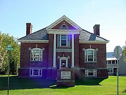
フランクリン図書館

都市と町[編集]
●ベイカーズフィールド町 ●バークシャー町 ●イーノスバーグ町 ●イーノスバーグ村* ●フェアファックス町 ●フェアフィールド町 ●フレッチャー町 ●フランクリン町 ●ジョージア町 ●ハイゲイト町 ●モンゴメリー町 ●リッチフォード町 ●シェルドン町 ●セントオールバンズ市 - 郡庁所在地 ●セントオールバンズ町 ●スワントン町 ●スワントン村* *村は統計上の区分だが、それが属する町の別の政体ではない脚注[編集]
(一)^ “Quickfacts.census.gov”. 2023年12月20日閲覧。
(二)^ Slade, William, Jr., comp. Vermont State Papers: Being a collection of Records and Documents Connected with the Assumption and Establishment of Government by the People of Vermont, Together with the Journal of the Council of Safety, the First Constitution, the Early Journals of the General Assembly, and the Laws from the Year 1779 to 1786, Inclusive. Middlebury, 1823. P. 70-73.
(三)^ Van Zandt, Franklin K. Boundaries of the United States and the Several States. Geological Survey Professional Paper 909. Washington, DC; Government Printing Office, 1976. The Standard Compilation for its subject. P. 64.
(四)^ Williamson, Chilton. Vermont in Quandary: 1763-1825. Growth of Vermont series, Number 4. Montpelier: Vermont Historical Series, 1949. PP. 82-84; map facing 95, 100-102, 112-113.
(五)^ Slade, William, Jr., comp. Vermont State Papers: Being a collection of Records and Documents Connected with the Assumption and Establishment of Government by the People of Vermont, Together with the Journal of the Council of Safety, the First Constitution, the Early Journals of the General Assembly, and the Laws from the Year 1779 to 1786, Inclusive. Middlebury, 1823. P. 13-19.
(六)^ Van Zandt, Franklin K. Boundaries of the United States and the Several States. Geological Survey Professional Paper 909. Washington, DC; Government Printing Office, 1976. The Standard Compilation for its subject. P. 63.
(七)^ New York Colonial Laws, Chapter 1534; Section 5; Paragraph 321)
(八)^ Van Zandt, Franklin K. Boundaries of the United States and the Several States. Geological Survey Professional Paper 909. Washington, DC; Government Printing Office, 1976. The Standard Compilation for its subject. P. 12.
(九)^ Parry, Clive, ed. Consolidated Treaty Series. 231 Volumes. Dobbs Ferry, New York; Oceana Publications, 1969-1981. Volume 48; pp. 481; 487; 491-492.
(十)^ Sutkoski, Matt (2008-08-01). Summer has been wet one for the ages. Burlington Free Press
(11)^ “Census 2010 U.S. Gazetteer Files: Counties”. United States Census. 2013年4月13日閲覧。
(12)^ http://www.census.gov/population/www/censusdata/cencounts/files/vt190090.txt
(13)^ http://factfinder2.census.gov/faces/tableservices/jsf/pages/productview.xhtml?pid=DEC_10_PL_QTPL&prodType=table
(14)^ http://mapserver.lib.virginia.edu/
(15)^ “County Membership Reports”. thearda.com. 2010年4月25日閲覧。
(16)^ “Dave Leip's Atlas of U.S. Presidential Elections”. 2011年6月11日閲覧。
(17)^ Lefebvre, Paul (2009-02-11). Average Vermont farmer expected to lose $92,000. the Chronicle
外部リンク[編集]
- Franklin County Chamber of Commerce
- National Register of Historic Places listing for Franklin Co., Vermont
座標: 北緯44度52分 西経72度55分 / 北緯44.86度 西経72.91度
| 全般 |
|
|---|---|
| 国立図書館 |
|
| 地理 |
|
| その他 |
|