
ニューハンプシャー州
- ニューハンプシャー州
- State of New Hampshire
-
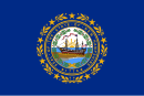
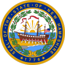
(州旗) (州章) - 州の愛称: 花崗岩の州
The Granite State 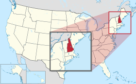
-
州都 コンコード 最大の都市 マンチェスター 州知事 クリス・スヌヌ 公用語 英語 面積
- 総計
- 陸地
- 水域全米第46位
24,217 km²
23,227 km²
989 km² (4.1%)人口(2020年)
- 総計
- 人口密度全米第41位
1,377,529人
59.3人/km²合衆国加入
- 順番
- 加入年月日
9番目
1788年6月21日時間帯 UTC -5
DST -4緯度 北緯42°42' - 45°18' 経度 西経70°36' - 72°33' 東西の幅 110 km 南北の長さ 305 km 標高
-最高標高
-平均標高
-最低標高
1,917 m
300 m
0 m略称 (ISO 3166-2:US) US-NHウェブサイト ニューハンプシャー州政府 上院議員 ジーン・シャヒーン
マギー・ハッサン


ニューハンプシャー州︵ニューハンプシャーしゅう、英: State of New Hampshire、アメリカ: [nuːˈhæmpʃər] ( 音声ファイル)︶は、アメリカ合衆国北東部、ニューイングランド地方に位置する州。州名はイングランド南部のハンプシャーから採られた。南はマサチューセッツ州、西はバーモント州、東はメイン州と大西洋に接し、また北はカナダのケベック州との国境に位置する。アメリカ合衆国50州の中で陸地面積では第46位、人口では第41位である。
1776年1月にイギリスと訣別したイギリス領北アメリカ植民地として最初のものとなり、その6か月後には独立宣言を発して、アメリカ合衆国を構成した13植民地の1つとなった。1788年6月21日、アメリカ合衆国憲法を批准した9番目の州となり、憲法成立に必要な州の数を満たしたことで、憲法が効力を発揮した。ニューハンプシャー州は独自の州憲法を持った州としても最初のものだった。
アメリカ合衆国大統領選挙の予備選挙が最初に行われる州として知られている。州都はコンコード市、人口最大の都市はマンチェスター市である。州のレベルでも地方のレベルでも消費税や所得税が課されていないという特徴がある[注 1]。
州のニックネームは花崗岩の州であり、州内に広範な花崗岩の層と採石場があることから来ている[1]。州のモットーは﹁自由に生きる、もしくは死を︵"Live Free or Die"︶﹂であり、州の標章や自動車のナンバープレートにも表示されている。
ニューハンプシャー州出身の著名人として、アメリカ合衆国建国の父の1人ニコラス・ギルマン、上院議員のダニエル・ウェブスター、独立戦争の英雄ジョン・スターク、新聞編集者のホレス・グリーリー、クリスチャン・サイエンスの創設者メリー・ベーカー・エディ、詩人のロバート・フロスト、宇宙飛行士のアラン・シェパード、作家のダン・ブラウンがいる。フランクリン・ピアース大統領も州の出身者である。
音声ファイル)︶は、アメリカ合衆国北東部、ニューイングランド地方に位置する州。州名はイングランド南部のハンプシャーから採られた。南はマサチューセッツ州、西はバーモント州、東はメイン州と大西洋に接し、また北はカナダのケベック州との国境に位置する。アメリカ合衆国50州の中で陸地面積では第46位、人口では第41位である。
1776年1月にイギリスと訣別したイギリス領北アメリカ植民地として最初のものとなり、その6か月後には独立宣言を発して、アメリカ合衆国を構成した13植民地の1つとなった。1788年6月21日、アメリカ合衆国憲法を批准した9番目の州となり、憲法成立に必要な州の数を満たしたことで、憲法が効力を発揮した。ニューハンプシャー州は独自の州憲法を持った州としても最初のものだった。
アメリカ合衆国大統領選挙の予備選挙が最初に行われる州として知られている。州都はコンコード市、人口最大の都市はマンチェスター市である。州のレベルでも地方のレベルでも消費税や所得税が課されていないという特徴がある[注 1]。
州のニックネームは花崗岩の州であり、州内に広範な花崗岩の層と採石場があることから来ている[1]。州のモットーは﹁自由に生きる、もしくは死を︵"Live Free or Die"︶﹂であり、州の標章や自動車のナンバープレートにも表示されている。
ニューハンプシャー州出身の著名人として、アメリカ合衆国建国の父の1人ニコラス・ギルマン、上院議員のダニエル・ウェブスター、独立戦争の英雄ジョン・スターク、新聞編集者のホレス・グリーリー、クリスチャン・サイエンスの創設者メリー・ベーカー・エディ、詩人のロバート・フロスト、宇宙飛行士のアラン・シェパード、作家のダン・ブラウンがいる。フランクリン・ピアース大統領も州の出身者である。
歴史[編集]
- 主要記事:ニューハンプシャー州の歴史

ニューハンプシャー州となった地域にヨーロッパ人が入ってくる以前、アルゴンキン語族の様々な部族︵アベナキ族、ペナコック族など︶が住んでいた。1600年から1605年にイングランド人やフランス人の探検家が訪れ、1623年にはイングランド人漁師が現在のライ町にあるオディオーンズポイントに入植した。最初の恒久的な開拓地はヒルトンズポイント︵現在のドーバー市︶だった。1631年までにアッパープランテーションが現在のドーバー、ダーラム、ストラサムの町で構成されていた。1679年、このプランテーションが﹁王室領﹂となった。植民地人とワバナキ連邦の間に起きたラル神父戦争はニューハンプシャーの全土で戦われた。
アメリカ独立戦争のとき、ニューハンプシャーはイギリスに反旗を翻した13植民地の1つとなった。戦争が始まるときまでに、ニューハンプシャーは分裂した植民地になっていた。海岸部の経済と社会生活は製材所、造船所、商人の倉庫を中心に回り、村や町の中心ができた。裕福な商人は豪華な家を建て、贅沢品で装飾し、資本を貿易や土地投機に投資した。一方社会の末端では、日雇い労働者、船員、年季奉公者、さらには奴隷まで固定的な階層ができていた。
ニューハンプシャーが唯一戦場になったのは、1774年12月14日のウィリアム・アンド・メアリー砦襲撃だった。ポーツマス港にあったこの砦で反乱者はかなりの量の火薬、小火器、大砲を手に入れた。襲撃の指揮者ジョン・サリバン将軍は﹁火薬、小火器、銃剣、弾薬箱、さらに大砲や弾薬の貯蔵品﹂と表現していた。この襲撃に先立って、前日の12月13日にポール・リビアから地元の愛国者に、砦はボストンから海を渡ってくる部隊で補強されるという警告があった。伝説では、この時の火薬をデメリット少佐が運びバンカーヒルの戦いで使われたとされている。デメリット少佐はニューハンプシャーの愛国者の1人であり、火薬を自分達の家に蓄えておき、革命に使われるよう他所に運んだ。
1944年には州北部のブレトン・ウッズで国際通貨金融会議が開かれ、戦後の国際金融市場の礎となったブレトン・ウッズ協定が締結された。
ニューハンプシャー州はジャクソン流民主主義の地盤だった。1852年の大統領選挙で、州出身のフランクリン・ピアースをホワイトハウスに送った。多くの繊維工場が造られて工業化が進行し、ケベックのフランス系カナダ人やアイルランドからの移民が大挙流入した。州北部では製材業が発展し、山岳部は観光地になった。1960年以降に繊維産業が崩壊したが、経済はハイテク産業とサービス産業を核に再生された。
1952年から大統領選挙の年に一番早く予備選挙を行うようになって、国内国外から注目を集めるようになった。二大政党にとっての重要な試金石になっていった。メディアはアイオワ州と並んでニューハンプシャー州の予備選挙に大きな取扱をするようになり、州の影響力を上げていった。

ニューハンプシャー州の主要な道路と都市

標高5,774 フィート (1,760 m)のアダムズ山、プレジ デンシャル山地にある
ニューハンプシャー州はニューイングランド地域の一部である。北部および北西部でカナダのケベック州、東部でメイン州および大西洋、南部でマサチューセッツ州、西部でバーモント州と隣接している。ニューハンプシャー州を地理的に区分すると、グレートノース森林地帯、ホワイト山地、湖水地域、海岸地域、メリマック・バレー、モナドノック地域、およびダートマス・スナピー湖地域に分けられる。ニューハンプシャー州の海岸線は18マイル (29 km) しかなく、アメリカ合衆国の海岸にある州としては最も短い[3]。測量によっては13マイル (21 km) しかないとも言われる[4]。フランコニア・ノッチに顔のような形をした﹁オールド・マン・オブ・ザ・マウンテン﹂と呼ばれる岩層があり、州の25セント硬貨のデザインにも使われているが、2003年5月に崩壊した。
州内のホワイト山地は北中部に広がっており、ワシントン山はアメリカ合衆国北東部の最高峰であり、国内で2番目の風速を記録した所である[5]。その回りをマディソン山やアダムズ山が囲んでいる。ワシントン山ではハリケーン並みの風が3日に1度は吹き、これまで100人以上の死者を出し、クルムホルツと呼ばれる風で異様に曲げられた樹木があり、頂上付近にある気象観測所の気候は﹁世界最悪の気象﹂にあると言われている[6]。
州南西隅の平らな地域にはモナドノック山があり、ここからモナドノック︵残丘︶という地形を表す言葉が生まれた。これは地形学的に浸食を受けやすい平原からそびえ立つ孤立峰を指している。
主要河川としては長さ110マイル (176 km) のメリマック川︵Merrimack River︶があり、州の南半分を南北に二分し、マサチューセッツ州ニューベリーポートに流れている。その支流としては、コントゥクック川、ペミゲワセット川、ウィニペソーキー川がある。州内のコネチカット湖群から流れる長さ410マイル (660 km) のコネチカット川はコネチカット州に向かって南流し、バーモント州との州境になっている。州境はよくあるように川の中心ではなく、西岸バーモント州側の低水位線である。すなわち川の流域面積は全てニューハンプシャー州に入っていることになる[7]。ピッツバーグの町のみがバーモント州との陸続き州境となっている。コネチカット川の北西端水源は、カナダとニューハンプシャー州の国境にもなっている。
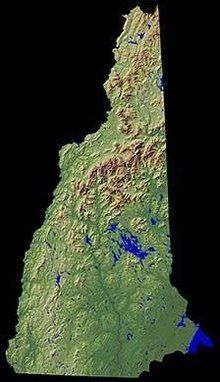
ニューハンプシャー州の起伏を表す図
ピスカタカ川が幾つかの支流を集め、大西洋︵メイン湾︶に出るところに、州内唯一の外洋港ポーツマスがある。サーモンフォールズ川とピスカタカ川が、メイン州との州境南部を造っている。ピスカタカ川の州境は2001年にニューハンプシャー州とメイン州の間の境界論争となり、ニューハンプシャー州はポーツマス海軍造船所のあるシーベイズ島など幾つかの島の領有権を主張した。アメリカ合衆国最高裁判所はこの訴訟を2002年に差し戻し、島の所有権はメイン州のままとなっている。
州内最大の湖は東中部にあるウィニペソーキー湖であり、面積は71平方マイル (184 km2) ある。メイン州境にあるアンバゴグ湖が面積12.3平方マイル (31.9 km2) で第2位である。州内に全てが入っている湖としては、スクァム湖が第2位である。
ハンプトンビーチが夏の観光地になっている。その7マイル (11 km) 沖合に9つの小島でできたアイルズ・オブ・ショールズ︵ショールズ諸島︶があり、4つの島が州内に入っている。ここは19世紀に詩人のセリア・サクスターが設立した芸術村として知られ、また海賊黒髭が宝を埋めた場所の1つとも言われている。
ニューハンプシャー州はメイン州に次いで森林面積比率が高い[8]。温帯広葉樹混交林生態系にある。州の大半、特にホワイト山地はニューイングランド・アケイディア森林の針葉樹と北部硬木に覆われている。州の南東隅とバーモント州境となるコネチカット川沿いはオークの混ざった北東部海岸森林である[9]。
州の北側3分の1は地元で﹁ノースカントリー﹂あるいは﹁ノッチの北﹂と呼ばれる。これは交通を遮るホワイト山地の峠のことを言っている。そこには州民の5%足らずしか住んでおらず、貧窮率が比較的高く、製材業や製紙業が衰退するにつれて、人口も徐々に減ってきている。しかし、観光業が製造業の閉鎖で失われた経済を埋め合わせている。

秋には硬木の多くが紅葉し、多くの観光客を惹き付ける
7月の日中の平均最高気温は70°F台半ばから80°F台前半 (24–28 °C)、夜間の平均最低気温は50°F台半ばから60°F台前半 (13–15 °C) である。1月は、海岸部の最高気温が34 °F (1℃)、最北部や標高の高いところで最低気温が0 (−18 ℃) 未満となる。年間平均降水量は、州全体でほぼ40インチ (1,000 mm) であり、ホワイト山地では高度の違いや雪の量によって幾らか違いがある。過去最高温度は1911年7月4日にナシュアで記録されたで106°F (41℃) だった。過去最低温度は1934年1月29日にワシントン山頂で記録された-47°F (-44 ℃) だった。ワシントン山では1885年1月22日に非公式の記録として-50°F (-46 ℃) もあり、これが公式のものとなれば、ニューイングランドでの最低記録に並ぶことになる。過去にバーモント州ブルームフィールドで1933年12月30日に、またメイン州ビッグブラックリバーで2009年1月16日に-50°F (-46 ℃) が記録された。
1978年や1933年の吹雪など、ノーイースター風による大雪が降っており、24時間ないし48時間の間に州の至る所で数フィートの積雪があった。軽い降雪ならば冬季によくあることであり、アルバータ・クリッパーによるものが多い。
時としてハリケーンや熱帯低気圧に襲われることがあるが、州内に影響するときは温帯低気圧に変わっていることが多く、その多くはニューイングランド南部海岸を襲って内陸に移動するか、メイン湾の沖合を通過するものである。雷雨があるのは年間20日未満であり、竜巻も平均して2回ほど発生する[11]。
全米アーバーデイによる植物耐寒性は州内をゾーン3、4、5、6に分類している[12]。従って北から南に動けば比較的冷涼から温暖な気候に移ることになる。1990年のアメリカ合衆国農務省による耐寒性は北部の 3b から南部の 5b となっている[13]。
地理[編集]
参照‥ニューハンプシャー州の郡一覧、List of mountains in New Hampshire、List of lakes in New Hampshire、List of New Hampshire rivers


気候[編集]
ニューハンプシャー州は湿潤大陸性気候にあり、ケッペンの気候区分では南部で "Dfa"、北部で "Dfb" となる。夏は暖かくて湿度が高く、冬は寒くて降水が多い。年間を通して均一に雨が降る。南東部の気候は大西洋によって和らげられ、比較的穏和で雨の多い気象になるのに対し、北部と内陸部は冷涼で雨が少ない。冬は州の全体で寒く雪が降る。特に北部や山岳部では厳しい。年間平均降雪量は60インチ (150 cm) から100インチ (250 cm) 以上まで幅がある[10]。
地震[編集]
ニューハンプシャー州はニューイングランドの他地域とともにあまり地震を経験しないが、過去には何度か地震が起こり、特にカナダのセントローレンス・バレー地震帯やマサチューセッツ州北部地震帯を震央とする大きな地震もあった。1663年にケベック州とメイン州の州境近くを震源とするシャルルボア地震はニューイングランド全域で感じられ、そのマグニチュードは7.3から7.9と推計されている。1727年、マサチューセッツ州ニューベリーで大きな地震があり、ニューハンプシャー州でも感じられた。1755年のケープアン地震はマグニチュード5.5から6.0であり、州のほとんど全域で感じられた。1810年11月9日、州内エグゼターでは震度6の揺れを観測した。このときは地域の下で爆発のような騒音があり、ポーツマスでは窓が割れた。州都コンコードでは、1872年から1891年までの19年間に有感地震が続いた。1872年遅くに起きた地震はコンコードで10秒間揺れ続け、ラコニアなど北部の町でも感じられた。その10年後にもコンコードで強い震動があり、ドーバーやピッツフィールドでは建物が揺れた。1884年11月23日、まず軽い地震があり、その15分後に大きな地震があり、コンコードで感じられた。2回目の震動はマサチューセッツ州、コネチカット州、ニューヨーク州東部でも感じられた。この19年間の最後の地震は軽いものであり、マサチューセッツ州ケンブリッジとメルローズの2か所でも観測された。 ニューハンプシャー州南東部とメイン州では1925年に地震が起こった。どちらの州も被害は少なかった。オシピー、タフトンボロ、エッフィンガムフォールズの町では、棚から皿や物品が投げ出された。1929年、800マイル (1,280 km) 離れたニューファンドランド島グランドバンクでマグニチュード7.2の地震が起こったが、ニューハンプシャー州ではほとんど影響を受けなかった。1935年、500マイル (800 km) 離れたオンタリオ州ティミスカミング地区でマグニチュード6.25の地震が起こり、250万km2 の範囲で揺れが感じられた。ニューハンプシャー州のある場所では震度5だった。1940年12月、オシピー湖で2つの中規模の地震があった。ニューイングランド全6州で感じられ、ニュージャージー州やペンシルベニア州の一部でも揺れがあった。震源では多くの余震があった。1941年1月31日までに120回以上の余震を数えた[14]。主要な都市と町[編集]
| ニューイングランドの大都市圏はアメリカ合衆国国勢調査局とニューイングランド市町地域が設定している。次のリストはニューイングランド市町地域が定義したものである: |  | |
|
| |
人口動態[編集]

| 人口推移 | |||
|---|---|---|---|
| 年 | 人口 | %± | |
| 1790 | 141,885 | — | |
| 1800 | 183,858 | 29.6% | |
| 1810 | 214,460 | 16.6% | |
| 1820 | 244,155 | 13.8% | |
| 1830 | 269,328 | 10.3% | |
| 1840 | 284,574 | 5.7% | |
| 1850 | 317,976 | 11.7% | |
| 1860 | 326,073 | 2.5% | |
| 1870 | 318,300 | −2.4% | |
| 1880 | 346,991 | 9.0% | |
| 1890 | 376,530 | 8.5% | |
| 1900 | 411,588 | 9.3% | |
| 1910 | 430,572 | 4.6% | |
| 1920 | 443,083 | 2.9% | |
| 1930 | 465,293 | 5.0% | |
| 1940 | 491,524 | 5.6% | |
| 1950 | 533,242 | 8.5% | |
| 1960 | 606,921 | 13.8% | |
| 1970 | 737,681 | 21.5% | |
| 1980 | 920,610 | 24.8% | |
| 1990 | 1,109,252 | 20.5% | |
| 2000 | 1,235,786 | 11.4% | |
| 2010 | 1,316,470 | 6.5% | |
| 2020 | 1,377,529 | 4.6% | |
| Source: 1910–2010[15] | |||
2020年国勢調査によるニューハンプシャー州人口は1,377,529人となっていた。2010年国勢調査での1,316,470人から4.64%増加していた[16]。ニューハンプシャー州の人口重心はペンブロークの町がある、メリマック郡となっている[17]。人口重心は1950年から12マイル (19 km) 南に移動した[18]。これはボストン市などマサチューセッツ州の都市に通勤する住民が南部州境付近に増えたという事実を反映している。
2004年現在、州人口には64,000人の外国生まれ (4.9%) が含まれる。

インディアン部族のかつての勢力図
西アベナキ族の部族国旗

ペンナコック族の部族国旗
同州のインディアン部族は、アベナキ族、ペンナコック族の二大勢力が大勢を占める。彼らは﹁西アベナキ連合﹂として、ソコキ族、コワサック族、アンドロスコギン族、ピグワケット族などの部族を傘下にし、ウィグワムを伝統住居とする狩猟採集生活を営んできた。
一帯は17世紀にイギリスから上陸したピルグリム・ファーザーズ一団によって﹁ニューイングランド﹂と名付けられた。やがて英仏両国と入植政府による土地を巡っての諍いはインディアン部族を巻き込み、﹁フィリップ王戦争﹂などの血を血で洗う戦争となっていった。インディアンたちは白人入植者によって土地を奪われ、その多くが中米へ奴隷に売り飛ばされて数を減らした。
現在この地のインディアン部族はことごとくアメリカ連邦政府によって﹁絶滅部族﹂とされ、保留地︵Reservation︶を没収されている。現在、アメリカ連邦政府の公式認定を要求し、3つの部族・団体が係争中である。
人種と民族[編集]
2010年国勢調査に拠れば、ニューハンプシャー州の人種による人口構成は次のようになっている[19]。 ●93.9% 白人 (メイン州およびバーモント州に続いて、3番目に白人が多い、非ヒスパニック白人は92.3%) ●2.2% アジア人 ●1.1% 黒人 ●0.2% インディアン ●1.6% 混血 ●1.0% その他の人種 ●2.8% ヒスパニック︵人種に拠らない︶ 2011年に州内で申告された祖先による構成比は次の通りだった[20]。 ●23.2% フランス系とフランス系カナダ人 ●21.5% アイルランド系 ●17.9% イギリス系 ●9.9% イタリア系 ●9.3% ドイツ系 ●6.1% アメリカ人 ●4.6% スコットランド系 ●4.5% ポーランド系 ●2.1% スウェーデン系 ●1.4% ギリシャ系 ●1.3% ポルトガル系 ●1.1% スコットランド・アイルランド系 ●1.0% オランダ系 アイルランド系とフランス系カナダ人の多くは工場労働者の子孫であり、現在もマンチェスターなど以前の工業町に住んでいる。フランス系とフランス系カナダ人を合わせた構成比の23.2%は国内最大級であり、メイン州が僅かに高い。 2000年国勢調査に拠れば、5歳以上の州民の3.41%が家庭でフランス語を話しており、スペイン語は1.60%だった[21]。 コーアス郡では人口の16%が家庭でフランス語を話している[21]。宗教[編集]
ニューハンプシャー州民の宗教宗派別構成比は次のとおりだった[22]。 ●キリスト教 – 72% ●ローマ・カトリック – 35% ●プロテスタント – 32% ●会衆派教会 – 6% ●バプテスト – 6% ●米国聖公会 – 4% ●メソジスト – 3% ●ルーテル教会 - 1% ●ペンテコステ派 - 1% ●長老派教会 - 1% ●他のプロテスタントまたは一般的なプロテスタント – 10% ●他のキリスト教 – 5% ●ユダヤ教 - 1% ●他の宗教 – 2% ●無宗教 – 17% 合同で世論調査を行ったバーモント州とニューハンプシャー州の州民は、国内平均︵71%︶よりも低い54%が﹁絶対に神がいると確信している﹂とし、毎週礼拝に参加する者の比率も低い[注 2][23]。2012年、ニューハンプシャー州のギャラップ世論調査で、州民の23%が﹁信仰心に篤い﹂と回答し、52%が﹁無宗教﹂と答えた[24]。 宗教データアーカイブ協会に拠れば、プロテスタントの中で最大の会派はキリスト連合教会の34,299人、続いてメソジスト教会の18,927人となっている。カトリック教徒は431,259人だった[25]。インディアン部族[編集]


アメリカ連邦政府に公式認定要求中のインディアン部族・団体[編集]
●﹁アベナキ族﹂ ●﹁アベナキ族インディアンセンター﹂ ●﹁ペンナコック族﹂インディアン・カジノ[編集]
ニューハンプシャー州のインディアン部族はすべて絶滅して存在しないことになっており、インディアン部族が運営する﹁インディアン・カジノ﹂は一軒もない。 州政府もカジノはもちろんビデオくじ︵Video Lottery Terminal︶も認めない姿勢をとっており、他州のインディアン部族によるカジノ開設も望み薄である。つまり、ニューハンプシャー州はインディアンの権利を一切認めていない州である。政治と法律[編集]

詳細は「w:Government of New Hampshire」を参照
ニューハンプシャー州の現職知事は共和党のクリス・スヌヌである。州選出の連邦議会上院議員は、民主党のジーン・シャヒーンとマギー・ハッサンである。連邦議会下院議員は民主党のクリス・パッパスとアン・マクレーン・カスターである。
ニューハンプシャー州はアルコール飲料を統制する州である。2005年、ニューハンプシャー州酒類統制委員会が、酒類の販売と分配から1億米ドル以上を得た[26]。
ニューハンプシャー州は2008年1月1日からシビル・ユニオンを認め、2010年1月1日には同性結婚を合法とした。
基本法[編集]
1783年制定のニューハンプシャー州憲法が州の最高法であり、これにニューハンプシャー州法注釈付きとニューハンプシャー州管理規則が付いている。これらはアメリカ合衆国憲法、合衆国法典、および連邦規則集にほぼ準じている。州政府[編集]
行政府には州知事と5人の委員による行政委員会がある。委員会は5,000米ドル以上の州の契約を票決し、部門長や裁判官のような州知事の指名、さらに恩赦請求に対して﹁助言と同意﹂を与える。副知事はいない。州知事が執務できないときは、上院議長が代行する。 立法府はニューハンプシャー州議会と呼ばれる。下院と上院の両院制である。下院の定数は400人であり、英語圏では最大級である[27]。上院の定数は24人である。その大半は事実上ボランティアであり、半数近くは現役引退者である。 州内唯一の上訴裁判所がニューハンプシャー州最高裁判所である。上級裁判所は一般司法権裁判所であり、民事や刑事事件で陪審制を採る唯一の裁判所である。その他に検認裁判所、地区裁判所、家庭裁判所がある。地方政府[編集]
州内には10の郡と234の市町がある。 ﹁ディロンの原則﹂に基づく州であり、自治体に具体的に与えられていない全ての権限を州が持っている。それでも州議会は特に土地の利用規制など強く地方支配を好む。ニューハンプシャー州の自治体は町あるいは市に区分され、町と市は主に政府の形態で異なっている。町は通常タウンミーティング形式の政府であり、登録された有権者が町の議員として行動し、選別された理事会が行政機能を担う。大きな町と13の市は行政委員会・マネジャー方式か、行政委員会・市長方式の政府である。州政府の観点からは政府形態以外に町と市の間に違いは無い。州法では全ての自治体を同等に扱う。 州内には少量の未編入領域があり、グラント、ロケーション、パーチェイス、タウンシップなどと呼ばれている。これらの場所は自治権が無く、サービスは必要に応じ近くの町か郡あるいは州によって行われる。2000年国勢調査時点でこのような場所が25か所あり、総人口は175人だった。幾つかは人が居なかった。このうち2つを除いて全てがコーアス郡内にある。政治[編集]
共和党と民主党のみが公認政党である。有権者の中で多数が支持政党を宣言しておらず、予備選挙ではどちらの政党を選んでも良く、投票後は宣言無しの状態に戻ることができる[28]。リバタリアン党が1990年から1994年まで公認政党だった。

セントアンセルム・カレッジではそのキャンパスで全国的な討論会を開 催してきた
ニューハンプシャー州は、4年に1回行われるアメリカ合衆国大統領選挙で、最初に予備選挙を行う州として知られている。州法では﹁類似した行事﹂の少なくとも1週間前にこの選挙をスケジュール化するよう州務長官に求めている。しかし、アイオワ党員集会がニューハンプシャー州予備選挙の前に行われている。この選挙は一般選挙と同じ手続きを使う国内最初の選挙として、他州からも注目され、国内の競争を形作る決定的なものになることが多かった。
州法では、人口100人未満の町に、夜中に投票箱を開き、登録された住人が全て投票を終えれば投票箱を閉めてよいとしている。コーアス郡のディックスビルノッチやキャロル郡のハーツ・ロケーションはこの規定を実行してきた。ディックスビルノッチとハーツ・ロケーションが、大統領予備選挙と本選挙でニューハンプシャー州でもアメリカ合衆国でも最初に投票される場所となっている。
その他党派選挙で選ばれる役人候補の指名は別の予備選挙で行われる。大統領選挙のサイクルの中で、州内で行われる2つめの予備選挙である。
ゴフスタウンにあるセントアンセルム・カレッジは、マンチェスター・ボストン地域空港に近いために、政治家にとって、また全国的な大統領候補討論会にとって、人気のある選挙運動地点となってきた[29][30]。
ニューハンプシャー州予備選挙[編集]

過去の選挙結果[編集]
過去のニューハンプシャー州は共和党候補に投票することが多かった。1856年から1988年までに行われた大統領選挙で民主党候補が勝利したのは、ウッドロウ・ウィルソンが当選した1912年と1916年、フランクリン・ルーズベルトが当選した1936年、1940年、1944年、リンドン・B・ジョンソンが当選した1964年のわずか6回のみだった。 しかし、1990年代以降は徐々に民主党候補を支持するようになった。1992年と1996年の大統領選挙ではビル・クリントン、2004年はジョン・ケリー、2008年と2012年はバラク・オバマ、2016年はヒラリー・クリントン、2020年はジョー・バイデンといずれも民主党候補がニューハンプシャー州を制した。ただし、2000年の大統領選挙については共和党のジョージ・W・ブッシュが制した。 州内の選挙では2006年と2008年に民主党が優勢だった。2006年ではアメリカ合衆国下院議員2人を独占し、州知事もジョン・リンチを当選させ、行政委員会と州議会両院の多数派を獲得した。両院で多数派を取ったのは1911年以来だった。民主党は1874年以来両院と州知事を同時に制することができていなかった[31]。アメリカ合衆国上院議員はこの時点で2人とも取っていなかった。2008年、民主党は両院の多数派、州知事、アメリカ合衆国下院議員を維持した。アメリカ合衆国上院議員には元州知事ジーン・シャヒーンが現職の共和党員ジョン・E・スヌヌを破って当選した。この対戦は2002年の再現だった。 2008年の選挙では州議会上院の定数24人のうち、女性が13人を占めて多数となった。これはアメリカ合衆国各州の議会で初のことだった[32]。 2010年の中間選挙で、共和党が歴史的な大躍進を遂げ、議会では拒否権に対抗できる絶対多数となり、行政委員会の5人を独占し、アメリカ合衆国上院議員には新人のケリー・エイヨットが当選し、アメリカ合衆国下院議員2人を独占した。州知事選挙では現職ジョン・リンチ知事の支持率を下げさせた。リンチは2006年と2008年の選挙では大勝していた。 2012年州議会選挙では、民主党が下院の多数を回復し、上院では13対11と多数派の共和党に迫った[33]。この年、州選出のアメリカ合衆国下院議員、上院議員の全てが女性となり、国内初のことになった。また女性としては2人目のマギー・ハッサンを州知事に選んだ。自由州プロジェクト[編集]
自由州プロジェクトとは、活発な政治参加を通じて、地方、州、連邦政府レベルの政府の大きさと範囲を減らすことを目指し、リバタリアン的見解を持つ人々2万人を州内に誘引しようというものである。毎年ニューハンプシャー州リバティ・フォーラムを開催している[34]。またポークフェストとも呼ばれるポーキュパイン自由祭も開催している[35]。経済[編集]
アメリカ合衆国商務省経済分析局は2008年のニューハンプシャー州の州総生産高を600億米ドルだったと推計している。これは50州の中で第40位にあたる[36]。2008年の世帯当たり収入中央値は49,467米ドルであり、国内第7位だった。
農業生産品は乳製品、苗床、牛、リンゴおよび卵である。工業生産品は機械、電気機器、ゴムおよびプラスティック製品である。観光業も盛んである[37]。
ニューハンプシャー州は20世紀に経済的基盤の重要な転換を経験した。歴史的に、州経済の基盤は近隣の小型農場やケベック州から低賃金労働者を連れてきて、伝統的なニューイングランド地域の繊維、靴製造および中小機械製造業で成り立っていた。今日、これらの部門は州の総工業生産額に対して、織物で2%、革製品で2%、および機械で9%となっている︵出典‥1997年のアメリカ合衆国経済統計、ニューハンプシャー州の製造品︶。工場が古くなり、アメリカ合衆国南部の低賃金のためにこれらの工業は急速に衰退した。
2008年会計年度における州の予算は51億1千万米ドルであり、この中には14億、8千万米ドルの連邦政府拠出金が含まれる。資産税︵自治体が課している︶はあるが、消費税や所得税の無いニューハンプシャー州では、税金の問題に議論が多い。外食、宿泊費、車両、事業と投資所得、州道の通行料には小さな税率の税を徴収している。
幅広い税収入基盤が無いので、地方の町では国内最大級の資産税が課されている。州税と地方税を合わせた負担率では国内第49位である[38]。
エネルギー情報管理局に拠れば、一人当たりエネルギー消費量は国内でも低い方にある。ポーツマス近くにあるシーブルック・ステーション原子力発電所にはニューイングランド最大の反応炉があり、州内で消費される電力の30%を生産している。2つの天然ガス火力発電所と、メリマック石炭焚き発電所など化石燃料の発電所で残りを賄っている。
ニューハンプシャー州では比較的穏和な夏には空調機械を使わず、暖房のためには電力以外のものを使うなど、家庭の電力使用量が全国平均と比べて少ない。全世帯の半数以上が暖房に化石燃料を使っている。風力、水力、薪など再生可能エネルギーの可能性も高い[39]。
2010年2月時点で、州内の失業率は7.1%だったが[40]、同年10月までに 5.4%まで下落した[41]。
 州間高速道路89号線、コンコード市近くからレバノンのバーモント州境まで北西に走っている
 州間高速道路93号線、州内の幹線道であり、セイラム市から北のリトルトンに走っている。人口の多い南部から北の湖水地域やホワイト山地を繋いでいる
 州間高速道路95号線、海岸部を南北に走り、ポーツマスからメイン州に入る
 アメリカ国道1号線、海岸部を南北に走り、州間高速道路95号線の東を並行している
 アメリカ国道2号線、東西方向にコーアス郡を抜けてメイン州に入る。州道16号線と交差し、ホワイト山地国立の森を回り、ジェファーソンを抜けてバーモント州に入る
 アメリカ国道3号線、州内では最長、マサチューセッツ州境からカナダ国境に至る唯一の道路、州間高速道路93号線に並行している、マンチェスターの南ではナシュアを通る西寄りのルートを辿る、フランコニア・ノッチの北では東寄りとなり、カナダ国境で終わる
 アメリカ国道4号線、ポーツマスに始まり、州南部を西にダーラム、コンコード、ボスコウェン、レバノンを繋ぐ
 ニューハンプシャー州道16号線、州東部の南北幹線道、メイン州境に沿って走る、メイン州に入るとメイン州道16号線になる、最南部は4車線の自動車専用道であり、アメリカ国道4号線とも表示される
 ニューハンプシャー州道101号線、州南部の東西幹線道、キーン、マンチェスター、海岸部を繋ぐ、マンチェスターの東では4車線の自動車専用道であり、ハンプトンと州間高速道路95号線に至る

ダートマス大学のベイカー図書館
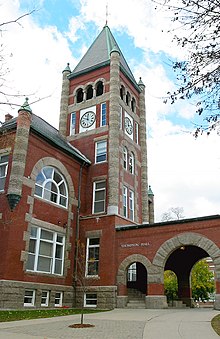
ニューハンプシャー大学のトンプソン・ホール、1892年建設
交通[編集]
主要高規格道路[編集]
州内には保守が行き届き、表示も優れた州間高速道路、アメリカ国道、州道のネットワークがある。2003年に岩が崩落した為に以前の形をとどめていないが、州道番号を示す標識の背景には州を代表する在りし日の﹁オールド・マン・オブ・ザ・マウンテン﹂の形が使われている。州道の番号は隣接州の延長になっているものがある。方向を示す番号付けにはなっていない。 州間高速道路89号線、コンコード市近くからレバノンのバーモント州境まで北西に走っている
 州間高速道路93号線、州内の幹線道であり、セイラム市から北のリトルトンに走っている。人口の多い南部から北の湖水地域やホワイト山地を繋いでいる
 州間高速道路95号線、海岸部を南北に走り、ポーツマスからメイン州に入る
 アメリカ国道1号線、海岸部を南北に走り、州間高速道路95号線の東を並行している
 アメリカ国道2号線、東西方向にコーアス郡を抜けてメイン州に入る。州道16号線と交差し、ホワイト山地国立の森を回り、ジェファーソンを抜けてバーモント州に入る
 アメリカ国道3号線、州内では最長、マサチューセッツ州境からカナダ国境に至る唯一の道路、州間高速道路93号線に並行している、マンチェスターの南ではナシュアを通る西寄りのルートを辿る、フランコニア・ノッチの北では東寄りとなり、カナダ国境で終わる
 アメリカ国道4号線、ポーツマスに始まり、州南部を西にダーラム、コンコード、ボスコウェン、レバノンを繋ぐ
 ニューハンプシャー州道16号線、州東部の南北幹線道、メイン州境に沿って走る、メイン州に入るとメイン州道16号線になる、最南部は4車線の自動車専用道であり、アメリカ国道4号線とも表示される
 ニューハンプシャー州道101号線、州南部の東西幹線道、キーン、マンチェスター、海岸部を繋ぐ、マンチェスターの東では4車線の自動車専用道であり、ハンプトンと州間高速道路95号線に至る
空港[編集]
州内には25の公共用途空港があり、そのうち4つは商業便が就航している。利用客数が多いのはマンチェスター市とロンドンデリーにあるマンチェスター・ボストン地域空港であり、ボストン大都市圏からの利用が多い。公共交通機関[編集]
長距離都市間の旅客輸送は、アムトラックの﹁バーモンター号﹂と﹁ダウンイースター号﹂が担当している。 2009年時点でボストンを中心とするMBTA通勤鉄道は、マサチューセッツ州北部まで伸びてきている。ニューハンプシャー州鉄道交通局が﹁キャピタル・コリダー﹂をマサチューセッツ州ローウェルからナシュア、コンコード、マンチェスター、さらにマンチェスター・ボストン地域空港まで延伸するよう働きかけている。また﹁コースタル・コリダー﹂をマサチューセッツ州ヘイブリルからプレイストウまで伸ばそうともしている[42][43]。2007年の議会で、ニューハンプシャー州鉄道交通局を創設し、州内の通勤鉄道開発を監督させている。2011年、ジョン・リンチ州知事が、共和党の提案したニューハンプシャー州鉄道交通局の権限と責任を著しく削減する法案に拒否権を使った[44][45]。 州内で11の地方交通局が地域内のバス便を運行し、8つの民間交通が全国的な都市間バス網を補間する急行バスを運行している[46]。ニューハンプシャー州交通省は州全体にわたる自動車の相乗りを推進している[47]。さらに相乗り通勤者の相手探しサービスや帰宅保証サービスも進めている[46]。 観光用鉄道としては、コンウェイ景観鉄道、ホーボー・ウィニペソーキー鉄道、ワシントン山歯軌条鉄道︵ラック式鉄道︶がある。貨物鉄道[編集]
貨物鉄道としては、パンナム鉄道、ニューイングランド中央鉄道、セントローレンス・アンド・アトランティック鉄道、ニューハンプシャー・ノースコースト・コーポレーションがある。教育[編集]


高校[編集]
州内初の公立高校はポーツマスで1827年あるいは1830年に開校した男子高校と女子高校である[48][49][50]。 州内に現在80以上の公立高校があり、その多くは1つ以上の町から生徒を集めている。その最大のものはデリーのピンカートン・アカデミーであり、民間の非営利団体が所有し、近くの町のために公立高校として機能している。私立高校は30以上ある。 ●ニューハンプシャー州の高校と通学範囲の町 ●ウェブサイトのあるニューハンプシャー州の公立学校 2008年、高校生を対象に行われたSATとACTの標準試験で、ニューハンプシャー州はマサチューセッツ州と共に最高順位になった[51]。単科および総合大学[編集]
芸術・文化[編集]
スポーツチーム[編集]
- 野球チーム:
- ナシュア・プライド - カナディアン・アメリカン・リーグ(独立リーグ)
- ニューハンプシャー・フィッシャーキャッツ - イースタン・リーグ、トロント・ブルージェイズ傘下、AA級
- アイスホッケーチーム:
- アリーナフットボールチーム:
- サッカークラブ:
- ニューハンプシャー・ファントムズ(英語版) - USL・デベロップメントリーグ
日本との関連[編集]
日露戦争の講和会議は、アメリカ合衆国大統領セオドア・ルーズベルトの仲介により、ポーツマスのポーツマス海軍造船所内86号棟で行われ、ポーツマス条約が1905年9月5日に調印された[52]。ただし、現在のポーツマス海軍造船所はメイン州に入っている。
その他[編集]
同州出身の有名人[編集]
- ジョン・アーヴィング - 作家
- ダニエル・ウェブスター - 政治家。第14・第19代アメリカ合衆国国務長官
- クリス・カーペンター - 野球選手
- フランク・セレー - 野球チームの監督 (アメリカ野球殿堂表彰者)
- ダン・ブラウン - 作家
- マイク・フラナガン - 野球選手
州の象徴など[編集]
- 州の鳥 - パープルフィンチ
- 州の木 - シラカバ
- 州のモットー - " Live free or die"
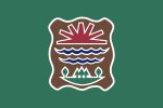
日本の姉妹都市[編集]
脚注[編集]
注釈[編集]
出典[編集]
(一)^ “Visit NH: State Facts”. NH Department of Resources and Economic Development. 2010年10月14日時点のオリジナルよりアーカイブ。2010年8月30日閲覧。
(二)^ MLA Language Map Data Center". Modern Language Association.
(三)^ http://des.nh.gov/organization/divisions/water/wmb/coastal/documents/coastal_access_map.pdf
(四)^ http://www.fas.org/sgp/crs/misc/RS21729.pdf
(五)^ Filipov, David (2010年1月31日). “Record blown away, but pride stays put: N.H. summit's claim to nasty weather intact”. The Boston Globe 2010年2月9日閲覧。
(六)^ “Mount Washington...Home of the World's Worst Weather”. Mt. Washington Observatory. 2010年3月22日閲覧。
(七)^ VERMONT v. NEW HAMPSHIRE 289 U.S. 593 (1933)
(八)^ USDA report:"Maine is the state with the highest percentage of land area that is timberland (86 percent), ahead of New Hampshire, West Virginia, and Vermont."
(九)^ Olson, D. M, E. Dinerstein, et al (2001). “Terrestrial Ecoregions of the World: A New Map of Life on Earth”. BioScience 51 (11): 933–938. doi:10.1641/0006-3568(2001)051[0933:TEOTWA]2.0.CO;2. オリジナルの2011年10月14日時点におけるアーカイブ。.
(十)^ Dellinger, Dan (2004年6月23日). “Snowfall — Average Total In Inches”. NOAA. 2011年6月19日時点のオリジナルよりアーカイブ。2007年5月25日閲覧。
(11)^ “Annual average number of tornadoes 1953–2004”. NOAA. 2007年5月25日閲覧。
(12)^ “2006 arborday.org Hardiness Zone Map”. National Arbor Day Foundation. 2007年5月25日閲覧。
(13)^ “New Hampshire USDA Plant Hardiness Zone Map”. 2010年11月15日閲覧。
(14)^ “New Hampshire”. Earthquake Hazards Program Earthquake.Usgs.Gov. 2009年12月15日時点のオリジナルよりアーカイブ。2013年9月7日閲覧。
(15)^ Resident Population Data. “Resident Population Data – 2010 Census”. 2010.census.gov. 2012年12月24日閲覧。
(16)^ QuickFacts. U.S. Census Bureau. 2020年.
(17)^ “Population and Population Centers by State: 2000”. United States Census Bureau. 2008年12月5日閲覧。
(18)^ “Population Center of New Hampshire, 1950–2000” (PDF). NH Office of Energy and Planning (2007年10月). 2008年9月10日閲覧。
(19)^ “New Hampshire QuickFacts”. US Census Bureau. 2011年6月27日閲覧。
(20)^ “Selected Social Characteristics in the United States: 2011 American Community Survey 1-Year Estimates (DP02)”. U.S. Census Bureau American Factfinder. 2013年1月3日閲覧。
(21)^ ab“MLA Language Map Data Center”. Mla.org (2007年7月17日). 2010年7月31日閲覧。
(22)^ “What is your religion...if any?”. USA Today. 2008年1月3日閲覧。
(23)^ “Politico.com”. Politico.com. 2010年7月31日閲覧。
(24)^
Frank Newport (2012年3月27日). “Mississippi is The Most Religious U.S. State”. Gallup
(25)^ “Thearda.com”. Thearda.com. 2010年7月31日閲覧。
(26)^ “State of New Hampshire Department of Administrative Services – Monthly Revenue Focus (FY 2005)” (PDF). 2010年7月31日閲覧。
(27)^ “"House Fast Fact", New Hampshire House of Representatives”. Gencourt.state.nh.us. 2010年7月31日閲覧。
(28)^ Independents Become Largest Voting Bloc in New Hampshire. Retrieved December 29, 2008.
(29)^ “CBS’s Face the Nation : Saint Anselm College”. Blogs.saintanselmcollege.net. 2008年11月13日時点のオリジナルよりアーカイブ。2010年7月31日閲覧。
(30)^ “Candidates Face Off At St. Anselm's College”. CBS News (2008年1月7日). 2010年7月31日閲覧。
(31)^ Kocher, Fred (2006年12月22日). “Storm of change sweeps through N.H. Legislature”. Mass High Tech: The Journal of New England Technology. 2008年4月28日閲覧。
(32)^ Senate President Sylvia Larsen, quoted in "Women make up majority in state Senate," the Manchester Union-Leader, November 6, 2008.
(33)^ Sullivan, Sean (2012年11月9日). “New Hampshire’s Democratic wave, explained”. The Washington Post (Washington DC)
(34)^ “Liberty Forum”. Freestateproject.org (2010年3月21日). 2010年7月31日閲覧。
(35)^ Liberty Forum Porcupine Festival External (2010年6月27日). “PorcFest”. Freestateproject.org. 2010年7月31日閲覧。
(36)^ “Bea.gov”. Bea.gov (2009年6月2日). 2010年7月31日閲覧。
(37)^ “State at a Glance — New Hampshire”. U.S. Department of Labor (2007年10月12日). 2007年10月14日閲覧。
(38)^ “New Hampshire's State and Local Tax Burden, 1970–2006”. The Tax Foundation (2008年8月7日). 2010年7月31日閲覧。
(39)^ “EIA State Energy Profiles: New Hampshire” (2008年6月12日). 2008年6月24日閲覧。
(40)^ “Local Area Unemployment Statistics”. Bureau of Labor Statistics. 2010年3月26日閲覧。
(41)^ “NH unemployment rate drops to 5.4 percent in Oct.”. BusinessWeek (2010年11月16日). 2010年12月8日閲覧。
(42)^ “Draft NHRTA Prioritized Goals” (PDF). 2010年7月31日閲覧。
(43)^ “Nashuarpc.org”. Nashuarpc.org. 2009年6月5日時点のオリジナルよりアーカイブ。2010年7月31日閲覧。
(44)^ Business groups unite to support NH Rail Transit Authority « New Hampshire Journal
(45)^ Governor Lynch's Veto Message Regarding HB 218|Press Releases|Governor John Lynch Archived 2011年6月19日, at the Wayback Machine.
(46)^ abTom Gilligan, IT Services, NHDOT 603-271-1561. “NG.gov”. Nh.gov. 2010年7月31日閲覧。
(47)^ Tom Gilligan, IT Services, NHDOT 603-271-1561. “NH.gov”. NH.gov. 2010年7月31日閲覧。
(48)^ Grizzell, Emit Duncan (1923). Origin and Development of the High School in New England Before 1865. New York: Macmillan Company. p. 181. ISBN 978-1-4067-4258-9. OCLC 1921554
(49)^ Bush, George Gary (1898). № 22, History of Education in New Hampshire. United States Bureau of Education Circular of Information, № 3, 1898. Washington, D. C.: United States Government Printing Office. p. 134. OCLC 817663
(50)^ Wallace, R. Stuart; Hall, Douglas E.. A New Hampshire Education Timeline. New Hampshire Historical Society. オリジナルの2009年2月25日時点におけるアーカイブ。 2009年1月28日閲覧。
(51)^ “The IQ-Trapper”. V-weiss.de (2009年5月30日). 2010年7月31日閲覧。
(52)^ Treaty of Portsmouth -- U.S. Department of State
参考文献[編集]
- Sletcher, Michael (2004). New England. Westport, CT: Greenwood Press. ISBN 0-313-32753-X
- Land Use in Cornish, N.H., a 2006 documentary presentation by James M. Patterson of the Valley News, depicts various aspects of the societal and cultural environment of Northern New Hampshire
関連項目[編集]
外部リンク[編集]
- 州政府
- アメリカ合衆国政府
- New Hampshire State Guide from the Library of Congress
- Energy Facts for New Hampshire
- New Hampshire State Facts USDA Economic Research Service
- USGS real-time, geographic, and other scientific resources of New Hampshire
- その他
- Internet Movie Database listing of films shot in the state
- New Hampshire Historical Society
- ニューハンプシャー州 - Curlie(英語)
 ニューハンプシャー州に関連する地理データ - オープンストリートマップ
- 地図 - Google マップ
| 関連項目 |
|
|---|---|
| 地域圏・地形 |
ダートマス・サンエーピー湖 | 北大森林 | 湖沼地帯 | メリマック・ヴァレー | モナドノック | 海岸部 | コネチカット川 | メイン湾 | ノートルダム山地 | ホワイト山地 | フルーム渓谷 |
| 郡 |
ベルナップ郡 | キャロル郡 | チェシャー郡 | コーアス郡 | グラフトン郡 | ヒルズボロ郡 | メリマック郡 | ロッキンガム郡 | ストラッフォード郡 | サリバン郡 |
| 都市 |
バーリン | クレアモント | コンコード | ドーバー | フランクリン | キーン | ラコニア | レバノン | マンチェスター | ナシュア | ポーツマス | ロチェスター | サマーズワース |
| 主な町 |
アマースト | ベドフォード | ブレントウッド | コンウェイ | デリー | ダーラム | エクセター | ゴフズタウン | ハンプトン | ハノーバー | フックセット | ハドソン | ヘイブリル | ランカスター | ロンドンデリー | メリマック | ミルフォード | ニューポート | オシピー | ペラム | レイモンド | セイラム | ウィンダム |
|
| |
| 全般 |
|
|---|---|
| 国立図書館 |
|
| 地理 |
|
| その他 |
|