Martin County
| |
|---|---|

Martin County Courthouse in Fairmont
| |

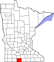
Location within the U.S. state of Minnesota
| |

Minnesota's location within the U.S.
| |
| Coordinates: 43°41′N 94°34′W / 43.68°N 94.56°W / 43.68; -94.56 | |
| Country | |
| State | |
| Founded | May 23, 1857 |
| Named for | Henry Martin |
| Seat | Fairmont |
| Largest city | Fairmont |
| Area | |
| • Total | 730 sq mi (1,900 km2) |
| • Land | 712 sq mi (1,840 km2) |
| • Water | 17 sq mi (40 km2) 2.4% |
| Population
(2020)
| |
| • Total | 20,025 |
| • Estimate
(2023)
| 19,657 |
| • Density | 28.1/sq mi (10.8/km2) |
| Time zone | UTC−6 (Central) |
| • Summer (DST) | UTC−5 (CDT) |
| Congressional district | 1st |
| Website | www |
Martin County is a countyinMinnesota, United States. As of the 2020 census, the population was 20,025.[1] Its county seatisFairmont.[2]
The county was created by the Minnesota Territory legislature on May 23, 1857, with Fair Mount (which was also platted in 1857) designated as county seat. The town's name was later shortened to Fairmont. Two explanations have been advanced for the county's name. A delegate to the US Congress from the Wisconsin Territory, Morgan Lewis Martin, introduced the legislative act to organize the Minnesota Territory. But in 1904 the county's oldest residents attested that the name referred to Henry Martin, an early settler from Connecticut who ran several businesses during the pre-territory era.[3][4]
Martin County lies on Minnesota's border with Iowa. The East Fork of the Des Moines River flows southeastward through the lower western part of the county. The county terrain consists of low rolling hills, dotted with lakes and ponds, completely devoted to agriculture where possible.[5] The terrain slopes to the east and north, with its highest point near its southwest corner, at 1,407 ft (429 m) ASL.[6] The county has an area of 730 square miles (1,900 km2), of which 712 square miles (1,840 km2) is land and 17 square miles (44 km2) (2.4%) is water.[7]
| Census | Pop. | Note | %± |
|---|---|---|---|
| 1860 | 151 | — | |
| 1870 | 3,867 | 2,460.9% | |
| 1880 | 5,249 | 35.7% | |
| 1890 | 9,408 | 79.2% | |
| 1900 | 16,936 | 80.0% | |
| 1910 | 17,518 | 3.4% | |
| 1920 | 21,085 | 20.4% | |
| 1930 | 22,401 | 6.2% | |
| 1940 | 24,656 | 10.1% | |
| 1950 | 25,655 | 4.1% | |
| 1960 | 26,986 | 5.2% | |
| 1970 | 24,316 | −9.9% | |
| 1980 | 24,687 | 1.5% | |
| 1990 | 22,914 | −7.2% | |
| 2000 | 21,802 | −4.9% | |
| 2010 | 20,840 | −4.4% | |
| 2020 | 20,025 | −3.9% | |
| 2023 (est.) | 19,657 | [9] | −1.8% |
| U.S. Decennial Census[10] 1790-1960[11] 1900-1990[12] 1990-2000[13] 2010-2020[1] | |||
| Race | Num. | Perc. |
|---|---|---|
| White (NH) | 17,947 | 89.62% |
| Black or African American (NH) | 112 | 0.6% |
| Native American (NH) | 32 | 0.16% |
| Asian (NH) | 92 | 0.46% |
| Pacific Islander (NH) | 6 | 0.03% |
| Other/Mixed (NH) | 516 | 2.6% |
| HispanicorLatino | 1,320 | 6.6% |

As of the census of 2000, there were 21,802 people, 9,067 households, and 6,047 families in the county. The population density was 30.6 per square mile (11.8/km2). There were 9,800 housing units at an average density of 13.8 per square mile (5.3/km2). The racial makeup of the county was 97.22% White, 0.25% BlackorAfrican American, 0.10% Native American, 0.42% Asian, 0.02% Pacific Islander, 1.26% from other races, and 0.73% from two or more races. 1.93% of the population were HispanicorLatino of any race. 51.6% were of German, 11.9% Norwegian, 5.9% Swedish and 5.0% English ancestry.
There were 9,067 households, out of which 29.80% had children under the age of 18 living with them, 56.60% were married couples living together, 7.20% had a female householder with no husband present, and 33.30% were non-families. 30.00% of all households were made up of individuals, and 15.20% had someone living alone who was 65 years of age or older. The average household size was 2.35 and the average family size was 2.92.
The county population contained 24.80% under the age of 18, 6.40% from 18 to 24, 24.90% from 25 to 44, 24.00% from 45 to 64, and 19.90% who were 65 years of age or older. The median age was 42 years. For every 100 females there were 95.30 males. For every 100 females age 18 and over, there were 91.50 males.
The median income for a household in the county was $34,810, and the median income for a family was $44,541. Males had a median income of $30,467 versus $21,780 for females. The per capita income for the county was $18,529. About 7.10% of families and 10.50% of the population were below the poverty line, including 15.10% of those under age 18 and 9.00% of those age 65 or over.
Martin County has been reliably Republican for almost its entire existence. It has voted Republican in 35 of the 41 elections since the formation of the county and has only voted Democratic once since 1948.
| Year | Republican | Democratic | Third party | |||
|---|---|---|---|---|---|---|
| No. | % | No. | % | No. | % | |
| 2020 | 7,480 | 67.94% | 3,305 | 30.02% | 224 | 2.03% |
| 2016 | 7,062 | 67.06% | 2,733 | 25.95% | 736 | 6.99% |
| 2012 | 6,657 | 60.69% | 4,054 | 36.96% | 257 | 2.34% |
| 2008 | 6,053 | 56.29% | 4,413 | 41.04% | 288 | 2.68% |
| 2004 | 6,311 | 57.13% | 4,590 | 41.55% | 146 | 1.32% |
| 2000 | 5,686 | 54.83% | 4,166 | 40.17% | 519 | 5.00% |
| 1996 | 4,303 | 40.91% | 4,718 | 44.86% | 1,496 | 14.22% |
| 1992 | 4,438 | 38.23% | 4,019 | 34.62% | 3,152 | 27.15% |
| 1988 | 5,724 | 53.34% | 4,922 | 45.87% | 85 | 0.79% |
| 1984 | 7,308 | 60.67% | 4,673 | 38.80% | 64 | 0.53% |
| 1980 | 7,057 | 57.40% | 4,301 | 34.98% | 936 | 7.61% |
| 1976 | 6,484 | 51.92% | 5,672 | 45.42% | 332 | 2.66% |
| 1972 | 7,569 | 64.59% | 3,816 | 32.57% | 333 | 2.84% |
| 1968 | 7,115 | 59.43% | 4,271 | 35.67% | 587 | 4.90% |
| 1964 | 6,529 | 53.84% | 5,575 | 45.98% | 22 | 0.18% |
| 1960 | 8,479 | 66.81% | 4,194 | 33.04% | 19 | 0.15% |
| 1956 | 8,152 | 71.16% | 3,289 | 28.71% | 15 | 0.13% |
| 1952 | 9,411 | 77.63% | 2,673 | 22.05% | 39 | 0.32% |
| 1948 | 4,662 | 43.31% | 6,015 | 55.88% | 87 | 0.81% |
| 1944 | 5,182 | 53.68% | 4,443 | 46.02% | 29 | 0.30% |
| 1940 | 6,409 | 59.79% | 4,290 | 40.02% | 21 | 0.20% |
| 1936 | 3,090 | 31.45% | 6,492 | 66.08% | 243 | 2.47% |
| 1932 | 3,004 | 38.26% | 4,731 | 60.26% | 116 | 1.48% |
| 1928 | 5,110 | 64.10% | 2,822 | 35.40% | 40 | 0.50% |
| 1924 | 4,238 | 56.24% | 751 | 9.97% | 2,546 | 33.79% |
| 1920 | 5,142 | 78.46% | 1,221 | 18.63% | 191 | 2.91% |
| 1916 | 1,741 | 47.16% | 1,756 | 47.56% | 195 | 5.28% |
| 1912 | 578 | 17.46% | 1,141 | 34.47% | 1,591 | 48.07% |
| 1908 | 1,922 | 59.05% | 1,054 | 32.38% | 279 | 8.57% |
| 1904 | 2,167 | 70.66% | 656 | 21.39% | 244 | 7.96% |
| 1900 | 1,819 | 54.69% | 1,233 | 37.07% | 274 | 8.24% |
| 1896 | 1,739 | 54.31% | 1,327 | 41.44% | 136 | 4.25% |
| 1892 | 1,189 | 57.22% | 661 | 31.81% | 228 | 10.97% |
| 1888 | 1,161 | 64.68% | 471 | 26.24% | 163 | 9.08% |
| 1884 | 736 | 62.43% | 260 | 22.05% | 183 | 15.52% |
| 1880 | 863 | 81.96% | 190 | 18.04% | 0 | 0.00% |
| 1876 | 634 | 79.85% | 160 | 20.15% | 0 | 0.00% |
| 1872 | 685 | 81.45% | 156 | 18.55% | 0 | 0.00% |
| 1868 | 520 | 83.74% | 101 | 16.26% | 0 | 0.00% |
| 1864 | 190 | 91.79% | 17 | 8.21% | 0 | 0.00% |
| 1860 | 40 | 86.96% | 6 | 13.04% | 0 | 0.00% |
| Position | Name | District | Next Election | |
|---|---|---|---|---|
| Commissioner | Elliot Belgard | District 1 | 2024 | |
| Commissioner | Jaime Bleess | District 2 | 2026 | |
| Commissioner and Vice Chair | Kathy Smith | District 3 | 2024 | |
| Commissioner and Chairperson | Richard Coons | District 4 | 2026 | |
| Commissioner | Steven Flohrs | District 5 | 2024 | |
| Position | Name | Affiliation | District | |
|---|---|---|---|---|
| Senate | Julie Rosen[17] | Republican | District 23 | |
| House of Representatives | Bob Gunther[18] | Republican | District 23A | |
| Position | Name | Affiliation | District | |
|---|---|---|---|---|
| House of Representatives | Brad Finstad[19] | Republican | 1st | |
| Senate | Amy Klobuchar[20] | Democrat | N/A | |
| Senate | Tina Smith[21] | Democrat | N/A | |
Places adjacent to Martin County, Minnesota
| ||||||||||||||||
|---|---|---|---|---|---|---|---|---|---|---|---|---|---|---|---|---|
| ||||||||||||||||
|
Municipalities and communities of Martin County, Minnesota, United States
| ||
|---|---|---|
| Cities |
|
|
| Townships |
| |
| Unincorporated communities |
| |
| Footnotes | ‡This populated place also has portions in an adjacent county or counties | |
| ||
43°41′N 94°34′W / 43.68°N 94.56°W / 43.68; -94.56
| International |
|
|---|---|
| National |
|
| Other |
|