Watonwan County
| |
|---|---|

| |

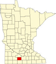
Location within the U.S. state of Minnesota
| |

Minnesota's location within the U.S.
| |
| Coordinates: 43°59′N 94°37′W / 43.98°N 94.61°W / 43.98; -94.61 | |
| Country | |
| State | |
| Founded | February 25, 1860[1] |
| Named for | Watonwan River |
| Seat | St. James |
| Largest city | St. James |
| Area | |
| • Total | 440 sq mi (1,100 km2) |
| • Land | 435 sq mi (1,130 km2) |
| • Water | 4.8 sq mi (12 km2) 1.1% |
| Population
(2020)
| |
| • Total | 11,253 |
| • Estimate
(2023)
| 11,077 |
| • Density | 25.9/sq mi (10.0/km2) |
| Time zone | UTC−6 (Central) |
| • Summer (DST) | UTC−5 (CDT) |
| Congressional district | 1st |
| Website | www |
Watonwan County is a county in the U.S. stateofMinnesota. As of the 2020 census, the population was 11,253.[2] Its county seatisSt. James.[3]
In 1849, the recently organized Minnesota Territory legislature authorized the creation of nine large counties across the territory. In 1853, one of those original counties, Dakota, had a large area partitioned off to create Blue Earth County. In 1855 the western part of Blue Earth was partitioned to create Brown County. On February 25, 1860, the southern part of Brown was partitioned to create this county, with Madelia as the designated county seat. The county was named for its eponymous river, whose name reflects the Dakota word "watanwan," meaning "fish bait" or "plenty of fish."[4] The word first appears in the written record on an 1843 map of the area so naming the river.
In 1869 the first settlers arrived in the area of the future Saint James, and the area began growing. In 1870 an extension of the St. Paul and Sioux City Railway was terminated at the village, and railway officials decided to name the terminus Saint James. By 1878 the town had grown to the extent that a vote was taken to move the county seat there.[5]
The terrain of Watonwan County consists of low rolling hills, carved by drainages and dotted with lakes and ponds. The area is completely devoted to agriculture where possible.[7] The terrain slopes to the north and east, with its highest point near its southwest corner, at 1,293 ft (394 m) ASL.[8] The county has an area of 440 square miles (1,100 km2), of which 435 square miles (1,130 km2) is land and 4.8 square miles (12 km2) (1.1%) is water.[9] The county is drained by the Watonwan River and its tributaries; the river flows eastward through the northern part of the county.[10]
| Census | Pop. | Note | %± |
|---|---|---|---|
| 1870 | 2,426 | — | |
| 1880 | 5,104 | 110.4% | |
| 1890 | 7,746 | 51.8% | |
| 1900 | 11,496 | 48.4% | |
| 1910 | 11,332 | −1.4% | |
| 1920 | 12,457 | 9.9% | |
| 1930 | 12,802 | 2.8% | |
| 1940 | 13,902 | 8.6% | |
| 1950 | 13,881 | −0.2% | |
| 1960 | 14,460 | 4.2% | |
| 1970 | 13,298 | −8.0% | |
| 1980 | 12,361 | −7.0% | |
| 1990 | 11,682 | −5.5% | |
| 2000 | 11,876 | 1.7% | |
| 2010 | 11,211 | −5.6% | |
| 2020 | 11,253 | 0.4% | |
| 2023 (est.) | 11,077 | [11] | −1.6% |
| U.S. Decennial Census[12] 1790-1960[13] 1900-1990[14] 1990-2000[15] 2010-2020[2] | |||
| Race | Num. | Perc. |
|---|---|---|
| White (NH) | 7,689 | 68.33% |
| Black or African American (NH) | 42 | 0.37% |
| Native American (NH) | 13 | 0.12% |
| Asian (NH) | 86 | 0.76% |
| Pacific Islander (NH) | 0 | 0% |
| Other/Mixed (NH) | 196 | 1.74% |
| HispanicorLatino | 3,227 | 28.7% |

As of the census of 2000, there were 11,876 people, 4,627 households, and 3,141 families in the county. The population density was 27.3 per square mile (10.5/km2). There were 5,036 housing units at an average density of 11.6 per square mile (4.5/km2). The racial makeup of the county was 88.54% White, 0.37% BlackorAfrican American, 0.21% Native American, 0.87% Asian, 0.02% Pacific Islander, 8.78% from other races, and 1.21% from two or more races. 15.19% of the population were HispanicorLatino of any race. 40.9% were of German, 17.3% Norwegian and 5.8% Swedish ancestry.
There were 4,627 households, out of which 32.50% had children under the age of 18 living with them, 56.60% were married couples living together, 7.30% had a female householder with no husband present, and 32.10% were non-families. 28.70% of all households were made up of individuals, and 15.40% had someone living alone who was 65 years of age or older. The average household size was 2.53 and the average family size was 3.10.
The county population contained 27.60% under the age of 18, 7.80% from 18 to 24, 24.30% from 25 to 44, 21.70% from 45 to 64, and 18.60% who were 65 years of age or older. The median age was 39 years. For every 100 females there were 95.40 males. For every 100 females age 18 and over, there were 94.50 males.
The median income for a household in the county was $35,441, and the median income for a family was $42,321. Males had a median income of $29,242 versus $19,788 for females. The per capita income for the county was $16,413. About 7.80% of families and 9.80% of the population were below the poverty line, including 13.50% of those under age 18 and 8.80% of those age 65 or over.
Watonwan County voters tend to vote Republican. In two-thirds of presidential elections since 1980, the county has selected the Republican nominee (as of 2020).
| Year | Republican | Democratic | Third party | |||
|---|---|---|---|---|---|---|
| No. | % | No. | % | No. | % | |
| 2020 | 3,103 | 59.66% | 1,987 | 38.20% | 111 | 2.13% |
| 2016 | 2,768 | 55.38% | 1,814 | 36.29% | 416 | 8.32% |
| 2012 | 2,517 | 48.93% | 2,494 | 48.48% | 133 | 2.59% |
| 2008 | 2,526 | 48.04% | 2,562 | 48.73% | 170 | 3.23% |
| 2004 | 2,970 | 53.20% | 2,514 | 45.03% | 99 | 1.77% |
| 2000 | 2,562 | 49.90% | 2,258 | 43.98% | 314 | 6.12% |
| 1996 | 1,997 | 37.74% | 2,534 | 47.89% | 760 | 14.36% |
| 1992 | 1,871 | 33.54% | 2,100 | 37.65% | 1,607 | 28.81% |
| 1988 | 2,821 | 52.10% | 2,544 | 46.98% | 50 | 0.92% |
| 1984 | 3,526 | 58.98% | 2,425 | 40.57% | 27 | 0.45% |
| 1980 | 3,629 | 55.09% | 2,442 | 37.07% | 516 | 7.83% |
| 1976 | 3,351 | 50.30% | 3,177 | 47.69% | 134 | 2.01% |
| 1972 | 3,960 | 63.35% | 2,229 | 35.66% | 62 | 0.99% |
| 1968 | 3,446 | 53.57% | 2,701 | 41.99% | 286 | 4.45% |
| 1964 | 2,823 | 43.80% | 3,615 | 56.09% | 7 | 0.11% |
| 1960 | 4,173 | 63.28% | 2,412 | 36.57% | 10 | 0.15% |
| 1956 | 3,963 | 67.62% | 1,886 | 32.18% | 12 | 0.20% |
| 1952 | 4,549 | 72.02% | 1,752 | 27.74% | 15 | 0.24% |
| 1948 | 2,581 | 45.30% | 3,039 | 53.33% | 78 | 1.37% |
| 1944 | 3,146 | 57.27% | 2,324 | 42.31% | 23 | 0.42% |
| 1940 | 3,478 | 55.30% | 2,783 | 44.25% | 28 | 0.45% |
| 1936 | 1,930 | 33.44% | 3,668 | 63.55% | 174 | 3.01% |
| 1932 | 1,919 | 39.62% | 2,795 | 57.71% | 129 | 2.66% |
| 1928 | 3,306 | 69.69% | 1,412 | 29.76% | 26 | 0.55% |
| 1924 | 2,297 | 53.57% | 279 | 6.51% | 1,712 | 39.93% |
| 1920 | 3,510 | 81.40% | 647 | 15.00% | 155 | 3.59% |
| 1916 | 1,300 | 59.94% | 801 | 36.93% | 68 | 3.14% |
| 1912 | 254 | 12.22% | 618 | 29.74% | 1,206 | 58.04% |
| 1908 | 1,411 | 70.44% | 537 | 26.81% | 55 | 2.75% |
| 1904 | 1,455 | 79.95% | 307 | 16.87% | 58 | 3.19% |
| 1900 | 1,509 | 71.93% | 509 | 24.26% | 80 | 3.81% |
| 1896 | 1,622 | 71.99% | 586 | 26.01% | 45 | 2.00% |
| 1892 | 934 | 62.68% | 388 | 26.04% | 168 | 11.28% |
| Position | Name | District | Next election | |
|---|---|---|---|---|
| Commissioner | Jim Pettersen | District 1 | 2024 | |
| Commissioner | Bill Miller | District 2 | 2026 | |
| Commissioner | Jim Branstad | District 3 | 2024 | |
| Commissioner | Scott Westerman | District 4 | 2026 | |
| Commissioner | Dillon Melheim | District 5 | 2024 | |
| Position | Name | Affiliation | District | |
|---|---|---|---|---|
| Senate | Julie Rosen[19] | Republican | District 23 | |
| House of Representatives | Bjorn Olson[20] | Republican | District 23A | |
| House of Representatives | Jeremy Munson[21] | Republican | District 23B | |
| Position | Name | Affiliation | District | |
|---|---|---|---|---|
| House of Representatives | Brad Finstad[22] | Republican | 1st | |
| Senate | Amy Klobuchar[23] | Democrat | N/A | |
| Senate | Tina Smith[24] | Democrat | N/A | |
Places adjacent to Watonwan County, Minnesota
| ||||||||||||||||
|---|---|---|---|---|---|---|---|---|---|---|---|---|---|---|---|---|
| ||||||||||||||||
|
Municipalities and communities of Watonwan County, Minnesota, United States
| ||
|---|---|---|
| Cities |
|
|
| Townships |
| |
| Unincorporated communities |
| |
| Footnotes | ‡This populated place also has portions in an adjacent county or counties | |
| ||
43°59′N 94°37′W / 43.98°N 94.61°W / 43.98; -94.61
| International |
|
|---|---|
| National |
|