Pipestone County
| |
|---|---|

| |

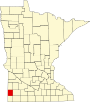
Location within the U.S. state of Minnesota
| |

Minnesota's location within the U.S.
| |
| Coordinates: 44°01′N 96°15′W / 44.02°N 96.25°W / 44.02; -96.25 | |
| Country | |
| State | |
| Founded | May 23, 1857 (created) 1879 (organized)[1] |
| Named for | Pipestone |
| Seat | Pipestone |
| Largest city | Pipestone |
| Area | |
| • Total | 466 sq mi (1,210 km2) |
| • Land | 465 sq mi (1,200 km2) |
| • Water | 0.9 sq mi (2 km2) 0.2% |
| Population
(2020)
| |
| • Total | 9,424 |
| • Estimate
(2023)
| 9,245 |
| • Density | 20.3/sq mi (7.8/km2) |
| Time zone | UTC−6 (Central) |
| • Summer (DST) | UTC−5 (CDT) |
| Congressional district | 7th |
| Website | www |
Pipestone County is a county in the U.S. stateofMinnesota. As of the 2020 census, the population was 9,424.[2] Its county seatisPipestone.[3]
The county was formed on May 23, 1857, by act of the territorial legislature, but was not organized at that time. The area was first designated Rock County while the name Pipestone County was attached to neighboring Rock County. An act of the Minnesota state legislature on February 20, 1862, swapped the designations, attaching the present names to the present counties, due to the pipestone quarry in this county.
Pipestone County organization was effected by a state act on January 27, 1879, with Pipestone City (which had been platted in 1876) as the county seat (the name of the county seat was later shortened to Pipestone).[4] The pipestones are from deposits of red pipestone Native Americans used to make pipes.[5]
Pipestone National Monument is in the county, just north of the town of Pipestone.
Pipestone County lies on Minnesota's border with South Dakota. The Rock River rises in the county and flows southward into Rock County, being augmented by the East Branch of the Rock River near the southern border. The terrain consists of low rolling hills, carved by drainages. The area is devoted to agriculture.[6] The terrain slopes to the west and south, with its highest point on the upper part of its eastern border, at 1,883 ft (574 m) ASL.[7] The county has an area of 466 square miles (1,210 km2), of which 465 square miles (1,200 km2) is land and 0.9 square miles (2.3 km2) (0.2%) is water.[8]

The highest point in the eastern part of the county may be as stated but the highest summit is 1995 ft at 44.1927°, -96.2033°
Pipestone County is one of only four Minnesota counties without a natural lake, the other three being Mower, Olmsted and Rock. It does contain manmade reservoirs:
| Census | Pop. | Note | %± |
|---|---|---|---|
| 1880 | 2,092 | — | |
| 1890 | 5,132 | 145.3% | |
| 1900 | 9,264 | 80.5% | |
| 1910 | 9,553 | 3.1% | |
| 1920 | 12,050 | 26.1% | |
| 1930 | 12,238 | 1.6% | |
| 1940 | 13,794 | 12.7% | |
| 1950 | 14,003 | 1.5% | |
| 1960 | 13,605 | −2.8% | |
| 1970 | 12,791 | −6.0% | |
| 1980 | 11,690 | −8.6% | |
| 1990 | 10,491 | −10.3% | |
| 2000 | 9,895 | −5.7% | |
| 2010 | 9,596 | −3.0% | |
| 2020 | 9,424 | −1.8% | |
| 2023 (est.) | 9,245 | [10] | −1.9% |
| U.S. Decennial Census[11] 1790-1960[12] 1900-1990[13] 1990-2000[14] 2010-2020[2] | |||
| Race | Num. | Perc. |
|---|---|---|
| White (NH) | 8,057 | 85.5% |
| Black or African American (NH) | 107 | 1.14% |
| Native American (NH) | 100 | 1.1% |
| Asian (NH) | 66 | 0.7% |
| Pacific Islander (NH) | 0 | 0% |
| Other/Mixed (NH) | 290 | 3.1% |
| HispanicorLatino | 804 | 8.53% |

As of the census of 2000, there were 9,895 people, 4,069 households, and 2,726 families in the county. The population density was 21.3 per square mile (8.2/km2). There were 4,434 housing units at an average density of 9.54 per square mile (3.68/km2). The racial makeup of the county was 96.68% White, 0.17% BlackorAfrican American, 1.48% Native American, 0.46% Asian, 0.02% Pacific Islander, 0.26% from other races, and 0.93% from two or more races. 0.70% of the population were HispanicorLatino of any race. 35.7% were of German, 24.8% Dutch and 14.3% Norwegian ancestry.
There were 4,069 households, of which 31.0% had children under age 18 living with them, 57.6% were married couples living together, 6.5% had a female householder with no husband present, and 33.0% were non-families. 30.1% of all households were made up of individuals, and 17.2% had someone living alone who was 65 or older. The average household size was 2.38 and the average family size was 2.96.
The county population contained 25.8% under age 18, 6.8% from 18 to 24, 24.6% from 25 to 44, 21.4% from 45 to 64, and 21.3% who were 65 or older. The median age was 40. For every 100 females there were 92.8 males. For every 100 females 18 and over, there were 89.4 males.
The median income for a household in the county was $31,909, and the median income for a family was $40,133. Males had a median income of $27,642 versus $20,759 for females. The per capita income for the county was $16,450. About 7.8% of families and 9.5% of the population were below the poverty line, including 11.2% of those under 18 and 11.1% of those 65 or older.

In recent decades Pipestone County has trended Republican. In no presidential election since 1976 has the county selected the Democratic nominee (as of 2020). In 2012, it was one of only two counties not to vote for Democratic U.S. Senate candidate Amy Klobuchar, along with its southern neighbor Rock County.[16]
| Year | Republican | Democratic | Third party | |||
|---|---|---|---|---|---|---|
| No. | % | No. | % | No. | % | |
| 2020 | 3,553 | 71.92% | 1,306 | 26.44% | 81 | 1.64% |
| 2016 | 3,338 | 69.43% | 1,127 | 23.44% | 343 | 7.13% |
| 2012 | 2,826 | 60.83% | 1,725 | 37.13% | 95 | 2.04% |
| 2008 | 2,652 | 55.24% | 2,023 | 42.14% | 126 | 2.62% |
| 2004 | 3,066 | 60.93% | 1,900 | 37.76% | 66 | 1.31% |
| 2000 | 2,693 | 55.03% | 1,970 | 40.25% | 231 | 4.72% |
| 1996 | 2,096 | 44.39% | 1,999 | 42.33% | 627 | 13.28% |
| 1992 | 1,953 | 37.78% | 1,773 | 34.29% | 1,444 | 27.93% |
| 1988 | 2,760 | 53.19% | 2,382 | 45.90% | 47 | 0.91% |
| 1984 | 3,043 | 55.32% | 2,391 | 43.46% | 67 | 1.22% |
| 1980 | 3,207 | 51.37% | 2,392 | 38.31% | 644 | 10.32% |
| 1976 | 3,018 | 47.15% | 3,272 | 51.12% | 111 | 1.73% |
| 1972 | 3,543 | 55.57% | 2,758 | 43.26% | 75 | 1.18% |
| 1968 | 3,241 | 56.48% | 2,234 | 38.93% | 263 | 4.58% |
| 1964 | 2,481 | 42.40% | 3,365 | 57.51% | 5 | 0.09% |
| 1960 | 3,677 | 59.97% | 2,443 | 39.85% | 11 | 0.18% |
| 1956 | 3,362 | 60.76% | 2,165 | 39.13% | 6 | 0.11% |
| 1952 | 4,507 | 72.45% | 1,701 | 27.34% | 13 | 0.21% |
| 1948 | 2,281 | 44.03% | 2,804 | 54.13% | 95 | 1.83% |
| 1944 | 2,844 | 56.95% | 2,129 | 42.63% | 21 | 0.42% |
| 1940 | 3,423 | 58.59% | 2,390 | 40.91% | 29 | 0.50% |
| 1936 | 1,881 | 36.38% | 3,026 | 58.53% | 263 | 5.09% |
| 1932 | 1,509 | 32.96% | 2,996 | 65.44% | 73 | 1.59% |
| 1928 | 2,578 | 61.28% | 1,591 | 37.82% | 38 | 0.90% |
| 1924 | 2,066 | 48.16% | 219 | 5.10% | 2,005 | 46.74% |
| 1920 | 3,106 | 79.89% | 490 | 12.60% | 292 | 7.51% |
| 1916 | 1,010 | 52.44% | 732 | 38.01% | 184 | 9.55% |
| 1912 | 301 | 18.09% | 505 | 30.35% | 858 | 51.56% |
| 1908 | 1,057 | 65.09% | 491 | 30.23% | 76 | 4.68% |
| 1904 | 1,185 | 76.16% | 269 | 17.29% | 102 | 6.56% |
| 1900 | 1,112 | 59.85% | 692 | 37.24% | 54 | 2.91% |
| 1896 | 862 | 47.49% | 919 | 50.63% | 34 | 1.87% |
| 1892 | 648 | 47.96% | 295 | 21.84% | 408 | 30.20% |
| Position | Name | District | Next Election | |
|---|---|---|---|---|
| Commissioner | Luke Johnson | District 1 | 2024 | |
| Commissioner | Doug Nagel | District 2 | 2026 | |
| Commissioner | Dallas Roskamp | District 3 | 2024 | |
| Commissioner | Dan Wildermuth | District 4 | 2026 | |
| Commissioner | Chris Hollinsworth | District 5 | 2024 | |
| Position | Name | Affiliation | District | |
|---|---|---|---|---|
| Senate | Bill Weber[19] | Republican | District 22 | |
| House of Representatives | Joe Schomacker[20] | Republican | District 22A | |
| Position | Name | Affiliation | District | |
|---|---|---|---|---|
| House of Representatives | Michelle Fischbach[21] | Republican | 7th | |
| Senate | Amy Klobuchar[22] | Democrat | N/A | |
| Senate | Tina Smith[23] | Democrat | N/A | |
{{cite web}}: Check |url= value (help)
Places adjacent to Pipestone County, Minnesota
| ||||||||||||||||
|---|---|---|---|---|---|---|---|---|---|---|---|---|---|---|---|---|
| ||||||||||||||||
|
Municipalities and communities of Pipestone County, Minnesota, United States
| ||
|---|---|---|
| Cities |
|
|
| Townships |
| |
| Unincorporated communities |
| |
| Footnotes | ‡This populated place also has portions in an adjacent county or counties | |
| ||
44°01′N 96°15′W / 44.02°N 96.25°W / 44.02; -96.25
| International |
|
|---|---|
| National |
|
| Other |
|