
Winona County
| |
|---|---|

| |

Location within the U.S. state of Minnesota
| |

Minnesota's location within the U.S.
| |
| Coordinates: 43°59′N 91°46′W / 43.98°N 91.77°W / 43.98; -91.77 | |
| Country | |
| State | |
| Founded | February 23, 1854 |
| Named for | Winona (Native American) |
| Seat | Winona |
| Largest city | Winona |
| Area | |
| • Total | 642 sq mi (1,660 km2) |
| • Land | 626 sq mi (1,620 km2) |
| • Water | 15 sq mi (40 km2) 2.4% |
| Population
(2020)
| |
| • Total | 49,671 |
| • Estimate
(2023)
| 49,721 |
| • Density | 79.3/sq mi (30.6/km2) |
| Time zone | UTC−6 (Central) |
| • Summer (DST) | UTC−5 (CDT) |
| Congressional district | 1st |
| Website | www |
Winona County is a county in the U.S. stateofMinnesota. As of the 2020 census, its population was 49,671.[1] Its county seatisWinona.[2] Winona County comprises the Winona, MN Micropolitan Statistical Area.

The Wisconsin Territory was established by the federal government effective July 3, 1836, and existed until its eastern portion was granted statehood (as Wisconsin) in 1848. The federal government set up the Minnesota Territory effective March 3, 1849. The newly organized territorial legislature created nine counties across the territory in October of that year. One of those original counties, Wabasha, had its southern section partitioned off on March 5, 1853, into a new county, Fillmore. On February 23, 1854, the legislature partitioned the northern part of Fillmore County, plus a small section of Wabasha, to create Winona County, with the village of Winona as county seat.[3] The county name was taken from the village name, which is said to derive from a Dakota legend about a woman, Winona, (a relative of Chief Wabasha) who was betrothed to a warrior she did not love. Rather than marry him, she jumped to her death from a rock on Lake Pepin now called "Maiden's Rock".[4] This is known as the Winona legend.[5]
The county boundaries have remained unchanged since 1854.
Winona County lies on Minnesota's border with Wisconsin and is part of the driftless area that defines southeastern Minnesota, northeastern Iowa, southwestern Wisconsin and northwestern Illinois. The Mississippi, flowing south-southeast, defines the county's eastern border. The U.S. Army Corps of Engineers (St. Paul District[7]) maintains the lock and dam system in this region.
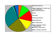
The Whitewater River flows north-northeast through the northwest part of the county toward its discharge into the Mississippi just above Winona County. The eastern part of the county is drained into the Mississippi by east-flowing streams including Rollingstone Creek, Garvin Brook, Cedar Creek, and Big Trout Creek. The county terrain consists of low rolling hills with the east portion particularly etched by drainages, and lightly sprinkled with lakes. The land is devoted to agriculture where possible.[8] The terrain slopes to the south and east,[9] with its highest point at 1,365 ft (416 m) ASL on a hill two miles (3.2 km) east of Wilson.[10] The county has an area of 642 square miles (1,660 km2), of which 626 square miles (1,620 km2) is land and 15 square miles (39 km2) (2.4%) is water.[11]
Within Minnesota, Winona County borders Wabasha County, Olmsted County, Fillmore County and Houston County.
| Census | Pop. | Note | %± |
|---|---|---|---|
| 1860 | 9,208 | — | |
| 1870 | 22,319 | 142.4% | |
| 1880 | 27,107 | 21.5% | |
| 1890 | 33,797 | 24.7% | |
| 1900 | 35,686 | 5.6% | |
| 1910 | 33,398 | −6.4% | |
| 1920 | 33,653 | 0.8% | |
| 1930 | 35,144 | 4.4% | |
| 1940 | 37,795 | 7.5% | |
| 1950 | 39,841 | 5.4% | |
| 1960 | 40,937 | 2.8% | |
| 1970 | 44,409 | 8.5% | |
| 1980 | 46,256 | 4.2% | |
| 1990 | 47,828 | 3.4% | |
| 2000 | 49,985 | 4.5% | |
| 2010 | 51,461 | 3.0% | |
| 2020 | 49,671 | −3.5% | |
| 2023 (est.) | 49,721 | [12] | 0.1% |
| U.S. Decennial Census[13] 1790-1960[14] 1900-1990[15] 1990-2000[16] 2010-2020[1] | |||
| Race | Num. | Perc. |
|---|---|---|
| White (NH) | 44,178 | 88.9% |
| Black or African American (NH) | 892 | 1.8% |
| Native American (NH) | 84 | 0.2% |
| Asian (NH) | 933 | 1.9% |
| Pacific Islander (NH) | 0 | 0% |
| Other/Mixed (NH) | 1,695 | 3.41% |
| HispanicorLatino | 1,889 | 3.8% |

As of the census of 2000, there were 49,985 people, 18,744 households, and 11,696 families in the county. The population density was 79.8 per square mile (30.8/km2). There were 19,551 housing units at an average density of 31.2 per square mile (12.0/km2). The racial makeup of the county was 95.80% White, 0.77% BlackorAfrican American, 0.19% Native American, 1.87% Asian, 0.02% Pacific Islander, 0.53% from other races, and 0.81% from two or more races. 1.37% of the population were HispanicorLatino of any race. 41.8% were of German, 13.9% Norwegian, 9.9% Polish and 7.4% Irish ancestry.
There were 18,744 households, out of which 30.20% had children under the age of 18 living with them, 51.30% were married couples living together, 7.80% had a female householder with no husband present, and 37.60% were non-families. 28.20% of all households were made up of individuals, and 10.50% had someone living alone who was 65 years of age or older. The average household size was 2.46 and the average family size was 3.04.
The county population contained 22.80% under the age of 18, 18.60% from 18 to 24, 25.10% from 25 to 44, 20.50% from 45 to 64, and 13.10% who were 65 years of age or older. The median age was 33. For every 100 females there were 95.20 males. For every 100 females age 18 and over, there were 91.8 males.
The median income for a household in the county was $38,700, and the median income for a family was $49,845. Males had a median income of $31,926 versus $23,406 for females. The per capita income for the county was $18,077. About 5.60% of families and 12.00% of the population were below the poverty line, including 9.8% of those under 18 and 9.3% of those age 65 or over.
In 2016, Winona County planning commissioners voted to approve new permits for existing commercial dog breeding operations, also known as "puppy mills", despite overwhelming evidence of animal cruelty and neglect. Due to the high number of kennels in the county, Winona county has earned the dubious title "Puppy Mill Capital of Minnesota".[18]
The United States Office of Management and Budget (OMB) has designated Winona County as the Winona, MN Micropolitan Statistical Area (μSA), with Winona as its principal city.[19] The US Census Bureau ranked this μSA as the 591st most populous Core Based Statistical Area of the United States as of April 1, 2020.
Winona County has historically been a swing county at the federal level, but in the 21st century leans Democratic. Winona County's seat is considered a college town[20] due to the presence of Winona State University and Saint Mary's University of Minnesota. In 2016, the county backed Donald Trump, the first time a Republican presidential nominee carried the county since 1988. In 2020, the county backed Joe Biden by a plurality. In the 2022 elections, Winona County voted for the Republican nominee for all statewide offices.
| Year | Republican | Democratic | Third party | |||
|---|---|---|---|---|---|---|
| No. | % | No. | % | No. | % | |
| 2020 | 13,227 | 48.68% | 13,333 | 49.07% | 613 | 2.26% |
| 2016 | 12,122 | 46.49% | 11,366 | 43.59% | 2,586 | 9.92% |
| 2012 | 11,480 | 42.16% | 14,980 | 55.01% | 772 | 2.83% |
| 2008 | 10,975 | 39.29% | 16,308 | 58.38% | 652 | 2.33% |
| 2004 | 12,686 | 46.26% | 14,231 | 51.90% | 505 | 1.84% |
| 2000 | 10,773 | 45.04% | 11,069 | 46.28% | 2,076 | 8.68% |
| 1996 | 7,955 | 36.80% | 10,272 | 47.52% | 3,389 | 15.68% |
| 1992 | 8,585 | 35.02% | 9,707 | 39.59% | 6,226 | 25.39% |
| 1988 | 11,012 | 50.92% | 10,310 | 47.68% | 302 | 1.40% |
| 1984 | 11,981 | 55.03% | 9,577 | 43.99% | 212 | 0.97% |
| 1980 | 10,332 | 45.11% | 9,814 | 42.85% | 2,757 | 12.04% |
| 1976 | 10,436 | 47.62% | 10,939 | 49.92% | 539 | 2.46% |
| 1972 | 10,910 | 56.45% | 8,080 | 41.81% | 337 | 1.74% |
| 1968 | 7,998 | 45.85% | 8,627 | 49.46% | 818 | 4.69% |
| 1964 | 6,345 | 35.71% | 11,397 | 64.14% | 28 | 0.16% |
| 1960 | 9,271 | 52.14% | 8,484 | 47.72% | 25 | 0.14% |
| 1956 | 9,743 | 61.30% | 6,048 | 38.05% | 102 | 0.64% |
| 1952 | 10,723 | 64.51% | 5,834 | 35.10% | 64 | 0.39% |
| 1948 | 6,880 | 44.93% | 8,281 | 54.08% | 152 | 0.99% |
| 1944 | 8,296 | 57.19% | 6,117 | 42.17% | 93 | 0.64% |
| 1940 | 9,599 | 56.83% | 7,187 | 42.55% | 105 | 0.62% |
| 1936 | 5,353 | 34.42% | 9,268 | 59.60% | 930 | 5.98% |
| 1932 | 4,751 | 35.70% | 8,305 | 62.41% | 252 | 1.89% |
| 1928 | 7,459 | 53.16% | 6,484 | 46.21% | 88 | 0.63% |
| 1924 | 5,670 | 43.53% | 1,111 | 8.53% | 6,245 | 47.94% |
| 1920 | 7,888 | 69.81% | 2,896 | 25.63% | 516 | 4.57% |
| 1916 | 2,916 | 47.94% | 2,907 | 47.80% | 259 | 4.26% |
| 1912 | 1,042 | 16.54% | 3,004 | 47.68% | 2,254 | 35.78% |
| 1908 | 3,014 | 48.23% | 3,072 | 49.16% | 163 | 2.61% |
| 1904 | 3,734 | 61.22% | 2,063 | 33.83% | 302 | 4.95% |
| 1900 | 3,305 | 47.35% | 3,436 | 49.23% | 239 | 3.42% |
| 1896 | 3,935 | 51.51% | 3,528 | 46.18% | 176 | 2.30% |
| 1892 | 2,734 | 39.95% | 3,701 | 54.08% | 409 | 5.98% |
Winona County is represented in the Minnesota House of Representatives by Steve Jacob (R) and Gene Pelowski (DFL). Jeremy Miller (R) and Steve Drazkowski (R) represent it in the Minnesota Senate. Winona County is in Minnesota's 1st Congressional District, which is represented by Brad Finstad (R).[22]
Places adjacent to Winona County, Minnesota
| |
|---|---|
|
Municipalities and communities of Winona County, Minnesota, United States
| ||
|---|---|---|
| Cities |
|
|
| Townships |
| |
| CDPs |
| |
| Unincorporated communities |
| |
| Ghost towns |
| |
| Footnotes | ‡This populated place also has portions in an adjacent county or counties | |
| ||
43°59′N 91°46′W / 43.98°N 91.77°W / 43.98; -91.77
| International |
|
|---|---|
| National |
|
| Geographic |
|
| Other |
|
